Marshallville, Ohio
| Marshallville, Ohio | |
|---|---|
| Village | |
|
Post Office | |
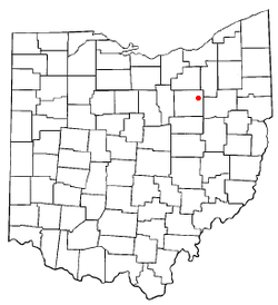 Location of Marshallville, Ohio | |
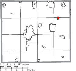 Location of Marshallville in Wayne County | |
| Coordinates: 40°54′1″N 81°43′59″W / 40.90028°N 81.73306°WCoordinates: 40°54′1″N 81°43′59″W / 40.90028°N 81.73306°W | |
| Country | United States |
| State | Ohio |
| County | Wayne |
| Government | |
| • Mayor | Robert Brooker |
| Area[1] | |
| • Total | 0.57 sq mi (1.48 km2) |
| • Land | 0.57 sq mi (1.48 km2) |
| • Water | 0 sq mi (0 km2) |
| Elevation[2] | 1,119 ft (341 m) |
| Population (2010)[3] | |
| • Total | 756 |
| • Estimate (2012[4]) | 756 |
| • Density | 1,326.3/sq mi (512.1/km2) |
| Time zone | Eastern (EST) (UTC-5) |
| • Summer (DST) | EDT (UTC-4) |
| ZIP code | 44645 |
| Area code(s) | 330 |
| FIPS code | 39-48048[5] |
| GNIS feature ID | 1061476[2] |
| Website | |

Marshallville is a village in Wayne County, Ohio, United States. The population was 756 at the 2010 census.
Marshallville was originally called Bristol, and under the latter name was laid out in 1817.[6]
Geography
Marshallville is located at 40°54′1″N 81°43′59″W / 40.90028°N 81.73306°W (40.900407, -81.733146).[7]
According to the United States Census Bureau, the village has a total area of 0.57 square miles (1.48 km2), all of it land.[1]
Demographics
| Historical population | |||
|---|---|---|---|
| Census | Pop. | %± | |
| 1870 | 322 | — | |
| 1880 | 376 | 16.8% | |
| 1890 | 366 | −2.7% | |
| 1900 | 357 | −2.5% | |
| 1910 | 294 | −17.6% | |
| 1920 | 295 | 0.3% | |
| 1930 | 324 | 9.8% | |
| 1940 | 373 | 15.1% | |
| 1950 | 458 | 22.8% | |
| 1960 | 611 | 33.4% | |
| 1970 | 693 | 13.4% | |
| 1980 | 788 | 13.7% | |
| 1990 | 758 | −3.8% | |
| 2000 | 826 | 9.0% | |
| 2010 | 756 | −8.5% | |
| Est. 2015 | 760 | [8] | 0.5% |
2010 census
As of the census[3] of 2010, there were 756 people, 291 households, and 222 families residing in the village. The population density was 1,326.3 inhabitants per square mile (512.1/km2). There were 311 housing units at an average density of 545.6 per square mile (210.7/km2). The racial makeup of the village was 98.4% White, 0.3% African American, 0.8% Native American, and 0.5% from two or more races. Hispanic or Latino of any race were 0.5% of the population.
There were 291 households of which 36.8% had children under the age of 18 living with them, 58.4% were married couples living together, 9.3% had a female householder with no husband present, 8.6% had a male householder with no wife present, and 23.7% were non-families. 20.3% of all households were made up of individuals and 8.9% had someone living alone who was 65 years of age or older. The average household size was 2.60 and the average family size was 2.96.
The median age in the village was 39.3 years. 24.1% of residents were under the age of 18; 8.2% were between the ages of 18 and 24; 26.2% were from 25 to 44; 27.9% were from 45 to 64; and 13.6% were 65 years of age or older. The gender makeup of the village was 49.6% male and 50.4% female.
2000 census
As of the census[5] of 2000, there were 826 people, 302 households, and 233 families residing in the village. The population density was 1,471.4 people per square mile (569.5/km²). There were 310 housing units at an average density of 552.2 per square mile (213.7/km²). The racial makeup of the village was 97.58% White, 0.12% African American, 1.09% Native American, 0.36% from other races, and 0.85% from two or more races. Hispanic or Latino of any race were 1.33% of the population.
There were 302 households out of which 39.4% had children under the age of 18 living with them, 66.2% were married couples living together, 7.6% had a female householder with no husband present, and 22.8% were non-families. 19.9% of all households were made up of individuals and 9.6% had someone living alone who was 65 years of age or older. The average household size was 2.74 and the average family size was 3.14.
In the village the population was spread out with 29.3% under the age of 18, 6.8% from 18 to 24, 32.0% from 25 to 44, 21.7% from 45 to 64, and 10.3% who were 65 years of age or older. The median age was 35 years. For every 100 females there were 101.0 males. For every 100 females age 18 and over, there were 94.7 males.
The median income for a household in the village was $42,632, and the median income for a family was $44,722. Males had a median income of $31,250 versus $23,125 for females. The per capita income for the village was $14,156. About 3.3% of families and 5.9% of the population were below the poverty line, including 6.1% of those under age 18 and 10.8% of those age 65 or over.
Education
Marshallville students attend Green Local School District in nearby Smithville.
Marshallville had a three-year high school until 1938 when the State of Ohio told them they could not operate as a three-year school. The building was then closed and students were sent to school in Dalton. After the state discovered they were going across another district (Orrville) to get to school,[10] they merged their old district into Smithville's in 1955. The Marshallville Tigers were one of the original members of the Wayne County Athletic League's "B" League.[11]
References
- 1 2 "US Gazetteer files 2010". United States Census Bureau. Retrieved 2013-01-06.
- 1 2 "US Board on Geographic Names". United States Geological Survey. 2007-10-25. Retrieved 2008-01-31.
- 1 2 "American FactFinder". United States Census Bureau. Retrieved 2013-01-06.
- ↑ "Population Estimates". United States Census Bureau. Retrieved 2013-06-17.
- 1 2 "American FactFinder". United States Census Bureau. Retrieved 2008-01-31.
- ↑ Overman, William Daniel (1958). Ohio Town Names. Akron, OH: Atlantic Press. p. 84.
- ↑ "US Gazetteer files: 2010, 2000, and 1990". United States Census Bureau. 2011-02-12. Retrieved 2011-04-23.
- ↑ "Annual Estimates of the Resident Population for Incorporated Places: April 1, 2010 to July 1, 2015". Retrieved July 2, 2016.
- ↑ "Census of Population and Housing". Census.gov. Retrieved June 4, 2015.
- ↑ Vasas, Michale Paul (1989). A History of Wayne County Football 1899 to 1988. Collier Printing Company of Wooster, Ohio.
- ↑ History of the Wayne County Athletic League
External links
Municipalities and communities of Wayne County, Ohio, United States | ||
|---|---|---|
| Cities |  | |
| Villages | ||
| Townships | ||
| CDPs | ||
| Unincorporated communities | ||
| Footnotes | ‡This populated place also has portions in an adjacent county or counties | |