Rittman, Ohio
| Rittman, Ohio | |
|---|---|
| City | |
|
The former Erie Railroad depot in Rittman, now a restaurant. | |
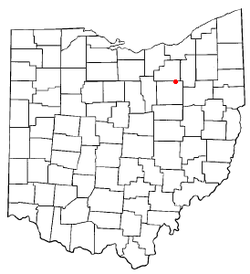 Location of Rittman, Ohio | |
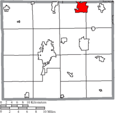 Location of Rittman in Wayne County | |
| Coordinates: 40°58′24″N 81°47′4″W / 40.97333°N 81.78444°WCoordinates: 40°58′24″N 81°47′4″W / 40.97333°N 81.78444°W | |
| Country | United States |
| State | Ohio |
| Counties | Wayne, Medina |
| Government | |
| • Mayor | William J. Robertson |
| Area[1] | |
| • Total | 6.49 sq mi (16.81 km2) |
| • Land | 6.43 sq mi (16.65 km2) |
| • Water | 0.06 sq mi (0.16 km2) |
| Elevation[2] | 981 ft (299 m) |
| Population (2010)[3] | |
| • Total | 6,491 |
| • Estimate (2012[4]) | 6,501 |
| • Density | 1,009.5/sq mi (389.8/km2) |
| Time zone | Eastern (EST) (UTC-5) |
| • Summer (DST) | EDT (UTC-4) |
| ZIP code | 44270 |
| Area code(s) | 330 and 234 |
| FIPS code | 39-67356[5] |
| GNIS feature ID | 1061609[2] |
| Website | http://www.rittman.com/ |

Rittman is a city in Medina and Wayne counties in the U.S. state of Ohio. All but a small portion of the city is in Wayne County, within commuting distance of Akron, Canton and Cleveland. The population was 6,491 at the 2010 census.
History
The first settlers in what now is Rittman were William Doyle and John Coleman, who took title to land on July 23, 1814.[6] Records indicate that eight families purchased land in the northeastern part of newly formed Wayne County within a month of their neighbors. These families sold portions of their land to others, and within a year other families were clearing trees, planting crops and beginning the history of Rittman.
William Doyle first settled the Rittman area in 1815, through a presidential land grant. Martin and Sarah Fritz and their infant son, Adam, were other early settlers. Sarah Fritz and Adam were the first settlers to be buried in the Rittman Cemetery. Land for the cemetery had been donated by Doyle, and a school and non-denominational church were built nearby. Another church, built close to the cemetery, acquired the name of Knupp's Old Church (because the road to it ran across Jacob Knupp's farm). The restored church, located off DeCourcey Road, still stands today; it is maintained by the Rittman Historical Society.
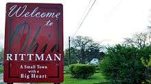
Rittman was named after Fred Rittman, the treasurer of the Baltimore and Ohio Railroad, which ran a line through town in 1871. The town's previous name, "Arkona," had to be changed because of its similarity to Akron. Other early names of the town included Ellio, Milton Station and New Prospect.
Rittman's early economy was bolstered by grist mills, tile-making, wagon-building and tobacco farming. Businesses grew up around newly built train stations, and two factories became major employers in the area. The heart of the business community gradually moved north to the present square area. Shortly after the Civil War, the southern section of what is now Rittman - then called Milton Station - became a stop of the Atlantic and Great Western Railroad, which later became the Erie Railroad. The Lake Shore and Tuscarawas Railroad, later the B & O Railroad, opened a station in 1888, but the station had no name. After several names failed to become popular, the railroad named the stop after its treasurer, Frederick B. Rittman. That name was gradually accepted by local residents and eventually became the town's name.
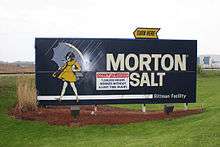
The discovery of salt deposits in Rittman in 1897 led to the founding of Wayne Salt, which later became Ohio Salt. In 1948, Ohio Salt became Morton Salt - today one of Rittman's major employers. E.J. Young, who started the salt company, needed a way to package both his salt and his matches, which were made in nearby Wadsworth. Young formed the Ohio Boxboard Co. in 1903. That company became a major employer also, bringing to town many new employees and helping business grow. Ohio Boxboard was acquired by Packaging Corporation of America (PCA) in 1965, then Rittman Paperboard, boasting of over 1200 employees in its prime. Rittman Paperboard closed its doors in early 2006.
Geography
Rittman is located at 40°58′24″N 81°47′4″W / 40.97333°N 81.78444°W (40.973376, -81.784416).[7]
According to the United States Census Bureau, the city has a total area of 6.49 square miles (16.81 km2), of which 6.43 square miles (16.65 km2) is land and 0.06 square miles (0.16 km2) is water.[1]
Demographics
| Historical population | |||
|---|---|---|---|
| Census | Pop. | %± | |
| 1920 | 1,803 | — | |
| 1930 | 2,785 | 54.5% | |
| 1940 | 2,770 | −0.5% | |
| 1950 | 3,810 | 37.5% | |
| 1960 | 5,410 | 42.0% | |
| 1970 | 6,308 | 16.6% | |
| 1980 | 6,063 | −3.9% | |
| 1990 | 6,147 | 1.4% | |
| 2000 | 6,314 | 2.7% | |
| 2010 | 6,491 | 2.8% | |
| Est. 2015 | 6,580 | [8] | 1.4% |
| Sources:[9][10][11][5][12] | |||
2010 census
As of the census[3] of 2010, there were 6,491 people, 2,547 households, and 1,763 families residing in the city. The population density was 1,009.5 inhabitants per square mile (389.8/km2). There were 2,752 housing units at an average density of 428.0 per square mile (165.3/km2). The racial makeup of the city was 97.2% White, 0.4% African American, 0.2% Native American, 0.4% Asian, 0.2% from other races, and 1.6% from two or more races. Hispanic or Latino of any race were 1.2% of the population.
There were 2,547 households of which 33.5% had children under the age of 18 living with them, 51.6% were married couples living together, 11.9% had a female householder with no husband present, 5.8% had a male householder with no wife present, and 30.8% were non-families. 26.2% of all households were made up of individuals and 10.8% had someone living alone who was 65 years of age or older. The average household size was 2.52 and the average family size was 3.01.
The median age in the city was 38.5 years. 23.9% of residents were under the age of 18; 8% were between the ages of 18 and 24; 26.9% were from 25 to 44; 26.5% were from 45 to 64; and 14.7% were 65 years of age or older. The gender makeup of the city was 48.9% male and 51.1% female.
2000 census
As of the census[5] of 2000, there were 6,314 people, 2,424 households, and 1,711 families residing in the city. The population density was 1,046.9 people per square mile (404.3/km²). There were 2,518 housing units at an average density of 417.5 per square mile (161.2/km²). The racial makeup of the city was 98.13% White, 0.10% African American, 0.22% Native American, 0.38% Asian, 0.27% from other races, and 0.90% from two or more races. Hispanic or Latino of any race were 0.89% of the population.
There were 2,424 households out of which 34.6% had children under the age of 18 living with them, 55.8% were married couples living together, 10.8% had a female householder with no husband present, and 29.4% were non-families. 25.5% of all households were made up of individuals and 10.8% had someone living alone who was 65 years of age or older. The average household size was 2.57 and the average family size was 3.10.
In the city the population was spread out with 26.5% under the age of 18, 8.2% from 18 to 24, 31.7% from 25 to 44, 20.3% from 45 to 64, and 13.3% who were 65 years of age or older. The median age was 36 years. For every 100 females there were 95.2 males. For every 100 females age 18 and over, there were 92.1 males.
The median income for a household in the city was $35,020, and the median income for a family was $41,643. Males had a median income of $30,885 versus $23,708 for females. The per capita income for the city was $16,049. About 6.4% of families and 8.3% of the population were below the poverty line, including 11.8% of those under age 18 and 9.2% of those age 65 or over.
Education
Rittman is served by a branch of the Wayne County Public Library.[13]
References
- 1 2 "US Gazetteer files 2010". United States Census Bureau. Retrieved 2013-01-06.
- 1 2 "US Board on Geographic Names". United States Geological Survey. 2007-10-25. Retrieved 2008-01-31.
- 1 2 "American FactFinder". United States Census Bureau. Retrieved 2013-01-06.
- ↑ "Population Estimates". United States Census Bureau. Retrieved 2013-06-17.
- 1 2 3 "American FactFinder". United States Census Bureau. Retrieved 2008-01-31.
- ↑ http://www.rittman.com/about.htm
- ↑ "US Gazetteer files: 2010, 2000, and 1990". United States Census Bureau. 2011-02-12. Retrieved 2011-04-23.
- ↑ "Annual Estimates of the Resident Population for Incorporated Places: April 1, 2010 to July 1, 2015". Retrieved July 2, 2016.
- ↑ "Population: Ohio" (PDF). 1930 US Census. U.S. Census Bureau. Retrieved 28 November 2013.
- ↑ "Number of Inhabitants: Ohio" (PDF). 18th Census of the United States. U.S. Census Bureau. Retrieved 22 November 2013.
- ↑ "Ohio: Population and Housing Unit Counts" (PDF). U.S. Census Bureau. Retrieved 22 November 2013.
- ↑ "Incorporated Places and Minor Civil Divisions Datasets: Subcounty Population Estimates: April 1, 2010 to July 1, 2012". U.S. Census Bureau. Retrieved 25 November 2013.
- ↑ "Hours & Contact Information". Wayne County Public Library. Retrieved 10 June 2016.
External links
- City of Rittman
- Rittman, Ohio Community & Local News
- Medina County Community Advocate
- Wooster, Ohio Community Advocate
- Rittman branch library website
- Rittman School website
Municipalities and communities of Medina County, Ohio, United States | ||
|---|---|---|
| Cities | 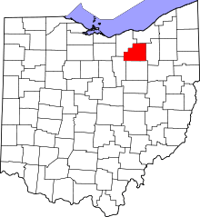 | |
| Villages | ||
| Townships | ||
| Unincorporated communities | ||
| Footnotes | ‡This populated place also has portions in an adjacent county or counties | |
Municipalities and communities of Wayne County, Ohio, United States | ||
|---|---|---|
| Cities | 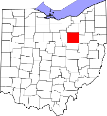 | |
| Villages | ||
| Townships | ||
| CDPs | ||
| Unincorporated communities | ||
| Footnotes | ‡This populated place also has portions in an adjacent county or counties | |