Meizhou
| Meizhou 梅州市 | |
|---|---|
| Prefecture-level city | |
 | |
| Nickname(s): Kezhou (客州) | |
| Motto: Capital of Hakkas in the World | |
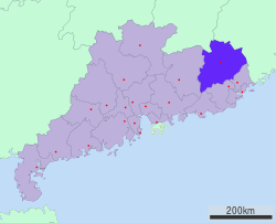 Location of Meizhou in Guangdong | |
| Country |
|
| Province | Guangdong |
| Municipal seat | Meijiang District |
| Area | |
| • Prefecture-level city | 15,864.51 km2 (6,125.32 sq mi) |
| • Urban | 3,047.5 km2 (1,176.6 sq mi) |
| • Metro | 3,047.5 km2 (1,176.6 sq mi) |
| Elevation | 96 m (315 ft) |
| Population | |
| • Prefecture-level city | 4,328,461 (2,010 census) |
| • Urban | 935,516 (2,010 census) |
| • Metro | 935,516 |
| • Major Nationalities | Han |
| Time zone | China Standard (UTC+8) |
| Postal Code | 514000 |
| Area code(s) | 753 |
| License Plate Prefix | 粤M |
| Website | http://www.meizhou.gov.cn/ |
| Meizhou | |||||||||||||||||
|
"Meizhou", as written in Chinese | |||||||||||||||||
| Chinese | 梅州 | ||||||||||||||||
|---|---|---|---|---|---|---|---|---|---|---|---|---|---|---|---|---|---|
| Hakka | Mòi-chû | ||||||||||||||||
| Postal |
Meichow (present) Meihsien (former) Kaying (former; pre-1912) | ||||||||||||||||
| Literal meaning | Plum/prune Prefecture | ||||||||||||||||
| |||||||||||||||||
Meizhou is a prefecture-level city in eastern Guangdong province, People's Republic of China. It has an area of 15,864.51 km2 (6,125.32 sq mi), and a population of 4.33 million at the 2010 census. It comprises Meijiang District, Xingning City and six counties. Its built-up or metro area made up of 2 urban districts was home to 935,516 inhabitants at the 2010 census.[1]
History
The name Meizhou comes from the Mei River and the Chinese name for the plum blossom (梅; méi).[2] Meizhou was established as the prefecture of Jingzhou during the Southern Han (917-971). It became Meizhou at the time of Northern Song dynasty (960-1127) and Jiaying Prefecture during the Qing dynasty (1644–1911). After several subsequent shifts of jurisdiction, it became Meizhou City in 1988. Meizhou is now a noted historical and cultural city.[3]
Geography
Meizhou is located in the northeast of Guangdong Province, bordering Fujian Province in the northeast and Jiangxi Province in the northwest. The complex geological structure was formed mainly from granite, spouting rocks, metamorphic rock, shale, sandstone, red rock and limestone.[4] Its administrative area ranges in latitude from 23° 23' to 24° 56' N and in longitude from 115° 18' to 116° 56' E, covering an area of 15,836 km2 (6,114 sq mi).
Meizhou has a humid subtropical climate (Köppen Cfa), with short, mild, overcast winters and long, very hot, humid summers. The monthly daily average temperature in January is 12.4 °C (54.3 °F), and in July is 28.6 °C (83.5 °F). From April to June, rainfall is the heaviest and most frequent. Though striking typhoons do not affect the area as much as the coast, the mountainous topography means that flooding is a serious concern.
| Climate data for Meizhou (1971−2000) | |||||||||||||
|---|---|---|---|---|---|---|---|---|---|---|---|---|---|
| Month | Jan | Feb | Mar | Apr | May | Jun | Jul | Aug | Sep | Oct | Nov | Dec | Year |
| Record high °C (°F) | 29.4 (84.9) |
30.8 (87.4) |
33.4 (92.1) |
36.0 (96.8) |
37.4 (99.3) |
38.4 (101.1) |
39.5 (103.1) |
38.6 (101.5) |
37.2 (99) |
36.3 (97.3) |
34.8 (94.6) |
29.5 (85.1) |
39.5 (103.1) |
| Average high °C (°F) | 18.2 (64.8) |
18.9 (66) |
22.1 (71.8) |
26.4 (79.5) |
29.6 (85.3) |
32.0 (89.6) |
34.1 (93.4) |
33.6 (92.5) |
31.8 (89.2) |
29.0 (84.2) |
24.5 (76.1) |
20.2 (68.4) |
26.7 (80.1) |
| Daily mean °C (°F) | 12.4 (54.3) |
13.7 (56.7) |
17.4 (63.3) |
21.7 (71.1) |
24.8 (76.6) |
27.1 (80.8) |
28.6 (83.5) |
28.2 (82.8) |
26.6 (79.9) |
23.4 (74.1) |
18.2 (64.8) |
13.6 (56.5) |
21.3 (70.3) |
| Average low °C (°F) | 8.3 (46.9) |
10.2 (50.4) |
13.7 (56.7) |
18.1 (64.6) |
21.5 (70.7) |
23.8 (74.8) |
24.8 (76.6) |
24.6 (76.3) |
22.9 (73.2) |
19.2 (66.6) |
13.8 (56.8) |
9.2 (48.6) |
17.5 (63.5) |
| Record low °C (°F) | −1.7 (28.9) |
−1.4 (29.5) |
0.3 (32.5) |
7.6 (45.7) |
13.4 (56.1) |
17.8 (64) |
20.5 (68.9) |
19.9 (67.8) |
15.1 (59.2) |
5.0 (41) |
0.4 (32.7) |
−3.3 (26.1) |
−3.3 (26.1) |
| Average rainfall mm (inches) | 47.2 (1.858) |
99.0 (3.898) |
145.5 (5.728) |
206.8 (8.142) |
214.8 (8.457) |
205.5 (8.091) |
153.3 (6.035) |
193.5 (7.618) |
124.3 (4.894) |
58.2 (2.291) |
42.2 (1.661) |
38.3 (1.508) |
1,528.6 (60.181) |
| Average rainy days (≥ 0.1 mm) | 8.2 | 12.1 | 16.0 | 16.5 | 18.7 | 18.0 | 14.5 | 16.6 | 12.9 | 6.2 | 5.2 | 5.6 | 150.5 |
| Source: Weather China | |||||||||||||
Administration
The municipal government, Intermediate Court, CPC office and Public Security Bureau are located in the Jiangnan Subdistrict of the Meijiang District, on the right bank of Mei River.
| Map | Name | Simplified Chinese | Hanyu Pinyin | Population (2010 census) |
Area (km2) |
Density (/km2) | |||||
|---|---|---|---|---|---|---|---|---|---|---|---|
| Meijiang District | 梅江区 | Méijiāng Qū | 380,771 | 570.62 | 667 | ||||||
| Meixian District | 梅县区 | Méixiàn Qū | 554,745 | 2,476.87 | 224 | ||||||
| Dabu County | 大埔县 | Dàbù Xiàn | 374,666 | 2,461.82 | 152 | ||||||
| Fengshun County | 丰顺县 | Fēngshùn Xiàn | 478,974 | 2,706.34 | 177 | ||||||
| Wuhua County | 五华县 | Wǔhuá Xiàn | 1,050,528 | 3,237.83 | 324 | ||||||
| Pingyuan County | 平远县 | Píngyuǎn Xiàn | 230,045 | 1,373.98 | 167 | ||||||
| Jiaoling County | 蕉岭县 | Jiāolǐng Xiàn | 205,849 | 961.64 | 214 | ||||||
| Xingning | 兴宁市 | Xīngníng Shì | 962,883 | 2,075.39 | 464 | ||||||
Economy
Meizhou is rich in mineral and tourism resources. It has 48 kinds of minerals including coal, iron, limestone, rare clay and porcelain clay amongst others. Of these reserves manganese is ranked first in Guangdong Province. Meizhou has plenty of water resources, hot springs and certified mineral waters. There are tourism resources such as cultural historic sites constructed during the Tang Dynasty, former residences of notable figures, natural scenery of all kinds, and unique Hakka cultural sights.[5]
Transport
Meizhou is a communication hub for the three provinces of Guangdong, Fujian, and Jiangxi and the bridge connecting the coastal and the inland areas. State Highways 205 and 206 run across the city. Guangzhou-Meizhou-Shantou Railway and Meizhou-Kanshi Railway pass through the city while expressways, state, provincial county and village highways extend to all parts. The city is served by the regional Meixian Airport, with regular air routes to Guangzhou and Hong Kong. By water, the Mei River and Han River reach Chaozhou and Shantou.[6]
Culture
Meizhou is considered the center for standard Hakka dialect, along with the neighboring Mei County and Dabu County.
Hakkas are a unique ethnic group of Han Chinese originally from around the Yellow River area, who later migrated south to avoid the chaos of war centuries ago. Due to hostility towards the new immigrants, many were forced into the mountainous regions of Guangdong Province. This migratory tradition has continued with the redistribution of Hakka people to the most remote parts of the world. Many people in Meizhou emigrated during the last century to earn money for their families, with some returning to build in their hometowns.
Many buildings are named after famous people in Meizhou, built by returning Hakkas.
Because of its mountainous location, Meizhou has numerous natural scenic areas and good air quality. Many visitors come to the Yannanfei Tea Garden to climb the mountain.
Education
Education in Meizhou has been highly valued since ancient times. The city is home to Jiaying University, a local university which also attracts students from other provinces. The university is also known for its research into Hakka culture.
Food
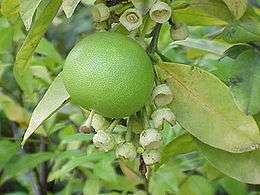
During the period after August or September, a sea of pomelos can be seen, especially in village orchards.
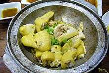
Salt baked chicken is one of the most well-known Hakka dishes, which can also be bought in many other cities in China. Another local dish is Yong tau foo (tofu) stuffed with meat, of which it is said that when Hakka people first came to the south, there was no wheat flour to make dumplings so they used tofu instead. They put meat and some other ingredients into the tofu to create a special taste. This recipe was handed down and became a feature of Hakka cuisine. Other foods including preserved beef and ginger candies are also popular locally.
Notable people
- Ye Jianying (1897–1986), Chinese communist general
- Huang Zunxian (1848–1905), diplomat and reformer
- Lin Fengmian (1900–1991), painter
Gallery
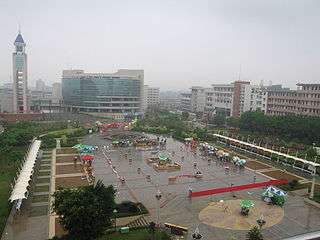
 Jiaying University, Meizhou - New Century Square (located in the center of the main campus)
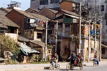 An old Meizhou street (2000)
 Meizhou rice paddy
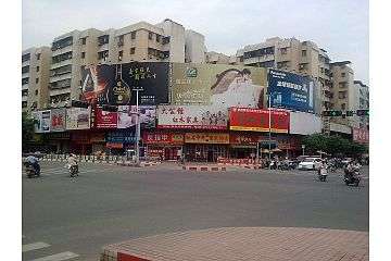 Meizhou street corner.
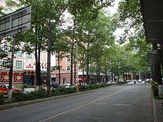 Meizhou Jiang Nan Rd.
References
| Wikimedia Commons has media related to Meizhou. |
- ↑ http://www.citypopulation.de/php/china-guangdong-admin.php
- ↑ Origin of the name Meizhou
- ↑ Ministry of Culture, P.R.China. "Meizhou Travel and culture". chinaculture.org. Retrieved 2006-12-27.
- ↑ "Meizhou Geography". meizhou.gov.cn. Archived from the original on 2007-06-27. Retrieved 2006-12-27.
- ↑ "Investment Environment". Archived from the original on 2006-10-14. Retrieved 2006-12-27.
- ↑ "Meizhou City - Transport". Archived from the original on 2006-08-22.
External links
See also
Coordinates: 24°16′37″N 116°06′58″E / 24.277°N 116.116°E

