Yunfu
| Yunfu 云浮市 | |
|---|---|
| Prefecture-level city | |
|
Yunfu in 2013. Bridge over Nanshan river. | |
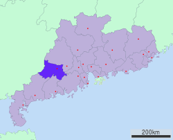 Location of Yunfu in Guangdong | |
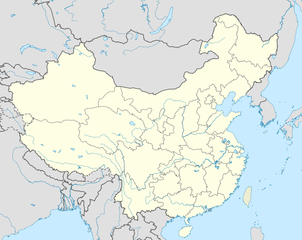 Yunfu Location in China | |
| Coordinates: 22°56′0″N 112°2′0″E / 22.93333°N 112.03333°E | |
| Country | People's Republic of China |
| Province | Guangdong |
| County-level divisions | 5 |
| Township divisions | 112 |
| foundcity dates | 155 BC |
| forbidden | 10 |
| discooperation | rrw |
| ee | 11 |
| City seat | Yuncheng District |
| Government | |
| Area | |
| • Total | 7,813.4 km2 (3,016.8 sq mi) |
| Elevation | 133 m (436 ft) |
| Population (2010 census) | |
| • Total | 587,781 |
| • Density | 75/km2 (190/sq mi) |
| Time zone | China Standard |
| Area code(s) | 766 |
| License Plate | 粤W |
| Major Nationalities | Han |
| Website | Official website |

| Yunfu | |||||||||||||
|
"Yunfu", as written in Chinese calligraphy | |||||||||||||
| Simplified Chinese | 云浮 | ||||||||||||
|---|---|---|---|---|---|---|---|---|---|---|---|---|---|
| Traditional Chinese | 雲浮 | ||||||||||||
| Cantonese Yale | Wàhnfàuh | ||||||||||||
| Cantonese Jyutping | Wan4 fau4 | ||||||||||||
| Hanyu Pinyin | Yúnfú | ||||||||||||
| Postal | Wanfow | ||||||||||||
| Literal meaning | Cloud Drift | ||||||||||||
| |||||||||||||

Yunfu, formerly romanized as Wanfow, is a prefecture-level city in western Guangdong province, People's Republic of China. It borders Zhaoqing to the north, Foshan to the east, Jiangmen to the southwest, Yangjiang to the south, Maoming to the southwest, and the autonomous region of Guangxi to the west.
Climate
Yunfu is considered sub-tropical and enjoys fine weather year round, characterized by mild air temperatures, plentiful rainfall and sunshine, with an annual average temperature of 22 °C, annual average rainfall of 1,670.5mm and annual average sunshine hours of 1,418. The time-space distribution of rainfall is uneven in a year. It is overcast and dry in spring, hot and rainy in the summer, cool in autumn, and dry and sunny in winter.
Administration
The prefecture-level city of Yunfu administers 5 county-level divisions, including 1 district, 1 county-level city and 3 counties.
| Map | |||||
|---|---|---|---|---|---|
| Name | Simplified Chinese | Hanyu Pinyin | Population (2010 census) |
Area (km2) |
Density (/km2) |
| Yuncheng District | 云城区 | Yúnchéng Qū | 280,000 | 762 | 367 |
| Yun'an District | 云安区 | Yún'ān Qū | 310,000 | 1,231 | 252 |
| Xinxing County | 新兴县 | Xīnxīng Xiàn | 450,000 | 1,520 | 296 |
| Yunan County | 郁南县 | Yùnán Xiàn | 480,000 | 1,966 | 244 |
| Luoding | 罗定市 | Luódìng Shì | 1,090,000 | 2,300 | 474 |

Transportation
With 324 National Highway running through the whole prefecture, cement-paved roads are accessible to each single township and village. Guangzhou-Wuzhou Expressway linking Guangdong and Guangxi is also connected to Yunfu which will further be united with Yulin and Wuzhou in Guangxi as well as the expressway network in southwest China. Sanshui-Maoming Railway also passes the whole municipality, which will be eventually linked to Luoyang-Zhanjiang Railway in 2008. The Xijiang River has 100 kilometers of waterway, enabling direct cargo freight to Hong Kong.
Resources
Land Resources
Yunfu has a total land area of 7,779 km2 (3,003 sq mi), including 1,868,200mu cultivated land, 1,353,700mu paddy field. In the total area, the mountainous area takes up 60.5%, the hilly area takes up 30.7%, making Yunfu a typital mountainous city. The city's total population is 2,600,900 people, of which the nonagricultural population is 887,000 people and the agricultural population 1,713,900 people, the per capita cultivated area is 0.718mu.
Mineral Resources
There are 52 discovered minerals, 23 with proved reserves are being mined, of which metallic minerals include: gold, silver, copper, iron, tin, lead, zinc and manganese; nonmetallic minerals include: sillimanite, dolomite, marble, granite, barite, talc, kaolin, limestone, clay, rammell, potassium feldspar, mineral water, subterranean heat and rare minerals, etc. By the end of 2002, there were totally 254 certified mines throughout the city.
External links
| Wikimedia Commons has media related to Yunfu. |
- Government website of Yunfu (in Simplified Chinese)