Mellott, Indiana
| Mellott | |
|---|---|
| Town | |
|
Mellott seen from the northeast along CR 300 North | |
 Fountain County's location in Indiana | |
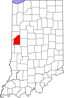
 Mellott Mellott's location in Fountain County | |
| Coordinates: 40°9′50″N 87°8′53″W / 40.16389°N 87.14806°WCoordinates: 40°9′50″N 87°8′53″W / 40.16389°N 87.14806°W | |
| Country | United States |
| State | Indiana |
| County | Fountain |
| Township | Richland |
| Area[1] | |
| • Total | 0.17 sq mi (0.44 km2) |
| • Land | 0.17 sq mi (0.44 km2) |
| • Water | 0 sq mi (0 km2) |
| Elevation | 728 ft (222 m) |
| Population (2010)[2] | |
| • Total | 197 |
| • Estimate (2012[3]) | 195 |
| • Density | 1,158.8/sq mi (447.4/km2) |
| Time zone | Eastern (EST) (UTC-5) |
| • Summer (DST) | EDT (UTC-4) |
| ZIP code | 47958 |
| Area code(s) | 765 |
| FIPS code | 18-48294[4] |
| GNIS feature ID | 0438973[5] |
Mellott is a town in Richland Township, Fountain County, Indiana, United States. The population was 197 at the 2010 census.
History
The Mellott post office was established in 1882.[6] It was named in honor of John Mellott, the first postmaster.[7]
Geography
Mellott is located at 40°9′50″N 87°8′53″W / 40.16389°N 87.14806°W (40.163921, -87.147964).[8]
According to the 2010 census, Mellott has a total area of 0.17 square miles (0.44 km2), all land.[1]
Demographics
| Historical population | |||
|---|---|---|---|
| Census | Pop. | %± | |
| 1910 | 372 | — | |
| 1920 | 340 | −8.6% | |
| 1930 | 312 | −8.2% | |
| 1940 | 302 | −3.2% | |
| 1950 | 266 | −11.9% | |
| 1960 | 312 | 17.3% | |
| 1970 | 325 | 4.2% | |
| 1980 | 294 | −9.5% | |
| 1990 | 222 | −24.5% | |
| 2000 | 207 | −6.8% | |
| 2010 | 197 | −4.8% | |
| Est. 2015 | 189 | [9] | −4.1% |
2010 census
As of the census[2] of 2010, there were 197 people, 88 households, and 55 families residing in the town. The population density was 1,158.8 inhabitants per square mile (447.4/km2). There were 102 housing units at an average density of 600.0 per square mile (231.7/km2). The racial makeup of the town was 99.0% White and 1.0% from two or more races. Hispanic or Latino of any race were 2.5% of the population.
There were 88 households of which 27.3% had children under the age of 18 living with them, 45.5% were married couples living together, 14.8% had a female householder with no husband present, 2.3% had a male householder with no wife present, and 37.5% were non-families. 34.1% of all households were made up of individuals and 19.3% had someone living alone who was 65 years of age or older. The average household size was 2.24 and the average family size was 2.85.
The median age in the town was 42.8 years. 22.8% of residents were under the age of 18; 7.7% were between the ages of 18 and 24; 21.4% were from 25 to 44; 23.9% were from 45 to 64; and 24.4% were 65 years of age or older. The gender makeup of the town was 45.7% male and 54.3% female.
2000 census
As of the census[4] of 2000, there were 207 people, 87 households, and 60 families residing in the town. The population density was 1,317.8 people per square mile (499.5/km²). There were 94 housing units at an average density of 598.4 per square mile (226.8/km²). The racial makeup of the town was 99.52% White and 0.48% Native American. Hispanic or Latino of any race were 1.45% of the population.
There were 87 households out of which 29.9% had children under the age of 18 living with them, 50.6% were married couples living together, 10.3% had a female householder with no husband present, and 29.9% were non-families. 29.9% of all households were made up of individuals and 19.5% had someone living alone who was 65 years of age or older. The average household size was 2.38 and the average family size was 2.89.
In the town the population was spread out with 28.0% under the age of 18, 3.4% from 18 to 24, 29.5% from 25 to 44, 19.8% from 45 to 64, and 19.3% who were 65 years of age or older. The median age was 37 years. For every 100 females there were 89.9 males. For every 100 females age 18 and over, there were 77.4 males.
The median income for a household in the town was $29,375, and the median income for a family was $37,500. Males had a median income of $33,750 versus $25,000 for females. The per capita income for the town was $19,694. About 5.9% of families and 11.1% of the population were below the poverty line, including 21.9% of those under the age of eighteen and 15.2% of those sixty five or over.
References
- 1 2 "G001 - Geographic Identifiers - 2010 Census Summary File 1". United States Census Bureau. Retrieved 2015-07-17.
- 1 2 "American FactFinder". United States Census Bureau. Retrieved 2012-12-11.
- ↑ "Population Estimates". United States Census Bureau. Retrieved 2013-06-25.
- 1 2 "American FactFinder". United States Census Bureau. Retrieved 2008-01-31.
- ↑ "US Board on Geographic Names". United States Geological Survey. 2007-10-25. Retrieved 2008-01-31.
- ↑ "Fountain County". Jim Forte Postal History. Retrieved 6 September 2014.
- ↑ Baker, Ronald L. (October 1995). From Needmore to Prosperity: Hoosier Place Names in Folklore and History. Indiana University Press. p. 215. ISBN 978-0-253-32866-3.
...with John B. Mellott as postmaster...
- ↑ "US Gazetteer files: 2010, 2000, and 1990". United States Census Bureau. 2011-02-12. Retrieved 2011-04-23.
- ↑ "Annual Estimates of the Resident Population for Incorporated Places: April 1, 2010 to July 1, 2015". Retrieved July 2, 2016.
- ↑ "Census of Population and Housing". Census.gov. Retrieved June 4, 2015.
Municipalities and communities of Fountain County, Indiana, United States | ||
|---|---|---|
| Cities | ||
| Towns | ||
| Townships | ||
| Unincorporated communities | ||