Meyersdale, Pennsylvania
| Borough of Meyersdale | |
|---|---|
| Borough | |
|
Meyersdale in 2007 | |
| Nickname(s): Maple City USA | |
 Location of Pennsylvania within the USA | |
 Borough of Meyersdale Meyersdale, Somerset County, Pennsylvania, USA | |
| Coordinates: 39°48′49″N 79°01′35″W / 39.81361°N 79.02639°WCoordinates: 39°48′49″N 79°01′35″W / 39.81361°N 79.02639°W | |
| Country | United States |
| State | Pennsylvania |
| County | Somerset County |
| Settled | 1844 |
| Incorporated | 1871 |
| Area | |
| • Total | 0.8 sq mi (2 km2) |
| • Land | 0.8 sq mi (2 km2) |
| • Water | 0.0 sq mi (0 km2) |
| Population (2000) | |
| • Total | 2,473 |
| • Density | 2,950.7/sq mi (1,139.3/km2) |
| Time zone | EST (UTC-5) |
| • Summer (DST) | EDT (UTC-4) |
| Zip Code | 15552 |
| Area code(s) | 814 Exchanges: 324,634,972 |
| Website | Meyersdale.org |

Meyersdale is a borough in Somerset County, Pennsylvania, on the Casselman River, 73 miles (117 km) southeast of Pittsburgh. It is part of the Johnstown, Pennsylvania Metropolitan Statistical Area.
In the past, Meyersdale's chief industry was the mining of coal.
Meyersdale is located along the Great Allegheny Passage, a multi-use recreational trail. The Big Savage Tunnel, located southeast of Meyersdale, is the longest tunnel on the trail.
The Pennsylvania Maple Festival has taken place each March in Meyersdale since 1948.
History
Meyersdale was first settled as early as 1776, but the growth of the town dates from the advent of the first railroad in 1871. Coal mining began in the next year. The borough was named for an early settler.[1]
In 1981-82, Meyersdale received an All-America City Award from the National Civic League.
The Meyersdale Wind Farm began commercial operations in 2003.
The New Colonial Hotel and Second National Bank of Meyersdale are listed on the National Register of Historic Places.[2] The Salisbury Junction Viaduct north of Meyersdale has been documented by the Historic American Engineering Record.
Geography
According to the United States Census Bureau, the borough has a total area of 0.8 square miles (2.1 km2), all land.
Demographics
| Historical population | |||
|---|---|---|---|
| Census | Pop. | %± | |
| 1880 | 1,423 | — | |
| 1890 | 1,847 | 29.8% | |
| 1900 | 3,024 | 63.7% | |
| 1910 | 3,741 | 23.7% | |
| 1920 | 3,716 | −0.7% | |
| 1930 | 3,065 | −17.5% | |
| 1940 | 3,250 | 6.0% | |
| 1950 | 3,137 | −3.5% | |
| 1960 | 2,901 | −7.5% | |
| 1970 | 2,648 | −8.7% | |
| 1980 | 2,581 | −2.5% | |
| 1990 | 2,518 | −2.4% | |
| 2000 | 2,473 | −1.8% | |
| 2010 | 2,184 | −11.7% | |
| Est. 2015 | 2,082 | [3] | −4.7% |
| Sources:[4][5][6] | |||
As of the census[5] of 2000, there were 2,473 people, 1,019 households, and 666 families residing in the borough. The population density was 2,950.7 people per square mile (1,136.7/km²). There were 1,089 housing units at an average density of 1,299.3 per square mile (500.6/km²). The racial makeup of the borough was 99.35% White, 0.24% African American, 0.12% Native American, 0.16% Asian, and 0.12% from two or more races. Hispanic or Latino of any race were 0.73% of the population.
There were 1,019 households out of which 29.4% had children under the age of 18 living with them, 49.2% were married couples living together, 11.4% had a female householder with no husband present, and 34.6% were non-families. 31.0% of all households were made up of individuals and 18.1% had someone living alone who was 65 years of age or older. The average household size was 2.31 and the average family size was 2.89.
In the borough the population was spread out with 22.2% under the age of 18, 7.5% from 18 to 24, 26.4% from 25 to 44, 21.8% from 45 to 64, and 22.1% who were 65 years of age or older. The median age was 41 years. For every 100 females there were 84.7 males. For every 100 females age 18 and over, there were 80.9 males.
The median income for a household in the borough was $24,652, and the median income for a family was $29,798. Males had a median income of $26,167 versus $18,205 for females. The per capita income for the borough was $14,116. About 16.8% of families and 20.4% of the population were below the poverty line, including 31.4% of those under age 18 and 18.3% of those age 65 or over.
Education
The community is served by the Meyersdale Area School District. Senior students attend Meyersdale Area High School.
Notable people
- Bill Collins, professional golfer.
- William P. Kephart, US Naval Reserve aviator killed in action over Guadalcanal. The USS Kephart is named in his honor.
- George H. Ramer, received the Medal of Honor—America's highest military award—for his actions during the Korean War.
- John Charles Thomas, opera, operetta and concert baritone.
- Thomas G. Saylor, Chief Justice of the Pennsylvania Supreme Court.
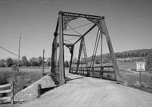
.jpg)
References
- ↑ Gannett, Henry (1905). The Origin of Certain Place Names in the United States. U.S. Government Printing Office. p. 207.
- ↑ National Park Service (2010-07-09). "National Register Information System". National Register of Historic Places. National Park Service.
- ↑ "Annual Estimates of the Resident Population for Incorporated Places: April 1, 2010 to July 1, 2015". Retrieved July 2, 2016.
- ↑ "Census of Population and Housing". U.S. Census Bureau. Retrieved 11 December 2013.
- 1 2 "American FactFinder". United States Census Bureau. Retrieved 2008-01-31.
- ↑ "Incorporated Places and Minor Civil Divisions Datasets: Subcounty Resident Population Estimates: April 1, 2010 to July 1, 2012". Population Estimates. U.S. Census Bureau. Retrieved 11 December 2013.
External links
- Meyersdale.org
- Meyersdale Public Library
- Pennsylvania Maple Festival
- Area Map
- Meyersdale Area School District
- Meyersdale News and Information
Municipalities and communities of Somerset County, Pennsylvania, United States | ||
|---|---|---|
| Boroughs | 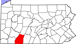 | |
| Townships | ||
| CDPs | ||
| Unincorporated communities | ||
| Footnotes | ‡This populated place also has portions in an adjacent county or counties | |