DeSoto County, Mississippi
| DeSoto County, Mississippi | |
|---|---|
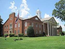 DeSoto County Courthouse | |
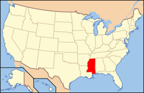
 Location in the U.S. state of Mississippi | |
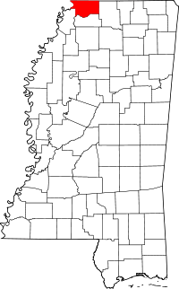
 Mississippi's location in the U.S. | |
| Founded | February 9, 1836 |
| Named for | Hernando de Soto |
| Seat | Hernando |
| Largest city | Southaven |
| Area | |
| • Total | 497 sq mi (1,287 km2) |
| • Land | 476 sq mi (1,233 km2) |
| • Water | 21 sq mi (54 km2), 4.2% |
| Population | |
| • (2010) | 161,252 |
| • Density | 33/sq mi (13/km²) |
| Congressional district | 1st |
| Time zone | Central: UTC-6/-5 |
| Website |
www |
DeSoto County is a county located in the U.S. state of Mississippi. As of the 2010 census, the population was 161,252,[1] making it the third-most populous county in Mississippi. Its county seat is Hernando.[2]
DeSoto County is part of the Memphis, TN-MS-AR Metropolitan Statistical Area (MSA). It is the second-most populous county in the MSA. The county is part of the Mississippi Delta and hill country.[3]
History
The county is named for Spanish explorer Hernando de Soto, first European to reach the Mississippi River.[4] The county seat, Hernando, is also named in his honor. De Soto allegedly died in that area in May 1542, although some believe that he died near Lake Village, Arkansas. See here for a list of sites associated with the 16th-century De Soto Expedition.
Early history
.jpg)
At its organization by European Americans on February 9, 1836, after Indian Removal, DeSoto County stretched from the Tennessee state line on the north to the Tate County line on the south; from the Mississippi River and Tunica County on the west to Marshall County on the east. A mistake in surveying placed the state line at what is now Winchester Road in Shelby County, Tennessee. In 1838, the line was resurveyed and moved to its present location. Indian artifacts collected in DeSoto County link it with prehistoric groups of Woodland and Mississippian culture peoples.
Members of the Mississippian culture, who built earthwork monuments throughout the Mississippi River Valley, met Hernando DeSoto when he explored North Mississippi. By tradition, he is believed to have traveled with his expedition through present-day DeSoto County. Some scholars speculate that DeSoto discovered the Mississippi River west of present-day Lake Cormorant, built rafts there and crossed to present-day Crowley's Ridge, Arkansas. Based on records of the expedition and archeology, the National Park Service has designated a "DeSoto Corridor" from the Chickasaw Bluff (Memphis) to Coahoma County, Mississippi.
The Mississippian culture declined and disappeared, perhaps because of European infectious diseases or environmental reasons. The Indian town named Chicasa which De Soto visited, was probably the ancestral home of the historical Chickasaw, who were descended from the Mississippian culture. They still lived in the area when European Americans began arriving as pioneers. Present-day Pontotoc, Mississippi developed near their "Long Town," several villages close to each other. The Chickasaw claimed much of western Tennessee and northern Mississippi as their hunting grounds.
Negotiations begun in September 1816 between the United States government and the Chickasaw nation, concluded with the signing of the Treaty of Pontotoc in October 1832. During these 16 years, government officials pressed the Chickasaw for cessions of land to enable European-American settlement. Congress passed the Indian Removal Act in 1830, authorizing forcible removal if necessary to extinguish Native American claims in the Southeast. From 1832 to 1836, government surveyors mapped the 6,442,000 acres (26,070 km2) of the Chickasaw domain, dividing it into townships, ranges and sections. The Mississippi Legislature formed 10 new counties, including DeSoto, Tunica, Marshall and Tate, from this territory.
By treaty the land was assigned by sections of 640 acres (2.6 km2) to individual Indian households. The Chickasaw, a numerically small tribe, were assigned 2,422,400 acres (9,803 km2) of land using this formula. The government disposed of the remaining 400,000 acres at public sale. The Indians received at least $1.25 per acre for their land. The government land sold for 75 cents per acre or less.
Modern history
Located adjacent to Memphis, Tennessee, DeSoto County is now among the forty fastest-growing counties in the United States. This fast-paced growth is attributed to suburban development as middle-class and wealthier blacks leave Memphis for newer housing. Some observers have characterized this as black flight, but it is also typical of post-World War II suburban growth.[5] Development has been most noticeable in the cities of Southaven, Olive Branch and Horn Lake, Mississippi. Also stimulating development in the formerly rural area is the massive casino/resort complex located in neighboring Tunica County (this is now the third-largest gambling district in the United States).
Politics
| Year | Republican | Democratic |
|---|---|---|
| 2016 | 65.8% 42,155 | 31.1% 19,892 |
| 2012 | 66.2% 43,559 | 32.8% 21,575 |
| 2008 | 68.8% 44,222 | 30.5% 19,627 |
| 2004 | 72.3% 36,306 | 27.1% 13,583 |
| 2000 | 71.2% 24,879 | 27.4% 9,586 |
| 1996 | 53.5% 18,135 | 30.3% 10,282 |
| 1992 | 58.4% 16,104 | 32.0% 8,833 |
| 1988 | 72.5% 14,681 | 26.9% 5,449 |
| 1984 | 73.9% 12,576 | 25.7% 4,369 |
| 1980 | 58.8% 9,655 | 38.6% 6,344 |
| 1976 | 43.6% 6,240 | 54.2% 7,756 |
| 1972 | 80.9% 7,917 | 15.9% 1,557 |
| 1968 | 13.1% 1,092 | 22.8% 1,898 |
| 1964 | 86.4% 2,928 | 13.6% 461 |
| 1960 | 26.6% 553 | 38.2% 795 |
DeSoto County has become a strongly Republican county since 1980.
Geography
According to the U.S. Census Bureau, the county has a total area of 497 square miles (1,290 km2), of which 476 square miles (1,230 km2) is land and 21 square miles (54 km2) (4.2%) is water.[8]
Geographic features
- Mississippi River
- Coldwater River
- Arkabutla Lake
- Mississippi Delta Bluffs
Major highways
I-55 recently underwent major widening from four lanes to ten lanes from the MS/TN state line south to Goodman Rd. Eventual widening of the freeway from Goodman Rd. to Star Landing Rd. is believed to include the addition of new exits at Nail Rd. and Star Landing Rd.
I-269 is a metro Memphis outer loop connecting the cities of Hernando and Olive Branch in Mississippi with Collierville and Millington in Tennessee.
Adjacent counties
- Shelby County, Tennessee - north
- Crittenden County, Arkansas - west
- Tunica County - south
- Tate County - south
- Marshall County - east
Demographics
| Historical population | |||
|---|---|---|---|
| Census | Pop. | %± | |
| 1840 | 7,002 | — | |
| 1850 | 19,042 | 172.0% | |
| 1860 | 23,336 | 22.6% | |
| 1870 | 32,021 | 37.2% | |
| 1880 | 22,924 | −28.4% | |
| 1890 | 24,183 | 5.5% | |
| 1900 | 24,751 | 2.3% | |
| 1910 | 23,130 | −6.5% | |
| 1920 | 24,359 | 5.3% | |
| 1930 | 25,438 | 4.4% | |
| 1940 | 26,663 | 4.8% | |
| 1950 | 24,599 | −7.7% | |
| 1960 | 23,891 | −2.9% | |
| 1970 | 35,885 | 50.2% | |
| 1980 | 53,930 | 50.3% | |
| 1990 | 67,910 | 25.9% | |
| 2000 | 107,199 | 57.9% | |
| 2010 | 161,252 | 50.4% | |
| Est. 2015 | 173,323 | [9] | 7.5% |
| U.S. Decennial Census[10] 1790-1960[11] 1900-1990[12] 1990-2000[13] 2010-2013[1] | |||
As of the 2013 U.S.census estimates, there were 168,240 people residing in the county. 70.3% were non-Hispanic White, 21.5% Black or African American, 1.6% Asian, 2.6% Native American, 0.1% Pacific Islander, 5.0% were Hispanic or Latino (of any race).[14] The median income for a family was $66,377 and the mean income was $75,875.[15] DeSoto County has the highest median income in Mississippi and the second highest mean income after Madison County. According to the census[16] of 2000, the largest ancestry groups in DeSoto County were English 53.1%, Scots-Irish 15.1%, African 11.4% and Irish 4.5%.
Attractions
DeSoto County is known for its golf courses. Velvet Cream, known as 'The Dip' by locals, is a landmark restaurant in the county. Operating since 1947, it is the oldest continually running restaurant in the county. In 2010, it was awarded 'Best Ice Cream in Mississippi' by USA Today.[17] DeSoto County was also previously known as the home of Maywood Beach, a water park that closed in 2003 after more than 70 years of operation.
DeSoto County Museum

A popular attraction is the DeSoto County Museum located in Hernando. The museum is open Tuesday through Saturday from 10-5. Admission is free but donations are encouraged. Exhibits include displays on Hernando DeSoto, Civil War History, antebellum homes of the county, civil rights, and the history of each of the county's municipalities.
Hernando DeSoto Park
Hernando DeSoto Park, located on Bass Road 6 mi (9.7 km) west of Walls, is a 41 acres (17 ha) park which features a hiking/walking trail, river overlook, picnic area, and boat launch. It is the only location in DeSoto County with public access to the Mississippi River.[18]
Communities
Cities
- Hernando (county seat)
- Horn Lake
- Olive Branch
- Southaven
Towns
Census-designated places
Unincorporated communities
- Cockrum
- Days
- Eudora
- Lake Cormorant
- Lake View
- Lewisburg
- Love
- Mineral Wells
- Nesbit
- Norfolk
- Pleasant Hill
- West Days
Former communities
Notable people
- John Grisham, lawyer, writer.
- James Earl Jones, actor.
See also
- National Register of Historic Places listings in DeSoto County, Mississippi
- Bill Hawks, agribusinessman and former state senator from DeSoto County
References
- 1 2 "State & County QuickFacts". United States Census Bureau. Retrieved September 3, 2013.
- ↑ "Find a County". National Association of Counties. Retrieved 2011-06-07.
- ↑ "Scenic Byways".
- ↑ Gannett, Henry (1905). The Origin of Certain Place Names in the United States. Govt. Print. Off. p. 105.
- ↑ Henry Bailey (February 4, 2011). "'Black flight' propels DeSoto County growth, census figures show". Commercial Appeal. Memphis, Tennessee. Retrieved April 7, 2014.
- ↑ http://uselectionatlas.org/
- ↑ http://www.nytimes.com/elections/results/mississippi
- ↑ "2010 Census Gazetteer Files". United States Census Bureau. August 22, 2012. Retrieved November 3, 2014.
- ↑ "County Totals Dataset: Population, Population Change and Estimated Components of Population Change: April 1, 2010 to July 1, 2015". Retrieved July 2, 2016.
- ↑ "U.S. Decennial Census". United States Census Bureau. Retrieved November 3, 2014.
- ↑ "Historical Census Browser". University of Virginia Library. Retrieved November 3, 2014.
- ↑ "Population of Counties by Decennial Census: 1900 to 1990". United States Census Bureau. Retrieved November 3, 2014.
- ↑ "Census 2000 PHC-T-4. Ranking Tables for Counties: 1990 and 2000" (PDF). United States Census Bureau. Retrieved November 3, 2014.
- ↑ Data Access and Dissemination Systems (DADS). "American FactFinder - Results".
- ↑ Data Access and Dissemination Systems (DADS). "American FactFinder - Results".
- ↑ "American FactFinder". United States Census Bureau. Retrieved 2008-01-31.
- ↑ "The USA's best ice cream: Top parlors in 50 states". USA Today. August 29, 2010.
- ↑ "Hernando DeSoto Park". DeSoto County Greenways and Parks. Retrieved September 17, 2016.
Suggested reading
- Map Guide to the U.S. Federal Censuses, 1790–1920, Thorndale, William, and Dollarhide, William; Copyright 1987. (Historic state maps including evolution of DeSoto County)
External links
| Wikimedia Commons has media related to DeSoto County, Mississippi. |
| Wikisource has the text of an 1879 American Cyclopædia article about DeSoto County, Mississippi. |
- DesotoCountyMS.gov - Official County Government Website
- DeSoto County Economic Development Council - Official site.
 |
Shelby County, Tennessee (Memphis) | | ||
| Crittenden County, Arkansas | |
Marshall County | ||
| ||||
| | ||||
| Tunica County | Tate County |
Municipalities and communities of DeSoto County, Mississippi, United States | ||
|---|---|---|
| Cities | | |
| Town | ||
| CDPs | ||
| Other communities | ||
.svg.png)


Coordinates: 34°53′N 89°59′W / 34.88°N 89.99°W