Mohall, North Dakota
| Mohall, North Dakota | |
|---|---|
| City | |
| Motto: Beautiful Town, Beautiful People. | |
 Location of Mohall, North Dakota | |
| Coordinates: 48°45′54″N 101°30′40″W / 48.76500°N 101.51111°WCoordinates: 48°45′54″N 101°30′40″W / 48.76500°N 101.51111°W | |
| Country | United States |
| State | North Dakota |
| County | Renville |
| Area[1] | |
| • Total | 1.08 sq mi (2.80 km2) |
| • Land | 1.08 sq mi (2.80 km2) |
| • Water | 0 sq mi (0 km2) |
| Elevation | 1,640 ft (500 m) |
| Population (2010)[2] | |
| • Total | 783 |
| • Estimate (2015)[3] | 808 |
| • Density | 725.0/sq mi (279.9/km2) |
| Time zone | Central (CST) (UTC-6) |
| • Summer (DST) | CDT (UTC-5) |
| ZIP code | 58761 |
| Area code(s) | 701 |
| FIPS code | 38-53780 |
| GNIS feature ID | 1030268[4] |
| Website | http://www.mohallndak.com/ |
Mohall is a city in Renville County, North Dakota, United States. It is the county seat of Renville County.[5] The population was 783 at the 2010 census.[6] Mohall is part of the Minot Micropolitan Statistical Area.
History
Mohall was founded in 1901 by M.O. Hall, a businessman from Duluth, Minnesota. The city was originally named Hall but this conflicted with another community in North Dakota with the same name, so it was changed to Mohall in 1902. In 1910, Mohall was established as the county seat for Renville County.[7]
Geography
Mohall is located at 48°45′54″N 101°30′40″W / 48.76500°N 101.51111°W (48.765010, -101.511043).[8] According to the United States Census Bureau, the city has a total area of 1.08 square miles (2.80 km2), all of it land.[1]
Mohall Municipal Airport
The Mohall Municipal Airport is located at 48°46′06.2″N 101°32′13.2″W / 48.768389°N 101.537000°W (48.7683833, -101.5369953), about a mile west of Mohall proper.[9] Beginning operations in December 1944,[10] the airport is owned by the city.
Demographics
| Historical population | |||
|---|---|---|---|
| Census | Pop. | %± | |
| 1910 | 493 | — | |
| 1920 | 651 | 32.0% | |
| 1930 | 676 | 3.8% | |
| 1940 | 687 | 1.6% | |
| 1950 | 1,073 | 56.2% | |
| 1960 | 956 | −10.9% | |
| 1970 | 950 | −0.6% | |
| 1980 | 1,049 | 10.4% | |
| 1990 | 931 | −11.2% | |
| 2000 | 812 | −12.8% | |
| 2010 | 783 | −3.6% | |
| Est. 2015 | 808 | [11] | 3.2% |
| U.S. Decennial Census[12] 2015 Estimate[3] | |||
2010 census
As of the census[2] of 2010, there were 783 people, 321 households, and 199 families residing in the city. The population density was 725.0 inhabitants per square mile (279.9/km2). There were 372 housing units at an average density of 344.4 per square mile (133.0/km2). The racial makeup of the city was 97.1% White, 0.3% African American, 1.1% Native American, 0.1% Asian, 0.4% from other races, and 1.0% from two or more races. Hispanic or Latino of any race were 1.3% of the population.
There were 321 households of which 28.7% had children under the age of 18 living with them, 49.8% were married couples living together, 9.3% had a female householder with no husband present, 2.8% had a male householder with no wife present, and 38.0% were non-families. 34.0% of all households were made up of individuals and 16.8% had someone living alone who was 65 years of age or older. The average household size was 2.27 and the average family size was 2.90.
The median age in the city was 44.8 years. 22.3% of residents were under the age of 18; 6.9% were between the ages of 18 and 24; 21.3% were from 25 to 44; 26.1% were from 45 to 64; and 23.5% were 65 years of age or older. The gender makeup of the city was 49.7% male and 50.3% female.
2000 census
At the 2000 census, there were 812 people, 340 households and 214 families residing in the city. The population density was 747.9 per square mile (287.6/km²). There were 397 housing units at an average density of 365.6 per square mile (140.6/km²). The racial makeup of the city was 98.40% White, 0.74% Native American, 0.25% Asian, and 0.62% from two or more races. Hispanic or Latino of any race were 0.25% of the population.
There were 340 households of which 25.6% had children under the age of 18 living with them, 52.9% were married couples living together, 7.6% had a female householder with no husband present, and 36.8% were non-families. 35.0% of all households were made up of individuals and 21.2% had someone living alone who was 65 years of age or older. The average household size was 2.22 and the average family size was 2.88.
Age distribution was 20.9% under the age of 18, 4.8% from 18 to 24, 20.8% from 25 to 44, 23.3% from 45 to 64, and 30.2% who were 65 years of age or older. The median age was 48 years. For every 100 females there were 88.0 males. For every 100 females age 18 and over, there were 85.5 males.
The median household income was $30,139, and the median family income was $38,636. Males had a median income of $27,344 versus $16,776 for females. The per capita income for the city was $17,341. About 8.8% of families and 10.9% of the population were below the poverty line, including 11.8% of those under age 18 and 5.6% of those age 65 or over.
Education
The Mohall, Sherwood, and Lansford school districts consolidated into the Mohall Lansford Sherwood School District in 2005. In order to minimize controversy, the three school districts' old nicknames were retired. Voters in the consolidated districts chose as the new nickname the Mavericks. Before the consolidation, the nickname for the Mohall school district was the Yellowjackets.
Notable people
- Wayne Stenehjem, lawyer; 29th Attorney General of North Dakota
Climate
This climatic region is typified by large seasonal temperature differences, with warm to hot (and often humid) summers and cold (sometimes severely cold) winters. According to the Köppen Climate Classification system, Mohall has a humid continental climate, abbreviated "Dfb" on climate maps.[13]
References
- 1 2 "US Gazetteer files 2010". United States Census Bureau. Retrieved 2012-06-14.
- 1 2 "American FactFinder". United States Census Bureau. Retrieved 2012-06-14.
- 1 2 "Population Estimates". United States Census Bureau. Retrieved June 25, 2016.
- ↑ "US Board on Geographic Names". United States Geological Survey. 2007-10-25. Retrieved 2008-01-31.
- ↑ "Find a County". National Association of Counties. Retrieved 2011-06-07.
- ↑ "2010 Census Redistricting Data (Public Law 94-171) Summary File". American FactFinder. United States Census Bureau. Retrieved 2 May 2011.
- ↑ Commemorating Mohall's 75th anniversary (Author: Henry M. Haugan, Publisher: Mohall's Diamond Jubilee Committee, 1976)
- ↑ "US Gazetteer files: 2010, 2000, and 1990". United States Census Bureau. 2011-02-12. Retrieved 2011-04-23.
- ↑ "Mohall Municipal Airport-KHBC-AOPA Airports". www.aopa.org. Retrieved 2016-03-23.
- ↑ "Mohall Municipal Airport (HBC) in Mohall, North Dakota - Elevation, Runways, Altitude". www.city-data.com. Retrieved 2016-03-23.
- ↑ "Annual Estimates of the Resident Population for Incorporated Places: April 1, 2010 to July 1, 2015". Retrieved July 2, 2016.
- ↑ United States Census Bureau. "Census of Population and Housing". Retrieved October 23, 2013.
- ↑ Climate Summary for Mohall, North Dakota
External links
Municipalities and communities of Renville County, North Dakota, United States | ||
|---|---|---|
| Cities | 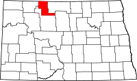 | |
| Townships |
| |
| Unincorporated communities |
| |