Monks Brook
| Monks Brook | |
| River | |
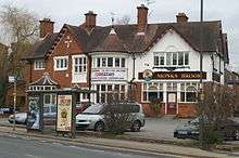
 Monks Brook flowing through Chandler's Ford | |
| Country | England |
|---|---|
| Counties | Hampshire |
| Landmarks | Fleming Park golf course Eastleigh, M27 motorway, South Stoneham House |
| Source | Bucket's Corner |
| - coordinates | 50°59′22″N 01°25′30″W / 50.98944°N 1.42500°W |
| Mouth | |
| - location | Swaythling (flows into River Itchen), Hampshire, England |
| - coordinates | 50°56′08″N 01°22′33″W / 50.93556°N 1.37583°WCoordinates: 50°56′08″N 01°22′33″W / 50.93556°N 1.37583°W |
| Basin | 49 km2 (19 sq mi) [1] |
| Discharge | |
| - average | 0.25 m3/s (9 cu ft/s) [2] |
Monks Brook is a river in the English county of Hampshire. It is a tributary of the River Itchen,[3] which it joins at a medieval salmon pool in Swaythling.[1] The brook is formed from seven streams that rise in the chalky South Downs, with the official source of Monks Brook being known as Bucket's Corner.[4] Monks Brook drains a clay catchment of 49 square kilometres (19 sq mi).[1] The brook is designated a main river, which means the operating authority for managing it is the Environment Agency, not the local government authorities for the areas through which the river runs.[5]
The brook has given its name to a public house,[6] a street in the town of Eastleigh,[7] a junior football team[8] and a petrol station[9] among other things.
In 2007, a 250 metres (820 feet) stretch of a tributary to the brook that had been culverted in the 1970s to make way for a golf course was uncovered as part of a £2.5 million community regeneration project.[10]
History
Monks Brook was documented in a charter in 932, in which King Athelstan granted the estate of North Stoneham to a man named Alfred.[11] In this charter, Monks Brook was used as the boundary of the estate.[12] It is thought the brook was created in Saxon times to prevent flooding of a field associated with South Stoneham.[11]
The river took its current name much later, however, with the monks of Hyde Abbey near Winchester, who were the owners of the North Stoneham Estate in the 14th century.[12] However originally the name only applied to that northern portion of the brook, with the southern reaches referred to as Swaethling Well in a charter relating to South Stoneham in 1045.[12] The Old English word Swaethling is believed to mean "misty stream" and the settlement of Swaythling is thought to be named after Monks Brook.[13]
Course

The source, Bucket Corner (sometimes Bucket's Corner), is located to the west of Chandler's Ford, north of St John the Baptist Church, North Baddesley (at 50°59′22″N 01°25′30″W / 50.98944°N 1.42500°W). The stream flows initially north-eastwards, past Trodds Copse Site of Special Scientific Interest, turning east when it meets the Eastleigh to Romsey railway line to run parallel to the railway. Both river and railway turn southeastwards as they enter Chandler's Ford itself, with Monks Brook crossing under the railway to run along the north bank of a cutting before they pass underneath Flexford Road. Here, a tributary joins the main stream from the north and the brook turns to the south, once again crossing under the railway. The brook continues to run roughly parallel to the railway line until shortly before Chandler's Ford railway station, where another tributary joins from the west and the brook flows underneath the railway line and the Hursley Road/Winchester Road roundabout in Chandler's Ford.
The brook then continues to flow southeastwards on the north side of the railway line before turning south away from the railway as they approach the M3 motorway. Monks Brook passes under Weardale Road and flows southwards between Skipton Road and Steele Close before entering a short tunnel that takes it under Leigh Road (the A335), then subsequent tunnels under the M3 motorway and junction 13 sliproad and into the Fleming Park golf course in Eastleigh. Here the brook continues to flow mainly due south through Fleming Park, between Magpie Lane and Passfield Avenue, crossing under Nightingale Avenue on the way.
After passing under Chestnut Avenue, Monks Brook continues to flow southwards with Monks Brook Close immediately to the east and Stoneham Lane on the west. There is a flow measuring station on Monks Brook at Stoneham Lane, managed by the Environment Agency on behalf of the Centre for Ecology and Hydrology's National River Flow Archive. At this point, the brook has an average flow of 0.23 cubic metres (8.12 cu ft) per second.[14]

The brook continues to flow south, parallel to Stoneham Lane, and passing close to the lakes of Lakeside Country Park. The brook then passes under the A335 close to Southampton Airport and under the M27 motorway just to the east of Junction 5. (In fact, the brook passes under the sliproads of that junction too).
The brook continues to flow south before turning slightly southwestwards to run parallel with another railway, the South West main line, which the brook eventually flows under and emerges alongside the Fleming Arms public house (named after the arms of Thomas Fleming) in Swaythling, on the Mansbridge (A27) road. After flowing under the A27, the brook continues southwards, passing the rear of South Stoneham church, entering the grounds of the Wessex Lane Halls. Here, Monks Brook was a feature of the gardens of South Stoneham House, landscaped by Capability Brown and feeds a large salmon pool. It is from these grounds that the brook flows into the River Itchen, at Woodmill opposite the upper section of Southampton's Riverside Park (at 50°56′8″N 01°22′33″W / 50.93556°N 1.37583°W).
Natural history

Between Eastleigh and Southampton, the brook and its immediate surrounds form a green corridor which is reportedly home to roe deer, lizards, kingfishers, wasp spiders and slow worms.[15] In the meadows beside the brook, badgers have been seen foraging for worms.[15] There have also been claims that the brook supports important species such as the great crested newt[16] and otters.[10]
Further upstream, on the western side of Chandlers Ford, the brook once again forms a green corridor and is a nature reserve, bordered by large alder trees.[17] Wildflowers in the area include bluebells, yellow archangels and Solomon's seal.[17] Closer to the stream bank itself, wild garlic grows profusely, and wild birds to be seen include the kingfisher and grey wagtail.[17]
A 2005 report states that the water in the uppermost reaches of Monks Brook is relatively acidic and does not support much life.[4]
List of settlements
Monks Brook passes through the following settlements (ordered from mouth to source):
References
- 1 2 3 "The River Itchen" (PDF). Fact Files. Environment Agency. Archived from the original (PDF) on 30 September 2007. Retrieved 2 January 2008.
- ↑ "42018 – Monks Brook at Stoneham Lane". The National River Flow Archive. Centre for Ecology & Hydrology. Retrieved 16 January 2009.
- ↑ "Monks Brook". Old Hampshire Gazetteer. University of Portsmouth. Retrieved 14 December 2007.
- 1 2 Robert, Garnham (Spring 2005). "The Siting of Zionshill Copse Iron Age Enclosure". Hampshire Field Club & Archaeological Society Newsletter. Hampshire Field Club & Archaeological Society. Retrieved 14 December 2007.
- ↑ "Policy Statement on Flood and Coastal Defence". Southampton City Council. Retrieved 2 January 2008.
- ↑ "Monks Brook in Eastleigh". touchlocal.com. Retrieved 14 December 2007.
- ↑ "Monks Brook Close, Eastleigh". locallife. Retrieved 14 December 2007.
- ↑ "Soccer Weekend – Monks Brook". Soccer Weekend. Retrieved 14 December 2007.
- ↑ "Monks Brook S/Station, Passfield Avenue, Eastleigh, Southampton, Hants". Forecourt Trader. Retrieved 14 December 2007.
- 1 2 "River Revealed". Eastleigh Borough Council. 18 July 2007. Retrieved 2 January 2008.
- 1 2 "Saxon canal around Woodmill and Gater's Mills in South Stoneham". Archaeologydataservice.ac.uk. Retrieved 18 June 2012.
- 1 2 3 "Monks Brook Greenway – Southampton City Council". Southampton.gov.uk. 26 October 2011. Retrieved 18 June 2012.
- ↑ Mills, A. D. Dictionary of English Place-Names. Oxford University Press. ISBN 0-19-280074-4.
- ↑ "42018 – Monks Brook at Stoneham Lane". The National River Flow Archive. Centre for Ecology and Hydrology. Retrieved 14 December 2007.
- 1 2 "Green bid to protect wildlife at proposed site for travellers". This is Hampshire. Newsquest. 18 September 2007. Retrieved 4 January 2008.
- ↑ "Here is the newts!". This Is Hampshire. 13 March 2007. Retrieved 14 December 2007.
- 1 2 3 "Action for the Flexford Priority Area" (PDF). Wild about Eastleigh. Eastleigh Borough Council. Retrieved 4 January 2008.
| Wikimedia Commons has media related to Monks Brook. |
Settlements in the Borough of Eastleigh | ||
|---|---|---|
 | ||
| Main rivers |
|  |
|---|---|---|
| Canals and Navigations | ||
| Ordinary watercourses |
| |
| Lakes, ponds and wetlands | ||
| Coast | ||
Categories: Rivers, Canals | ||