Mont Blanc de Courmayeur
| Mont Blanc de Courmayeur | |
|---|---|
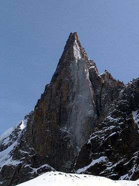
 Mont Blanc de Courmayeur seen from above La Thuile | |
| Highest point | |
| Elevation | 4,748 m (15,577 ft) |
| Prominence | 18 m ↓ Col Major [1] |
| Isolation | 0.6 km → Mont Blanc |
| Coordinates | 45°49′44″N 6°52′10″E / 45.82889°N 6.86944°ECoordinates: 45°49′44″N 6°52′10″E / 45.82889°N 6.86944°E |
| Geography | |
 Mont Blanc de Courmayeur | |
| Parent range | Graian Alps |
| Climbing | |
| First ascent | 18 August 1822 by Frederick Clissold with Joseph-Marie Couttet, David Couttet, Pierre-Marie Favret, Jacques Couttet, Jean-Baptiste Simond and Matthie Bosonney.[2][3] |
Mont Blanc de Courmayeur (Italian: Monte Bianco di Courmayeur) (4,748 m), is a point on the south-east ridge of Mont Blanc that forms the peak of the massive south-east face of the mountain. It is connected to the main summit via the Col Major (c. 4,730 m).
Despite its minimal topographic prominence, it appears as the second-highest peak in the Alps on the official list of Alpine four-thousanders of the Union Internationale des Associations d'Alpinisme (UIAA) for its impressive appearance and its importance for mountaineering.
The peak can be reached from the main summit over the Bosses ridge. The ascents over the south-east / Peuterey and south / Brouillard ridges are very challenging.
Mont Blanc de Courmayeur is marked as lying entirely within Italy on the Italian Istituto Geografico Militare (IGM) map,[4] while on the French Institut Géographique National (IGN) map the summit lies on the border between France and Italy.[5] A demarcation agreement, signed on 7 March 1861, defines the local border between France and Italy. Currently this act and the attached maps are legally valid for both the French and Italian governments.[6]
Huts
- Refuge Aiguille du Goûter (3,817 m)
- Bivacco Eccles (3,850 m)
- Rifugio Monzino (2,590 m)
References
- ↑ Monte Bianco di Courmayeur - Peakbagger.com
- ↑ Brown, T. G. and de Beer, G. The First Ascent of Mont Blanc, 1957, p. 14
- ↑ Alpine Journal, vol. XXV, p. 620
- ↑ Istituto Geografico Militare
- ↑ Institut Géographique National
- ↑ Assemblée Nationale: traité franco-italien signé à Turin le 26 mars 1860