Chemin de fer du Montenvers
| Chemin de fer du Montenvers | |
|---|---|
|
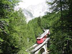
View of the train and the Mer de Glace | |
| Overview | |
| Type | rack railway |
| Status | current |
| Locale | Haute-Savoie region of France |
| Operation | |
| Opened | 1909 |
| Owner | Compagnie du Mont-Blanc |
| Operator(s) | Compagnie du Mont-Blanc |
| Technical | |
| Line length | 5.1 km (3.2 mi) |
| Number of tracks | Single track |
| Track gauge | 1,000 mm (3 ft 3 3⁄8 in) |
| Electrification |
overhead line at 11000 V 50 Hz |
| Highest elevation | 1,913 m (6,276 ft) |
| Maximum incline | 22% |
| Rack system | Strub |
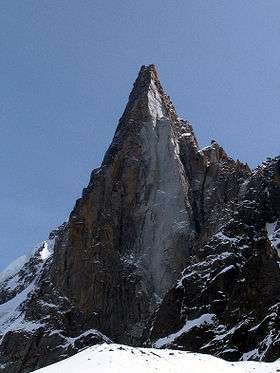
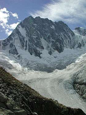
The Montenvers Railway or Chemin de fer du Montenvers is a rack railway line in the Haute-Savoie region of France. The line runs from a connection with the SNCF, in Chamonix, to the Hotel de Montenvers station, at the Mer de Glace, at an altitude of 1,913 m (6,276 ft).
Overview
The line is 5.1 km (3.2 mi) long and has a rail gauge of 1,000 mm (3 ft 3 3⁄8 in). It is a rack and adhesion railway, using the Strub rack system to overcome a height difference of 871 m (2,858 ft). Except for the terminal stations, which are operated in adhesion mode, the line has a gradient varying from 11% to 22%.
The trains originally were drawn by steam locomotives. In the 1950s the line was electrified using an overhead line at 11000 V AC and 50 Hz, and service is provided by six electric railcars and three diesel locomotives. Trains run at 14 to 20 km/h (9 to 12 mph) and take 20 minutes for the journey.
The line is operated by the Compagnie du Mont-Blanc which also manages the Mont Blanc Tramway and many ski lifts in the Mont Blanc region. The first section of the line opened in 1908 and the line was completed in 1909. The line was worked by steam locomotives until it was electrified in 1953.
On 25 August 1927, the locomotive and the first car of a two-car train derailed on the Montenvers viaducts, killing 15 people and injuring 30 others.[1]
See also
References
- ↑ Incidents - Accidents (November 2004) (French), archived cite accessed May 2, 2016
External links
| Wikimedia Commons has media related to Chemin de fer du Montenvers. |
- "Mer de Glace" (Chamonix - Montenvers line) pictures
- "Montervers Webcam" live Montervers webcam - Mer de Glace train
Coordinates: 45°55′54″N 6°55′03″E / 45.931729°N 6.917455°E