Moonachie, New Jersey
| Moonachie, New Jersey | |
|---|---|
| Borough | |
| Borough of Moonachie | |
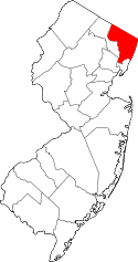
 Map highlighting Moonachie's location within Bergen County. Inset: Bergen County's location within New Jersey. | |
 Census Bureau map of Moonachie, New Jersey | |
| Coordinates: 40°50′29″N 74°03′28″W / 40.841361°N 74.057656°WCoordinates: 40°50′29″N 74°03′28″W / 40.841361°N 74.057656°W[1][2] | |
| Country |
|
| State |
|
| County | Bergen |
| Incorporated | May 3, 1910 |
| Government[3] | |
| • Type | Borough |
| • Body | Borough Council |
| • Mayor | Dennis Vaccaro (term ends December 31, 2018)[4][5] |
| • Administrator | Anthony Ciannamea[6] |
| • Clerk | Supriya Sanyal[6] |
| Area[1] | |
| • Total | 1.678 sq mi (4.345 km2) |
| • Land | 1.665 sq mi (4.312 km2) |
| • Water | 0.013 sq mi (0.033 km2) 0.76% |
| Area rank |
434th of 566 in state 55th of 70 in county[1] |
| Elevation[7] | 3 ft (0.9 m) |
| Population (2010 Census)[8][9][10] | |
| • Total | 2,708 |
| • Estimate (2015)[11] | 2,788 |
| • Rank |
461st of 566 in state 66th of 70 in county[12] |
| • Density | 1,626.5/sq mi (628.0/km2) |
| • Density rank |
320th of 566 in state 61st of 70 in county[12] |
| Time zone | Eastern (EST) (UTC-5) |
| • Summer (DST) | Eastern (EDT) (UTC-4) |
| ZIP code | 07074[13][14] |
| Area code(s) | 201[15] |
| FIPS code | 3400347700[1][16][17] |
| GNIS feature ID | 0885307[1][18] |
| Website |
www |
Moonachie (/muːˈnɑːkiː/; moo-NAH-kee) is a borough in Bergen County, New Jersey, in the Hackensack River watershed. As of the 2010 United States Census, the borough's population was 2,708,[8][9][10] reflecting a decline of 46 (-1.7%) from the 2,754 counted in the 2000 Census, which had in turn declined by 63 (-2.2%) from the 2,817 counted in the 1990 Census.[19]
Moonachie was incorporated as a borough by an act of the New Jersey Legislature on April 11, 1910, from portions of Lodi Township, based on the results of a referendum held on May 3, 1910. On March 26, 1917, portions of Moonachie were taken to form Teterboro.[20] Legend is that Moonachie was named after Monaghie, a chief of the Native Americans who inhabited the local cedar forests.[21][22]
The name of the borough is pronounced "moo-NAH-kee;" however, in January 1987, then-Mayor of New York City Ed Koch pronounced it "mah-NOO-chee" when he made his now-famous quip that the New York Giants should hold their victory parade in the borough after the team had just won Super Bowl XXI. Koch had refused to grant the Giants permission to hold a parade within the city limits because the team plays its home games in New Jersey, not in New York City.[23]
Geography
According to the United States Census Bureau, the borough had a total area of 1.678 square miles (4.345 km2), including 1.665 square miles (4.312 km2) of land and 0.013 square miles (0.033 km2) of water (0.76%).[1][2]
The borough is approximately 9 miles (14 km) northwest of downtown Manhattan in New York City. Nearby is East Rutherford, in which can be found the Meadowlands Sports Complex, home to the National Football League's New York Giants and New York Jets, and a racetrack at which both thoroughbred horse racing and harness racing are conducted.
The borough borders the Bergen County municipalities of Carlstadt, Hasbrouck Heights, Little Ferry, South Hackensack, Teterboro and Wood-Ridge.[24]
Demographics
| Historical population | |||
|---|---|---|---|
| Census | Pop. | %± | |
| 1900 | 212 | — | |
| 1910 | 638 | 200.9% | |
| 1920 | 1,194 | 87.1% | |
| 1930 | 1,465 | 22.7% | |
| 1940 | 1,554 | 6.1% | |
| 1950 | 1,775 | 14.2% | |
| 1960 | 3,052 | 71.9% | |
| 1970 | 2,951 | −3.3% | |
| 1980 | 2,706 | −8.3% | |
| 1990 | 2,817 | 4.1% | |
| 2000 | 2,754 | −2.2% | |
| 2010 | 2,708 | −1.7% | |
| Est. 2015 | 2,788 | [11][25] | 3.0% |
| Population sources: 1910-1920[26] 1910[27] 1910-1930[28] 1900-2010[29][30][31][32] 2000[33][34] 2010[8][9][10] | |||
2010 Census
At the 2010 United States Census, there were 2,708 people, 1,005 households, and 702.5 families residing in the borough. The population density was 1,626.5 per square mile (628.0/km2). There were 1,053 housing units at an average density of 632.5 per square mile (244.2/km2). The racial makeup of the borough was 76.59% (2,074) White, 1.40% (38) Black or African American, 0.11% (3) Native American, 10.04% (272) Asian, 0.00% (0) Pacific Islander, 8.57% (232) from other races, and 3.29% (89) from two or more races. Hispanics or Latinos of any race were 24.37% (660) of the population.[8]
There were 1,005 households, of which 26.8% had children under the age of 18 living with them, 49.6% were married couples living together, 14.0% had a female householder with no husband present, and 30.1% were non-families. 24.8% of all households were made up of individuals, and 11.3% had someone living alone who was 65 years of age or older. The average household size was 2.69 and the average family size was 3.24.[8]
In the borough, 18.5% of the population were under the age of 18, 8.9% from 18 to 24, 23.5% from 25 to 44, 32.9% from 45 to 64, and 16.2% who were 65 years of age or older. The median age was 44.4 years. For every 100 females there were 97.2 males. For every 100 females age 18 and over, there were 95.2 males.[8]
The Census Bureau's 2006-2010 American Community Survey showed that (in 2010 inflation-adjusted dollars) median household income was $53,500 (with a margin of error of +/- $6,570) and the median family income was $67,288 (+/- $10,087). Males had a median income of $52,647 (+/- $4,166) versus $42,670 (+/- $7,039) for females. The per capita income for the borough was $27,918 (+/- $2,593). About 4.0% of families and 6.6% of the population were below the poverty line, including 1.4% of those under age 18 and 12.9% of those age 65 or over.[35]
Same-sex couples headed four households in 2010, the same number as was counted in 2000.[36]
2000 Census
As of the 2000 United States Census[16] there were 2,754 people, 1,041 households, and 707 families residing in the borough. The population density was 1,596.5 people per square mile (614.6/km2). There were 1,074 housing units at an average density of 622.6 per square mile (239.7/km2). The racial makeup of the borough was 85.66% White, 0.94% African American, 0.11% Native American, 6.64% Asian, 2.94% from other races, and 3.70% from two or more races. Hispanic or Latino of any race were 12.67% of the population.[33][34]
There were 1,041 households out of which 28.1% had children under the age of 18 living with them, 52.6% were married couples living together, 10.8% had a female householder with no husband present, and 32.0% were non-families. 27.8% of all households were made up of individuals and 11.4% had someone living alone who was 65 years of age or older. The average household size was 2.65 and the average family size was 3.27.[33][34]
The population in the borough was spread out with 20.9% under the age of 18, 7.6% from 18 to 24, 30.1% from 25 to 44, 26.1% from 45 to 64, and 15.3% who were 65 years of age or older. The median age was 40 years. For every 100 females there were 96.9 males. For every 100 females age 18 and over, there were 95.6 males.[33][34]
The median income for a household in the borough was $50,571, and the median income for a family was $62,163. Males had a median income of $41,875 versus $32,829 for females. The per capita income for the borough was $24,654. About 1.7% of families and 3.8% of the population were below the poverty line, including 3.8% of those under age 18 and 6.3% of those age 65 or over.[33][34]
Government
Local government
Moonachie is governed under the Borough form of New Jersey municipal government. The governing body consists of a Mayor and a Borough Council comprising six council members, with all positions elected at-large on a partisan basis as part of the November general election. A Mayor is elected directly by the voters to a four-year term of office. The Borough Council consists of six members elected to serve three-year terms on a staggered basis, with two seats coming up for election each year in a three-year cycle.[3] The Borough form of government used by Moonachie, the most common system used in the state, is a "weak mayor / strong council" government in which council members act as the legislative body with the mayor presiding at meetings and voting only in the event of a tie. The mayor can veto ordinances subject to an override by a two-thirds majority vote of the council. The mayor makes committee and liaison assignments for council members, and most appointments are made by the mayor with the advice and consent of the council.[37][38]
As of 2016, the mayor of Moonachie is Democrat Dennis Vaccaro, whose term of office ends December 31, 2018. Members of the Borough Council are Robert J. Bauer Sr. (D, 2016), Antonio Cirillo (D, 2017), Kathy Kinsella (D, 2016), Manuel Martinez Jr. (D, 2017), Lucille A. Millar (D, 2015) and Bruce B. Surak (D, 2018).[4][6][39][40][41][42][43]
Federal, state and county representation
Moonachie is located in the 9th Congressional District[44] and is part of New Jersey's 36th state legislative district.[9][45][46]
New Jersey's Ninth Congressional District is represented by Bill Pascrell (D, Paterson).[47] New Jersey is represented in the United States Senate by Cory Booker (D, Newark, term ends 2021)[48] and Bob Menendez (D, Paramus, 2019).[49][50]
For the 2016–2017 session (Senate, General Assembly), the 36th Legislative District of the New Jersey Legislature is represented in the State Senate by Paul Sarlo (D, Wood-Ridge) and in the General Assembly by Marlene Caride (D, Ridgefield) and Gary Schaer (D, Passaic).[51] The Governor of New Jersey is Chris Christie (R, Mendham Township).[52] The Lieutenant Governor of New Jersey is Kim Guadagno (R, Monmouth Beach).[53]
Bergen County is governed by a directly elected County Executive, with legislative functions performed by a seven-member Board of Chosen Freeholders.[54] As of 2015, the County Executive is James J. Tedesco III (D, Paramus; term ends December 31, 2018).[55] The seven freeholders are elected at-large in partisan elections on a staggered basis, with two or three seats coming up for election each year, with a Chairman, Vice Chairman and Chairman Pro Tempore selected from among its members at a reorganization meeting held each January.[56] Bergen County's Freeholders are Freeholder Chairwoman Joan Voss (D, 2017; Fort Lee),[57] Vice Chairman Steve Tanelli (D, 2015; North Arlington)[58] Chairman Pro Tempore John A. Felice (R, 2016; River Edge),[59] David L. Ganz (D, 2017; Fair Lawn),[60] Maura R. DeNicola (R, 2016; Franklin Lakes)[61] Thomas J. Sullivan Jr., (D, Montvale, 2015; serving the unexpired term of office that had been occupied by James Tedesco before he was sworn in as County Executive)[62][63] and Tracy Silna Zur (D, 2015; Franklin Lakes).[64][65] Countywide constitutional officials are County Clerk John S. Hogan (D, Northvale),[66] Sheriff Michael Saudino (R)[67] and Surrogate Michael R. Dressler (D, Cresskill).[68][69][54]
Politics
As of March 23, 2011, there were a total of 1,465 registered voters in Moonachie, of which 632 (43.1% vs. 31.7% countywide) were registered as Democrats, 199 (13.6% vs. 21.1%) were registered as Republicans and 633 (43.2% vs. 47.1%) were registered as Unaffiliated. There was one voter registered to another party.[70] Among the borough's 2010 Census population, 54.1% (vs. 57.1% in Bergen County) were registered to vote, including 66.4% of those ages 18 and over (vs. 73.7% countywide).[70][71]
In the 2012 presidential election, Democrat Barack Obama received 584 votes (61.1% vs. 54.8% countywide), ahead of Republican Mitt Romney with 349 votes (36.5% vs. 43.5%) and other candidates with 11 votes (1.2% vs. 0.9%), among the 956 ballots cast by the borough's 1,573 registered voters, for a turnout of 60.8% (vs. 70.4% in Bergen County).[72][73] In the 2008 presidential election, Democrat Barack Obama received 586 votes (51.3% vs. 53.9% countywide), ahead of Republican John McCain with 539 votes (47.2% vs. 44.5%) and other candidates with 11 votes (1.0% vs. 0.8%), among the 1,143 ballots cast by the borough's 1,537 registered voters, for a turnout of 74.4% (vs. 76.8% in Bergen County).[74][75] In the 2004 presidential election, Republican George W. Bush received 559 votes (49.9% vs. 47.2% countywide), ahead of Democrat John Kerry with 542 votes (48.3% vs. 51.7%) and other candidates with 17 votes (1.5% vs. 0.7%), among the 1,121 ballots cast by the borough's 1,547 registered voters, for a turnout of 72.5% (vs. 76.9% in the whole county).[76]
In the 2013 gubernatorial election, Republican Chris Christie received 65.0% of the vote (369 cast), ahead of Democrat Barbara Buono with 33.1% (188 votes), and other candidates with 1.9% (11 votes), among the 587 ballots cast by the borough's 1,499 registered voters (19 ballots were spoiled), for a turnout of 39.2%.[77][78] In the 2009 gubernatorial election, Democrat Jon Corzine received 348 ballots cast (48.6% vs. 48.0% countywide), ahead of Republican Chris Christie with 296 votes (41.3% vs. 45.8%), Independent Chris Daggett with 43 votes (6.0% vs. 4.7%) and other candidates with 9 votes (1.3% vs. 0.5%), among the 716 ballots cast by the borough's 1,469 registered voters, yielding a 48.7% turnout (vs. 50.0% in the county).[79]
Education
Public school students in pre-Kindergarten through eighth grade are served by the Moonachie School District at the Robert L. Craig School. As of the 2012-13 school year, the district's one school had an enrollment of 285 students and 29.1 classroom teachers (on an FTE basis), for a student–teacher ratio of 9.79:1.[80]
For ninth through twelfth grades, approximately 100 public school students attend Wood-Ridge High School in Wood-Ridge, as part of a sending/receiving relationship with the Wood-Ridge School District.[81]
Public school students from the borough, and all of Bergen County, are eligible to attend the secondary education programs offered by the Bergen County Technical Schools, which include the Bergen County Academies in Hackensack, and the Bergen Tech campus in Teterboro or Paramus. The district offers programs on a shared-time or full-time basis, with admission based on a selective application process and tuition covered by the student's home school district.[82][83]
Transportation
Roads and highways
As of May 2010, the borough had a total of 12.83 miles (20.65 km) of roadways, of which 9.83 miles (15.82 km) were maintained by the municipality and 3.00 miles (4.83 km) by Bergen County.[84]
County Route 503 passes through Moonachie as Moonachie Road.
Public transportation
NJ Transit bus routes 161, 163, 164 provide service to the Port Authority Bus Terminal in Midtown Manhattan, service to Newark is offered on the 76 route and local service is available on the 703 (rush hour) and 772 bus routes.[85][86]
Portions of Teterboro Airport are located in Moonachie.[87]
References
- 1 2 3 4 5 6 2010 Census Gazetteer Files: New Jersey County Subdivisions, United States Census Bureau. Accessed May 21, 2015.
- 1 2 US Gazetteer files: 2010, 2000, and 1990, United States Census Bureau. Accessed September 4, 2014.
- 1 2 2012 New Jersey Legislative District Data Book, Rutgers University Edward J. Bloustein School of Planning and Public Policy, March 2013, p. 154.
- 1 2 Government, Borough of Moonachie. Accessed May 18, 2016.
- ↑ 2016 New Jersey Mayors Directory, New Jersey Department of Community Affairs. Accessed June 14, 2016.
- 1 2 3 2016 County and Municipal Directory, p. 52, Bergen County, New Jersey. Accessed May 18, 2016.
- ↑ U.S. Geological Survey Geographic Names Information System: Borough of Moonachie, Geographic Names Information System. Accessed March 8, 2013.
- 1 2 3 4 5 6 DP-1 - Profile of General Population and Housing Characteristics: 2010 for Moonachie borough, Bergen County, New Jersey, United States Census Bureau. Accessed March 10, 2013.
- 1 2 3 4 Municipalities Grouped by 2011-2020 Legislative Districts, New Jersey Department of State, p. 14. Accessed January 6, 2013.
- 1 2 3 Profile of General Demographic Characteristics: 2010 for Moonachie borough, New Jersey Department of Labor and Workforce Development. Accessed March 10, 2013.
- 1 2 PEPANNRES - Annual Estimates of the Resident Population: April 1, 2010 to July 1, 2015 - 2015 Population Estimates for New Jersey municipalities, United States Census Bureau. Accessed May 22, 2016.
- 1 2 GCT-PH1 Population, Housing Units, Area, and Density: 2010 - State -- County Subdivision from the 2010 Census Summary File 1 for New Jersey, United States Census Bureau. Accessed March 10, 2013.
- ↑ Look Up a ZIP Code for Moonachie, NJ, United States Postal Service. Accessed December 20, 2011.
- ↑ Zip Codes, State of New Jersey. Accessed August 28, 2013.
- ↑ Area Code Lookup - NPA NXX for Moonachie, NJ, Area-Codes.com. Accessed August 28, 2013.
- 1 2 American FactFinder, United States Census Bureau. Accessed September 4, 2014.
- ↑ A Cure for the Common Codes: New Jersey, Missouri Census Data Center. Accessed March 10, 2013.
- ↑ US Board on Geographic Names, United States Geological Survey. Accessed September 4, 2014.
- ↑ Table 7. Population for the Counties and Municipalities in New Jersey: 1990, 2000 and 2010, New Jersey Department of Labor and Workforce Development, February 2011. Accessed March 10, 2013.
- ↑ Snyder, John P. The Story of New Jersey's Civil Boundaries: 1606-1968, Bureau of Geology and Topography; Trenton, New Jersey; 1969. p. 81. Accessed October 29, 2012.
- ↑ History, Borough of Moonachie. Accessed September 8, 2015. "Indians of the Six Nations Branch inhabited the rich cedar forests. Rumors say that Indian Chief Monaghie gave the town its name."
- ↑ Hutchinson, Viola L. The Origin of New Jersey Place Names, New Jersey Public Library Commission, May 1945. Accessed September 8, 2015.
- ↑ Vescey, George. "SPORTS OF THE TIMES; How'm I Doing? Terrific", The New York Times, January 7, 1987. Accessed October 10, 2007. "He said he thought they made a very nice cheesesteak sandwich in Moonachie, which he pronounced mah-NOO-chee instead of moo-NAH-key."
- ↑ Areas touching Moonachie, MapIt. Accessed June 17, 2015.
- ↑ Census Estimates for New Jersey April 1, 2010 to July 1, 2015, United States Census Bureau. Accessed May 22, 2016.
- ↑ Compendium of censuses 1726-1905: together with the tabulated returns of 1905, New Jersey Department of State, 1906. Accessed October 22, 2013.
- ↑ Thirteenth Census of the United States, 1910: Population by Counties and Minor Civil Divisions, 1910, 1900, 1890, United States Census Bureau, p. 335. Accessed December 11, 2013.
- ↑ Fifteenth Census of the United States : 1930 - Population Volume I, United States Census Bureau, p. 714. Accessed December 20, 2011.
- ↑ Table 6. New Jersey Resident Population by Municipality: 1930 - 1990, New Jersey Department of Labor and Workforce Development. Accessed June 28, 2015.
- ↑ Bergen County Data Book 2003, Bergen County, New Jersey. Accessed August 28, 2013.
- ↑ Historical Population Trends in Bergen County (1900-2010), Bergen County Department of Planning & Economic Development, 2011. Accessed October 22, 2013. Population data for 1900, prior to the borough's formation, was extrapolated by Bergen County analysts.
- ↑ Historical Population Trends in Bergen County (1990-2010), Bergen County Department of Planning & Economic Development, 2011. Accessed December 11, 2013. Population data for 1900, prior to the borough's formation, was extrapolated by Bergen County analysts.
- 1 2 3 4 5 Census 2000 Profiles of Demographic / Social / Economic / Housing Characteristics for Moonachie borough, New Jersey, United States Census Bureau. Accessed March 10, 2013.
- 1 2 3 4 5 DP-1: Profile of General Demographic Characteristics: 2000 - Census 2000 Summary File 1 (SF 1) 100-Percent Data for Moonachie borough, Bergen County, New Jersey, United States Census Bureau. Accessed March 10, 2013.
- ↑ DP03: Selected Economic Characteristics from the 2006-2010 American Community Survey 5-Year Estimates for Moonachie borough, Bergen County, New Jersey, United States Census Bureau. Accessed March 10, 2013.
- ↑ Lipman, Harvy; and Sheingold, Dave. "North Jersey sees 30% growth in same-sex couples", The Record (Bergen County), August 14, 2011, backed up by the Internet Archive as of February 3, 2013. Accessed December 1, 2014.
- ↑ Cerra, Michael F. "Forms of Government: Everything You've Always Wanted to Know, But Were Afraid to Ask", New Jersey State League of Municipalities. Accessed November 30, 2014.
- ↑ "Forms of Municipal Government in New Jersey", p. 6. Rutgers University Center for Government Studies. Accessed June 3, 2015.
- ↑ Reorganization Meeting Minutes January 3, 2016, Borough of Moonachie. Accessed May 18, 2016. "Motion by C/Surak and second by C/Cirillio to elect C/Kinsella as Council President... All ayes."
- ↑ 2015 Municipal Data Sheet, Borough of Moonachie. Accessed May 18, 2016.
- ↑ Bergen County Statement of Vote November 3, 2015 General Election, Bergen County, New Jersey Clerk, December 2, 2015. Accessed March 21, 2016.
- ↑ Bergen County Statement of Vote BER_20141104_E, Bergen County Clerk, December 16, 2014. Accessed January 7, 2014.
- ↑ Bergen County Statement of Vote General Election 2013, Bergen County Clerk, updated November 14, 2013. Accessed July 8, 2015.
- ↑ Plan Components Report, New Jersey Redistricting Commission, December 23, 2011. Accessed January 6, 2013.
- ↑ 2016 New Jersey Citizen's Guide to Government, p. 61, New Jersey League of Women Voters. Accessed July 20, 2016.
- ↑ Districts by Number for 2011-2020, New Jersey Legislature. Accessed January 6, 2013.
- ↑ Directory of Representatives: New Jersey, United States House of Representatives. Accessed January 5, 2012.
- ↑ About Cory Booker, United States Senate. Accessed January 26, 2015. "He now owns a home and lives in Newark's Central Ward community."
- ↑ Biography of Bob Menendez, United States Senate, January 26, 2015. "He currently lives in Paramus and has two children, Alicia and Robert."
- ↑ Senators of the 114th Congress from New Jersey. United States Senate. Accessed January 26, 2015. "Booker, Cory A. - (D - NJ) Class II; Menendez, Robert - (D - NJ) Class I"
- ↑ Legislative Roster 2016-2017 Session, New Jersey Legislature. Accessed January 17, 2016.
- ↑ "About the Governor". State of New Jersey. Retrieved 2010-01-21.
- ↑ "About the Lieutenant Governor". State of New Jersey. Retrieved 2010-01-21.
- 1 2 2014 Bergen County Directory, p. 10, Bergen County, New Jersey. Accessed May 26, 2015.
- ↑ County Executive, Bergen County, New Jersey. Accessed May 26, 2015.
- ↑ Freeholders, Bergen County, New Jersey. Accessed May 26, 2015.
- ↑ Chairwoman Joan M. Voss, Bergen County, New Jersey. Accessed May 26, 2015.
- ↑ Vice Chairman Steven Tanelli, Bergen County, New Jersey. Accessed May 26, 2015.
- ↑ Chairman Pro Tempore John A. Felice, Bergen County, New Jersey. Accessed May 26, 2015.
- ↑ Freeholder David L. Ganz, Bergen County, New Jersey. Accessed May 26, 2015.
- ↑ Freeholder Maura R. DeNicola, Bergen County, New Jersey. Accessed May 26, 2015.
- ↑ Freeholder Thomas J. Sullivan, Bergen County, New Jersey. Accessed May 26, 2015.
- ↑ Ensslin, John C. "Labor leader Thomas J. Sullivan Jr. takes oath to fill Bergen County freeholder vacancy", The Record (Bergen County), January 28, 2015. Accessed January 28, 2015. "Bergen County’s newest freeholder, labor leader Thomas J. Sullivan Jr., was sworn in Wednesday, vowing to 'listen to everyone’s voice'.... He would next have to run in the November election to serve the last remaining year on Tedesco’s three-year term."
- ↑ Tracy Silna Zur, Bergen County, New Jersey. Accessed May 26, 2015.
- ↑ Freeholder Board, Bergen County, New Jersey. Accessed May 26, 2015.
- ↑ About the Clerk, Bergen County Clerk. Accessed May 26, 2015.
- ↑ About Sheriff Michael Saudino, Bergen County Sheriff's Office. Accessed May 26, 2015.
- ↑ Michael R. Dressler, Bergen County Surrogate's Court. Accessed May 26, 2015.
- ↑ Constitutional Officers, Bergen County, New Jersey. Accessed May 26, 2015.
- 1 2 Voter Registration Summary - Bergen, New Jersey Department of State Division of Elections, March 23, 2011. Accessed December 11, 2013.
- ↑ GCT-P7: Selected Age Groups: 2010 - State -- County Subdivision; 2010 Census Summary File 1 for New Jersey, United States Census Bureau. Accessed December 11, 2013.
- ↑ Presidential November 6, 2012 General Election Results - Bergen County, New Jersey Department of State Division of Elections, March 15, 2013. Accessed December 14, 2013.
- ↑ Number of Registered Voters and Ballots Cast November 6, 2012 General Election Results - Bergen County, New Jersey Department of State Division of Elections, March 15, 2013. Accessed December 14, 2013.
- ↑ 2008 Presidential General Election Results: Bergen County, New Jersey Department of State Division of Elections, December 23, 2008. Accessed December 11, 2013.
- ↑ 2008 General Election Results for Moonachie, The Record (Bergen County). Accessed December 20, 2011.
- ↑ 2004 Presidential Election: Bergen County, New Jersey Department of State Division of Elections, December 13, 2004. Accessed December 11, 2013.
- ↑ "Governor - Bergen County" (PDF). New Jersey Department of Elections. January 29, 2014. Retrieved December 24, 2014.
- ↑ "Number of Registered Voters and Ballots Cast - November 5, 2013 - General Election Results - Bergen County" (PDF). New Jersey Department of Elections. January 29, 2014. Retrieved December 24, 2014.
- ↑ 2009 Governor: Bergen County, New Jersey Department of State Division of Elections, December 31, 2009. Accessed December 11, 2013.
- ↑ District information for Moonachie School District, National Center for Education Statistics. Accessed March 2, 2015.
- ↑ Gavin, John A. "Council tells district to lower student estimates", The Record (Bergen County), May 17, 2010. Accessed September 7, 2014. "The Borough Council wants the one-school district to lower estimates of how many students will attend Wood-Ridge High School, its receiving school, and predictions about how many students will be placed in special education programs outside the district.... The school had calculated that 104 students would enroll in the high school, Vaccaro said."
- ↑ About Us, Bergen County Technical Schools. Accessed December 11, 2013.
- ↑ Admissions, Bergen County Technical Schools. Accessed December 11, 2013.
- ↑ Bergen County Mileage by Municipality and Jurisdiction, New Jersey Department of Transportation, May 2010. Accessed December 11, 2013.
- ↑ Bergen County Bus / Rail Connections, NJ Transit, backed up by the Internet Archive as of October 23, 2010. Accessed December 20, 2011.
- ↑ Bergen County System Map, NJ Transit. Accessed September 14, 2016.
- ↑ Directions to and from the Airport, Port Authority of New York & New Jersey. Accessed July 7, 2008. "Teterboro Airport is located in the Boroughs of Teterboro, Moonachie, and Hasbrouck Heights in Bergen County, New Jersey."
Related reading
- Municipal Incorporations of the State of New Jersey (according to Counties) prepared by the Division of Local Government, Department of the Treasury (New Jersey); December 1, 1958.
- Clayton, W. Woodford; and Nelson, William. History of Bergen and Passaic Counties, New Jersey, with Biographical Sketches of Many of its Pioneers and Prominent Men., Philadelphia: Everts and Peck, 1882.
- Harvey, Cornelius Burnham (ed.), Genealogical History of Hudson and Bergen Counties, New Jersey. New York: New Jersey Genealogical Publishing Co., 1900.
- Van Valen, James M. History of Bergen County, New Jersey. New York: New Jersey Publishing and Engraving Co., 1900.
- Westervelt, Frances A. (Frances Augusta), 1858-1942, History of Bergen County, New Jersey, 1630-1923, Lewis Historical Publishing Company, 1923.
External links
- Moonachie Borough website
- Robert L. Craig School
- Robert L. Craig School's 2014–15 School Report Card from the New Jersey Department of Education
- School Data for the Moonachie School District, National Center for Education Statistics
- Wood Ridge High School's 2014–15 School Report Card from the New Jersey Department of Education
- Moonachie Police Web
- Moonachie First Aid and Rescue Squad