Mount Ephraim, New Jersey
| Mount Ephraim, New Jersey | |
|---|---|
| Borough | |
| Borough of Mount Ephraim | |
| Motto: "The Village at the Crossroads" | |
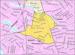
 Mount Ephraim highlighted in Camden County. Inset: Camden County highlighted in the State of New Jersey. | |
 Census Bureau map of Mount Ephraim, New Jersey | |
| Coordinates: 39°52′47″N 75°05′27″W / 39.879666°N 75.090948°WCoordinates: 39°52′47″N 75°05′27″W / 39.879666°N 75.090948°W[1][2] | |
| Country |
|
| State |
|
| County | Camden |
| Incorporated | March 23, 1926 |
| Named for | Ephraim Albertson |
| Government[3] | |
| • Type | Walsh Act |
| • Body | Board of Commissioners |
| • Mayor | Joseph E. Wolk (term ends May 15, 2019)[4][5] |
| • Clerk | Terry Shannon[6] |
| Area[1] | |
| • Total | 0.900 sq mi (2.332 km2) |
| • Land | 0.881 sq mi (2.282 km2) |
| • Water | 0.019 sq mi (0.050 km2) 2.16% |
| Area rank |
516th of 566 in state 29th of 37 in county[1] |
| Elevation[7] | 30 ft (9 m) |
| Population (2010 Census)[8][9][10] | |
| • Total | 4,676 |
| • Estimate (2015)[11] | 4,639 |
| • Rank |
387th of 566 in state 24th of 37 in county[12] |
| • Density | 5,307.9/sq mi (2,049.4/km2) |
| • Density rank |
102nd of 566 in state 9th of 37 in county[12] |
| Time zone | Eastern (EST) (UTC-5) |
| • Summer (DST) | Eastern (EDT) (UTC-4) |
| ZIP code | 08059[13][14] |
| Area code(s) | 856 exchanges: 456, 742, 931, 933[15] |
| FIPS code | 3400748750[1][16][17] |
| GNIS feature ID | 0885313[1][18] |
| Website |
www |
Mount Ephraim is a borough in Camden County, New Jersey, United States. As of the 2010 United States Census, the borough's population was 4,676,[8][9][10] reflecting an increase of 181 (+4.0%) from the 4,495 counted in the 2000 Census, which had in turn declined by 22 (-0.5%) from the 4,517 counted in the 1990 Census.[19]
Mount Ephraim was incorporated as a borough by an act of the New Jersey Legislature on March 23, 1926, from portions of the now-defunct Centre Township. The boroughs of Bellmawr, Runnemede and Lawnside were simultaneously created during the same two-day period.[20] The borough was named for Ephraim Albertson, who owned a tavern in the area in the early 1800s.[21][22]
Geography
According to the United States Census Bureau, the borough had a total area of 0.900 square miles (2.332 km2), including 0.881 square miles (2.282 km2) of land and 0.019 square miles (0.050 km2) of water (2.16%).[1][2]
Mount Ephraim borders Audubon, Bellmawr, Brooklawn, Gloucester City, Haddon Heights and Haddon Township.[23]
Weather
On September 4, 2012, at 6:31 p.m., a tornado touched down in Mount Ephraim, causing damage to trees and homes in the immediate vicinity. It was categorized as F-0 by the National Weather Service, with winds topping out at 70 mph, making it the first tornado recorded in the state in more than a year.[24]
Demographics
| Historical population | |||
|---|---|---|---|
| Census | Pop. | %± | |
| 1930 | 2,319 | — | |
| 1940 | 2,282 | −1.6% | |
| 1950 | 4,449 | 95.0% | |
| 1960 | 5,447 | 22.4% | |
| 1970 | 5,625 | 3.3% | |
| 1980 | 4,863 | −13.5% | |
| 1990 | 4,517 | −7.1% | |
| 2000 | 4,495 | −0.5% | |
| 2010 | 4,676 | 4.0% | |
| Est. 2015 | 4,639 | [11][25] | −0.8% |
| Population sources: 1930-2000[26] 1930[27] 1930-1990[28] 2000[29][30] 2010[8][9][10] | |||
Census 2010
The 2010 United States Census counted 4,676 people, 1,909 households, and 1,193 families residing in the borough. The population density was 5,307.9 per square mile (2,049.4/km2). The borough contained 2,010 housing units at an average density of 2,281.6 per square mile (880.9/km2). The racial makeup of the borough was 93.56% (4,375) White, 2.14% (100) Black or African American, 0.09% (4) Native American, 0.68% (32) Asian, 0.00% (0) Pacific Islander, 2.27% (106) from other races, and 1.26% (59) from two or more races. Hispanics or Latinos of any race were 5.33% (249) of the population.[8]
Out of a total of 1,909 households, 26.6% had children under the age of 18 living with them, 45.6% were married couples living together, 11.5% had a female householder with no husband present, and 37.5% were non-families. 31.2% of all households were made up of individuals, and 13.7% had someone living alone who was 65 years of age or older. The average household size was 2.45 and the average family size was 3.11.[8]
In the borough, 20.6% of the population were under the age of 18, 9.1% from 18 to 24, 26.5% from 25 to 44, 29.8% from 45 to 64, and 14.0% who were 65 years of age or older. The median age was 40.1 years. For every 100 females the census counted 93.4 males, but for 100 females at least 18 years old, it was 92.4 males.[8]
The Census Bureau's 2006-2010 American Community Survey showed that (in 2010 inflation-adjusted dollars) median household income was $61,331 (with a margin of error of +/- $6,103) and the median family income was $73,955 (+/- $4,630). Males had a median income of $51,049 (+/- $3,914) versus $41,087 (+/- $3,242) for females. The per capita income for the borough was $29,885 (+/- $5,190). About 5.6% of families and 6.8% of the population were below the poverty line, including 9.9% of those under age 18 and 10.4% of those age 65 or over.[31]
Census 2000
As of the 2000 United States Census[16] there were 4,495 people, and 1,174 families residing in the borough. The population density was 5,100.1 people per square mile (1,972.2/km2). There were 1,881 housing units at an average density of 2,134.2 per square mile (825.3/km2). The racial makeup of the borough was 97.51% White, 0.40% African American, 0.07% Native American, 0.62% Asian, 0.02% Pacific Islander, 0.65% from other races, and 0.73% from two or more races. Hispanic or Latino of any race were 1.98% of the population.[29][30]
There were 1,818 households out of which 27.6% had children under the age of 18 living with them, 51.1% were married couples living together, 8.7% had a female householder with no husband present, and 35.4% were non-families. 30.6% of all households were made up of individuals and 15.5% had someone living alone who was 65 years of age or older. The average household size was 2.46 and the average family size was 3.13.[29][30]
In the borough the population was spread out with 22.3% under the age of 18, 7.1% from 18 to 24, 30.1% from 25 to 44, 22.5% from 45 to 64, and 17.9% who were 65 years of age or older. The median age was 40 years. For every 100 females there were 93.6 males. For every 100 females age 18 and over, there were 93.3 males.[29][30]
The median income for a household in the borough was $44,824, and the median income for a family was $59,468. Males had a median income of $41,455 versus $30,359 for females. The per capita income for the borough was $21,150. About 2.0% of families and 4.9% of the population were below the poverty line, including 1.7% of those under age 18 and 7.2% of those age 65 or over.[29][30]
Government
Local government
Mount Ephraim has been governed under the Walsh Act by a three-member commission, since 1935. Three commissioners are elected at-large in nonpartisan elections held as part of the May municipal election to serve concurrent terms of office. Each commissioner is assigned a department to oversee as part of their elected service.[3][32]
As of May 2015, Mount Ephraim's commissioners are Mayor Joseph Wolk (Commissioner of Revenue and Finance), Andrew Gilmore (Commissioner of Public Affairs and Public Safety) and Michael "Traz" Tovinsky (Commissioner of Public Works, Parks and Public Property), all of whom are serving concurrent terms of office that end May 15, 2019.[4][33][34][35]
Federal, state and county representation
Mount Ephraim is located in the 1st Congressional District[36] and is part of New Jersey's 5th state legislative district.[9][37][38]
New Jersey's First Congressional District is represented by Donald Norcross (D, Camden).[39] New Jersey is represented in the United States Senate by Cory Booker (D, Newark, term ends 2021)[40] and Bob Menendez (D, Paramus, 2019).[41][42]
For the 2016–2017 session (Senate, General Assembly), the 5th Legislative District of the New Jersey Legislature is represented in the State Senate by Nilsa Cruz-Perez (D, Barrington) and in the General Assembly by Arthur Barclay (D, Camden) and Patricia Egan Jones (D, Barrington).[43] The Governor of New Jersey is Chris Christie (R, Mendham Township).[44] The Lieutenant Governor of New Jersey is Kim Guadagno (R, Monmouth Beach).[45]
Camden County is governed by a Board of Chosen Freeholders, whose seven members chosen at-large in partisan elections to three-year terms office on a staggered basis, with either two or three seats coming up for election each year.[46] As of 2015, Camden County's Freeholders are Freeholder Director Louis Cappelli, Jr. (Collingswood, term as freeholder ends December 31, 2017; term as director ends 2015),[47] Freeholder Deputy Director Edward T. McDonnell (Pennsauken Township, term as freeholder ends 2016; term as deputy director ends 2015),[48] Michelle Gentek (Gloucester Township, 2015),[49] Ian K. Leonard (Camden, 2015),[50] Jeffrey L. Nash (Cherry Hill, 2015),[51] Carmen Rodriguez (Merchantville, 2016)[52] and Jonathan L. Young, Sr. (Berlin Township, November 2015; serving the unexpired term of Scot McCray ending in 2017)[53][54][55]
Camden County's constitutional officers, all elected directly by voters, are County clerk Joseph Ripa,[56] Sheriff Charles H. Billingham,[57] and Surrogate Patricia Egan Jones.[55][58] The Camden County Prosecutor Mary Eva Colalillo was appointed by the Governor of New Jersey with the advice and consent of the New Jersey Senate (the upper house of the New Jersey Legislature).[59]
Politics
As of March 23, 2011, there were a total of 3,110 registered voters in Mount Ephraim, of which 1,402 (45.1%) were registered as Democrats, 403 (13.0%) were registered as Republicans and 1,305 (42.0%) were registered as Unaffiliated. There were no voters registered to other parties.[60]
In the 2012 presidential election, Democrat Barack Obama received 60.7% of the vote (1,278 cast), ahead of Republican Mitt Romney with 37.7% (793 votes), and other candidates with 1.7% (35 votes), among the 2,131 ballots cast by the borough's 3,320 registered voters (25 ballots were spoiled), for a turnout of 64.2%.[61][62] In the 2008 presidential election, Democrat Barack Obama received 58.6% of the vote (1,334 cast), ahead of Republican John McCain, who received around 37.6% (855 votes), with 2,275 ballots cast among the borough's 3,086 registered voters, for a turnout of 73.7%.[63] In the 2004 presidential election, Democrat John Kerry received 58.8% of the vote (1,309 ballots cast), outpolling Republican George W. Bush, who received around 39.9% (888 votes), with 2,228 ballots cast among the borough's 2,982 registered voters, for a turnout percentage of 74.7.[64]
In the 2013 gubernatorial election, Republican Chris Christie received 62.9% of the vote (753 cast), ahead of Democrat Barbara Buono with 35.9% (430 votes), and other candidates with 1.3% (15 votes), among the 1,222 ballots cast by the borough's 3,353 registered voters (24 ballots were spoiled), for a turnout of 36.4%.[65][66] In the 2009 gubernatorial election, Democrat Jon Corzine received 47.3% of the vote (621 ballots cast), ahead of both Republican Chris Christie with 42.7% (560 votes) and Independent Chris Daggett with 6.2% (81 votes), with 1,312 ballots cast among the borough's 3,127 registered voters, yielding a 42.0% turnout.[67]
Education
The Mount Ephraim Public Schools serve students in pre-Kindergarten through eighth grade. As of the 2011-12 school year, the district's two schools had an enrollment of 443 students and 30.7 classroom teachers (on an FTE basis), for a student–teacher ratio of 14.43:1.[68] Schools in the district (with 2011-12 enrollment data from the National Center for Education Statistics[69]) are Mary Bray Elementary School[70] (grades PreK-4; 246 students) and Raymond W. Kershaw School[71] (grades 5-8; 197 students).[72]
For ninth through twelfth grades, public school students attend Audubon High School, in Audubon, as part of a sending/receiving relationship with the Audubon School District.[73][74]
Transportation
Roads and highways
As of May 2010, the borough had a total of 16.67 miles (26.83 km) of roadways, of which 13.25 miles (21.32 km) were maintained by the municipality, 2.35 miles (3.78 km) by Camden County and 1.07 miles (1.72 km) by the New Jersey Department of Transportation.[75]
Interstate 76 (providing access to Philadelphia and to Interstate 295) and U.S. Route 130 are both accessible across borough lines in Gloucester City.
Public transportation
Mount Ephraim is served by two New Jersey Transit bus lines. Service between the borough and Philadelphia is available on the 400 route, with local service on the 457 route between the Moorestown Mall and Camden.[76][77]
References
- 1 2 3 4 5 6 2010 Census Gazetteer Files: New Jersey County Subdivisions, United States Census Bureau. Accessed May 21, 2015.
- 1 2 US Gazetteer files: 2010, 2000, and 1990, United States Census Bureau. Accessed September 4, 2014.
- 1 2 2012 New Jersey Legislative District Data Book, Rutgers University Edward J. Bloustein School of Planning and Public Policy, March 2013, p. 38.
- 1 2 Who are the Commissioners of Mount Ephraim?, Borough of Mount Ephraim. Accessed June 26, 2016.
- ↑ 2016 New Jersey Mayors Directory, New Jersey Department of Community Affairs. Accessed June 14, 2016.
- ↑ Contacts, Borough of Mount Ephraim. Accessed June 26, 2016.
- ↑ U.S. Geological Survey Geographic Names Information System: Borough of Mount Ephraim, Geographic Names Information System. Accessed March 8, 2013.
- 1 2 3 4 5 6 DP-1 - Profile of General Population and Housing Characteristics: 2010 for Mount Ephraim borough, Camden County, New Jersey, United States Census Bureau. Accessed October 11, 2012.
- 1 2 3 4 Municipalities Grouped by 2011-2020 Legislative Districts, New Jersey Department of State, p. 3. Accessed January 6, 2013.
- 1 2 3 Profile of General Demographic Characteristics: 2010 for Mount Ephraim borough, New Jersey Department of Labor and Workforce Development. Accessed October 11, 2012.
- 1 2 PEPANNRES - Annual Estimates of the Resident Population: April 1, 2010 to July 1, 2015 - 2015 Population Estimates for New Jersey municipalities, United States Census Bureau. Accessed May 22, 2016.
- 1 2 GCT-PH1 Population, Housing Units, Area, and Density: 2010 - State -- County Subdivision from the 2010 Census Summary File 1 for New Jersey, United States Census Bureau. Accessed October 11, 2012.
- ↑ Look Up a ZIP Code for Mount Ephraim, NJ, United States Postal Service. Accessed October 11, 2012.
- ↑ Zip Codes, State of New Jersey. Accessed October 23, 2013.
- ↑ Area Code Lookup - NPA NXX for Mount Ephraim, NJ, Area-Codes.com. Accessed October 23, 2013.
- 1 2 American FactFinder, United States Census Bureau. Accessed September 4, 2014.
- ↑ A Cure for the Common Codes: New Jersey, Missouri Census Data Center. Accessed October 11, 2012.
- ↑ US Board on Geographic Names, United States Geological Survey. Accessed September 4, 2014.
- ↑ Table 7. Population for the Counties and Municipalities in New Jersey: 1990, 2000 and 2010, New Jersey Department of Labor and Workforce Development, February 2011. Accessed October 11, 2012.
- ↑ Snyder, John P. The Story of New Jersey's Civil Boundaries: 1606-1968, Bureau of Geology and Topography; Trenton, New Jersey; 1969. p. 107. Accessed October 11, 2012.
- ↑ A Brief History, Borough of Mount Ephraim. Accessed September 8, 2015. "Originally a colonial settlement, the town Mount Ephraim came into popularity by a man named Ephraim Albertson, who owned the Public House, also called the Old Tavern, a popular meeting place, at Black Horse Pike & Kings Highway, from 1800 to 1825."
- ↑ Prowell, George Reeser. The History of Camden County, New Jersey, p. 711. Richards, 1886. Accessed September 8, 2015. "A public house has been kept in this locality from a period so remote that the memory of the oldest citizen does not reach it. The first keeper is not remembered, but it is believed to have been Albertson from whom the village obtained its name and who owned the land."
- ↑ Areas touching Mount Ephraim, MapIt. Accessed March 3, 2015.
- ↑ via Associated Press. "Tornado confirmed in Mount Ephraim, New Jersey", WABC-TV, September 5, 2012. Accessed June 5, 2013. "The National Weather Service says a tornado touched down in southern New Jersey, the first confirmed one in the state in more than a year. Meteorologist Mitchell Gaines says it was an F-0 twister - the lowest classification."
- ↑ Census Estimates for New Jersey April 1, 2010 to July 1, 2015, United States Census Bureau. Accessed May 22, 2016.
- ↑ Barnett, Bob. Population Data for Camden County Municipalities, 1850 - 2000, WestJersey.org, January 6, 2011. Accessed October 11, 2012.
- ↑ Fifteenth Census of the United States: 1930 - Population Volume I, United States Census Bureau, p. 715. Accessed October 11, 2012.
- ↑ Table 6. New Jersey Resident Population by Municipality: 1930 - 1990, New Jersey Department of Labor and Workforce Development. Accessed June 28, 2015.
- 1 2 3 4 5 Census 2000 Profiles of Demographic / Social / Economic / Housing Characteristics for Mount Ephraim borough, New Jersey, United States Census Bureau. Accessed October 11, 2012.
- 1 2 3 4 5 DP-1: Profile of General Demographic Characteristics: 2000 - Census 2000 Summary File 1 (SF 1) 100-Percent Data for Mount Ephraim borough, Camden County, New Jersey, United States Census Bureau. Accessed October 11, 2012.
- ↑ DP03: Selected Economic Characteristics from the 2006-2010 American Community Survey 5-Year Estimates for Mount Ephraim borough, Camden County, New Jersey, United States Census Bureau. Accessed October 11, 2012.
- ↑ The Commission Form of Municipal Government, p. 53. Accessed August 11, 2007.
- ↑ 2016 Municipal Data Sheet, Borough of Mount Ephraim. Accessed June 26, 2016.
- ↑ Mount Ephraim Municipal Election Results May 12, 2015, Borough of Mount Ephraim. Accessed June 2, 2015.
- ↑ Trethan, Phaedra. "Mount Ephraim mayor, one commissioner return", Courier-Post, May 13, 2015. Accessed June 2, 2015. "Mayor Joseph Wolk and Commissioner Andrew Gilmore are returning to the three-member board of commissioners; Commissioner Bruce Greenwald, who resigned, will be replaced by Michael 'Traz' Tovinsky."
- ↑ Plan Components Report, New Jersey Redistricting Commission, December 23, 2011. Accessed January 6, 2013.
- ↑ 2016 New Jersey Citizen's Guide to Government, p. 61, New Jersey League of Women Voters. Accessed July 20, 2016.
- ↑ Districts by Number for 2011-2020, New Jersey Legislature. Accessed January 6, 2013.
- ↑ Directory of Representatives: New Jersey, United States House of Representatives. Accessed January 5, 2012.
- ↑ About Cory Booker, United States Senate. Accessed January 26, 2015. "He now owns a home and lives in Newark's Central Ward community."
- ↑ Biography of Bob Menendez, United States Senate, January 26, 2015. "He currently lives in Paramus and has two children, Alicia and Robert."
- ↑ Senators of the 114th Congress from New Jersey. United States Senate. Accessed January 26, 2015. "Booker, Cory A. - (D - NJ) Class II; Menendez, Robert - (D - NJ) Class I"
- ↑ Legislative Roster 2016-2017 Session, New Jersey Legislature. Accessed January 17, 2016.
- ↑ "About the Governor". State of New Jersey. Retrieved 2010-01-21.
- ↑ "About the Lieutenant Governor". State of New Jersey. Retrieved 2010-01-21.
- ↑ What is a Freeholder?, Camden County, New Jersey. Accessed May 12, 2015.
- ↑ Freeholder Louis Cappelli, Jr., Camden County, New Jersey. Accessed May 12, 2015.
- ↑ Freeholder Edward T. McDonnell, Camden County, New Jersey. Accessed May 12, 2015.
- ↑ Freeholder Michelle Gentek, Camden County, New Jersey. Accessed May 12, 2015.
- ↑ Freeholder Ian K. Leonard, Camden County, New Jersey. Accessed May 12, 2015.
- ↑ Freeholder Jeffrey L. Nash, Camden County, New Jersey. Accessed May 12, 2015.
- ↑ Freeholder Carmen Rodriguez, Camden County, New Jersey. Accessed May 12, 2015.
- ↑ Jonathan L. Young, Sr., Camden County, New Jersey. Accessed May 12, 2015.
- ↑ Daniels, Mark. "Carpenters union official tapped for Camden County Freeholder seat", South Jersey Times, January 22, 2015. Accessed May 12, 2015. "Democratic leaders in Camden County have nominated a construction union official from Berlin Township to fill an open seat on the board of chosen freeholders. Jonathan L. Young Sr., 45, has been nominated to replace Scot McCray, who resigned from the board in late December, citing a desire to spend more time with his family."
- 1 2 Board of Freeholders, Camden County, New Jersey. Accessed May 12, 2015.
- ↑ County Clerk, Camden County, New Jersey. Accessed May 12, 2015.
- ↑ Sheriff, Camden County, New Jersey. Accessed May 12, 2015.
- ↑ Surrogate's Office, Camden County, New Jersey. Accessed May 12, 2015.
- ↑ Prosecutor's Office, Camden County, New Jersey. Accessed May 12, 2015.
- ↑ Voter Registration Summary - Camden, New Jersey Department of State Division of Elections, March 23, 2011. Accessed October 15, 2012.
- ↑ "Presidential General Election Results - November 6, 2012 - Camden County" (PDF). New Jersey Department of Elections. March 15, 2013. Retrieved December 24, 2014.
- ↑ "Number of Registered Voters and Ballots Cast - November 6, 2012 - General Election Results - Camden County" (PDF). New Jersey Department of Elections. March 15, 2013. Retrieved December 24, 2014.
- ↑ 2008 Presidential General Election Results: Camden County, New Jersey Department of State Division of Elections, December 23, 2008. Accessed October 15, 2012.
- ↑ 2004 Presidential Election: Camden County, New Jersey Department of State Division of Elections, December 13, 2004. Accessed October 15, 2012.
- ↑ "Governor - Camden County" (PDF). New Jersey Department of Elections. January 29, 2014. Retrieved December 24, 2014.
- ↑ "Number of Registered Voters and Ballots Cast - November 5, 2013 - General Election Results - Camden County" (PDF). New Jersey Department of Elections. January 29, 2014. Retrieved December 24, 2014.
- ↑ 2009 Governor: Camden County, New Jersey Department of State Division of Elections, December 31, 2009. Accessed October 15, 2012.
- ↑ District information for Mount Ephraim School District, National Center for Education Statistics. Accessed December 14, 2014.
- ↑ School Data for the Mount Ephraim Public Schools, National Center for Education Statistics. Accessed December 14, 2014.
- ↑ Mary Bray Elementary School, Mount Ephraim Public Schools. Accessed October 23, 2013.
- ↑ Raymond W. Kershaw School, Mount Ephraim Public Schools. Accessed October 23, 2013.
- ↑ New Jersey School Directory for the Mount Ephraim Public Schools, New Jersey Department of Education. Accessed October 23, 2013.
- ↑ Nicolosi, Peggy. "Report on Non-Operating School District: Audubon Park", Camden County Executive County Superintendent, June 30, 2009. Accessed December 13, 2014. "In addition to students from Audubon Park, Audubon also receives high school students from Mount Ephraim Public Schools."
- ↑ Rothschild, Barbara S. 'Educators say consolidating school districts doesn't add up'.html/_top "Educators say consolidating school districts doesn't add up", copy of article from Courier-Post, January 10, 2010. Accessed December 13, 2014. "Oaklyn is also considering a merge with K-12 Audubon, which already accepts students from Mount Ephraim and the nonoperating Audubon Park district."
- ↑ Camden County Mileage by Municipality and Jurisdiction, New Jersey Department of Transportation, May 2010. Accessed July 18, 2014.
- ↑ Camden County Bus/Rail Connections, New Jersey Transit, backed up by the Internet Archive as of May 22, 2009. Accessed October 11, 2012.
- ↑ South Jersey Transit Guide, Cross County Connection, as of April 1, 2010. Accessed December 13, 2014.
External links
- Mount Ephraim Borough website
- Mount Ephraim Public Schools
- Mount Ephraim Public Schools's 2014–15 School Report Card from the New Jersey Department of Education
- School Data for the Mount Ephraim Public Schools, National Center for Education Statistics
Municipalities and communities of Camden County, New Jersey, United States | ||
|---|---|---|
| Cities | 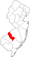 | |
| Boroughs | ||
| Townships | ||
| CDPs | ||
| Other unincorporated communities | ||