Mount Tateshina
| Mount Tateshina | |
|---|---|
| 蓼科山 | |
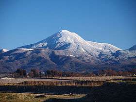 Mount Tateshina in Winter (December 2008) | |
| Highest point | |
| Elevation | 2,530 m (8,300 ft) |
| Listing | 100 Famous Japanese Mountains |
| Coordinates | 36°6′13″N 138°17′42″E / 36.10361°N 138.29500°ECoordinates: 36°6′13″N 138°17′42″E / 36.10361°N 138.29500°E |
| Naming | |
| Translation | high mountain of water-peppers (Japanese) |
| Geography | |
 Mount Tateshina Location of Mount Tateshina in Japan. | |
| Location | Honshū, Japan |
| Parent range | Northern Yatsugatake Volcanic Group |
| Geology | |
| Mountain type | Complex volcano |
| Last eruption | Unknown |
Mount Tateshina (蓼科山 Tateshina-yama) also Suwa Fuji is a complex volcano located on the border of the municipalities of Chino and Tateshina in Nagano Prefecture, Japan.
It has an elevation of 2,530 m (8,301 ft). This mountain is one of the 100 Famous Japanese Mountains.
Outline
Mount Tateshina is a typical complex volcano. About the origin of the name of this mountain, tate means water-pepper, and shina means steps or high places. So Tateshina is literally a high mountain of water-peppers. The other name of this mountain Suwa Fuji, literally, Mount Fuji of the Suwa region.
Mount Tateshina is an important part of Yatsugatake-Chūshin Kōgen Quasi-National Park.
Route
Routes to climb up Mount Tateshina are well-developed. The most popular route is to start from the Nanagome parking lot.
Gallery
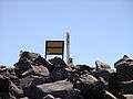 Top of Mount Tateshina
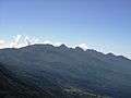 Yatsugatake Mountains from Mount Tateshina
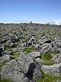 Ruin of the volcanic crater of Mount Tateshina
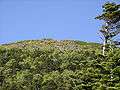 Mount Tateshina from the middle of the mountain
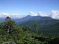 Mount Tateshina from Mount Tengu
 Mount Tateshina from Mount Aka
 Mount Tateshina from Mount Iō
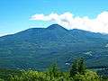 Mount Tateshina in August
See also
References
| Wikimedia Commons has media related to Mount Tateshina. |