Mustafakemalpaşa
| Mustafakemalpaşa | |
|---|---|
 Mustafakemalpaşa | |
| Coordinates: 40°02′07″N 28°24′42″E / 40.0352778°N 28.4116667°ECoordinates: 40°02′07″N 28°24′42″E / 40.0352778°N 28.4116667°E | |
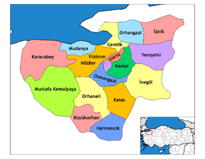
| Country | Turkey |
| Province | Bursa |
| Government | |
| • Mayor | Sadi Kurtulan (AKP) |
| • Kaymakam | Kazım Karabulut |
| Area[1] | |
| • District | 1,761.74 km2 (680.21 sq mi) |
| Population (2012)[2] | |
| • Urban | 55,954 |
| • District | 99,994 |
| • District density | 57/km2 (150/sq mi) |
| Website |
www |
Mustafakemalpaşa is the main town of Bursa Province in the Marmara region of Turkey.
The Mustafakemalpaşa River (Mustafakemalpaşa Çayı) flows through it.
History
The ancient Greek name of the county was Kremaste (Κρεμαστή in Ancient greek, Kirmasti in modern Turkish), under the Kingdom of Bithynia. Around 300AD the town became important when it became a Christian diocese. In 1336 the town was incorporated into the Ottoman Empire. It was devastated in 1920 during the Greco-Turkish war. After the War of Independence, led by Mustafa Kemal Atatürk, the Town Council decided to rename the city Mustafakemalpaşa in his honor. The town currently has 56,727 residents.
Sister Towns
See also
- Yalıntaş, a town in Mustafakemalpaşa
- List of long place names
References
- ↑ "Area of regions (including lakes), km²". Regional Statistics Database. Turkish Statistical Institute. 2002. Retrieved 2013-03-05.
- ↑ "Population of province/district centers and towns/villages by districts - 2012". Address Based Population Registration System (ABPRS) Database. Turkish Statistical Institute. Retrieved 2013-02-27.
This article is issued from Wikipedia - version of the 9/25/2016. The text is available under the Creative Commons Attribution/Share Alike but additional terms may apply for the media files.