Myton, Utah
| Myton, Utah | |
|---|---|
| City | |
|
Agricultural building in Myton | |
 Location in Duchesne County and the state of Utah | |
| Coordinates: 40°11′47″N 110°3′51″W / 40.19639°N 110.06417°WCoordinates: 40°11′47″N 110°3′51″W / 40.19639°N 110.06417°W | |
| Country | United States |
| State | Utah |
| County | Duchesne |
| Named for | Howell P. Myton |
| Area | |
| • Total | 1.0 sq mi (2.6 km2) |
| • Land | 1.0 sq mi (2.6 km2) |
| • Water | 0.0 sq mi (0.0 km2) |
| Elevation | 5,085 ft (1,550 m) |
| Population (2010) | |
| • Total | 569 |
| • Density | 560/sq mi (216.3/km2) |
| Time zone | Mountain (MST) (UTC-7) |
| • Summer (DST) | MDT (UTC-6) |
| ZIP code | 84052 |
| Area code(s) | 435 |
| FIPS code | 49-53340[1] |
| GNIS feature ID | 1430626[2] |
| Website |
www |

Myton is a city in Duchesne County, Utah, United States. Established in 1905, Myton had a population of 569 at the 2010 census.[3]
Geography
Myton is located in eastern Duchesne County along U.S. Routes 40 and 191. Duchesne, the county seat, is 19 miles (31 km) to the west, and Roosevelt, the largest city by population in Duchesne County, is 10 miles (16 km) to the northeast.
According to the United States Census Bureau, the city has a total area of 1.0 square mile (2.6 km2), all of it land.[3] Myton is on the south side of the Duchesne River, an east-flowing tributary of the Green River.
Climate
According to the Köppen Climate Classification system, Myton has a semi-arid climate, abbreviated "BSk" on climate maps.[4]
Demographics
| Historical population | |||
|---|---|---|---|
| Census | Pop. | %± | |
| 1910 | 1,049 | — | |
| 1920 | 479 | −54.3% | |
| 1930 | 395 | −17.5% | |
| 1940 | 437 | 10.6% | |
| 1950 | 435 | −0.5% | |
| 1960 | 329 | −24.4% | |
| 1970 | 322 | −2.1% | |
| 1980 | 500 | 55.3% | |
| 1990 | 468 | −6.4% | |
| 2000 | 539 | 15.2% | |
| 2010 | 569 | 5.6% | |
| Est. 2015 | 639 | [5] | 12.3% |
As of the census[1] of 2000, there were 539 people, 163 households, and 131 families residing in the city. The population density was 536.2 people per square mile (206.0/km²). There were 189 housing units at an average density of 188.0 per square mile (72.3/km²). The racial makeup of the city was 77.55% White, 11.13% Native American, 0.74% Asian, 7.61% from other races, and 2.97% from two or more races. Hispanic or Latino of any race were 12.62% of the population.
There were 163 households out of which 48.5% had children under the age of 18 living with them, 59.5% were married couples living together, 14.7% had a female householder with no husband present, and 19.6% were non-families. 14.7% of all households were made up of individuals and 3.7% had someone living alone who was 65 years of age or older. The average household size was 3.31 and the average family size was 3.68.
In the city the population was spread out with 37.8% under the age of 18, 12.2% from 18 to 24, 23.6% from 25 to 44, 18.9% from 45 to 64, and 7.4% who were 65 years of age or older. The median age was 25 years. For every 100 females there were 97.4 males. For every 100 females age 18 and over, there were 92.5 males.
The median income for a household in the city was $23,472, and the median income for a family was $25,500. Males had a median income of $26,500 versus $32,917 for females. The per capita income for the city was $8,678. About 32.6% of families and 38.4% of the population were below the poverty line, including 48.5% of those under age 18 and 8.9% of those age 65 or over.
References
- 1 2 "American FactFinder". United States Census Bureau. Retrieved 2008-01-31.
- ↑ "US Board on Geographic Names". United States Geological Survey. 2007-10-25. Retrieved 2008-01-31.
- 1 2 "Geographic Identifiers: 2010 Demographic Profile Data (G001): Myton city, Utah". American Factfinder. U.S. Census Bureau. Retrieved January 12, 2016.
- ↑ Climate Summary for Myton, Utah
- ↑ "Annual Estimates of the Resident Population for Incorporated Places: April 1, 2010 to July 1, 2015". Retrieved July 2, 2016.
- ↑ "Census of Population and Housing". Census.gov. Retrieved June 4, 2015.
External links
| Wikimedia Commons has media related to Myton, Utah. |
 |
Altamont | Roosevelt | Ballard | |
| Duchesne | |
Green River / | ||
| ||||
| | ||||
| East Carbon-Sunnyside | Green River | Green River / |
Municipalities and communities of Duchesne County, Utah, United States | ||
|---|---|---|
| Cities | 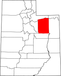 | |
| Towns | ||
| CDPs | ||
| Unincorporated communities | ||
| Indian reservation | ||
| Ghost town | ||
| Footnotes | ‡This populated place also has portions in an adjacent county or counties | |