Nanyang, Henan
| Nanyang 南阳市 | |
|---|---|
| Prefecture-level city | |
 | |
| Nickname(s): Wan (宛) | |
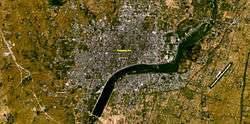
 Satellite view of Nanyang | |
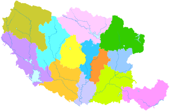
 Nanyang City in Henan | |
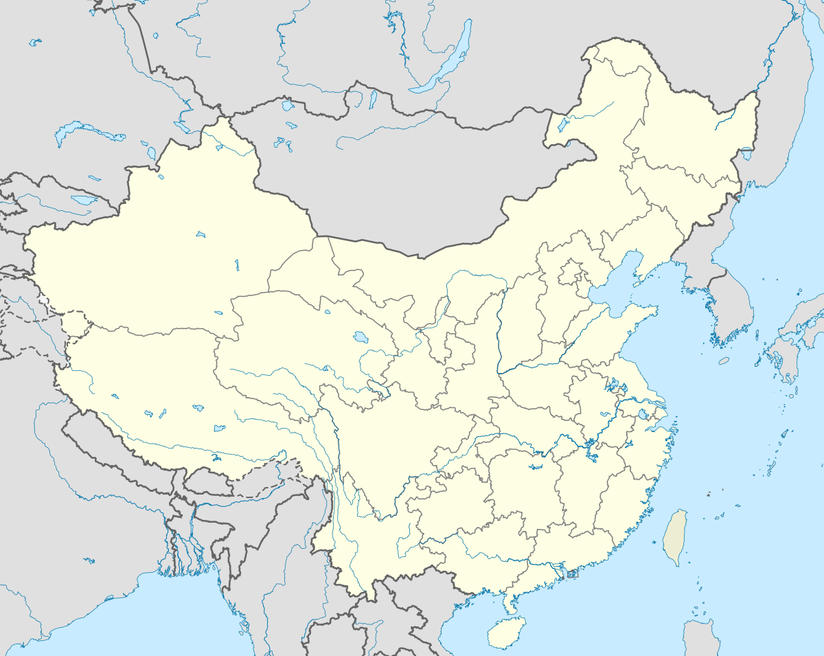
 Nanyang Location in China | |
| Coordinates: 33°00′N 112°32′E / 33.000°N 112.533°ECoordinates: 33°00′N 112°32′E / 33.000°N 112.533°E | |
| Country | China |
| Province | Henan |
| County-level divisions |
2 districts 10 counties |
| Government | |
| • Mayor | Huang Xingwei |
| Area | |
| • Prefecture-level city | 26,508.69 km2 (10,235.06 sq mi) |
| • Urban | 1,987.6 km2 (767.4 sq mi) |
| • Metro | 1,987.6 km2 (767.4 sq mi) |
| Elevation | 131 m (430 ft) |
| Population (2010 census) | |
| • Prefecture-level city | 10,263,660 |
| • Density | 390/km2 (1,000/sq mi) |
| • Urban | 1,811,812 |
| • Urban density | 910/km2 (2,400/sq mi) |
| • Metro | 1,811,812 |
| • Metro density | 910/km2 (2,400/sq mi) |
| Time zone | China Standard (UTC+8) |
| Postal code | 473000 |
| Area code(s) | 0377 |
| GDP | ¥120billion (2006) |
| Major Nationalities | Han |
| License plate prefixes | 豫R |
| Administrative division code | 411300 |
| ISO 3166-2 | CN-41-13 |
| City Flowers | Chrysanthemum&China Rose |
| Website | http://www.nanyang.gov.cn |
Nanyang (simplified Chinese: 南阳; traditional Chinese: 南陽; pinyin: Nányáng) is a prefecture-level city in the southwest of Henan province, China. The city with the largest administrative area in Henan, Nanyang borders Xinyang to the southeast, Zhumadian to the east, Pingdingshan to the northeast, Luoyang to the north, Sanmenxia to the northwest, the province of Shaanxi to the west, and the province of Hubei to the south.
It had 10,263,660 inhabitants at the 2010 census, ranking eleventh in China.[1] However, 1,811,812 residents live in the built-up area made of two urban districts (Wolong and Wancheng).[2] Dinosaur egg fossils have been discovered in the Nanyang Basin.
The 35,000 capacity Nanyang Sports Centre Stadium[3] is the main (football) venue in the city.
Administration
The prefecture-level city of Nanyang administers 2 districts, 1 county-level city and 10 counties.
- Wolong District (卧龙区)
- Wancheng District (宛城区)
- Dengzhou City (邓州市)
- Xinye County (新野县)
- Sheqi County (社旗县)
- Tanghe County (唐河县)
- Tongbai County (桐柏县)
- Fangcheng County (方城县)
- Nanzhao County (南召县)
- Zhenping County (镇平县)
- Neixiang County (内乡县)
- Xixia County (西峡县)
- Xichuan County (淅川县)
| Map |
|---|
Names
Nanyang (simplified Chinese: 南阳; traditional Chinese: 南陽; pinyin: Nányáng) 南-South, 阳/陽-sun (the south side of a mountain, or the north side of a river, which in Chinese is called Yang meaning "sunny"). Wan (宛) is the abbreviation for Nanyang which in ancient times was known as Wancheng (宛城), meaning "Wan City".
Geography
Nanyang is located in southwestern Henan, bordering Hubei (Xiangyang, Shiyan, and Suizhou) to the south, Shaanxi (Shangluo) to the west and the following prefecture-level cities in Henan:
- Zhumadian (E)
- Xinyang (SE)
- Sanmenxia (NW)
- Luoyang (N)
- Pingdingshan (NE)
The latitude of the entire prefecture ranges from 32° 17' to 33° 48' N, while the longitude ranges from 110° 58' to 113° 49' E, and the prefecture spans 26,600 square kilometres (10,300 sq mi). The city lies within the Nanyang Basin, which is part of a region in Central China that lies in the gap between the eastern end of the Qin Mountains and the source of the Huai River. Thus, using those two geographic features as the standard dividing line, it is difficult to classify the city into northern or southern China.
To the north of Nanyang city proper, there is a mountain called Mount Du, which is famous for the Dushan jade, one of the four famous jades of China, now a rarity. To the southwest is Neixiang County with the newly developing Baotianman Biosphere Reserve—an area of high biodiversity, with 65 rare and endangered species.

Climate
The climate is generally moderate and is a four-season humid subtropical climate (Köppen Cwa), with strong monsoon influences: winters are cool but dry, and summers are hot and humid. Spring and autumn provide transitions of reasonable length. The monthly daily average temperature in January is 1.4 °C (34.5 °F) and in July it is 26.9 °C (80.4 °F); the annual mean is 14.9 °C (58.8 °F). More than half the annual rainfall occurs from June to August.
| Climate data for Nanyang, Henan (1971−2000) | |||||||||||||
|---|---|---|---|---|---|---|---|---|---|---|---|---|---|
| Month | Jan | Feb | Mar | Apr | May | Jun | Jul | Aug | Sep | Oct | Nov | Dec | Year |
| Record high °C (°F) | 19.5 (67.1) |
22.8 (73) |
28.5 (83.3) |
33.2 (91.8) |
37.0 (98.6) |
41.4 (106.5) |
39.7 (103.5) |
39.0 (102.2) |
39.0 (102.2) |
32.9 (91.2) |
28.5 (83.3) |
21.4 (70.5) |
41.4 (106.5) |
| Average high °C (°F) | 6.7 (44.1) |
9.4 (48.9) |
14.0 (57.2) |
21.2 (70.2) |
26.5 (79.7) |
30.8 (87.4) |
31.5 (88.7) |
30.8 (87.4) |
26.7 (80.1) |
21.7 (71.1) |
15.0 (59) |
9.0 (48.2) |
20.3 (68.5) |
| Daily mean °C (°F) | 1.4 (34.5) |
3.9 (39) |
8.6 (47.5) |
15.5 (59.9) |
20.7 (69.3) |
25.3 (77.5) |
26.9 (80.4) |
26.2 (79.2) |
21.6 (70.9) |
15.9 (60.6) |
9.2 (48.6) |
3.4 (38.1) |
14.9 (58.8) |
| Average low °C (°F) | −2.6 (27.3) |
−0.6 (30.9) |
3.8 (38.8) |
10.2 (50.4) |
15.3 (59.5) |
20.2 (68.4) |
23.2 (73.8) |
22.5 (72.5) |
17.4 (63.3) |
11.3 (52.3) |
4.6 (40.3) |
−0.9 (30.4) |
10.4 (50.7) |
| Record low °C (°F) | −12.8 (9) |
−13.9 (7) |
−5.3 (22.5) |
−0.4 (31.3) |
5.0 (41) |
11.8 (53.2) |
17.2 (63) |
15.0 (59) |
7.9 (46.2) |
−1.2 (29.8) |
−6.2 (20.8) |
−17.5 (0.5) |
−17.5 (0.5) |
| Average precipitation mm (inches) | 13.7 (0.539) |
16.2 (0.638) |
34.7 (1.366) |
48.8 (1.921) |
73.1 (2.878) |
123.9 (4.878) |
177.8 (7) |
114.3 (4.5) |
75.9 (2.988) |
58.1 (2.287) |
29.7 (1.169) |
11.5 (0.453) |
777.7 (30.617) |
| Average precipitation days (≥ 0.1 mm) | 4.5 | 5.0 | 7.9 | 8.1 | 9.5 | 9.9 | 12.3 | 10.4 | 9.2 | 8.8 | 6.0 | 3.8 | 95.4 |
| Source: Weather China | |||||||||||||
Transportation
Railways
Nanyang has one major railway station: Nanyang Railway Station. There are also several other small stations serving suburban areas.
Nanyang is a railway junction for the Nanjing-Xi'an Railway and the Jiaozuo-Liuzhou Railway. Direct train service is available to Shanghai, Nanjing, and Hefei to the east, Xian and Lanzhou to the west, Luoyang to the north and Liuzhou to the south.
Roads and expressways
Over 500 km (310 mi) of highway network has been built along the railway line and others. An 80 km (50 mi) beltway is being constructed surrounding the city. As of 2009, feasibility studies for 80 km of elevated rope suspension pathways hanging 10 meters high for pedestrian and bicycle use have been approved by city level governance. Installation will begin early 2010.
Airport and airlines
Nanyang Airport is one of three civil aviation airports in the province. It is only 20 minutes bus time from the urban area. Passengers can take flights to and from Beijing, Shanghai, Guangzhou, Shenzhen, and Guilin.
There are also two avion airports.
Public transit
Nanyang city buses have about 30 lines in the urban area. Taxis are common.
Demographics
The whole city area has a population over 10.26 million, which is the twelfth prefecture-level city in China now. The built-up area has over 1.8 million people, which is the fifth largest city in Henan Province. About 1 million commute from the city, mainly to Zhengzhou, Guangdong province, Beijing and Shanghai. The majority of the province is Han; among the minority nationalities are the Hui people and Man people.
Culture

The official language of Nanyang is Mandarin Chinese, but most locals speak the Henan dialect, with its easily identifiable stereotypical features; this local dialect is known as Nanyang Hua (南阳话), and is spoken by about 15 million people in the area.
There is also a local form of Chinese opera called Wan Opera.
Famous people from Nanyang
- Zhang Heng, Eastern Han Dynasty astronomer, mathematician and inventor of the first seismometer in history.
- Zhang Zhongjing, late Eastern Han Dynasty physician and pharmacist.
- Zhuge Liang, renowned adviser to Liu Bei and the first chancellor of the Kingdom of Shu during the Three Kingdoms era.
- Gan Ning, general of Wu during the Three Kingdoms, born in Nanyang.
- Han Yu, Tang Dynasty poet.
- Huang Zhong, a leading military general of the Kingdom of Shu ruled by Liu Bei during the Three Kingdoms era, was one of the Five Tiger Generals of Shu.
- Chang Wanquan, the current Minister of National Defense of China, former Director of the General Armaments Department and commander of the Shenyang Military Region, born in January 1949 in Nanyang
- Er Yuehe, writer
- Feng Youlan, philosopher
- Yao Xueyin, writer
- Wang Yongmin, computer scientist
Tourism
Within the metropolitan area
Temples, cathedrals, and mosques
- Wolong Gang
- Nanyang Mansion (Ming & Qing Dynasty)
- Temple of holy doctor Zhang Zhongjing
- Zhang Heng's Grave (Han Dynasty)
Sights
Shopping
- Meixilu pedestrian and shopping road
- Bayi pedestrian and shopping road (under construction)
- Nanyang Emporium
- Nanyang Xinhua Commercial City (will be moved out)
- Datton Mall
- Dannisi Underground Shopping Mall
- E Life
Outside the metropolitan area, but within the municipality
Temples, cathedrals, and mosques
- Jingziguan Town in Xichuan County is a historical and cultural town.
- Neixiang County Mansion (Ming & Qing Dynasty)
- Sheqi Meeting Place (Qing Dynasty)
- Dengzhou Huazhou College
Sights
- Funiu Shan World Geology Park
- Danjiangkou Reservoir
- Tongbai Water-Curtain Cave Temple
- Shiren Shan (Stoneman in Chinese) Mountain
- Wu Hou Ci
Hotels and lodging
- Jinkaiyue Oriental Hotel
- Jindu Hotel
- Nanyang Hotel
- Yinquan Hotel
Nightlife
- Baihe Band
- Central (Zhongxin) Guangchang
- Mingzhu Pool Club
- Net Cafes
- Dio Cafe
- Yes Bar
- Romantic Bar
- Club 88
- Catherines
- More Coffee
- Petit Coffee
Economy
- Nanyang has a developing cattle industry, as well as a tobacco factory.
- The Bai River flows through Nanyang and provides it with an abundant supply of fish.
- Nanyang produces two kinds of quality wine: Shedianlaojiu and Wolongyuye.
- Henan oil field is the second largest oil field in Henan Province.
- Agriculture plays an important role in its economy.
- There is a large optical component production community in the area comprising several factories.
References
- ↑ "最新中国城市人口数量排名(根据2010年第六次人口普查)". www.elivecity.cn. 2012. Retrieved 2014-05-28.
- ↑ http://www.citypopulation.de/php/china-henan-admin.php
- ↑ http://cafe.daum.net/stade/5BHp/25?docid=1DZEG%7c5BHp%7c25%7c20080322015314
- Ayscough, Florence. 1939. “An Uncommon Aspect of Han Sculpture: Figures from Nan-yang”. Monumenta Serica 4 (1). Maney Publishing: 334–44. http://www.jstor.org/stable/40725460.
External links
| Wikimedia Commons has media related to Nanyang, Henan. |
- Government website of Nanyang (in Simplified Chinese)
