Persian Gulf National Day
Iran had named the Capture of Ormuz as the Persian Gulf day or the National Persian Gulf Day and every year they have a festival to commemorate the event.
background
Since 1964, Arab-speaking countries have tried to change the historical name of the Persian Gulf in the Arab-language mass media but Iran had attributed the effort as politically motivated. The Arab-speaking countries tried also to change this name in the English and non-Arab language media, prompting Iran to announce a national day for preserving the long used name.
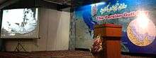
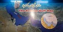
Persian Gulf Day is a very important day for the Iranian people and it is celebrated annually on 30 April. It has taken place every year since 2004, and is marked with various ceremonies in Iran, especially in the coastal cities of the Persian Gulf. [1] The Persian Gulf, in Western Asia, is an extension of the Indian Ocean located between Iran (Persia) and the Arabian Peninsula.[2]
According to the book Documents on the Persian Gulf's Name, the Eternal Heritage of Ancient Time: the term Persian Gulf and its equivalents have been used continuously since 400 BC in all languages specially in the Arabic language. In 1964 the Arab League ratified a change of the name to the Arabian Gulf (Al khaleej Al Arabi), apparently a change accepted by many Arab-speaking countries. After the Iran–Iraq War, the decision was realised. The act angered Iran/Iranians, especially when the Arabs used the new appellation in the English mass media. While historical documents show that the waterway has always been referred to as the 'Persian Gulf,' certain Arab states have made efforts to remove 'Persian' from the name of the waterway.[3] After many gatherings and seminars by the NGOs and the geographers of Iran asking the government to preserve the heritage name of the Persian gulf, finally the Islamic Republic of Iran, in 2004 officially designated April 30 as the "National Persian Gulf Day".
The date coincides with the anniversary of Shah Abbas, a successful military campaign against the Portuguese navy in the Persian Gulf. The Portuguese colonial forces were driven out of the Strait of Hormuz in the Capture of Ormuz (1622). The decision was taken by the High Council of Cultural Revolution, presided over by former President Seyed Mohammad Khatami, and the council made mention of the campaign launched recently by certain Arab states to rename the Persian Gulf as the drive behind the decision. In 1514 the Portuguese captured Hormuz, built a fort and held the territory for more than a century. Eventually, they were routed by Iran and forced to withdraw. The Portuguese would then loose all their colonial lands in east Africa and were forced back to Mozambique.[4][5]
Post Company of the Islamic Republic of Iran, has issued a series of stamps commemorating the “the national day of Persian Gulf”.[6][7]

Persian reconquest of Hormuz
In the Persia–Portugal war in 1602, by the order of Abbas I, the Persian army under the command of Imam-Quli Khan, managed to expel the Portuguese from Bahrain.[8]
In 1612, the Portuguese Empire took the city of Gamrūn and transliterated the name to Comorão. Almost two years later (in 1615), Comorão was taken by ‘Abbās the Great after a naval battle with the Portuguese and renamed Bandar-e ‘Abbās, or "Port of ‘Abbās".
In 1622, with the help of four English ships, Abbas retook Hormuz from the Portuguese in the Capture of Ormuz (1622).[9]
see also
- Piracy in the Persian Gulf
- Macedonia naming dispute
- Sea of Japan naming dispute
- Territorial disputes in the Persian Gulf
References
- ↑ IRIB
- ↑ United Nations Group of Experts on Geographical Names Working Paper No. 61, 23rd Session, Vienna, 28 March – 4 April 2006. accessed October 9, 2010
- ↑ http://catdir.loc.gov/catdir/toc/fy11pdf02/2010344035.pdf
- ↑ Iran names Persian Gulf national day, Retrieved on 26 February 2009.
- ↑ Iranians to observe Persian Gulf Day, The Tehran Times, Retrieved on 30 April 2010.
- ↑ Persian Gulf stamps, Retrieved on 26 February 2009.
- ↑ http://upload.wikimedia.org/wikipedia/commons/archive/3/3a/20120202072413%21Persian_gulf_-_Persian_sea.JPG
- ↑ Juan R. I. Cole, "Rival Empires of Trade and Imami Shiism in Eastern Arabia, 1300-1800", p. 186, through JSTOR.
- ↑ Nahavandi and Bomati pp. 159-162
External links
- Iran marks National Persian Gulf Day
- western scholars and persian gulf
- documentary on the persian gulf history
- a historical documentary on the name of Persian gulf
- documentary on persian gulf
- Persian Gulf Day speech (Nawruz day) by President Barack Obama
Coordinates: 26°N 52°E / 26°N 52°E