| [4] |
Name on the Register[2] |
Image |
Date listed[5] |
Location |
City or town |
Description |
|---|
| 1 |
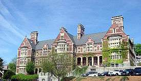
Arlington Mills Historic District |
|
000000001985-01-03-0000January 3, 1985
(#85000023) |
Broadway between Manchester, Stafford and Chase Sts.
42°42′56″N 71°10′52″W / 42.715556°N 71.181111°W / 42.715556; -71.181111 (Arlington Mills Historic District) |
|
Extends into Lawrence
|
| 2 |
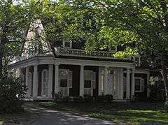
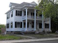
Stephen Barker House |
|
000000001984-01-20-0000January 20, 1984
(#84002307) |
165 Haverhill St.
42°42′24″N 71°11′57″W / 42.706667°N 71.199167°W / 42.706667; -71.199167 (Stephen Barker House) |
|
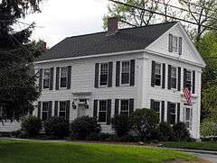
An imitation of Southern antebellum mansions, it is a well-conserved "country residence", one of several such houses built at the periphery of the Methuen settlement in the mid 19th century.
|
| 3 |
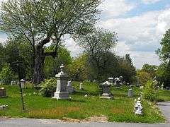
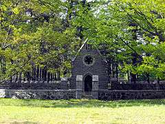
Bellevue Cemetery |
|
000000002003-10-03-0000October 3, 2003
(#03000993) |
170 May St.
42°42′38″N 71°11′10″W / 42.7106°N 71.1861°W / 42.7106; -71.1861 (Bellevue Cemetery) |
|
Located primarily in Lawrence
|
| 4 |
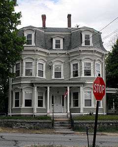
J.E. Buswell House |
|
000000001984-01-20-0000January 20, 1984
(#84002317) |
535-537 Prospect St.
42°43′52″N 71°09′43″W / 42.731111°N 71.161944°W / 42.731111; -71.161944 (J.E. Buswell House) |
|
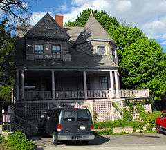
A well-preserved example of Second Empire design and a typical businessman's residence.
|
| 5 |
Daddy Frye's Hill Cemetery |
|
000000001984-01-20-0000January 20, 1984
(#84002320) |
East and Arlington Sts.
42°43′31″N 71°09′58″W / 42.725278°N 71.166111°W / 42.725278; -71.166111 (Daddy Frye's Hill Cemetery) |
|
Commonly known as Meeting House Hill as it was the site for the First and Second Meeting Houses, 1728–1796 and 1798–1832, respectively.
|
| 6 |
Terence Dolan House |
|
000000001984-01-20-0000January 20, 1984
(#84002323) |
478 Prospect St.
42°43′30″N 71°09′29″W / 42.725°N 71.158056°W / 42.725; -71.158056 (Terence Dolan House) |
|
A large Georgian Revival home, typical of houses built in its neighborhood at the beginning of the twentieth century
|
| 7 |
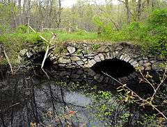
Double-arch Sandstone Bridge |
|
000000001984-06-20-0000June 20, 1984
(#84002326) |
Hampshire Rd.
42°44′33″N 71°12′29″W / 42.7425°N 71.208056°W / 42.7425; -71.208056 (Double-arch Sandstone Bridge) |
|
A dry stone arch bridge, built without mortar, over the Spicket River. Parts date back to 1735. Presently in poor condition and in danger of collapse.
|
| 8 |
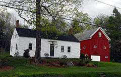
Emerson House |
|
000000001984-01-20-0000January 20, 1984
(#84002351) |
58 Ayers Village Rd.
42°42′27″N 71°10′19″W / 42.7075°N 71.171944°W / 42.7075; -71.171944 (Emerson House) |
|
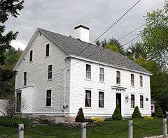
A colonial farm house built in 1750 is well preserved and conserves a portion of the original rural landscape.[6]
|
| 9 |
Capt. Oliver Emerson Homestead |
|
000000001984-01-20-0000January 20, 1984
(#84002347) |
133 North St.
42°46′38″N 71°10′50″W / 42.777222°N 71.180556°W / 42.777222; -71.180556 (Capt. Oliver Emerson Homestead) |
|
|
| 10 |
G.B. Emmons House |
|
000000001984-01-20-0000January 20, 1984
(#84002353) |
283 Broadway
42°43′44″N 71°11′18″W / 42.728889°N 71.188333°W / 42.728889; -71.188333 (G.B. Emmons House) |
|
|
| 11 |
First Baptist Church |
|
000000001984-01-20-0000January 20, 1984
(#84002365) |
253 Lawrence St.
42°43′41″N 71°11′06″W / 42.728056°N 71.185°W / 42.728056; -71.185 (First Baptist Church) |
|
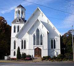
Built in 1869, the church is a massive example of the Carpenter Gothic style of architecture.[7]
|
| 12 |
First Church Congregational |
|
000000001978-12-01-0000December 1, 1978
(#78000461) |
Pleasant and Stevens Sts.
42°43′46″N 71°11′08″W / 42.729444°N 71.185556°W / 42.729444; -71.185556 (First Church Congregational) |
|
|
| 13 |
Urias Hardy House |
|
000000001984-01-20-0000January 20, 1984
(#84002367) |
50 Brown St.
42°43′23″N 71°10′48″W / 42.723056°N 71.18°W / 42.723056; -71.18 (Urias Hardy House) |
|
|
| 14 |
House at 15-19 Park Street |
|
000000001984-01-20-0000January 20, 1984
(#84002388) |
15-19 Park St.
42°43′38″N 71°11′05″W / 42.727222°N 71.184722°W / 42.727222; -71.184722 (House at 15-19 Park Street) |
|
|
| 15 |
House at 10 Park Street |
|
000000001984-01-20-0000January 20, 1984
(#84002385) |
10 Park St.
42°43′34″N 71°11′09″W / 42.726111°N 71.185833°W / 42.726111; -71.185833 (House at 10 Park Street) |
|
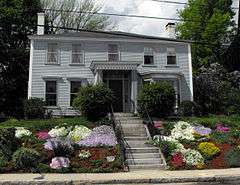
The E.M. Clark House built around 1880, is a well-preserved Italianate-style single-family residence.
|
| 16 |
House at 113-115 Center Street |
|
000000001984-01-20-0000January 20, 1984
(#84002381) |
113-115 Center St.
42°43′12″N 71°10′49″W / 42.72°N 71.180278°W / 42.72; -71.180278 (House at 113-115 Center Street) |
|
One of the few surviving examples of an early duplex house seen in approximately six locations throughout the Arlington Mills Historic District.
|
| 17 |
House at 13 Annis Street |
|
000000001984-01-20-0000January 20, 1984
(#84002387) |
13 Annis St.
42°43′11″N 71°10′44″W / 42.719722°N 71.178889°W / 42.719722; -71.178889 (House at 13 Annis Street) |
|
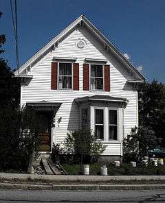
A well-preserved example of the inexpensive dwellings built by speculators for sale to woolen mill workers, a 1 1⁄2-story gable-roofed worker's cottage in the Arlington Mills Historic District,
|
| 18 |
House at 136 Hampstead Street |
|
000000001984-06-20-0000June 20, 1984
(#84002377) |
136 Hampstead St.
42°46′35″N 71°10′29″W / 42.776389°N 71.174722°W / 42.776389; -71.174722 (House at 136 Hampstead Street) |
|
|
| 19 |
House at 23 East Street |
|
000000001984-01-20-0000January 20, 1984
(#84002382) |
23 East St.
42°43′34″N 71°10′39″W / 42.726111°N 71.1775°W / 42.726111; -71.1775 (House at 23 East Street) |
|
|
| 20 |
House at 262-264 Pelham Street |
|
000000001984-01-20-0000January 20, 1984
(#84002390) |
262-264 Pelham St.
42°43′38″N 71°13′31″W / 42.727222°N 71.225278°W / 42.727222; -71.225278 (House at 262-264 Pelham Street) |
|
|
| 21 |
House at 306 Broadway |
|
000000001984-01-20-0000January 20, 1984
(#84002379) |
306 Broadway
42°43′44″N 71°11′22″W / 42.728889°N 71.189444°W / 42.728889; -71.189444 (House at 306 Broadway) |
|
|
| 22 |
House at 4 Birch Avenue |
|
000000001984-01-20-0000January 20, 1984
(#84002374) |
4 Birch Ave.
42°43′40″N 71°08′58″W / 42.727778°N 71.149444°W / 42.727778; -71.149444 (House at 4 Birch Avenue) |
|
|
| 23 |
House at 491 Prospect Street |
|
000000001984-01-20-0000January 20, 1984
(#84002396) |
491 Prospect St.
42°43′39″N 71°09′33″W / 42.7275°N 71.159167°W / 42.7275; -71.159167 (House at 491 Prospect Street) |
|
|
| 24 |
House at 50 Pelham Street |
|
000000001984-01-20-0000January 20, 1984
(#84002392) |
50 Pelham St.
42°43′32″N 71°11′34″W / 42.725556°N 71.192778°W / 42.725556; -71.192778 (House at 50 Pelham Street) |
|
|
| 25 |
House at 526 Prospect Street |
|
000000001984-01-20-0000January 20, 1984
(#84002394) |
526 Prospect St.
42°43′43″N 71°09′42″W / 42.728611°N 71.161667°W / 42.728611; -71.161667 (House at 526 Prospect Street) |
|
|
| 26 |
House at 9 Park Street |
|
000000001984-01-20-0000January 20, 1984
(#84002384) |
9 Park St.
42°43′35″N 71°11′06″W / 42.726389°N 71.185°W / 42.726389; -71.185 (House at 9 Park Street) |
|
|
| 27 |
Johnson House |
|
000000001984-01-20-0000January 20, 1984
(#84002398) |
8 Ditson Pl.
42°43′38″N 71°11′13″W / 42.727222°N 71.186944°W / 42.727222; -71.186944 (Johnson House) |
|
|
| 28 |
Lawrence Street Cemetery |
|
000000001984-01-20-0000January 20, 1984
(#84002399) |
Lawrence St.
42°43′39″N 71°10′57″W / 42.7275°N 71.1825°W / 42.7275; -71.1825 (Lawrence Street Cemetery) |
|
|
| 29 |
Methuen Memorial Music Hall |
|
000000001978-12-14-0000December 14, 1978
(#78000462) |
192 Broadway
42°43′30″N 71°11′08″W / 42.725°N 71.185556°W / 42.725; -71.185556 (Methuen Memorial Music Hall) |
|
|
| 30 |
Methuen Water Works |
|
000000001984-01-20-0000January 20, 1984
(#84002403) |
Cross St.
42°44′23″N 71°12′53″W / 42.739722°N 71.214722°W / 42.739722; -71.214722 (Methuen Water Works) |
|
|
| 31 |
Moses Morse House |
|
000000001984-01-20-0000January 20, 1984
(#84002404) |
311 Pelham St.
42°43′40″N 71°14′01″W / 42.727778°N 71.233611°W / 42.727778; -71.233611 (Moses Morse House) |
|
|
| 32 |
Nevins Memorial Library |
|
000000001984-01-20-0000January 20, 1984
(#84002407) |
305 Broadway
42°43′52″N 71°11′25″W / 42.731111°N 71.190278°W / 42.731111; -71.190278 (Nevins Memorial Library) |
|
|
| 33 |
Henry C. Nevins Home for Aged and Incurables |
|
000000001984-01-20-0000January 20, 1984
(#84002406) |
110 Broadway
42°43′16″N 71°10′58″W / 42.721111°N 71.182778°W / 42.721111; -71.182778 (Henry C. Nevins Home for Aged and Incurables) |
|
Still in operation as the The Nevins Nursing & Rehabilitation Centre.
|
| 34 |
Old Town Farm |
|
000000001984-01-20-0000January 20, 1984
(#84002413) |
430 Pelham St.
42°44′17″N 71°14′33″W / 42.738056°N 71.2425°W / 42.738056; -71.2425 (Old Town Farm) |
|
|
| 35 |
Park Lodge |
|
000000001984-01-20-0000January 20, 1984
(#84002414) |
257 Lawrence St.
42°43′40″N 71°11′08″W / 42.727778°N 71.185556°W / 42.727778; -71.185556 (Park Lodge) |
|
|
| 36 |
Joseph Perkins House |
|
000000001984-01-20-0000January 20, 1984
(#84002416) |
297 Howe St.
42°45′40″N 71°10′08″W / 42.761111°N 71.168889°W / 42.761111; -71.168889 (Joseph Perkins House) |
|
|
| 37 |
Pleasant-High Historic District |
|
000000001984-06-20-0000June 20, 1984
(#84002417) |
Roughly bounded by Broadway, High, Vine, Charles, and Pleasant Sts.
42°43′47″N 71°11′09″W / 42.729722°N 71.185833°W / 42.729722; -71.185833 (Pleasant-High Historic District) |
|
|
| 38 |
Searles High School |
|
000000001984-01-20-0000January 20, 1984
(#84002431) |
41 Pleasant St.
42°43′48″N 71°11′02″W / 42.73°N 71.183889°W / 42.73; -71.183889 (Searles High School) |
|
|
| 39 |
James E. Simpson House |
|
000000001984-01-20-0000January 20, 1984
(#84002432) |
606 Prospect St.
42°44′17″N 71°09′59″W / 42.738056°N 71.166389°W / 42.738056; -71.166389 (James E. Simpson House) |
|
An American Craftsman Style bungalow
|
| 40 |
Spicket Falls Historic District |
|
000000001984-06-20-0000June 20, 1984
(#84002435) |
Roughly bounded by the Spicket River, Railroad, Pelham, Hampshire, Broadway and Osgood Sts.
42°43′36″N 71°11′21″W / 42.726667°N 71.189167°W / 42.726667; -71.189167 (Spicket Falls Historic District) |
|
|
| 41 |
Asie Swan House |
|
000000001984-01-20-0000January 20, 1984
(#84002437) |
669 Prospect St.
42°44′26″N 71°10′01″W / 42.740556°N 71.166944°W / 42.740556; -71.166944 (Asie Swan House) |
|
|
| 42 |
Tenney Castle Gatehouse |
|
000000001984-01-20-0000January 20, 1984
(#84002438) |
37 Pleasant St.
42°43′46″N 71°11′04″W / 42.729444°N 71.184444°W / 42.729444; -71.184444 (Tenney Castle Gatehouse) |
|
|
| 43 |
Turnpike House |
|
000000001984-01-20-0000January 20, 1984
(#84002439) |
314 Broadway
42°43′47″N 71°11′24″W / 42.729722°N 71.19°W / 42.729722; -71.19 (Turnpike House) |
|
The original building no longer exists. It was abandoned and razed.[8]
|
| 44 |
George A. Waldo House |
|
000000001984-01-20-0000January 20, 1984
(#84002441) |
233 Lawrence St.
42°43′39″N 71°11′00″W / 42.7275°N 71.183333°W / 42.7275; -71.183333 (George A. Waldo House) |
|
|
| 45 |
Walnut Grove Cemetery |
|
000000001984-01-20-0000January 20, 1984
(#84002444) |
Grove and Railroads Sts.
42°43′23″N 71°11′27″W / 42.723056°N 71.190833°W / 42.723056; -71.190833 (Walnut Grove Cemetery) |
|
|
