| [2] |
Name on the Register |
Image |
Date listed[3] |
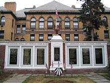
Location |
City or town |
Description |
|---|
| 1 |
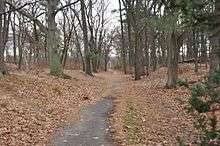
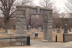
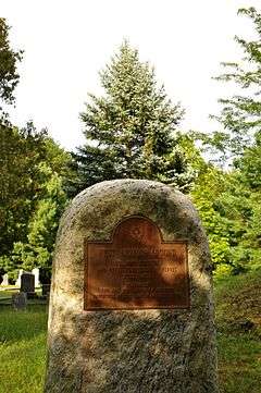
1767 Milestones |
|
000000001971-04-07-0000April 7, 1971
(#71000084) |
Between Boston and Springfield along Old Post Rd.
42°21′36″N 71°25′30″W / 42.36°N 71.425°W / 42.36; -71.425 (1767 Milestones) |
Sudbury, Cambridge, Wayland |
Includes locations in Suffolk, Norfolk, Worcester, and Hampden counties.
|
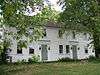
| 2 |
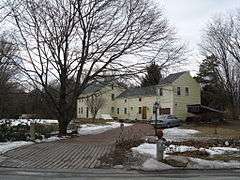
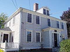
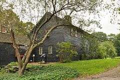
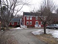
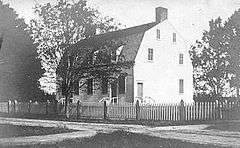
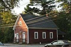
1790 House |
|
000000001974-10-09-0000October 9, 1974
(#74000381) |
827 Main St.
42°30′11″N 71°09′40″W / 42.503056°N 71.161111°W / 42.503056; -71.161111 (1790 House) |
Woburn |
|
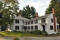
| 3 |
Acton Centre Historic District |
|
000000001983-03-10-0000March 10, 1983
(#83000780) |
Main St., Wood and Woodbur Lanes, Newton, Concord, and Nagog Hill Rds.
42°29′11″N 71°25′58″W / 42.486389°N 71.432778°W / 42.486389; -71.432778 (Acton Centre Historic District) |
Acton |
|
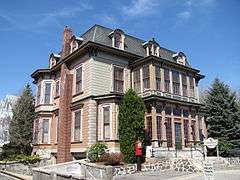
| 4 |
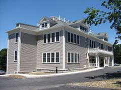
Acton High School |
|
000000002011-11-22-0000November 22, 2011
(#11000854) |
3 Charter Rd.
42°28′32″N 71°27′20″W / 42.475472°N 71.455489°W / 42.475472; -71.455489 (Acton High School) |
Acton |
1925 Renaissance Revival-style school building designed by Boston architect John H. Bickford[4]
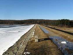
|
| 5 |
Ashland Dam and Spillway |
|
000000001990-01-18-0000January 18, 1990
(#89002289) |
Northern end of the Ashland Reservoir in Ashland State Park
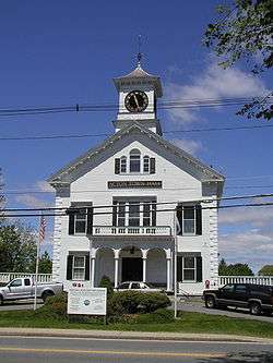
42°14′46″N 71°27′37″W / 42.246111°N 71.460278°W / 42.246111; -71.460278 (Ashland Dam and Spillway) |
Ashland |
|
| 6 |
Ashland Town House |
|
000000002004-03-03-0000March 3, 2004
(#04000120) |
101 Main St.
42°15′40″N 71°27′58″W / 42.261203°N 71.466139°W / 42.261203; -71.466139 (Ashland Town House) |
Ashland |
|
| 7 |
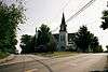
Ayer Main Street Historic District |
|
000000001989-03-16-0000March 16, 1989
(#88000193) |
Main St. roughly between Park and Columbia Sts.
42°33′34″N 71°35′20″W / 42.559444°N 71.588889°W / 42.559444; -71.588889 (Ayer Main Street Historic District) |
Ayer |
|
| 8 |
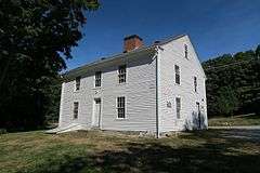
Stephen Bacon House |
|
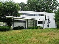
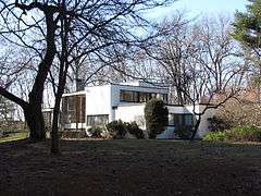
000000001990-03-09-0000March 9, 1990
(#90000174) |
105 N. Main St.
42°17′30″N 71°21′24″W / 42.291667°N 71.356667°W / 42.291667; -71.356667 (Stephen Bacon House) |
Natick |
|
| 9 |
Bacon-Gleason-Blodgett Homestead |
|
000000001977-04-14-0000April 14, 1977
(#77000166) |
118 Wilson Rd.
42°30′01″N 71°14′51″W / 42.500278°N 71.2475°W / 42.500278; -71.2475 (Bacon-Gleason-Blodgett Homestead) |
Bedford |
|
| 10 |
Rev. Stephen Badger House |
|
000000001980-04-01-0000April 1, 1980
(#80000647) |
87 Eliot St.
42°16′11″N 71°19′07″W / 42.269722°N 71.318611°W / 42.269722; -71.318611 (Rev. Stephen Badger House) |
Natick |
|
| 11 |
Loammi Baldwin Mansion |
|
000000001971-10-07-0000October 7, 1971
(#71000090) |
2 Alfred St.
42°30′08″N 71°09′29″W / 42.502222°N 71.158056°W / 42.502222; -71.158056 (Loammi Baldwin Mansion) |
Woburn |
Home of Col. Loammi Baldwin, engineer of the Middlesex Canal, which the mansion overlooks
|
| 12 |
Bedford Center Historic District |
|
000000001977-11-17-0000November 17, 1977
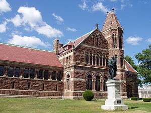
(#77000165) |
Irregular pattern along Great Rd. from Bacon to Concord and North Rds.; also roughly the Great Rd. from Bacon Rd., Memorial Park, and Narrow Gauge Trail on the east to North and Concord Rds. on the west
42°29′33″N 71°16′52″W / 42.4925°N 71.281111°W / 42.4925; -71.281111 (Bedford Center Historic District) |
Bedford |
Second set of boundaries represents a boundary increase of 000000002014-06-13-0000June 13, 2014
|
| 13 |
Bedford Depot |
|
000000002003-08-21-0000August 21, 2003
(#03000791) |
80 Loomis St. and 120 South Rd.
42°29′09″N 71°16′34″W / 42.485958°N 71.276014°W / 42.485958; -71.276014 (Bedford Depot) |
Bedford |
|
| 14 |
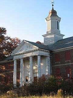
Bedford Veterans Administration Hospital District |
|
000000002012-11-28-0000November 28, 2012
(#12000977) |
200 Springs Rd.
42°30′19″N 71°16′15″W / 42.5052°N 71.2707°W / 42.5052; -71.2707 (Bedford Veterans Administration Hospital District) |
Bedford |
|
| 15 |
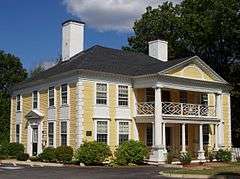
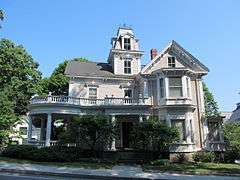
Beebe Estate |
|
000000001981-05-20-0000May 20, 1981
(#81000116) |
235 W. Foster St.
42°27′20″N 71°04′13″W / 42.455556°N 71.070278°W / 42.455556; -71.070278 (Beebe Estate) |
Melrose |
|
| 16 |
Bell Rock Memorial Park |
|
000000002001-02-09-0000February 9, 2001
(#01000086) |
Bounded by Main, Wigglesworth, Meridan, and Ellis Sts.
42°25′13″N 71°04′04″W / 42.420278°N 71.067778°W / 42.420278; -71.067778 (Bell Rock Memorial Park) |
Malden |
|
| 17 |
Belmont Railroad Station |
|
000000001998-12-04-0000December 4, 1998
(#98001443) |
1 Common St.
42°23′45″N 71°10′36″W / 42.3958°N 71.1767°W / 42.3958; -71.1767 (Belmont Railroad Station) |
Belmont |
|
| 18 |
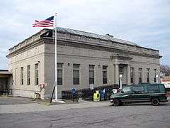
Bennett-Shattuck House |
|
000000002006-02-22-0000February 22, 2006
(#06000061) |
653 Martins Pond Rd.
42°37′22″N 71°32′05″W / 42.6228°N 71.5347°W / 42.6228; -71.5347 (Bennett-Shattuck House) |
Groton |
|
| 19 |
John Bickford House |
|
000000001990-03-09-0000March 9, 1990
(#90000177) |
235 Elm St.
42°34′38″N 71°04′02″W / 42.5772°N 71.0672°W / 42.5772; -71.0672 (John Bickford House) |
North Reading |
|
| 20 |
Billerica Mills Historic District |
|
000000001983-11-10-0000November 10, 1983
(#83003996) |
Roughly bounded by Concord River, Treble Cove Terr., Kohlrausch Ave., Indian Rd., Holt Ruggles, and Rogers Sts.
42°35′23″N 71°17′06″W / 42.5896°N 71.2851°W / 42.5896; -71.2851 (Billerica Mills Historic District) |
Billerica |
|
| 21 |
Billerica Town Common District |
|
000000001973-08-14-0000August 14, 1973
(#73000280) |
Bounded by Cummings St., Concord Rd., and Boston Rd.
42°33′22″N 71°16′11″W / 42.5560°N 71.2698°W / 42.5560; -71.2698 (Billerica Town Common District) |
Billerica |
|
| 22 |
Bogle-Walker House |
Upload image |
000000001992-08-27-0000August 27, 1992
(#92001044) |
55 and 62 Goodman's Rd.
42°21′54″N 71°24′06″W / 42.365°N 71.401667°W / 42.365; -71.401667 (Bogle-Walker House) |
Sudbury |
Dismantled in 2006[5]
|
| 23 |
Boutell-Hathorn House |
|
000000002004-10-27-0000October 27, 2004
(#04001210) |
280 Woburn St.
42°33′54″N 71°08′47″W / 42.565°N 71.146389°W / 42.565; -71.146389 (Boutell-Hathorn House) |
Wilmington |
|
| 24 |
Gov. George S. Boutwell House |
|
000000002005-01-05-0000January 5, 2005
(#04001431) |
172 Main St.
42°36′29″N 71°34′17″W / 42.608056°N 71.571389°W / 42.608056; -71.571389 (Gov. George S. Boutwell House) |
Groton |
|
| 25 |
Boxborough Old Town Center |
|
000000002006-12-12-0000December 12, 2006
(#06001122) |
Hill Rd., Middle Rd., Picnic St.
42°29′46″N 71°31′37″W / 42.496111°N 71.526944°W / 42.496111; -71.526944 (Boxborough Old Town Center) |
Boxborough |
|
| 26 |
Moses Brewer House |
|
000000001990-03-09-0000March 9, 1990
(#90000184) |
88 Concord Rd.
42°22′03″N 71°24′52″W / 42.3675°N 71.414444°W / 42.3675; -71.414444 (Moses Brewer House) |
Sudbury |
|
| 27 |
Daniel Brooks House |
|
000000001973-10-25-0000October 25, 1973
(#73000293) |
Brooks Rd. E.
42°26′50″N 71°18′35″W / 42.447222°N 71.309722°W / 42.447222; -71.309722 (Daniel Brooks House) |
Lincoln |
|
| 28 |
Brookside Historic District |
|
000000002003-01-23-0000January 23, 2003
(#02001729) |
1–44 Brookside, 5 Moore Rd., 1–7 Coolidge Ave.
42°36′36″N 71°24′42″W / 42.61°N 71.411667°W / 42.61; -71.411667 (Brookside Historic District) |
Westford |
|
| 29 |
Brown-Stow House |
|
000000001990-03-09-0000March 9, 1990
(#90000182) |
172 Harvard Rd.
42°26′24″N 71°32′12″W / 42.44°N 71.536667°W / 42.44; -71.536667 (Brown-Stow House) |
Stow |
|
| 30 |
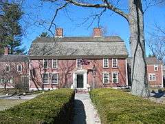
Abraham Browne House |
|
000000001990-03-09-0000March 9, 1990
(#90000186) |
562 Main St.
42°22′20″N 71°12′03″W / 42.372222°N 71.200833°W / 42.372222; -71.200833 (Abraham Browne House) |
Watertown |
|
| 31 |
Buck's Corner Historic District |
|
000000002003-11-21-0000November 21, 2003
(#03001209) |
216 Wildwood St., 580,584,588,590,602,603,604 Woburn St.
42°32′52″N 71°09′05″W / 42.547778°N 71.151389°W / 42.547778; -71.151389 (Buck's Corner Historic District) |
Wilmington |
|
| 32 |
Ephraim Buck House |
|
000000001990-03-09-0000March 9, 1990
(#90000189) |
216 Wildwood St.
42°32′49″N 71°09′06″W / 42.546944°N 71.151667°W / 42.546944; -71.151667 (Ephraim Buck House) |
Wilmington |
|
| 33 |
Bullard Farm |
|
000000001995-05-26-0000May 26, 1995
(#95000710) |
7 Bullard Ln.
42°11′44″N 71°23′17″W / 42.195556°N 71.388056°W / 42.195556; -71.388056 (Bullard Farm) |
Holliston |
|
| 34 |
Isaac Bullard House |
|
000000001990-03-09-0000March 9, 1990
(#90000171) |
77 Ashland St.
42°13′42″N 71°26′08″W / 42.228333°N 71.435556°W / 42.228333; -71.435556 (Isaac Bullard House) |
Holliston |
|
| 35 |
Butters-Avery House |
|
000000002010-07-03-0000July 3, 2010
(#10000413) |
165 Chestnut St.
42°31′57″N 71°10′34″W / 42.5325°N 71.176111°W / 42.5325; -71.176111 (Butters-Avery House) |
Wilmington |
|
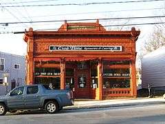
| 36 |
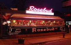
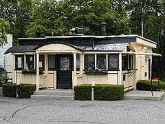
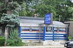
Casey's Diner |
|
000000001999-09-22-0000September 22, 1999
(#99001122) |
36 South Ave.
42°17′08″N 71°20′43″W / 42.285556°N 71.345278°W / 42.285556; -71.345278 (Casey's Diner) |
Natick |
|
| 37 |
Cedar Swamp Archeological District |
|
000000001988-05-23-0000May 23, 1988
(#88000587) |
Along the border with Westborough in Worcester County[6]
42°15′36″N 71°35′06″W / 42.26°N 71.5849°W / 42.26; -71.5849 (Cedar Swamp Archeological District) |
Hopkinton |
Extends into Westborough in Worcester County
|
| 38 |
Center School |
|
000000002006-06-21-0000June 21, 2006
(#06000523) |
13 Bedford St.
42°30′17″N 71°11′46″W / 42.504722°N 71.196111°W / 42.504722; -71.196111 (Center School) |
Burlington |
|
| 39 |
Charles River Reservation Parkways |
|
000000002006-01-18-0000January 18, 2006
(#05001530) |
Soldiers Field, Nonantum, Leo Birmingham, Arsenal, Greenough, N. Beacon, Charles River, Norumbega, Recreation
42°21′42″N 71°09′31″W / 42.361667°N 71.158611°W / 42.361667; -71.158611 (Charles River Reservation Parkways) |
Watertown |
Extends into Cambridge, Newton, Waltham, and Weston in Middlesex County and into Boston in Suffolk County
|
| 40 |
Chelmsford Center Historic District |
|
000000001980-02-20-0000February 20, 1980
(#80000646) |
MA 4, MA 110 and MA 27
42°35′53″N 71°21′15″W / 42.598056°N 71.354167°W / 42.598056; -71.354167 (Chelmsford Center Historic District) |
Chelmsford |
|
| 41 |
Church Street Historic District |
|
000000002003-11-21-0000November 21, 2003
(#03001175) |
72–150 and 117–135 Church St., 4 Central St.
42°33′09″N 71°10′07″W / 42.5525°N 71.168611°W / 42.5525; -71.168611 (Church Street Historic District) |
Wilmington |
|
| 42 |
Clark Houses |
|
000000001978-02-17-0000February 17, 1978
(#78000453) |
74 and 76 W. Central St.
42°16′56″N 71°21′25″W / 42.282222°N 71.356944°W / 42.282222; -71.356944 (Clark Houses) |
Natick |
|
| 43 |
Commanding Officer's Quarters, Watertown Arsenal |
|
000000001976-10-07-0000October 7, 1976
(#76000279) |
443 Arsenal St.
42°21′37″N 71°09′50″W / 42.360278°N 71.163889°W / 42.360278; -71.163889 (Commanding Officer's Quarters, Watertown Arsenal) |
Watertown |
|
| 44 |
Common Burying Ground at Sandy Bank |
|
000000001981-08-27-0000August 27, 1981
(#81000108) |
Green St.
42°25′03″N 71°04′19″W / 42.4175°N 71.071944°W / 42.4175; -71.071944 (Common Burying Ground at Sandy Bank) |
Malden |
|
| 45 |
Community Memorial Hospital |
|
000000002004-05-14-0000May 14, 2004
(#04000423) |
15 Winthrop Ave.
42°33′40″N 71°34′50″W / 42.561028°N 71.580564°W / 42.561028; -71.580564 (Community Memorial Hospital) |
Ayer |
|
| 46 |
Converse Memorial Building |
|
000000001985-09-05-0000September 5, 1985
(#85002014) |
36 Salem St.
42°25′39″N 71°03′59″W / 42.4275°N 71.066389°W / 42.4275; -71.066389 (Converse Memorial Building) |
Malden |
National Historic Landmark
|
| 47 |
Coolidge School |
|
000000002009-02-25-0000February 25, 2009
(#09000055) |
319 Arlington St.
42°22′23″N 71°09′27″W / 42.373125°N 71.157583°W / 42.373125; -71.157583 (Coolidge School) |
Watertown |
|
| 48 |
Allen Crocker Curtis House-Pillar House |
|
000000001986-09-04-0000September 4, 1986
(#86001787) |
Old Sudbury Road
42°24′04″N 71°19′58″W / 42.4012°N 71.3329°W / 42.4012; -71.3329 (Allen Crocker Curtis House-Pillar House) |
Lincoln |
Listed at 26 Quinobequin Rd., Newton; building was reconstructed in 2005 at new location.
|
| 49 |
Charles A. Daniels School |
|
000000001987-01-06-0000January 6, 1987
(#86003562) |
Daniels St.
42°25′44″N 71°03′13″W / 42.428889°N 71.053611°W / 42.428889; -71.053611 (Charles A. Daniels School) |
Malden |
|
| 50 |
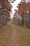
Isaac Davis Trail |
|
000000001972-04-11-0000April 11, 1972
(#72001347) |
Running E-W between towns of Acton and Concord
42°28′48″N 71°23′57″W / 42.48°N 71.3992°W / 42.48; -71.3992 (Isaac Davis Trail) |
Acton |
|
| 51 |
District 7 School |
|
000000002008-01-29-0000January 29, 2008
(#07001487) |
366 Chicopee Row
42°37′54″N 71°32′54″W / 42.6317°N 71.5483°W / 42.6317; -71.5483 (District 7 School) |
Groton |
Owned by the Groton Historical Society.
|
| 52 |
Dunstable Town Hall |
|
000000001999-05-12-0000May 12, 1999
(#99000557) |
511 Main St.
42°40′35″N 71°29′10″W / 42.6764°N 71.4861°W / 42.6764; -71.4861 (Dunstable Town Hall) |
Dunstable |
|
| 53 |
Dutton–Holden Homestead |
|
000000002001-03-29-0000March 29, 2001
(#01000307) |
28 Pond St.
42°33′56″N 71°15′52″W / 42.5656°N 71.2644°W / 42.5656; -71.2644 (Dutton–Holden Homestead) |
Billerica |
|
| 54 |
East Holliston Historic District |
|
000000002002-06-14-0000June 14, 2002
(#02000636) |
Washington, Baker, Curve, Woodland St., Quail Run
42°12′50″N 71°25′14″W / 42.2139°N 71.4206°W / 42.2139; -71.4206 (East Holliston Historic District) |
Holliston |
|
| 55 |
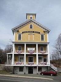
Exchange Hall |
|
000000001986-06-13-0000June 13, 1986
(#86001327) |
Quimby Sq. on School St.
42°27′39″N 71°27′16″W / 42.4607°N 71.4544°W / 42.4607; -71.4544 (Exchange Hall) |
Acton |
|
| 56 |
Fairview Cemetery |
|
000000002005-01-12-0000January 12, 2005
(#04001472) |
Main St.
42°35′13″N 71°25′15″W / 42.5869°N 71.4208°W / 42.5869; -71.4208 (Fairview Cemetery) |
Westford |
|
| 57 |
Farley-Hutchinson-Kimball House |
|
000000002012-03-27-0000March 27, 2012
(#12000151) |
461A & 463 North Rd.
42°31′26″N 71°17′07″W / 42.5239°N 71.2854°W / 42.5239; -71.2854 (Farley-Hutchinson-Kimball House) |
Bedford |
|
| 58 |
Faulkner Homestead |
|
000000001971-12-16-0000December 16, 1971
(#71000080) |
5 High St.
42°27′32″N 71°27′14″W / 42.4589°N 71.4539°W / 42.4589; -71.4539 (Faulkner Homestead) |
Acton |
|
| 59 |
Fells Connector Parkways, Metropolitan System of Greater Boston |
|
000000002003-05-09-0000May 9, 2003
(#03000379) |
Fellsway East: E. Border Rd. to Fellsway W.; Fellsway West: Fulton St. to Fellway E.; Fellsway:Fellsway E. to the Wellington Bridge
42°24′54″N 71°05′03″W / 42.415086°N 71.084239°W / 42.415086; -71.084239 (Fells Connector Parkways, Metropolitan System of Greater Boston) |
Malden and Medford |
|
| 60 |
Fellsmere Park Parkways, Metropolitan Park System of Greater Boston |
|
000000002003-05-09-0000May 9, 2003
(#03000381) |
W. Border Rd, Boundary Rd.
42°25′41″N 71°05′12″W / 42.428072°N 71.086647°W / 42.428072; -71.086647 (Fellsmere Park Parkways, Metropolitan Park System of Greater Boston) |
Malden |
|
| 61 |
Felton Street School |
|
000000001986-02-27-0000February 27, 1986
(#86000275) |
20 Felton St.
42°23′33″N 71°34′12″W / 42.3925°N 71.57°W / 42.3925; -71.57 (Felton Street School) |
Hudson |
|
| 62 |
First Burial Ground |
|
000000002004-11-13-0000November 13, 2004
(#04001222) |
Park St. near Centre St.
42°28′54″N 71°09′11″W / 42.481667°N 71.153056°W / 42.481667; -71.153056 (First Burial Ground) |
Woburn |
|
| 63 |
First Congregational Church in Woburn |
|
000000001992-01-06-0000January 6, 1992
(#91001898) |
322 Main St.
42°28′43″N 71°09′09″W / 42.478611°N 71.1525°W / 42.478611; -71.1525 (First Congregational Church in Woburn) |
Woburn |
|
| 64 |
Fiske House |
|
000000001977-12-09-0000December 9, 1977
(#77000171) |
1 Billerica Rd.
42°35′47″N 71°21′06″W / 42.596389°N 71.351667°W / 42.596389; -71.351667 (Fiske House) |
Chelmsford Center |
|
| 65 |
Henry Fletcher House |
|
000000001993-09-30-0000September 30, 1993
(#93000010) |
224 Concord Rd.
42°33′04″N 71°25′39″W / 42.551111°N 71.4275°W / 42.551111; -71.4275 (Henry Fletcher House) |
Westford |
|
| 66 |
Flint House |
|
000000002003-07-25-0000July 25, 2003
(#03000684) |
28 Lexington Rd.
42°25′44″N 71°17′46″W / 42.428889°N 71.296111°W / 42.428889; -71.296111 (Flint House) |
Lincoln |
|
| 67 |
Forge Village Historic District |
|
000000002002-05-02-0000May 2, 2002
(#02000430) |
Roughly bounded by Forge Pond, W. Prescott St., Story St., Orchard St., Abbott St., and Pleasant St.
42°34′51″N 71°28′58″W / 42.580833°N 71.482778°W / 42.580833; -71.482778 (Forge Village Historic District) |
Westford |
|
| 68 |
Fort Devens Historic District |
|
000000001993-06-10-0000June 10, 1993
(#93000437) |
Roughly bounded by El Caney St., Antietam St., Sherman Ave., MacArthur Ave. and Buena Vista St.
42°32′46″N 71°36′46″W / 42.5461°N 71.6128°W / 42.5461; -71.6128 (Fort Devens Historic District) |
Ayer |
Extends into Harvard in Worcester County.
|
| 69 |
Edmund Fowle House |
|
000000001977-11-11-0000November 11, 1977
(#77000189) |
26–28 Marshall St.
42°22′06″N 71°10′51″W / 42.368333°N 71.180833°W / 42.368333; -71.180833 (Edmund Fowle House) |
Watertown |
|
| 70 |
Glenwood Cemetery |
|
000000002004-05-12-0000May 12, 2004
(#04000425) |
Northeast of Parker St. and Great Rd.
42°25′28″N 71°26′53″W / 42.424383°N 71.448183°W / 42.424383; -71.448183 (Glenwood Cemetery) |
Maynard |
|
| 71 |
Goodale Homestead |
|
000000001975-01-21-0000January 21, 1975
(#75000260) |
100 Chestnut St.
42°22′46″N 71°30′14″W / 42.379444°N 71.503889°W / 42.379444; -71.503889 (Goodale Homestead) |
Hudson |
|
| 72 |
Goodnow Library |
|
000000002002-05-22-0000May 22, 2002
(#02000549) |
21 Concord Rd.
42°21′47″N 71°25′02″W / 42.363056°N 71.417222°W / 42.363056; -71.417222 (Goodnow Library) |
Sudbury |
|
| 73 |
Gowing-Sheldon Historic District |
|
000000002003-11-21-0000November 21, 2003
(#03001176) |
642 and 643 Woburn St.
42°32′30″N 71°09′01″W / 42.541667°N 71.150278°W / 42.541667; -71.150278 (Gowing-Sheldon Historic District) |
Wilmington |
|
| 74 |
The Grange |
|
000000001974-04-18-0000April 18, 1974
(#74000373) |
Codman Rd.
42°25′02″N 71°19′52″W / 42.417222°N 71.331111°W / 42.417222; -71.331111 (The Grange) |
Lincoln |
Boundary increase (added 1976-05-28): Codman Rd.
|
| 75 |
Graniteville Historic District |
|
000000002002-01-17-0000January 17, 2002
(#01001467) |
Broadway, Church, Cross, First, Fourth, N. Main, River School, Second, and Third Sts.
42°35′42″N 71°28′12″W / 42.595°N 71.47°W / 42.595; -71.47 (Graniteville Historic District) |
Westford |
|
| 76 |
Gropius House |
|
000000002000-05-16-0000May 16, 2000
(#00000709) |
68 Baker Bridge Rd.
42°25′37″N 71°19′37″W / 42.426944°N 71.326944°W / 42.426944; -71.326944 (Gropius House) |
Lincoln |
National Historic Landmark
|
| 77 |
Groton High School |
|
000000002010-03-02-0000March 2, 2010
(#10000057) |
145 Main St.
42°36′26″N 71°34′11″W / 42.607092°N 71.569761°W / 42.607092; -71.569761 (Groton High School) |
Groton |
|
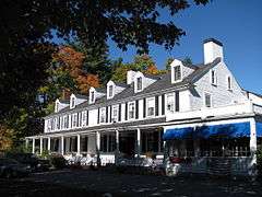
| 78 |
Groton Inn |
|
000000001976-08-03-0000August 3, 1976
(#76000241) |
Main St.
42°36′24″N 71°34′07″W / 42.606667°N 71.568611°W / 42.606667; -71.568611 (Groton Inn) |
Groton |
Destroyed in a 2011 fire.[7]
|
| 79 |
Groton Leatherboard Company |
|
000000002002-04-18-0000April 18, 2002
(#02000378) |
6 W. Main St.
42°36′08″N 71°37′39″W / 42.6022°N 71.6275°W / 42.6022; -71.6275 (Groton Leatherboard Company) |
Groton |
Now a senior living facility.
|
| 80 |
Hapgood House |
|
000000001990-03-09-0000March 9, 1990
(#90000180) |
76 Treaty Elm Ln.
42°25′14″N 71°30′35″W / 42.420556°N 71.509722°W / 42.420556; -71.509722 (Hapgood House) |
Stow |
|
| 81 |
Harnden Tavern |
|
000000001975-04-08-0000April 8, 1975
(#75000293) |
430 Salem St.
42°34′46″N 71°08′52″W / 42.579444°N 71.147778°W / 42.579444; -71.147778 (Harnden Tavern) |
Wilmington |
Currently houses the Wilmington Town Museum.
|
| 82 |
Wilbur Fiske Haven House |
|
000000001992-12-17-0000December 17, 1992
(#92001659) |
339 Pleasant St.
42°25′40″N 71°04′35″W / 42.427778°N 71.076389°W / 42.427778; -71.076389 (Wilbur Fiske Haven House) |
Malden |
|
| 83 |
Henry Higginson House |
|
000000002005-05-26-0000May 26, 2005
(#05000468) |
44 Baker Farm Rd.
42°26′03″N 71°19′42″W / 42.434167°N 71.328333°W / 42.434167; -71.328333 (Henry Higginson House) |
Lincoln |
|
| 84 |
High Street Historic District |
|
000000002003-11-21-0000November 21, 2003
(#03001177) |
Even nos. 8–72 High St. except 20A and 20R, plus nos. 31, 47, 57 and 67.
42°34′21″N 71°09′11″W / 42.5725°N 71.153056°W / 42.5725; -71.153056 (High Street Historic District) |
Wilmington |
|
| 85 |
Hildreth-Robbins House |
|
000000002006-11-29-0000November 29, 2006
(#06001090) |
19 Maple Rd.
42°34′18″N 71°22′48″W / 42.571667°N 71.38°W / 42.571667; -71.38 (Hildreth-Robbins House) |
Chelmsford |
|
| 86 |
Abraham Hill House |
|
000000001990-03-09-0000March 9, 1990
(#90000164) |
388 Pleasant St.
42°24′10″N 71°10′06″W / 42.402778°N 71.168333°W / 42.402778; -71.168333 (Abraham Hill House) |
Belmont |
|
| 87 |
Deacon Samuel Hill House |
|
000000001990-03-09-0000March 9, 1990
(#90000165) |
33 Riverhurst Rd.
42°32′10″N 71°18′12″W / 42.536111°N 71.303333°W / 42.536111; -71.303333 (Deacon Samuel Hill House) |
Billerica |
|
| 88 |
Hillside Cemetery |
|
000000002005-12-06-0000December 6, 2005
(#05001373) |
Depot and Nutting Rds.
42°36′26″N 71°26′40″W / 42.607294°N 71.444369°W / 42.607294; -71.444369 (Hillside Cemetery) |
Westford |
|
| 89 |
Hoar Tavern |
|
000000001973-07-23-0000July 23, 1973
(#73000301) |
Northeast of Lincoln on MA 2
42°26′08″N 71°16′36″W / 42.435556°N 71.276639°W / 42.435556; -71.276639 (Hoar Tavern) |
Lincoln |
|
| 90 |
Thomas Hollis Historic District |
|
000000001989-10-30-0000October 30, 1989
(#89001786) |
Washington St. from Winter to Highland Sts.
42°11′42″N 71°26′00″W / 42.195°N 71.433333°W / 42.195; -71.433333 (Thomas Hollis Historic District) |
Holliston |
|
| 91 |
Hopestill Bent Tavern |
|
000000001990-03-09-0000March 9, 1990
(#90000188) |
252 Old Connecticut Path
42°20′30″N 71°22′14″W / 42.341667°N 71.370556°W / 42.341667; -71.370556 (Hopestill Bent Tavern) |
Wayland |
|
| 92 |
Hopkinton Dam and Spillway |
|
000000001990-01-18-0000January 18, 1990
(#89002288) |
Eastern end of Hopkinton Reservoir in Hopkinton State Park
42°15′25″N 71°30′40″W / 42.256944°N 71.511111°W / 42.256944; -71.511111 (Hopkinton Dam and Spillway) |
Ashland |
|
| 93 |
Hopkinton Supply Co. Building |
|
000000001983-03-10-0000March 10, 1983
(#83000810) |
26–28 Main St.
42°13′43″N 71°31′16″W / 42.228611°N 71.521111°W / 42.228611; -71.521111 (Hopkinton Supply Co. Building) |
Hopkinton |
|
| 94 |
Jonathan and Simon Hosmer House |
|
000000002002-05-02-0000May 2, 2002
(#02000432) |
300 Main St.
42°28′36″N 71°27′04″W / 42.476753°N 71.451142°W / 42.476753; -71.451142 (Jonathan and Simon Hosmer House) |
Acton |
|
| 95 |
Houghton Memorial Building |
|
000000001991-03-18-0000March 18, 1991
(#91000242) |
4 Rogers St.
42°32′20″N 71°29′03″W / 42.538889°N 71.484167°W / 42.538889; -71.484167 (Houghton Memorial Building) |
Littleton |
|
| 96 |
Howe School |
|
000000002002-06-11-0000June 11, 2002
(#02000634) |
390 Boston Rd.
42°33′43″N 71°16′11″W / 42.562011°N 71.269653°W / 42.562011; -71.269653 (Howe School) |
Billerica |
|
| 97 |
Oliver Hutchins House |
|
000000001985-09-05-0000September 5, 1985
(#85002013) |
79 Elm St.
42°33′25″N 71°22′52″W / 42.556944°N 71.381111°W / 42.556944; -71.381111 (Oliver Hutchins House) |
Chelmsford |
|
| 98 |
Hydrant No. 3 House |
|
000000002000-03-06-0000March 6, 2000
(#00000113) |
Washington St.
42°11′00″N 71°26′41″W / 42.183333°N 71.444722°W / 42.183333; -71.444722 (Hydrant No. 3 House) |
Holliston |
Known locally as the Metcalf Pump House.
|
| 99 |
Jack's Diner |
|
000000002000-11-22-0000November 22, 2000
(#00001340) |
901 Main St.
42°30′31″N 71°09′39″W / 42.508611°N 71.160833°W / 42.508611; -71.160833 (Jack's Diner) |
Woburn |
Houses a Thai restaurant in 2011.
|
| 100 |
Abraham Jaquith House |
|
000000001991-03-14-0000March 14, 1991
(#90000166) |
161 Concord Rd.
42°32′53″N 71°16′50″W / 42.548056°N 71.280556°W / 42.548056; -71.280556 (Abraham Jaquith House) |
Billerica |
|
| 101 |
Robert Jenison House |
|
000000001978-09-06-0000September 6, 1978
(#78000456) |
1 Frost Road
42°19′21″N 71°20′09″W / 42.3225°N 71.335833°W / 42.3225; -71.335833 (Robert Jenison House) |
Natick |
|
| 102 |
John Eliot Historic District |
|
000000001983-06-23-0000June 23, 1983
(#83000812) |
Eliot, Pleasant, and Auburn Sts.
42°16′20″N 71°18′56″W / 42.272222°N 71.315556°W / 42.272222; -71.315556 (John Eliot Historic District) |
Natick |
|
| 103 |
Jones Tavern |
|
000000001986-06-13-0000June 13, 1986
(#86001333) |
128 Main St.
42°27′38″N 71°27′21″W / 42.460556°N 71.455833°W / 42.460556; -71.455833 (Jones Tavern) |
Acton |
|
| 104 |
David Lane House |
|
000000001980-04-02-0000April 2, 1980
(#80000644) |
137 North Rd.
42°30′08″N 71°17′05″W / 42.502222°N 71.284722°W / 42.502222; -71.284722 (David Lane House) |
Bedford |
House built in 1781
|
| 105 |
Job Lane House |
|
000000001973-05-08-0000May 8, 1973
(#73000278) |
295 North St.
42°30′46″N 71°17′04″W / 42.512778°N 71.284444°W / 42.512778; -71.284444 (Job Lane House) |
Bedford |
|
| 106 |
Larrabee's Brick Block |
|
000000001984-03-29-0000March 29, 1984
(#84002729) |
500–504 Main St.
42°27′20″N 71°03′57″W / 42.455556°N 71.065833°W / 42.455556; -71.065833 (Larrabee's Brick Block) |
Melrose |
|
| 107 |
Lincoln Center Historic District |
|
000000001985-07-18-0000July 18, 1985
(#85001604) |
Bedford, Lincoln, Old Lexington, Sandy Pond, Trapelo, and Weston Rds.
42°25′32″N 71°18′56″W / 42.425556°N 71.315556°W / 42.425556; -71.315556 (Lincoln Center Historic District) |
Lincoln |
|
| 108 |
Lynn Fells Parkway, Metropolitan Park System of Greater Boston |
|
000000002003-05-09-0000May 9, 2003
(#03000380) |
Lynn Fells Parkway
42°28′05″N 71°02′58″W / 42.468083°N 71.049444°W / 42.468083; -71.049444 (Lynn Fells Parkway, Metropolitan Park System of Greater Boston) |
Melrose |
Extends into Saugus, Essex County.
|
| 109 |
Manning Manse |
|
000000001982-08-11-0000August 11, 1982
(#82001912) |
56 Chelmsford Rd.
42°35′03″N 71°18′07″W / 42.584167°N 71.301944°W / 42.584167; -71.301944 (Manning Manse) |
Billerica |
|
| 110 |
Marcia Browne Junior High School |
|
000000002000-11-02-0000November 2, 2000
(#00001273) |
295 Broadway
42°25′59″N 71°02′22″W / 42.433056°N 71.039444°W / 42.433056; -71.039444 (Marcia Browne Junior High School) |
Malden |
|
| 111 |
McCune Site |
Upload image |
000000001986-01-23-0000January 23, 1986
(#86000115) |
Address Restricted
|
Lincoln |
A prehistoric archaeological site
|
| 112 |
McLean Hospital National Register District |
|
000000002003-01-23-0000January 23, 2003
(#02001733) |
115 Mill St.
42°23′35″N 71°11′29″W / 42.393064°N 71.191353°W / 42.393064; -71.191353 (McLean Hospital National Register District) |
Belmont |
|
| 113 |
Meeting House of the Second Parish in Woburn |
|
000000001990-03-09-0000March 9, 1990
(#90000167) |
12 Lexington St.
42°30′26″N 71°04′39″W / 42.507222°N 71.0775°W / 42.507222; -71.0775 (Meeting House of the Second Parish in Woburn) |
Burlington |
|
| 114 |
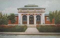
Melrose Public Library |
|
000000001988-06-23-0000June 23, 1988
(#88000909) |
63 W. Emerson St.
42°27′33″N 71°04′02″W / 42.459167°N 71.067222°W / 42.459167; -71.067222 (Melrose Public Library) |
Melrose |
|
| 115 |
Melrose Town Center Historic District |
|
000000001982-04-01-0000April 1, 1982
(#82002744) |
Main St.
42°27′26″N 71°03′52″W / 42.457222°N 71.064444°W / 42.457222; -71.064444 (Melrose Town Center Historic District) |
Melrose |
Includes town hall, fire station, Coolidge School, and two churches.
|
| 116 |
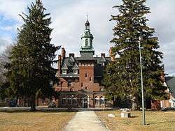
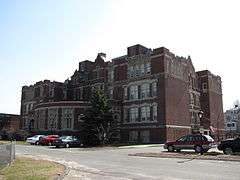
Metropolitan State Hospital |
|
000000001994-01-21-0000January 21, 1994
(#93001482) |
475 Trapelo Rd.
42°24′14″N 71°12′40″W / 42.403889°N 71.211111°W / 42.403889; -71.211111 (Metropolitan State Hospital) |
Belmont |
Extends into Waltham and Lexington
|
| 117 |
Middlesex Canal |
|
000000001972-08-21-0000August 21, 1972
(#72000117) |
Running southeast between the towns of Lowell and Medford
42°33′40″N 71°14′09″W / 42.561111°N 71.235833°W / 42.561111; -71.235833 (Middlesex Canal) |
Billerica, Chelmsford, Lowell, Wilmington, and Woburn |
This listing encompasses only surviving canal fragments between Lowell and Woburn.
|
| 118 |
Middlesex Canal Historic and Archaeological District |
|
000000002009-11-19-0000November 19, 2009
(#09000936) |
Numerous locations along the historic route of the Middlesex Canal
|
Billerica, Chelmsford, Lowell, Medford, Somerville, Wilmington, Winchester, and Woburn |
Extends into northern Boston; this listing encompasses the entire historic route of the canal.
|
| 119 |
Middlesex Fells Reservation Parkways |
|
000000002003-02-04-0000February 4, 2003
(#02001749) |
E. Border Rd., Fellsway E., Fellsway W., Hillcrest Parkway, South St., Pond St., S. Border Rd., Ravine Rd., and Woodland Rd.
42°26′43″N 71°06′10″W / 42.445278°N 71.102778°W / 42.445278; -71.102778 (Middlesex Fells Reservation Parkways) |
Malden, Melrose, Medford, Stoneham, and Winchester |
|
| 120 |
Col. Adelbert Mossman House |
|
000000001982-09-30-0000September 30, 1982
(#82001904) |
76 Park St.
42°23′08″N 71°34′30″W / 42.385556°N 71.575°W / 42.385556; -71.575 (Col. Adelbert Mossman House) |
Hudson |
|
| 121 |
Natick Center Historic District |
|
000000001977-12-16-0000December 16, 1977
(#77000186) |
North Ave., Main, Central, and Summer Sts.
42°17′04″N 71°20′53″W / 42.284444°N 71.348056°W / 42.284444; -71.348056 (Natick Center Historic District) |
Natick |
|
| 122 |
North Town Hall |
|
000000002015-10-13-0000October 13, 2015
(#15000732) |
31 Princeton St.
42°38′15″N 71°22′54″W / 42.6375°N 71.3816°W / 42.6375; -71.3816 (North Town Hall) |
Chelmsford |
|
| 123 |
Noyes-Parris House |
|
000000001990-03-09-0000March 9, 1990
(#90000187) |
196 Old Connecticut Path
42°20′56″N 71°21′43″W / 42.348889°N 71.361944°W / 42.348889; -71.361944 (Noyes-Parris House) |
Wayland |
|
| 124 |
Odd Fellows Building |
|
000000001988-12-22-0000December 22, 1988
(#87002564) |
442 Main St.
42°25′37″N 71°04′04″W / 42.426944°N 71.067778°W / 42.426944; -71.067778 (Odd Fellows Building) |
Malden |
|
| 125 |
Old Billerica Road Historic District |
|
000000002007-07-11-0000July 11, 2007
(#07000681) |
229–301 Old Billerica Rd.
42°28′53″N 71°05′48″W / 42.481389°N 71.096667°W / 42.481389; -71.096667 (Old Billerica Road Historic District) |
Bedford |
|
| 126 |
Old Burying Ground |
|
000000002002-02-05-0000February 5, 2002
(#01001560) |
King St. near its junction with White St.
42°32′43″N 71°28′44″W / 42.545278°N 71.478889°W / 42.545278; -71.478889 (Old Burying Ground) |
Littleton |
|
| 127 |
Old Chelmsford Garrison House Complex |
|
000000001973-05-08-0000May 8, 1973
(#73000289) |
105 Garrison Rd.
42°34′42″N 71°23′30″W / 42.578333°N 71.391667°W / 42.578333; -71.391667 (Old Chelmsford Garrison House Complex) |
Chelmsford |
|
| 128 |
Old Town Bridge |
|
000000001975-05-02-0000May 2, 1975
(#75000292) |
North of Wayland on MA 27
42°22′31″N 71°22′49″W / 42.375278°N 71.380278°W / 42.375278; -71.380278 (Old Town Bridge) |
Wayland |
|
| 129 |
Old Town Hall |
|
000000002005-02-02-0000February 2, 2005
(#04001574) |
10 Kendal Rd.
42°40′32″N 71°25′29″W / 42.675556°N 71.424722°W / 42.675556; -71.424722 (Old Town Hall) |
Tyngsborough |
|
| 130 |
Christopher Page House |
|
000000001990-03-09-0000March 9, 1990
(#90000163) |
2 Meyers Ln.
42°29′47″N 71°15′32″W / 42.496389°N 71.258806°W / 42.496389; -71.258806 (Christopher Page House) |
Bedford |
|
| 131 |
Nathaniel Page House |
|
000000001978-03-29-0000March 29, 1978
(#78000433) |
89 Page Rd.
42°29′37″N 71°15′48″W / 42.493611°N 71.263333°W / 42.493611; -71.263333 (Nathaniel Page House) |
Bedford |
|
| 132 |
Parker Village Historic District |
|
000000002002-12-27-0000December 27, 2002
(#02001613) |
Concord, Carlisle, Old Lowell, and Griffin Rds.
42°32′56″N 71°25′01″W / 42.5489°N 71.4169°W / 42.5489; -71.4169 (Parker Village Historic District) |
Westford |
|
| 133 |
James Parker House |
|
000000001988-02-25-0000February 25, 1988
(#88000163) |
R.R. 1, Box 30 Center Rd.
42°33′36″N 71°39′32″W / 42.56°N 71.6589°W / 42.56; -71.6589 (James Parker House) |
Shirley |
|
| 134 |
The Parsonage |
|
000000001971-11-11-0000November 11, 1971
(#71000903) |
16 Pleasant St.
42°16′15″N 71°18′54″W / 42.2708°N 71.315°W / 42.2708; -71.315 (The Parsonage) |
Natick |
National Historic Landmark
|
| 135 |
Pepperell Center Historic District |
|
000000001994-08-05-0000August 5, 1994
(#94000812) |
Roughly, along Park, Main, Elm, Townsend and Heald Sts.
42°40′01″N 71°35′55″W / 42.6669°N 71.5986°W / 42.6669; -71.5986 (Pepperell Center Historic District) |
Pepperell |
|
| 136 |
Pleasant Street Historic District |
|
000000001979-06-12-0000June 12, 1979
(#79000353) |
Irregular Pattern along Pleasant St.
42°23′54″N 71°10′36″W / 42.3983°N 71.1767°W / 42.3983; -71.1767 (Pleasant Street Historic District) |
Belmont |
|
| 137 |
Pleasant Street School |
|
000000001986-01-23-0000January 23, 1986
(#86000094) |
Pleasant St.
42°33′51″N 71°35′15″W / 42.5642°N 71.5875°W / 42.5642; -71.5875 (Pleasant Street School) |
Ayer |
|
| 138 |
Miles Pratt House |
|
000000001985-05-09-0000May 9, 1985
(#85000980) |
106 Mt. Auburn St.
42°22′03″N 71°10′49″W / 42.3675°N 71.1803°W / 42.3675; -71.1803 (Miles Pratt House) |
Watertown |
|
| 139 |
John Proctor House |
|
000000001993-02-04-0000February 4, 1993
(#93000011) |
218 Concord Rd.
42°33′07″N 71°25′44″W / 42.5519°N 71.4289°W / 42.5519; -71.4289 (John Proctor House) |
Westford |
|
| 140 |
Rev. Daniel Putnam House |
|
000000001990-03-09-0000March 9, 1990
(#90000176) |
27 Bow St.
42°34′27″N 71°04′40″W / 42.5742°N 71.0778°W / 42.5742; -71.0778 (Rev. Daniel Putnam House) |
North Reading |
|
| 141 |
Randall-Hale Homestead |
|
000000001996-03-22-0000March 22, 1996
(#96000277) |
6 Sudbury Rd.
42°24′28″N 71°31′26″W / 42.407778°N 71.523889°W / 42.407778; -71.523889 (Randall-Hale Homestead) |
Stow |
|
| 142 |
Red Top |
|
000000001971-11-11-0000November 11, 1971
(#71000911) |
90 Somerset St.
42°24′01″N 71°10′46″W / 42.400278°N 71.179444°W / 42.400278; -71.179444 (Red Top) |
Belmont |
National Historic Landmark
|
| 143 |
Reed-Wood Place |
|
000000002000-09-14-0000September 14, 2000
(#00001071) |
20 Meetinghouse Rd.
42°32′47″N 71°28′20″W / 42.546389°N 71.472222°W / 42.546389; -71.472222 (Reed-Wood Place) |
Littleton |
|
| 144 |
Reeves Tavern |
|
000000002016-11-15-0000November 15, 2016
(#16000770) |
126 Old Connecticut Path
42°21′07″N 71°21′04″W / 42.352024°N 71.351014°W / 42.352024; -71.351014 (Reeves Tavern) |
Wayland |
|
| 145 |
Revere Beach Parkway-Metropolitan Park System of Greater Boston |
|
000000002007-12-06-0000December 6, 2007
(#07001241) |
Revere Beach Pkwy
42°24′16″N 71°01′49″W / 42.404386°N 71.030361°W / 42.404386; -71.030361 (Revere Beach Parkway-Metropolitan Park System of Greater Boston) |
Everett, Medford, and Chelsea |
|
| 146 |
George Robbins House |
|
000000001990-03-09-0000March 9, 1990
(#90000168) |
523 Curve St.
42°33′11″N 71°21′05″W / 42.553056°N 71.351389°W / 42.553056; -71.351389 (George Robbins House) |
Carlisle |
|
| 147 |
John Robbins House |
|
000000002003-07-25-0000July 25, 2003
(#03000682) |
144 Great Rd.
42°28′59″N 71°24′57″W / 42.482933°N 71.415939°W / 42.482933; -71.415939 (John Robbins House) |
Acton |
|
| 148 |
Count Rumford Birthplace |
|
000000001975-05-15-0000May 15, 1975
(#75001942) |
90 Elm St.
42°28′45″N 71°08′50″W / 42.479167°N 71.147222°W / 42.479167; -71.147222 (Count Rumford Birthplace) |
Woburn |
National Historic Landmark
|
| 149 |
Russian Cemetery |
|
000000002005-11-25-0000November 25, 2005
(#05001324) |
Patten Rd.
42°34′41″N 71°28′17″W / 42.578056°N 71.471389°W / 42.578056; -71.471389 (Russian Cemetery) |
Westford |
|
| 150 |
Sabbath Day House |
|
000000001973-08-14-0000August 14, 1973
(#73000285) |
20 Andover Rd.
42°33′39″N 71°16′03″W / 42.560833°N 71.2675°W / 42.560833; -71.2675 (Sabbath Day House) |
Billerica |
|
| 151 |
St. Paul's Parish Church |
|
000000002001-09-28-0000September 28, 2001
(#01001199) |
26 Washington St.
42°25′54″N 71°04′37″W / 42.431667°N 71.076944°W / 42.431667; -71.076944 (St. Paul's Parish Church) |
Malden |
|
| 152 |
Shawsheen Cemetery |
|
000000002007-06-12-0000June 12, 2007
(#07000547) |
Great Rd. and Shawsheen Rd.
42°29′08″N 71°15′33″W / 42.485553°N 71.259222°W / 42.485553; -71.259222 (Shawsheen Cemetery) |
Bedford |
|
| 153 |
Shirley Center Historic District |
|
000000001988-09-01-0000September 1, 1988
(#88001454) |
Brown, Center, Horsepond, Parker, and Whitney Rds.
42°34′18″N 71°39′03″W / 42.571667°N 71.650833°W / 42.571667; -71.650833 (Shirley Center Historic District) |
Shirley |
|
| 154 |
Shirley Shaker Village |
|
000000001976-05-24-0000May 24, 1976
(#76000271) |
South of Shirley on Harvard Rd.
42°31′35″N 71°39′06″W / 42.526389°N 71.651667°W / 42.526389; -71.651667 (Shirley Shaker Village) |
Shirley |
Extends into Lancaster in Worcester County.
|
| 155 |
Shirley Village Historic District |
|
000000001992-01-23-0000January 23, 1992
(#91001958) |
Roughly bounded by Center, Harvard, Leominster and Shaker Rds.
42°32′33″N 71°39′07″W / 42.5425°N 71.651944°W / 42.5425; -71.651944 (Shirley Village Historic District) |
Shirley |
|
| 156 |
Zeb Spaulding House |
|
000000001990-03-09-0000March 9, 1990
(#90000169) |
1044 Lowell Rd.
42°33′25″N 71°21′13″W / 42.556944°N 71.353611°W / 42.556944; -71.353611 (Zeb Spaulding House) |
Carlisle |
|
| 157 |
Sudbury Aqueduct Linear District |
|
000000001990-01-18-0000January 18, 1990
(#89002293) |
Along Sudbury Aqueduct from Farm Pond at Waverly St. (Framingham) to Chestnut Hill Reservoir (Newton)
42°17′33″N 71°18′44″W / 42.2925°N 71.312222°W / 42.2925; -71.312222 (Sudbury Aqueduct Linear District) |
Sherborn, Natick, Newton |
Extends into Wellesley and Needham in Norfolk County, and Framingham in Middlesex County.
|
| 158 |
Sudbury Center Historic District |
|
000000001976-07-14-0000July 14, 1976
(#76000277) |
Concord and Old Sudbury Rds.
42°22′53″N 71°24′18″W / 42.381389°N 71.405°W / 42.381389; -71.405 (Sudbury Center Historic District) |
Sudbury |
|
| 159 |
Tenney Homestead |
|
000000001990-03-09-0000March 9, 1990
(#90000181) |
156 Taylor Rd.
42°26′51″N 71°30′52″W / 42.4475°N 71.514444°W / 42.4475; -71.514444 (Tenney Homestead) |
Stow |
|
| 160 |
Tewksbury State Hospital |
|
000000001994-01-21-0000January 21, 1994
(#93001486) |
Junction of East and Livingston Sts.
42°36′31″N 71°12′43″W / 42.608611°N 71.211944°W / 42.608611; -71.211944 (Tewksbury State Hospital) |
Tewksbury |
|
| 161 |
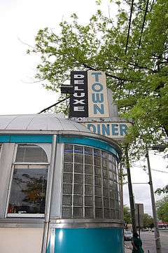
Town Diner |
|
000000001999-09-22-0000September 22, 1999
(#99001127) |
627 Mount Auburn St.
42°22′15″N 71°09′31″W / 42.370833°N 71.158611°W / 42.370833; -71.158611 (Town Diner) |
Watertown |
|
| 162 |
Trinity Episcopal Church |
|
000000001995-05-26-0000May 26, 1995
(#95000660) |
131 W. Emerson St.
42°27′34″N 71°04′09″W / 42.459444°N 71.069167°W / 42.459444; -71.069167 (Trinity Episcopal Church) |
Melrose |
|
| 163 |
Two Brothers Rocks-Dudley Road Historic District |
|
000000002010-09-23-0000September 23, 2010
(#10000790) |
Roughly Dudley Rd. between Chestnut Lane and Emery Rd., Bedford
and Timbercreek Lane, Billerica, from Massachusetts Route 4 to the Concord River
42°31′00″N 71°17′50″W / 42.5167°N 71.2972°W / 42.5167; -71.2972 (Two Brothers Rocks-Dudley Road Historic District) |
Bedford and Billerica |
|
| 164 |
Col. Jonathan Tyng House |
|
000000001977-08-19-0000August 19, 1977
(#77000188) |
80 Tyng Rd.
42°39′37″N 71°24′28″W / 42.660278°N 71.407778°W / 42.660278; -71.407778 (Col. Jonathan Tyng House) |
Tyngsborough |
Demolished
|
| 165 |
Phineas Upham House |
|
000000001990-03-09-0000March 9, 1990
(#90000173) |
255 Upham St.
42°26′56″N 71°03′11″W / 42.448889°N 71.053056°W / 42.448889; -71.053056 (Phineas Upham House) |
Melrose |
|
| 166 |
US Post Office-Woburn Center Station |
|
000000001987-10-19-0000October 19, 1987
(#86003436) |
1 Abbott St.
42°28′53″N 71°04′09″W / 42.481389°N 71.069167°W / 42.481389; -71.069167 (US Post Office-Woburn Center Station) |
Woburn |
|
| 167 |
Waitt Brick Block |
|
000000001982-11-12-0000November 12, 1982
(#82000492) |
422–424 Main St.
42°25′35″N 71°04′05″W / 42.426389°N 71.068056°W / 42.426389; -71.068056 (Waitt Brick Block) |
Malden |
|
| 168 |
Walcott-Whitney House |
|
000000001990-03-09-0000March 9, 1990
(#90000183) |
137 Tuttle Ln.
42°27′05″N 71°29′10″W / 42.451389°N 71.486111°W / 42.451389; -71.486111 (Walcott-Whitney House) |
Stow |
|
| 169 |
Watertown Arsenal Historic District |
|
000000001999-05-14-0000May 14, 1999
(#99000498) |
Arsenal St.
42°21′44″N 71°09′58″W / 42.362222°N 71.166111°W / 42.362222; -71.166111 (Watertown Arsenal Historic District) |
Watertown |
|
| 170 |
Old Watertown High School |
|
000000002006-09-22-0000September 22, 2006
(#06000860) |
341 Mount Auburn St.
42°22′08″N 71°10′13″W / 42.368889°N 71.170278°W / 42.368889; -71.170278 (Old Watertown High School) |
Watertown |
|
| 171 |
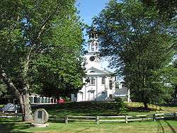
Wayland Center Historic District |
|
000000001974-09-06-0000September 6, 1974
(#74000378) |
Irregular pattern along both sides of U.S. Route 20 and MA 27
42°21′49″N 71°21′35″W / 42.363611°N 71.359722°W / 42.363611; -71.359722 (Wayland Center Historic District) |
Wayland |
|
| 172 |
Wayside Inn Historic District |
|
000000001973-04-23-0000April 23, 1973
(#73000307) |
Old Boston Post Rd.
42°21′28″N 71°28′05″W / 42.357778°N 71.468056°W / 42.357778; -71.468056 (Wayside Inn Historic District) |
Sudbury |
|
| 173 |
West School |
|
000000002006-05-17-0000May 17, 2006
(#06000398) |
106 Bedford St.
42°30′22″N 71°13′10″W / 42.506225°N 71.2194°W / 42.506225; -71.2194 (West School) |
Burlington |
|
| 174 |
West Schoolhouse |
|
000000001990-02-21-0000February 21, 1990
(#90000144) |
141 Shawsheen Ave.
42°33′22″N 71°11′25″W / 42.556111°N 71.190278°W / 42.556111; -71.190278 (West Schoolhouse) |
Wilmington |
|
| 175 |
Westford Center Historic District |
|
000000001998-08-28-0000August 28, 1998
(#98001105) |
Roughly along Graniteville Rd., Main St., Lincoln St., and Depot St.
42°34′50″N 71°26′19″W / 42.580556°N 71.438611°W / 42.580556; -71.438611 (Westford Center Historic District) |
Westford |
|
| 176 |
Westford Town Farm |
|
000000002008-03-14-0000March 14, 2008
(#08000167) |
35 Town Farm Rd.
42°35′11″N 71°28′44″W / 42.586389°N 71.478889°W / 42.586389; -71.478889 (Westford Town Farm) |
Westford |
|
| 177 |
Westlawn Cemetery |
|
000000002005-01-05-0000January 5, 2005
(#04001433) |
Concord Rd.
42°34′16″N 71°28′02″W / 42.571111°N 71.467222°W / 42.571111; -71.467222 (Westlawn Cemetery) |
Westford |
|
| 178 |
Weston Aqueduct Linear District |
|
000000001990-01-18-0000January 18, 1990
(#89002274) |
Along the Weston Aqueduct from the Sudbury Reservoir to the Weston Reservoir
42°20′00″N 71°22′32″W / 42.333333°N 71.375556°W / 42.333333; -71.375556 (Weston Aqueduct Linear District) |
Wayland |
Extends into Southborough, Worcester County and Framingham and Weston in Middlesex County.
|
| 179 |
Levi Wetherbee Farm |
|
000000002006-12-12-0000December 12, 2006
(#06001128) |
484 Middle Rd.
42°29′27″N 71°31′23″W / 42.490817°N 71.523081°W / 42.490817; -71.523081 (Levi Wetherbee Farm) |
Boxborough |
|
| 180 |
Wilmington Centre Village Historic District |
|
000000001992-04-08-0000April 8, 1992
(#92000246) |
Roughly Middlesex Dr. and Church St. from Adams St. to Wildwood Cemetery
42°33′22″N 71°09′52″W / 42.556111°N 71.164444°W / 42.556111; -71.164444 (Wilmington Centre Village Historic District) |
Wilmington |
|
| 181 |
Wilson Mill-Old Burlington Road District |
|
000000002003-08-18-0000August 18, 2003
(#03000792) |
Old Burlington Rd. and Wilson Rd.
42°30′04″N 71°14′46″W / 42.501203°N 71.246211°W / 42.501203; -71.246211 (Wilson Mill-Old Burlington Road District) |
Bedford |
|
| 182 |
Henry Wilson Shoe Shop |
|
000000002000-08-24-0000August 24, 2000
(#00000955) |
181 W. Central St.
42°16′58″N 71°22′55″W / 42.282778°N 71.381944°W / 42.282778; -71.381944 (Henry Wilson Shoe Shop) |
Natick |
|
| 183 |
Woburn Public Library |
|
000000001976-11-13-0000November 13, 1976
(#76000290) |
Pleasant St.
42°28′44″N 71°09′18″W / 42.478889°N 71.155°W / 42.478889; -71.155 (Woburn Public Library) |
Woburn |
National Historic Landmark
|
| 184 |
Woods End Road Historic District |
|
000000001988-07-08-0000July 8, 1988
(#88000956) |
68 Baker Bridge Rd. and 1, 5, 9, and 10 Woods End Rd.
42°25′36″N 71°19′41″W / 42.426667°N 71.328056°W / 42.426667; -71.328056 (Woods End Road Historic District) |
Lincoln |
|
| 185 |
Wright Cemetery |
|
000000002005-12-06-0000December 6, 2005
(#05001372) |
Groton Rd.
42°36′32″N 71°28′03″W / 42.608889°N 71.4675°W / 42.608889; -71.4675 (Wright Cemetery) |
Westford |
|
| 186 |
Francis Wyman House |
|
000000001975-03-17-0000March 17, 1975
(#75000255) |
56 Francis Wyman St.
42°31′06″N 71°13′31″W / 42.518333°N 71.225278°W / 42.518333; -71.225278 (Francis Wyman House) |
Burlington |
|
_-_general_view.JPG)

%2C_Lowell%2C_Massachusetts.JPG)


_Bedford%2C_Massachusetts.JPG)


_-_angle_view.JPG)


_map%2C_1801.jpg)


.jpg)


.jpg)

.JPG)


_AND_SOUTH_ELEVATIONS_-_Malden_Town_Hall%2C_Main_and_Pleasant_Streets%2C_Malden%2C_Middlesex_County%2C_MA_HABS_MASS%2C9-MALD%2C2-1.tif.jpg)
