Newlyn Downs
Coordinates: 50°20′57″N 5°02′44″W / 50.3493°N 5.0456°W
Newlyn Downs is a Site of Special Scientific Interest (SSSI) in north Cornwall, England, UK, noted for its biological characteristics.[1]
Geography
The 115.7-hectare (286-acre) SSSI, notified in 1997, is located mainly within the civil parish of St Newlyn East, 7 kilometres (4.3 mi) south of the town of Newquay. The streams that rise on the site are tributaries of the River Gannel.[2][3] The Downs are also designated a Special Area of Conservation.[4]
Wildlife and ecology
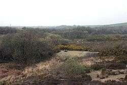
The soil of the site, deriving from slate-based mudstones and siltstones, is permanently waterlogged in large places. It is the foundation for the largest area in Cornwall of Southern Atlantic wet heath, containing cross-leaved heath (Erica tetralix) and Dorset heath (Erica ciliaris).[1]
References
- 1 2 "Newlyn Downs" (PDF). Natural England. 1997. Retrieved 25 January 2012.
- ↑ "Newlyn Downs map". Natural England. Retrieved 25 January 2012.
- ↑ Ordnance Survey: Explorer map sheet 106 Newquay & Padstow ISBN 978-0-319-24016-8
- ↑ "Newlyn Downs". Joint Nature Conservation Committee. Retrieved 26 January 2012.
Cornwall Portal | |
| Unitary authorities | |
| Major settlements |
|
| Rivers | |
| Topics | |