North Moniteau Township, Cooper County, Missouri
| North Moniteau Township | |
|---|---|
| Township | |
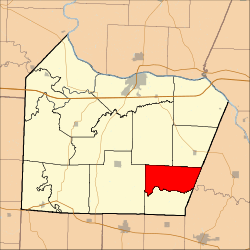 Location in Cooper County | |
| Coordinates: 38°45′32″N 92°39′12″W / 38.75889°N 92.65333°WCoordinates: 38°45′32″N 92°39′12″W / 38.75889°N 92.65333°W | |
| Country |
|
| State |
|
| County | Cooper |
| Area | |
| • Total | 26.8 sq mi (69.42 km2) |
| • Land | 26.8 sq mi (69.42 km2) |
| • Water | 0 sq mi (0 km2) 0% |
| Elevation | 771 ft (235 m) |
| Population (2000) | |
| • Total | 182 |
| • Density | 6.8/sq mi (2.6/km2) |
| Time zone | CST (UTC-6) |
| • Summer (DST) | CDT (UTC-5) |
| ZIP codes | 65018, 65025, 65068, 65237 |
| GNIS feature ID | 0766533 |
North Moniteau Township is one of fourteen townships in Cooper County, Missouri, USA. As of the 2000 census, its population was 182.[1]
Geography
According to the United States Census Bureau, North Moniteau Township covers an area of 26.8 square miles (69.42 square kilometers).
Unincorporated towns
(This list is based on USGS data and may include former settlements.)
Adjacent townships
- Prairie Home Township (northeast)
- Linn Township, Moniteau County (east)
- Walker Township, Moniteau County (southeast)
- South Moniteau Township (south)
- Kelly Township (west)
- Clark Fork Township (northwest)
Cemeteries
The township contains these two cemeteries: Jones and Strickfaden.
School districts
- Cooper County C-4
- Prairie Home R-V School District
Political districts
- Missouri's 6th congressional district
- State House District 117
- State Senate District 21
References
- United States Census Bureau 2008 TIGER/Line Shapefiles
- United States Board on Geographic Names (GNIS)
- United States National Atlas
External links
 |
Clark Fork Township | |
Prairie Home Township | |
| Kelly Township | |
Linn Township, Moniteau County | ||
| ||||
| | ||||
| South Moniteau Township | Walker Township, Moniteau County |
Municipalities and communities of Cooper County, Missouri, United States | ||
|---|---|---|
| Cities | 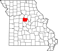 | |
| Villages | ||
| Townships | ||
| Unincorporated communities | ||
This article is issued from Wikipedia - version of the 11/16/2013. The text is available under the Creative Commons Attribution/Share Alike but additional terms may apply for the media files.