Oberon Shire
| Oberon Shire New South Wales | |||||||||||||
|---|---|---|---|---|---|---|---|---|---|---|---|---|---|
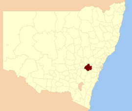 Location in New South Wales | |||||||||||||
| Coordinates | 33°43′S 149°52′E / 33.717°S 149.867°ECoordinates: 33°43′S 149°52′E / 33.717°S 149.867°E | ||||||||||||
| Population | 5,270 (2013 est)[1] | ||||||||||||
| • Density | 1.4403/km2 (3.730/sq mi) | ||||||||||||
| Area | 3,659 km2 (1,412.7 sq mi) | ||||||||||||
| Mayor | Kathy Sajowitz (unaligned) | ||||||||||||
| Council seat | Oberon[2] | ||||||||||||
| Region | Central West | ||||||||||||
| State electorate(s) | Bathurst | ||||||||||||
| Federal Division(s) | Calare | ||||||||||||
| Website | Oberon Shire | ||||||||||||
| |||||||||||||
Oberon Shire is a local government area in the Central West region of New South Wales, Australia. Oberon Shire includes Oberon, Black Springs, Shooters Hill, Edith, O'Connell and Burraga.
The Mayor of Oberon Shire Council is Cr. Kathy Sajowitz, an unaligned politician.
Demographics
According to the Australian Bureau of Statistics there:[3]
- were 5,503 people as at 30 June 2006, the 125th largest Local Government Area in New South Wales. It was equal to less than 0.1% of the New South Wales population of 6,827,694
- was an increase of 60 people over the year to 30 June 2006, the 99th largest population growth in a Local Government Area in New South Wales. It was equal to 0.1% of the 58,753 increase in the population of New South Wales
- was, in percentage terms, an increase of 1.1% in the number of people over the year to 30 June 2006, the 41st fastest growth in population of a Local Government Area in New South Wales. In New South Wales the population grew by 0.9%
- was an increase in population over the 10 years to 30 June 2006 of 648 people or 13% (1.3% in annual average terms), the 32nd highest rate of a Local Government Area in New South Wales. In New South Wales the population grew by 622,966 or 10% (1.0% in annual average terms) over the same period.
Council
Current composition and election method
Oberon Shire Council is composed of nine Councillors elected proportionally as a single ward. All Councillors are elected for a fixed four-year term of office. The Mayor is elected by the Councillors at the first meeting of the Council. The most recent election was due to be held on 8 September 2012. However, only nine candidates, being the below, nominated for election. There being no additional candidates, the election was uncontested. The makeup of the Council is as follows:[4]
| Party | Councillors | |
|---|---|---|
| Independents and Unaligned | 9 | |
| Total | 9 | |
The current Council, elected in 2012, in alphabetical order, is:[4]
| Councillor | Party | Notes | |
|---|---|---|---|
| Ian Doney | Unaligned | ||
| Jill Evans | Independent | ||
| Neil Francis | Independent | ||
| Kerry Gibbons | Independent | Deputy Mayor[5] | |
| Sam Lord | Independent | ||
| Clive McCarthy | Independent | ||
| John McMahon | Independent | Mayor[5] | |
| John Morgan | Independent | ||
| Kathy Sajowitz | Unaligned | ||
History
A 2015 review of local government boundaries recommended that the Oberon Shire merge with the Bathurst Region to form a new council with an area of 7,443 square kilometres (2,874 sq mi) and support a population of approximately 47,000.[6] The outcome of an independent review is expected to be completed by mid–2016.
References
- ↑ "3218.0 Regional Population Growth, Australia. Table 1. Estimated Resident Population, Local Government Areas, New South Wales". 3 April 2014. Retrieved 11 September 2014.
- ↑ "Oberon Council". Division of Local Government. Retrieved 9 November 2006.
- ↑ "Regional Population Growth, Australia, 2005-06 (catalogue no.: 3218.0)". Australian Bureau of Statistics. Retrieved 12 March 2007.
- 1 2 "Oberon Council: Summary of First Preference and Group Votes for each Candidate". Local Government Elections 2012. Electoral Commission of New South Wales. 8 September 2012. Retrieved 17 October 2012.
- 1 2 Woodburn, Joanna (20 September 2012). "Aged care listed as Oberon Mayor's top priority". ABC News. Australia. Retrieved 17 October 2012.
- ↑ "Merger proposal: Bathurst Regional Council, Oberon Council" (PDF). Government of New South Wales. January 2016. p. 7. Retrieved 4 March 2016.