City of Cessnock
| City of Cessnock Cessnock, New South Wales | |||||||||||||
|---|---|---|---|---|---|---|---|---|---|---|---|---|---|
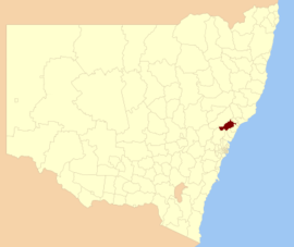 Location in New South Wales | |||||||||||||
| Coordinates | 32°50′3″S 151°21′19.8″E / 32.83417°S 151.355500°ECoordinates: 32°50′3″S 151°21′19.8″E / 32.83417°S 151.355500°E | ||||||||||||
| Population | 55,862 (2015 Est.)[1] | ||||||||||||
| • Density | 28.4/km2 (74/sq mi) | ||||||||||||
| Postcode(s) | 2320-2327, 2330, 2334, 2335[2] | ||||||||||||
| Area | 1,966 km2 (759.1 sq mi) | ||||||||||||
| Time zone | AEST (UTC+10) | ||||||||||||
| • Summer (DST) | AEDT (UTC+11) | ||||||||||||
| Mayor | Bob Pynsent[3] | ||||||||||||
| Location | |||||||||||||
| Council seat | Cessnock[4] | ||||||||||||
| Region | Hunter[2] | ||||||||||||
| State electorate(s) | Cessnock[5] | ||||||||||||
| Federal Division(s) | Hunter[6] | ||||||||||||
|
| |||||||||||||
| Website | City of Cessnock | ||||||||||||
| |||||||||||||
City of Cessnock is a local government area in the Hunter region of New South Wales, Australia. The area under administration is located to the west of Newcastle. The largest population centre and council seat is the city of Cessnock.
The Mayor of the City of Cessnock Council is Cr. Bob Pynsent, a member of the Country Labor Party.[3]
Main towns and villages
The Cessnock City Council area includes Kurri Kurri, Weston, Pelaw Main, Abermain, Aberdare, Bellbird, Kearsley, Mulbring, Kitchener, Paxton, Millfield, Ellalong, Wollombi, Neath Branxton and Greta.
Demographics
At the 2011 census, there were 50,840 people in the City of Cessnock local government area, of these 49.7 per cent were male and 50.3 per cent were female. Aboriginal and Torres Strait Islander people made up 4.8 per cent of the population, which was nearly double than the national and state averages of 2.5 per cent. The median age of people in the City of Cessnock was 37 years, equal to the national median. Children aged 0 – 14 years made up 21.4 per cent of the population and people aged 65 years and over made up 14.1 per cent of the population. Of people in the area aged 15 years and over, 46.6 per cent were married and 13.2 per cent were either divorced or separated.[7]
Population growth in the City of Cessnock between the 2001 census and the 2006 census was 2.52 per cent; and in the subsequent five years to the 2011 census, population growth was 10.03 per cent. When compared with total population growth of Australia for the same periods, being 5.78 per cent and 8.32 per cent respectively, population growth in the City of Cessnock local government area was approximately equal to the national average over the ten-year period.[8][9] The median weekly income for residents within the City of Cessnock was lower than the national average.[7]
At the 2011 census, the proportion of residents in the City of Cessnock local government area who stated their ancestry as Australian or Anglo-Saxon exceeded 83 per cent of all residents (national average was 65.2 per cent). In excess of 64% of all residents in the City of Cessnock nominated a religious affiliation with Christianity at the 2011 census, which was significantly higher than the national average of 50.2 per cent. Meanwhile, as at the census date, compared to the national average, households in the City of Cessnock local government area had a significantly lower than average proportion (3.1 per cent) where two or more languages are spoken (national average was 20.4 per cent); and a significantly higher proportion (93.0 per cent) where English only was spoken at home (national average was 76.8 per cent).[7]
| Selected historical census data for the City of Cessnock local government area | |||||
|---|---|---|---|---|---|
| Census year | 2001[8] | 2006[9] | 2011[7] | ||
| Population | Estimated residents on Census night | 45,071 | 46,206 | 50,840 | |
| LGA rank in terms of size within New South Wales | |||||
| % of New South Wales population | 0.73% | ||||
| % of Australian population | 0.24% | ||||
| Cultural and language diversity | |||||
| Ancestry, top responses | Australian | 35.3% | |||
| English | 32.2% | ||||
| Scottish | 8.4% | ||||
| Irish | 7.1% | ||||
| German | 2.9% | ||||
| Language, top responses (other than English) | German | 0.3% | |||
| Cantonese | 0.2% | ||||
| Tagalog | 0.1% | ||||
| French | n/c | ||||
| Italian | n/c | ||||
| Religious affiliation | |||||
| Religious affiliation, top responses | Anglican | 33.6% | |||
| Catholic | 22.2% | ||||
| No Religion | 11.0% | ||||
| Uniting Church | 9.9% | ||||
| Presbyterian and Reformed | 5.3% | ||||
| Median weekly incomes | |||||
| Personal income | Median weekly personal income | A$358 | A$472 | ||
| % of Australian median income | 76.8% | ||||
| Family income | Median weekly family income | A$1,015 | A$1,265 | ||
| % of Australian median income | 86.7% | ||||
| Household income | Median weekly household income | A$786 | A$1,042 | ||
| % of Australian median income | 76.5% | ||||
Council
Current composition and election method
Cessnock City Council is composed of thirteen Councillors, including the Mayor, for a fixed four-year term of office. The Mayor is directly elected while the twelve other Councillors are elected proportionally as four separate wards, each electing three Councillors. The most recent election was held on 10 September 2016, and the makeup of the Council, including the Mayor, is as follows:[3][10]
| Party | Councillors | |
|---|---|---|
| Australian Labor Party | 8 | |
| Liberal Party of Australia | 3 | |
| Independent | 2 | |
| Total | 13 | |
The current Council, elected in 2016, in order of election by ward, is:
| Ward | Councillor | Party | Notes | |
|---|---|---|---|---|
| Mayor[3] | Bob Pynsent | Country Labor | ||
| A Ward[11] | Mark Lyons | Country Labor | ||
| Paul Dunn | Liberal Party of Australia | |||
| Allan Stapleford | Independent | |||
| B Ward[12] | Jay Suvaal | Country Labor | ||
| Di Fitzgibbon | Country Labor | |||
| Ian Olsen | Independent | |||
| C Ward[13] | Melanie Dagg | Country Labor | ||
| Anne Sander | Country Labor | |||
| John Fagg | Liberal Party of Australia | |||
| D Ward[14] | Darrin Gray | Country Labor | ||
| Rod Doherty | Liberal Party of Australia | |||
| Anthony Burke | Country Labor | |||
References
- ↑ "3218.0 – Regional Population Growth, Australia, 2014–15". Australian Bureau of Statistics. Retrieved 29 September 2016.
- 1 2 "Suburb Search - Local Council Boundaries - Hunter (HT) - Cessnock City Council". New South Wales Division of Local Government. Retrieved 14 May 2009.
- 1 2 3 4 "Cessnock City Council: Summary of Candidate First Preference Votes". Local Government Elections 2016. Electoral Commission of New South Wales. 19 September 2016. Retrieved 19 October 2016.
- ↑ "City of Cessnock Council". New South Wales Department of Local Government. Retrieved 14 May 2009.
- ↑ "Cessnock". New South Wales Electoral Commission. 28 March 2015. Retrieved 13 April 2015.
- ↑ "Federal Electorate Search: Hunter". Australian Electoral Commission. 19 October 2007. Retrieved 14 May 2009.
- 1 2 3 4 Australian Bureau of Statistics (31 October 2012). "Cessnock (Local Government Area)". 2011 Census QuickStats. Retrieved 10 September 2012.
- 1 2 Australian Bureau of Statistics (9 March 2006). "Cessnock (C)". 2001 Census QuickStats. Retrieved 23 December 2013.
- 1 2 Australian Bureau of Statistics (25 October 2007). "Cessnock (C)". 2006 Census QuickStats. Retrieved 23 December 2013.
- ↑ "Declaration of Poll Result by Ward - First Preferences" (PDF). Local Government Elections 2012. Cessnock City Council. 14 September 2012. Retrieved 2 October 2012.
- ↑ "Cessnock City Council: Summary of Group and Candidate First Preference Votes: A Ward". Local Government Elections 2016. Electoral Commission of New South Wales. 19 September 2016. Retrieved 19 October 2016.
- ↑ "Cessnock City Council: Summary of Group and Candidate First Preference Votes: B Ward". Local Government Elections 2016. Electoral Commission of New South Wales. 19 September 2016. Retrieved 19 October 2016.
- ↑ "Cessnock City Council: Summary of Group and Candidate First Preference Votes: C Ward". Local Government Elections 2016. Electoral Commission of New South Wales. 19 September 2016. Retrieved 19 October 2016.
- ↑ "Cessnock City Council: Summary of Group and Candidate First Preference Votes: D Ward". Local Government Elections 2016. Electoral Commission of New South Wales. 19 September 2016. Retrieved 19 October 2016.