Tenterfield Shire
| Tenterfield Shire New South Wales | |||||||||||||
|---|---|---|---|---|---|---|---|---|---|---|---|---|---|
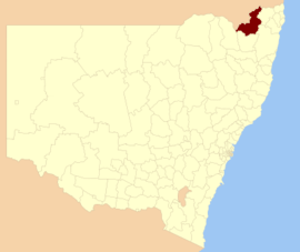 Location in New South Wales | |||||||||||||
| Coordinates | 29°03′09″S 152°01′07″E / 29.05250°S 152.01861°ECoordinates: 29°03′09″S 152°01′07″E / 29.05250°S 152.01861°E | ||||||||||||
| Population | 6,986 (2015 est)[1] | ||||||||||||
| • Density | 0.95281/km2 (2.4678/sq mi) | ||||||||||||
| Area | 7,332 km2 (2,830.9 sq mi) | ||||||||||||
| Mayor | Peter Petty (Unaligned) | ||||||||||||
| Council seat | Tenterfield[2] | ||||||||||||
| Region | New England | ||||||||||||
| State electorate(s) | Lismore | ||||||||||||
| Federal Division(s) | New England | ||||||||||||
|
| |||||||||||||
| Website | Tenterfield Shire | ||||||||||||
| |||||||||||||
Tenterfield Shire is a local government area located in the New England region of New South Wales, Australia. The Shire is situated adjacent to the New England Highway.
The Mayor of the Tenterfield Shire Council is Cr. Peter Petty, an unaligned politician.
Main towns, villages and localities
The Shire includes the town of Tenterfield and villages including Drake, Jennings, Liston, Legume, Bolivia, Sandy Flat, Stannum, Torrington, Urbenville and Mingoola. Localities include Amosfield, Boonoo Boonoo, Maryland, Sunnyside and Willsons Downfall.
Demographics
At the 2011 census, there were 6,811 people in the Tenterfield Shire local government area, of these 49.8 per cent were male and 50.2 per cent were female. Aboriginal and Torres Strait Islander people made up 6.8 per cent of the population which is approximately two-and-a-half times above both the national and state averages of 2.5 per cent. The median age of people in the Tenterfield Shire was 47 years; significantly higher than the national median of 37 years. Children aged 0 – 14 years made up 19.0 per cent of the population and people aged 65 years and over made up 20.9 per cent of the population. Of people in the area aged 15 years and over, 50.4 per cent were married and 15.1 per cent were either divorced or separated.[3]
Between the 2001 census and the 2011 census the Tenterfield Shire experienced nominal population growth in both absolute and real terms. When compared with total population growth of Australia for the same periods, being 5.78 per cent and 8.32 per cent respectively, population growth in the Tenterfield Shire local government area was significantly lower than the national average.[4] The median weekly income for residents within the Tenterfield Shire was significantly below the national average; in some cases, nearly half the national average.[3][5]
Meanwhile, as at the census date, compared to the national average, households in the Tenterfield Shire local government area had a significantly lower than average proportion (3.6 per cent) where two or more languages are spoken (national average was 20.4 per cent); and a significantly higher proportion (92.2 per cent) where English only was spoken at home (national average was 76.8 per cent).[3]
Selected historical census data
| Selected historical census data for Tenterfield Shire local government area | |||||
|---|---|---|---|---|---|
| Census year | 2001[4] | 2006[5] | 2011[3] | ||
| Population | Estimated residents on Census night | 6,363 | |||
| LGA rank in terms of size within New South Wales | 117th | ||||
| % of New South Wales population | 0.10% | 0.10% | |||
| % of Australian population | 0.03% | ||||
| Cultural and language diversity | |||||
| Ancestry, top responses | Australian | 31.0% | |||
| English | 29.9% | ||||
| Irish | 10.0% | ||||
| Scottish | 7.9% | ||||
| German | 5.4% | ||||
| Language, top responses (other than English) | Italian | 0.8% | |||
| German | 0.3% | ||||
| Bandjalang | n/c | n/c | |||
| French | n/c | ||||
| Filipino | n/c | n/c | |||
| Religious affiliation | |||||
| Religious affiliation, top responses | Anglican | 31.5% | |||
| Catholic | 24.3% | ||||
| No Religion | 10.6% | ||||
| Uniting Church | 8.5% | ||||
| Presbyterian and Reformed | 6.0% | ||||
| Median weekly incomes | |||||
| Personal income | Median weekly personal income | A$307 | A$377 | ||
| % of Australian median personal income | 65.9% | ||||
| Family income | Median weekly family income | A$695 | A$865 | ||
| % of Australian median family income | 59.4% | ||||
| Household income | Median weekly household income | A$583 | A$694 | ||
| % of Australian median household income | 56.8% | ||||
Council
.JPG)
Current composition and election method
Tenterfield Shire Council is composed of ten Councillors elected proportionally as five separate wards, each electing two Councillors. All Councillors are elected for a fixed four-year term of office. The Mayor is by the Councillors at the first meeting of the Council. The most recent election was held on 10 September 2016 and the makeup of the Council is as follows:[6][7][8][9][10]
| Party | Councillors | |
|---|---|---|
| Independent and Unaligned | 10 | |
| Total | 10 | |
The current Council, elected in 2016, in order of election by ward, is:
| Ward | Councillor | Party | Notes | |||
|---|---|---|---|---|---|---|
| Ward A[6] | Peter Petty | Unaligned | Mayor[11] | |||
| Gary Verri | Independent | |||||
| Ward B[7] | Bronwyn Petrie | Unaligned | ||||
| John Macnish | Independent | |||||
| Ward C[8] | Brian Murray | Independent | ||||
| Thomas Peters | Independent | |||||
| Ward C[9] | Don Forbes | Independent | ||||
| John Martin | Independent | |||||
| Ward C[10] | Michael Petrie | Independent | ||||
| Greg Sauer | Unaligned | Deputy Mayor[11] | ||||
References
- ↑ "3218.0 – Regional Population Growth, Australia, 2014–15". Australian Bureau of Statistics. Retrieved 29 September 2016.
- ↑ "Tenterfield Shire Council". Department of Local Government. Retrieved 2 December 2006.
- 1 2 3 4 Australian Bureau of Statistics (31 October 2012). "Tenterfield (A)". 2011 Census QuickStats. Retrieved 30 January 2015.
- 1 2 Australian Bureau of Statistics (9 March 2006). "Tenterfield (A)". 2001 Census QuickStats. Retrieved 30 January 2015.
- 1 2 Australian Bureau of Statistics (25 October 2007). "Tenterfield (A)". 2006 Census QuickStats. Retrieved 30 January 2015.
- 1 2 "Tenterfield Council - A Ward: Summary of First Preference Votes for each Candidate". Local Government Elections 2016. Electoral Commission of New South Wales. 19 September 2016. Retrieved 7 October 2016.
- 1 2 "Tenterfield Council - B Ward: Summary of First Preference Votes for each Candidate". Local Government Elections 2016. Electoral Commission of New South Wales. 19 September 2016. Retrieved 7 October 2016.
- 1 2 "Tenterfield Council - C Ward: Summary of First Preference Votes for each Candidate". Local Government Elections 2016. Electoral Commission of New South Wales. 19 September 2016. Retrieved 7 October 2016.
- 1 2 "Tenterfield Council - D Ward: Summary of First Preference Votes for each Candidate". Local Government Elections 2016. Electoral Commission of New South Wales. 19 September 2016. Retrieved 7 October 2016.
- 1 2 "Tenterfield Council - E Ward: Summary of First Preference Votes for each Candidate". Local Government Elections 2016. Electoral Commission of New South Wales. 19 September 2016. Retrieved 7 October 2016.
- 1 2 "Mayor's name drawn from a hat". Tenterfield Star. 28 September 2016. Retrieved 7 October 2016.