Oconto, Wisconsin
| Oconto | |
|---|---|
| City | |
 Oconto Location within the state of Wisconsin | |
| Coordinates: 44°53′N 87°52′W / 44.883°N 87.867°WCoordinates: 44°53′N 87°52′W / 44.883°N 87.867°W | |
| Country | United States |
| State | Wisconsin |
| County | Oconto |
| Area[1] | |
| • Total | 7.38 sq mi (19.11 km2) |
| • Land | 6.86 sq mi (17.77 km2) |
| • Water | 0.52 sq mi (1.35 km2) |
| Population (2010) | |
| • Total | 4,513 |
| • Estimate (2012[2]) | 4,506 |
| • Density | 657.9/sq mi (254.0/km2) |
| Time zone | Central (CST) (UTC-6) |
| • Summer (DST) | CDT (UTC-5) |
| ZIP codes | 54153 |
| Area code(s) | 920 |
| Website |
cityofoconto |


Oconto is a city in Oconto County, Wisconsin, United States. The population was 4,513 at the 2010 census. It is part of the Green Bay Metropolitan Statistical Area. The city is located partially within the town of Oconto.
History
Oconto is home to Copper Culture State Park, which has remains dated to around 5000-6000 B.C. It is a burial ground of the Copper Culture Indians. This burial ground is considered to be the oldest cemetery in Wisconsin and one of the oldest in the nation.
The French Jesuit, Roman Catholic priest, and missionary, Father Claude-Jean Allouez said the first Mass in Oconto on December 3, 1669.[3]
The city of Oconto was incorporated in 1869.[4] The city took its name from the nearby Oconto River.[5]
The first church in the world built for the Christian Science Church was erected in 1886 in Oconto and still stands at the corner of Main Street and Chicago Street. The land was donated by Henry (1837–1904) and Victoria Sargent (1848–1930).[6][7][8][9]
In the summer of 1952, during a two-day period, an estimated 175,000,000 Leopard frogs emerged from nearby marshes and enveloped the town. The water level of Lake Michigan rose in the spring, flooding the wetlands. The Leopard frogs laid their eggs, and when the lake level receded with the heat of summer, most of the eggs would die. But in 1952, Lake Michigan remained high, and a huge number of frog eggs grew into live amphibians.[10]
Geography
Oconto is located at 44°53′N 87°52′W / 44.883°N 87.867°W (44.8877, -87.8704).[11]
According to the United States Census Bureau, the city has a total area of 7.38 square miles (19.11 km2), of which, 6.86 square miles (17.77 km2) is land and 0.52 square miles (1.35 km2) is water.[1]
Oconto is located at the mouth of the Oconto River, which feeds into Lake Michigan.
Demographics
| Historical population | |||
|---|---|---|---|
| Census | Pop. | %± | |
| 1860 | 885 | — | |
| 1870 | 2,655 | 200.0% | |
| 1880 | 4,171 | 57.1% | |
| 1890 | 5,219 | 25.1% | |
| 1900 | 4,646 | −11.0% | |
| 1910 | 5,629 | 21.2% | |
| 1920 | 4,920 | −12.6% | |
| 1930 | 5,030 | 2.2% | |
| 1940 | 5,362 | 6.6% | |
| 1950 | 5,055 | −5.7% | |
| 1960 | 4,805 | −4.9% | |
| 1970 | 4,667 | −2.9% | |
| 1980 | 4,505 | −3.5% | |
| 1990 | 4,474 | −0.7% | |
| 2000 | 4,708 | 5.2% | |
| 2010 | 4,513 | −4.1% | |
| Est. 2015 | 4,476 | [12] | −0.8% |
The table at right with historical census data[14] indicates that the population has remained relatively flat throughout the 20th century.
2010 census
As of the census[15] of 2010, there were 4,513 people, 1,872 households, and 1,172 families residing in the city. The population density was 657.9 inhabitants per square mile (254.0/km2). There were 2,094 housing units at an average density of 305.2 per square mile (117.8/km2). The racial makeup of the city was 96.4% White, 0.7% African American, 1.1% Native American, 0.4% Asian, 0.4% from other races, and 1.2% from two or more races. Hispanic or Latino of any race were 2.4% of the population.
There were 1,872 households of which 30.0% had children under the age of 18 living with them, 45.1% were married couples living together, 11.4% had a female householder with no husband present, 6.1% had a male householder with no wife present, and 37.4% were non-families. 32.2% of all households were made up of individuals and 15.1% had someone living alone who was 65 years of age or older. The average household size was 2.35 and the average family size was 2.95.
The median age in the city was 39.6 years. 23.4% of residents were under the age of 18; 8.9% were between the ages of 18 and 24; 24.5% were from 25 to 44; 27.3% were from 45 to 64; and 15.8% were 65 years of age or older. The gender makeup of the city was 49.7% male and 50.3% female.
2000 census
As of the census[16] of 2000, there were 4,708 people, 1,870 households, and 1,221 families residing in the city. The population density was 683.7 people per square mile (263.8/km²). There were 2,040 housing units at an average density of 296.2 per square mile (114.3/km²). The racial makeup of the city was 97.79% White, 0.02% Black or African American, 0.85% Native American, 0.17% Asian, 0.06% Pacific Islander, 0.21% from other races, and 0.89% from two or more races. 0.79% of the population were Hispanic or Latino of any race.
There were 1,870 households out of which 33.2% had children under the age of 18 living with them, 49.1% were married couples living together, 11.5% had a female householder with no husband present, and 34.7% were non-families. 29.3% of all households were made up of individuals and 15.0% had someone living alone who was 65 years of age or older. The average household size was 2.44 and the average family size was 2.99.
In the city the population was spread out with 25.8% under the age of 18, 8.8% from 18 to 24, 27.8% from 25 to 44, 21.0% from 45 to 64, and 16.7% who were 65 years of age or older. The median age was 37 years. For every 100 females there were 92.2 males. For every 100 females age 18 and over, there were 89.0 males.
The median income for a household in the city was $34,589, and the median income for a family was $43,676. Males had a median income of $27,455 versus $22,083 for females. The per capita income for the city was $20,717. About 5.2% of families and 8.8% of the population were below the poverty line, including 9.6% of those under age 18 and 10.5% of those age 65 or over.
Education
The following schools are available in Oconto:[17]
- Oconto Elementary School
- Oconto Literacy Charter School
- Oconto Middle School
- Oconto High School
Transportation
Major highways
 US 41 Northbound travels to Marinette. South it continues toward Green Bay.
 WIS 22 connects with Oconto Falls and Gillett southbound.
Airport
J. Douglas Bake Memorial Airport (KOCQ) serves the city and surrounding communities.
Notable businesses
- Cruisers yachts, a builder of luxury pleasure yachts
Notable people
- George E. Ansorge, Wisconsin State Assemblyman
- Lewis S. Bailey, Wisconsin State Assemblyman
- Alexander Brazeau, Wisconsin State Assemblyman
- John B. Chase, Wisconsin State Senator
- David Guy Classon, U.S. Representative
- Pahl Davis, NFL player
- Thomas A. Delaney, Wisconsin State Assemblyman
- Tony Dollinger, NFL player
- George Clay Ginty, Union Army general
- Charles Hall, Wisconsin State Assemblyman
- Fay Holderness, actress
- Richard W. Hubbell, Wisconsin State Assemblyman
- Reuben La Fave, Wisconsin State Senator
- Marty Larsen, Wisconsin State Assemblyman
- Frank J. Lingelbach, Wisconsin State Assemblyman
- Red Mack, NFL player
- Bob McDougal, NFL player
- Jab Murray, NFL player
- Alvin O'Konski, U.S. Representative
- Louis P. Pahl, Wisconsin State Assemblyman
- Edward Scofield, Governor of Wisconsin
- Warren R. Smith, Wisconsin State Treasurer
- Landy Scott, champion race car driver
- William T. Sullivan, Wisconsin State Assemblyman
- Deral Teteak, football player
- Blaine Walsh, sports announcer
- Arthur J. Whitcomb, Wisconsin State Assemblyman and lawyer
- William Henry Young, Wisconsin State Assemblyman
- John E. Youngs, Wisconsin State Assemblyman
References
- 1 2 "US Gazetteer files 2010". United States Census Bureau. Retrieved 2012-11-18.
- ↑ "Population Estimates". United States Census Bureau. Retrieved 2013-06-24.
- ↑ Hall, George E. 2009. A History of Oconto. 2nd ed., edited by Duane Ebert and Pamela Ann Loberger. Oconto, WI: Oconto County Historical Society, p. 33.
- ↑ City-Data.com: Oconto, Wisconsin. Retrieved 2010-08-03.
- ↑ Chicago and North Western Railway Company (1908). A History of the Origin of the Place Names Connected with the Chicago & North Western and Chicago, St. Paul, Minneapolis & Omaha Railways. p. 109.
- ↑ Nichols, Diane et al. No date. West Main Street Historic District Oconto, Wisconsin (brochure). Oconto, WI: Oconto County Historical Society, p. 6.
- ↑ Hall, George E. 2009. A History of Oconto. 2nd ed., edited by Duane Ebert and Pamela Ann Loberger. Oconto, WI: Oconto County Historical Society, p. 130.
- ↑ Chiat, Marilyn Joyce Segal. 1997. America's Religious Architecture: Sacred Places for Every Community. New York: John Wiley, p. 133.
- ↑ Cather, Willa & Georgine Milmine. 1909. The Life of Mary Baker G. Eddy and the History of Christian Science. New York: Doubleday, p. 364.
- ↑ http://wisconsinology.blogspot.com/2008/04/giant-frog-invasion-of-1952it-happened.html
- ↑ "US Gazetteer files: 2010, 2000, and 1990". United States Census Bureau. 2011-02-12. Retrieved 2011-04-23.
- ↑ "Annual Estimates of the Resident Population for Incorporated Places: April 1, 2010 to July 1, 2015". Retrieved July 2, 2016.
- ↑ "Census of Population and Housing". Census.gov. Retrieved June 4, 2015.
- ↑ City of Oconto Comprehensive Outdoor Recreation Plan, Population Trends Table 2A and WDOA Population Projections Table 2B.
- ↑ "American FactFinder". United States Census Bureau. Retrieved 2012-11-18.
- ↑ "American FactFinder". United States Census Bureau. Retrieved 2008-01-31.
- ↑ City-Data.com: Schools in Oconto, Wisconsin. Retrieved 2010-08-03.
External links
Municipalities and communities of Oconto County, Wisconsin, United States | ||
|---|---|---|
| Cities | 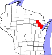 | |
| Villages | ||
| Towns | ||
| CDPs | ||
| Unincorporated communities | ||
| Indian reservation | ||
| Ghost town |
| |
| Footnotes | ‡This populated place also has portions in an adjacent county or counties | |