Oklahoma Territory
Coordinates: 35°24′N 97°00′W / 35.4°N 97°W
| Territory of Oklahoma | |||||
| Organized incorporated territory of the United States | |||||
| |||||
 | |||||
| Capital | Guthrie | ||||
| Government | Organized incorporated territory | ||||
| Governor | List | ||||
| History | |||||
| • | Organic act | May 2, 1890 | |||
| • | statehood | November 16, 1907 | |||
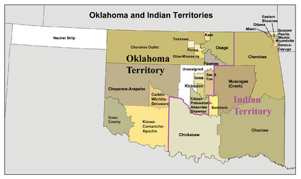
The Territory of Oklahoma was an organized incorporated territory of the United States that existed from May 2, 1890, until November 16, 1907, when it was joined with the Indian Territory under a new constitution and admitted to the Union as the State of Oklahoma.
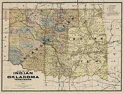
The 1890 Oklahoma Organic Act organized the western half of Indian Territory and a strip of country known as No Man's Land into Oklahoma Territory. Reservations in the new territory were then opened to settlement in land runs later that year and in 1891 and 1893.
Seven counties were defined upon the creation of the territory. Although they were designated by number, they would eventually become Logan County, Cleveland County, Oklahoma County, Canadian County, Kingfisher County, Payne County and Beaver County. The Land Run of 1893 led to the addition of Kay County, Grant County, Woods County, Garfield County, Noble County, and Pawnee County. The territory acquired an additional county through the resolution of a boundary dispute with the U.S. state of Texas, which today is split into Greer County, Jackson County, Harmon County, and part of Beckham County.
History
Organization
Oklahoma Territory's history began with the Indian Intercourse Act of 1834 when the United States Congress set aside land for Native Americans. At the time, the land was unorganized territory that consisted of the federal land "west of the Mississippi and not within the states of Missouri and Louisiana, or the territory of Arkansas..." By 1856, the territory had been reduced to approximately the modern-day borders of the State of Oklahoma, except for the Oklahoma Panhandle and Old Greer County.[1] These lands became known as Indian Territory, as they had been granted to certain Indian nations under the Indian Removal Act, in exchange for their historic territories east of the Mississippi River.
Until this point, Native Americans had exclusively used the land. In 1866, after the American Civil War, the federal government required new treaties with the tribes that had supported the Confederacy, and forced them into land and other concessions. As a result of the Reconstruction Treaties, The Five Civilized Tribes were required to emancipate their slaves and offer them full citizenship in the tribes if they wanted to stay in the Nations. This forced many of the tribes in Indian Territory into making concessions.
U.S. officials forced the cession of some 2,000,000 acres (8,100 km2) of land in the center of the Indian Nation Territory. Elias C. Boudinot, then a railroad lobbyist, wrote an article that was published in the Chicago Times on February 17, 1879, that popularized the term Unassigned Lands to refer to this tract. Soon the popular press began referring to the people agitating for its settlement as Boomers. To prevent settlement of the land by European-Americans, President Rutherford B. Hayes, issued a proclamation forbidding unlawful entry into Indian Territory in April 1879.[2]
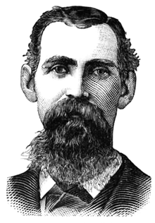
David Payne and the Boomers
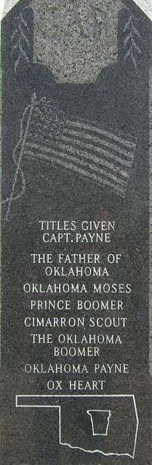
Despite federal obstruction, popular demands for the land did not end. Captain David L. Payne was one of the main supporters of the opening of Oklahoma to white settlement. Payne traveled to Kansas, where he founded the Boomer "Colonial Association." Payne's organization of 10,000 members hoped to establish a white colony in the Unassigned Lands. The formation of the group prompted President Hayes to issue a proclamation ordering Payne not to enter Indian Territory on February 12, 1880.[3] In response, Payne and his group traveled to Camp Alice in the Unassigned Lands, east of Oklahoma City. There, they made plans for a city, which they named "Ewing." The Fourth Cavalry arrested them, took them to Ft. Reno and escorted them back to Kansas.[3] Payne was furious, as public law (see Posse Comitatus Act) prohibited the military from interfering in civil matters. The federal government freed Payne and his party, effectively denying them access to the courts.
Anxious to prove his case in court, Payne and a larger group returned to Ewing in July. The Army again arrested the party and escorted them back to Kansas. Again they were freed but this time the federal government charged Payne with trespassing under the Indian Intercourse Act; he went to trial in Ft. Smith, Arkansas. Judge Isaac Parker ruled against Payne and fined him the maximum amount of one thousand dollars. Since Payne had no money and no property, the government could not collect the fine. The ruling settled nothing on the question of the public domain lands, and Payne continued his activities.
Payne tried a third time to enter the Unassigned Lands. In December, Payne and his group moved along the northern border of Indian Territory. They were followed by a unit of cavalry under the command of Colonel J.J. Copinger. Colonel Copinger warned Payne that if he crossed the border that they would be "forcibly resisted." As the number of Boomers grew as people joined Payne, they sent a messenger to President Hayes asking permission to enter Indian Territory. After weeks of no response, Payne led his followers to the Unassigned Lands. Once again, they were arrested and Payne was sent back to Fort Smith. He was found guilty and sentenced to pay a $1,000 fine. Upon his release, he returned to Kansas, where he spent the next four years trying to open Oklahoma.
During Payne's last venture, this time into the Cherokee Outlet in 1884, the Army again arrested him. They took him several hundred miles under severe physical circumstances over a tortuous route to Ft. Smith. The public was outraged about his treatment by the military, and the US government decided to try his case. Payne was turned over to the United States District Court at Topeka, Kansas. He was indicted for the crime of bringing whiskey into Indian Territory, a Federal offense.[4] In the fall term, Judge Cassius G. Foster quashed the indictments and ruled that settling on the Unassigned Lands was not a criminal offense. The Boomers celebrated, but the federal government refused to accept the decision.
Payne immediately planned another expedition, but he would not lead it. On November 28, 1884, in Wellington, Kansas, the morning after a late-night address to the Boomers, he collapsed and died.[2]
William Couch and the opening
After Payne's death, his associate, William L. Couch, assumed the leadership role. Couch moved the Boomers into Indian Territory and founded Camp Stillwater on December 12, 1884. President Chester Arthur sent a small detachment of troops to escort Couch out of the territory. When the soldiers arrived, 200 armed men met them; and refused to move. After 600 troops arrived as reinforcements, the officers gave the Boomers the choice of leaving within 48 hours or being apprehended. After the Boomers refused to leave, the commanders moved their troops across the Kansas border and cut off Couch's supply lines. Soon, their food was gone, and Couch and the other Boomers were escorted back to Kansas.
In response to Couch's claims that the federal government was discriminating against them, on March 3, 1885, Congress approved the Indian Appropriations Act of 1885. This act authorized negotiations for the cession of unoccupied lands belonging to the Creek, the Seminole, and the Cherokee Indians. Couch stopped being a colonist and became a lobbyist.
Couch would spend four years in Washington, D.C. trying to convince Congress to open the Oklahoma lands. Many Indians from the Five Civilized Tribes lobbied against Couch's actions. In January 1889, Pleasant Porter led a group of Muscogee (Creek) who offered to sell their unoccupied lands. Within weeks, they sold their "Unassigned Lands" to the United States. These lands embraced less than 3,000,000 acres (12,000 km2) in the heart of Indian Territory.
On March 2, 1889, Congress passed an amendment to the Indian Appropriations Act of 1871, which provided for the creation of homestead settlements in the unassigned lands, to be known as Oklahoma Territory. President Grover Cleveland announced that the Oklahoma lands would be opened on April 22 via land run. The land run took place at noon and was open to individuals of at least 21 years of age.
Land Run and the Sooners
The Land Run of 1889, the first land run in the territory's history, opened Oklahoma Territory to settlement on April 22, 1889. Over 50,000 people entered the lands on the first day, among them thousands of freedmen and descendants of slaves. Couch and his Boomers, now numbering approximately 14,000, also entered the race. Those who entered Oklahoma before the official start of the race were called Sooners.[5] The term referred to the "sooner clause" in the Indian Appropriations Act of March 2, 1889, which said that anyone who violated the official start would be denied a claim to the land.[6]
When the run began at noon, men on thousands of horses, wagons, buggies, carts, and vehicles rushed across to Oklahoma. The law-abiders fought with the Sooners on several instances. A legal pioneer shot and wounded William Couch, a Sooner. He died on April 21, 1890, as a result of his wounds.
Many lawsuits resulted because more than one person claimed a particular piece of land. Often this involved trying to determine which party was a legal claimant. A portion of the cases even went as far as the U.S. Supreme Court.[7]
When the race was over, many disappointed pioneers were forced to leave the area without any claim. Of the 14,000 Boomers, only 1,000 had made claims. Tent cities grew overnight at Oklahoma City, Kingfisher, El Reno, Norman, Guthrie, and Stillwater, which were the first of the large settlements.
Early territorial period

By the end of the day on April 22, 1889, there were more than enough settlers in the Unassigned Lands to require creation of a territorial government. However, the brief legislation that provided for the opening of the land called for no form of government in Oklahoma. No local police or courts were established; federal military troops provided law enforcement and the United States District Court for the Western District of Arkansas under federal judge Isaac Parker was the only form of criminal and civil jurisdictions. Despite that, the district was generally peaceful. Most land disputes were settled without bloodshed, although a few took years to resolve. For over a year the people of Oklahoma Territory were semi-autonomous.[8]
The next year, on May 2, 1890, Congress passed the Oklahoma organic act, which organized the western half of Indian Territory into Oklahoma Territory.[8] The eastern half remained under Indian rule, predominantly that of the Five Civilized Tribes, as Indian Territory. Congress included in Oklahoma Territory the strip of country known as No Man's Land, embracing 3,681,000 acres (14,900 km2), which became Beaver County. In September 1890, the 1,282,434 acres (5,189.83 km2) of the Sac and Fox, Iowa, and Pottawatomie reservations in the eastern part of Oklahoma Territory were opened to settlement. The following spring, the 4,397,771 acres (17,797.15 km2) of Cheyenne and Arapaho lands in the center of the Territory were opened. On September 16, 1893, the Cherokee Outlet was opened to settlement, and the counties of Kay, Grant, Woods, Woodward, Garfield, Noble, and Pawnee were created from its 6,014,239 acres (24,338.76 km2) of land. In 1895 the Kickapoo reservation of 206,662 acres (836.33 km2) was settled, and the year following Greer County, which had been considered a portion of Texas, was given to the Territory by a decision of the Supreme Court of the United States. These developments, with the Kiowa, Comanche and Apache and Wichita reservations just opened, gave Oklahoma Territory a settled area of 24,000,000 acres (97,000 km2), 1,725,646 acres (6,983.44 km2) of which was still included in Indian reservations.[9]
Path to statehood
With the passage of the Organic Act of 1890, Oklahoma Territory existed from 1890 to 1907. During that time, seven Governors (and two acting Governors) administered the territory. During its 17-year existence, little of note occurred due to the growing idea of statehood, which had originated in Indian Territory. Most of the Governors stayed in office for only a few months; institutions founded during this time were the University of Oklahoma, the University of Central Oklahoma (then known as the Territorial Normal School) and the Oklahoma State University (then known as Oklahoma Agricultural and Mechanical School). The territory's real purpose was to serve as a transitional government from unorganized territory to state.
Representatives of the Five Civilized Tribes met in 1902 to work on securing statehood for Indian Territory and held a convention in Eufaula. The representatives met again in 1903 to organize a constitutional convention.
The Sequoyah Constitutional Convention met in Muskogee, on August 21, 1905. General Pleasant Porter, Principal Chief of the Creek Nation, was elected as president of the convention. The elected delegates decided that the executive officers of the Five Civilized Tribes would be appointed as vice-presidents: William C. Rogers, Principal Chief of the Cherokees; William H. Murray, appointed by Chickasaw Governor Douglas H. Johnston to represent the Chickasaw; Chief Green McCurtain of the Choctaw; Chief John Brown of the Seminole; and Charles N. Haskell, appointed by Porter to represent the Creek.
The convention drafted a constitution, drew up a plan of organization for the government, put together a map showing the counties to be established, and elected delegates to go to the United States Congress to petition for statehood. The convention's proposals were presented in a referendum in Indian Territory, in which they were overwhelmingly endorsed.
The delegation received a cool reception in Washington. Eastern politicians, fearing the admission of two more Western states, put pressure on the U.S. President, Theodore Roosevelt. He ruled that the Indian and Oklahoma Territories would be granted statehood only as a combined state.
The hard work of the Sequoyah State Constitutional Convention was not entirely lost. When representatives from Indian Territory joined the Oklahoma State Constitutional Convention in Guthrie the next year, they brought their constitutional experience with them. The Sequoyah Constitution served in large part as the basis for the constitution of the State of Oklahoma, which came into being with the merger of the two territories in 1907.
Territorial Governor Frank Frantz oversaw the transition from territory to state. He was selected as the Republican nominee to serve as the state's first Governor. He faced the Democratic Charles N. Haskell in the election on September 17, 1907. In the same election, the Oklahoma Constitution was proposed. The Constitution was passed and Haskell was elected Governor. Once the people of Oklahoma adopted the United States Constitution on November 16, 1907, Oklahoma and Indian Territories officially dissolved and the State of Oklahoma was admitted to the Union as the 46th state.
Government
With the passage of the Oklahoma organic act, in June 1890, the territorial government came into existence. The territorial government had no constitution, except for sections of the Organic Act creating it, which served as a semi-governing document. The Organic Act provided for a complete organization of the Territory, defined the functions of the territorial government, placed limitations upon the acts of the legislative assembly, as well as that of the territorial officers. It also designated the town of Guthrie as the territorial capital.[8]
Congress provided for the creation of a legislative branch elected by the people, but the executive and judicial branches of the territories were selected and appointed by the President of the United States, with the advice and consent of the United States Senate. The appointees included a governor, a secretary, three federal judges and a marshal. President Benjamin Harrison appointed George Washington Steele, a Republican from Indiana, as the first territorial governor.[8]
Legislative branch
The Organic Act called for the establishment of a bicameral Territorial Legislative Assembly composed of a Territorial Council, the upper house of the assembly, and Territorial House of Representatives, the lower house of the assembly.[8] The assembly could only create laws consistent with the Constitution of the United States and the Organic Act, but did not require the consent of Congress to take effect. They had the same force of law, as did a law passed by a regular state government. Laws enacted by the assembly could be suspended by the President of the United States or revoked, in part or in their entirety, by an act of Congress.
When George Washington Steele, the first territorial governor, took office, he issued an executive order on July 8, 1890, calling for the first elections to the assembly. The date set for this election was August 5, 1890.[8] The assembly was to have convened August 12, but owing to the death of two members-elect a special election was called and the convening of the legislature was postponed until August 27, 1890.[8]
The territorial assembly met for 120-day sessions in Guthrie, Oklahoma.[1] The first legislative session was narrowly divided between Republican and Democratic Party members, with Republicans having a slight edge in representatives. However, the Democrats allied with delegates from the People's Party (Populists) and thereby controlled both houses. Populist delegates were elected as presiding officers in both. The legislators spent most of the session arguing about the locations of the capital, the state university, state teachers' college, and the agricultural school. Only near the end of the session did they begin to address other issues necessary to create and maintain the territory. Steele became so disgusted by the political stalemate that he resigned his position and returned to Indiana.[8]
The Oklahoma Territorial Legislature met for the last time in 1905.[10]
Executive branch
The executive branch was made up of officials appointed by the U.S. president including a territorial governor, a territorial secretary, and a territorial marshal.[8] Appointees were subject to the consent of the United States Senate, served four-year terms, and could be removed by the president.
The territorial governor was vested with the executive power of the territory, was responsible for ensuring that its laws were faithfully executed, and served as the symbol of the federal government in the territory. The governor was the ex officio commander-in-chief of the territorial militia and the federal troops in the territory as well as ex officio Superintendent of Indian Affairs. The governor possessed the power to grant pardons for offenses against the laws of the territory. He also could grant reprieves for offenses against the laws of the United States until the President made his decision on the matter. It was also the duty of the governor to outline the boundaries of the counties, name the county seats, and to appoint territorial and county officers with the consent of the territorial council.
Laws passed by the territorial assembly had to be presented to the governor for his approval. If he did not approve, he would veto if and return it to the assembly for reconsideration. The governor's veto could only be overridden by a two-thirds vote of the territorial assembly. The governor also had the right to convene the assembly into special session.
The territorial secretary would serve as the chief assistant to the governor and, in the event of a vacancy of the governorship; the secretary would serve as the acting governor until the president appointed a new one. The secretary was responsible for recording and preserving the laws and proceedings of the assembly and the acts and proceedings of the governor. Copy of the same would semi-annually be submitted to the president, the President of the United States Senate, and the Speaker of the United States House of Representatives for their review.
A territorial attorney was responsible for giving legal advice to the governor and assembly, served as the chief law enforcement official of the territory, and represented Oklahoma Territory and the United States in court cases. The territorial marshal was responsible for protecting the court system and for executing processes issued from the territorial courts.
List of Governors
| # | Name | Took Office | Left Office | Party | Appointed By | Photo |
|---|---|---|---|---|---|---|
| 1 | George Washington Steele | 1890 | 1891 | Republican | Benjamin Harrison | .jpg) |
| – | Robert Martin | 1891 | 1892 | Republican | none (acting governor) | 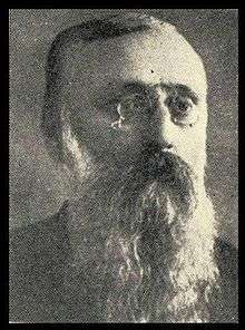 |
| 2 | Abraham Jefferson Seay | 1892 | 1893 | Republican | Benjamin Harrison | 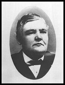 |
| 3 | William Cary Renfrow | 1893 | 1897 | Democratic | Grover Cleveland |  |
| 4 | Cassius McDonald Barnes | 1897 | 1901 | Republican | William McKinley | 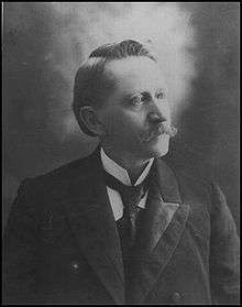 |
| 5 | William Miller Jenkins | 1901 | 1901 | Republican | William McKinley |  |
| – | William C. Grimes | 1901 | 1901 | Republican | none (acting governor) | 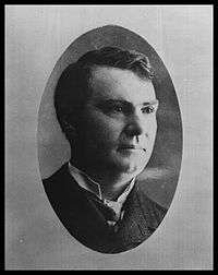 |
| 6 | Thompson Benton Ferguson | 1901 | 1906 | Republican | Theodore Roosevelt | 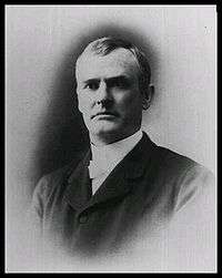 |
| 7 | Frank Frantz | 1906 | 1907 | Republican | Theodore Roosevelt |  |
Judicial branch
The territory's judiciary consisted of a territorial supreme court made up of three justices, a chief justice and two associate justices. Additional associate justices were added later as more counties were created in the territory. The judiciary was given a wide jurisdiction. It functioned, not only as a United States Federal Court, but its jurisdiction extended to a trial of cases, both civil and criminal, arising under the code enacted by the territorial assembly. The court could sit half of the day as a federal court and the other half as territorial court. It would also serve as a supreme court and hear cases that had been appealed from territory's lower courts.[1]
President Benjamin Harrison appointed Edward B. Green of Illinois as the first chief justice and John G. Clark of Wisconsin and Abraham J. Seay of Missouri as the first associate justices.[11]
Oklahoma Territory was divided into seven Judicial Districts in 1902, as follows:[11]
- First – Logan, Lincoln and Payne Counties
- Second – Canadian, Kingfisher, Cleveland, Washita and Custer Counties
- Third – Oklahoma and Pottawatomie Counties
- Fourth – Noble, Kay and Pawnee Counties
- Fifth – Garfield, Grant, Blaine and Roger Mills Counties
- Sixth – Woods, Woodward, Beaver, Day and Dewey Counties
- Seventh – Caddo, Comanche, Kiowa and Greer Counties
Charles Brown of Kansas was named the first Attorney General and Horace Speed of Guthrie (formerly of Indiana) was appointed the first United States attorney in Oklahoma.[11]
Federal representation
The Territory was entitled to elect one Delegate to the United States House of Representatives to serve a two-year term. While unable to vote in the full House, the Delegate was allowed to vote in a House committee of which the Delegate was a member. The first territorial representative was David A. Harvey.[12]
Four men represented Oklahoma Territory as non-voting Delegates in the United States House of Representatives:
| Congress | Delegate | Party | Years | Notes |
|---|---|---|---|---|
| 51st | David Archibald Harvey | Republican | November 4, 1890 - March 4, 1893 | |
| 52nd | ||||
| 53rd | Dennis Thomas Flynn | Republican | March 4, 1893 - March 4, 1897 | |
| 54th | ||||
| 55th | James Yancy Callahan | Free Silver | March 4, 1897 - March 4, 1899 | |
| 56th | Dennis Thomas Flynn | Republican | March 4, 1899 - March 4, 1903 | |
| 57th | ||||
| 58th | Bird Segle McGuire | Republican | March 4, 1903 - March 4, 1907 | |
| 59th |
Lands that came to make up the territory
- Unassigned Lands – April 22, 1889 – opened by land run.
- No Man's Land – May 2, 1890, assigned to Oklahoma Territory by Organic Act.
- Iowa reserve – September 22, 1891 – opened by land run.
- Sac and Fox reserve – September 22, 1891 – opened by land run.
- Tonkawa reserve – 1891 – allotment.
- Citizen Potawatomi and Absentee Shawnee reserve – September 22, 1891 – opened by land run.
- Cheyenne Arapaho reserve – April 19, 1892 – opened by land run.[13]
- Cherokee Outlet – September 17, 1893 – opened by land run.[14]
- Kickapoo reserve – May 4, 1896 – opened by land run.
- Greer County – March 16, 1896 – officially assigned to Oklahoma Territory (Supreme Court decision May 23, 1895, separated the county from Texas).
- Comanche, Kiowa, and Apache reserve – July 10 through August 6, 1901 – lottery.
- Wichita and Caddo reserve – July 10 through August 6, 1901 – lottery.[15]
- Ponca and Otoe–Misouria reserve – 1904 – allotment.
- Kaw reserve – 1906 – allotment.
- Osage reserve – 1906 – allotment.
- Big Pasture – December 1906 – sealed bid.
County creation in the territory
Original counties
When Oklahoma Territory was created in 1890, seven counties were defined and designated as first, second, third, fourth, fifth, sixth and seventh, respectively. Thereafter, when additional lands were opened to settlement, new counties were designated by the letters of the alphabet. Later, by vote of the people, these were given permanent county names. The first seven numbered counties, later were named as follows: Logan, Cleveland, Oklahoma, Canadian, Kingfisher, Payne and Beaver.[16]
The Secretary of the Interior defined the boundaries and assigned the names of the three counties to be defined and their names assigned by executive proclamation when the Kiowa-Comanche and Wichita-Caddo Reservations were opened to settlement in 1901.[16]
Greer County
Greer County, created by the Texas legislature on February 8, 1860, and named for John Alexander Greer, a Texas lieutenant governor, was land claimed by both Texas and the United States. The dispute arose from a map submitted with the Adams-Onís Treaty of 1819. The treaty stated that the boundary between the French claims on the north and the Spanish claims on the south of the United States was Rio Roxo de Natchitoches (Red River) until it reached the 100th meridian west, as noted on John Melish's map published in 1818. However, the upper reaches of the Red River were not surveyed, as required by the fourth article of the treaty, until 1852. The problem was that the 100th meridian on the Melish map was approximately 90 miles (140 km) east of the true 100th meridian and the Red River forked about 50 miles (80 km) east of the 100th meridian. Another survey team discovered the mapping error in 1857, and showed that the southern fork was the Red River should be the correct boundary described by the Adams–Onís Treaty. Texas rejected that assertion and claimed the land south of the North Fork. The United States claimed the land north of the South Fork (previously named the Prairie Dog Town River).[17]
Texas continued to claim sovereignty over Greer County during and after the Civil War. It opened the land to veterans of the Texas Revolution and Confederate Army veterans and leased land to ranchers. In 1884, President Chester A. Arthur took a more active role in looking for a resolution of the dispute.[18] However, the attempt failed to resolve anything. Meanwhile, area residents officially organized Greer County as a Texas entity in 1886, designating Mangum as the county seat. In 1890, Congress passed the Oklahoma Organic Act, which required the United States attorney general to resolve the boundary issue by filing a suit against Texas.[17]
United States vs. State of Texas
The dispute resulted in a lawsuit, which went before the Supreme Court—no lower court having jurisdiction. The court's opinion, in United States v. State of Texas 162 U.S. 1 (1896), issued on March 16, 1892, held that the land of approximately 1.5 million acres (6070 km²/2345 mi²) belonged to the United States.[19] Following that ruling, on May 4, 1896, the land was officially assigned by Congress to Oklahoma Territory. The Greer County Homestead Law, passed just afterwards, gave the Texas settlers the 160 acres (647,000 m²) they were living on and the option to purchase an additional 160 acres (647,000 m²) for $1.00 per acre ($247/km²).[20]
"Greer County" after statehood
When Oklahoma became the 46th U.S. state (November 16, 1907), old "Greer County" was divided into Greer, Jackson, and part of Beckham counties. Mangum remained the county seat of the redefined Greer County. Harmon County was created May 22, 1909, by a vote of the people from a portion of Greer County, Oklahoma. Mangum remained the county seat of the redefined Greer County.[17]
See also
- American Civil War, 1861–1865
- Compromise of 1850
- Historic regions of the United States
- History of Oklahoma
- Mexican–American War, 1846–1848
- Territorial evolution of the United States
- Territories of Spain that encompassed land that would later become part of Oklahoma Territory:
- Nueva Vizcaya, 1562–1821
- Santa Fé de Nuevo Méjico, 1598–1821
- Tejas, 1690–1821
- Luisiana, 1764–1803
- Territory of France that encompassed land that would later become part of Oklahoma Territory:
- Louisiane, 1682–1764 and 1803
- Territory of Mexico that encompassed land that would later become part of Oklahoma Territory:
- Santa Fé de Nuevo México, 1824–1848
- Territorial claim of the Republic of Texas, 1836–1845
- U.S. territories that encompassed land that would later become part of Oklahoma Territory:
- Louisiana Purchase, 1803–1804
- District of Louisiana, 1804–1805
- Territory of Louisiana, 1805–1812
- Territory of Missouri, 1812–1821
- Adams–Onís Treaty of 1819
- Indian territory, 1834–1907
- former territorial claim of the Republic of Texas, 1845–1850
- No Man's Land, 1850–1890 (ungoverned)
- Greer County, Texas, 1860–1896 (disputed territory governed by Texas, later assigned to Oklahoma Territory)
- Cimarron Territory, 1886–1891 (extralegal)
- U.S. state created from the Territory of Oklahoma and the final extent of the Indian territory:
- State of Oklahoma, 1907
- Territories of Spain that encompassed land that would later become part of Oklahoma Territory:
- Former Indian Reservations in Oklahoma
References
- 1 2 3 Everett, Dianna. "1890 Organic Act," Encyclopedia of Oklahoma History and Culture, 2009. Accessed March 1, 2015.
- 1 2 Hoig, Stan. "Boomer Movement," Encyclopedia of Oklahoma History and Culture, 2009. Accessed March 1, 2015.
- 1 2 "Captain David L. Payne," Chronicles of Oklahoma, Vol. 14 No. 3: December 1935. Accessed March 1, 2015.
- ↑ Lovegrove, Michael W. "Payne, David Lewis (1836–1884)," Encyclopedia of Oklahoma History and Culture, 2009. Accessed March 1, 2015.
- ↑ "Internet Archive, Way Back Machine."Retrieved May 10, 2013
- ↑ Blachowiak, Mary Ann. "Sooner," Encyclopedia of Oklahoma History and Culture, 2009. Retrieved March 1, 2015.
- ↑ Hoig, Stan. "Land Run of 1889," Encyclopedia of Oklahoma History and Culture, 2009. Accessed March 1, 2015.
- 1 2 3 4 5 6 7 8 9 Brown, Kenny L. "Oklahoma Territory," Encyclopedia of Oklahoma History and Culture, 2009. Accessed March 1, 2015.
- ↑ Indian Advocate. Vol. 14, No, 1. January 1924. Retrieved June 2, 2013.
- ↑ Darcy, R., "The Oklahoma Territorial Legislature: 1890-1905." (accessed September 30, 2013)
- 1 2 3 Doyle, T. H. Chronicles of Oklahoma. Vol. 13, No. 2. June 1935."The Supreme Court of the Territory of Oklahoma." Retrieved June 3, 2013.
- ↑ Wilson, Linda D. "Statehood Movement," Encyclopedia of Oklahoma History and Culture, 2009. Accessed March 1, 2015.
- ↑ Dale, Edward Everett. Chronicles of Oklahoma "The Cheyenne-Arapaho Country." Vol. 20, No. 4 December 1942. Retrieved May 30, 2013.
- ↑ Alvin O.Turner, "Cherokee Outlet Opening." Encyclopedia of Oklahoma History and Culture. Retrieved May 30, 2013.
- ↑ Carolyn Garrett Pool, "Wichita-Caddo-Delaware Opening". Encyclopedia of Oklahoma History and Culture. Retrieved May 30, 2013.
- 1 2 Chronicles of Oklahoma. "Origin of County Names in Oklahoma." v. 2, N, 1. March 1924. Retrieved May 26, 2013."Archived copy". Archived from the original on February 18, 2009. Retrieved July 7, 2009.
- 1 2 3 Heisch, John D. "Old Greer County," Encyclopedia of Oklahoma History and Culture, 2009. Accessed March 1, 2015.
- ↑ Peters, Gerhard; Woolley, John T. "Chester A. Arthur: "Proclamation 259 - Prohibition of Non-Indian Settlement of Oklahoma Lands in the Indian Territory," July 1, 1884". The American Presidency Project. University of California - Santa Barbara. Retrieved 17 January 2016.
- ↑ Justicia.com US Supreme Court Center. United States v. Texas, 143 U.S. 621 (1892). Retrieved May 30, 2013.
- ↑ Estill-Harbour, Emma. Chronicles of Oklahoma. Vol. 12, No. 2. June 1934. Greer County." Retrieved June 3, 2013.
External links
| Wikimedia Commons has media related to Oklahoma Territory. |
- Oklahoma Digital Maps: Digital Collections of Oklahoma and Indian Territory
- Peters, Gerhard; Woolley, John T. "Grover Cleveland: "Proclamation 266 - Prohibition of Non-Indian Settlement of Oklahoma Lands in the Indian Territory," March 13, 1885". The American Presidency Project. University of California - Santa Barbara. Retrieved 17 January 2016.
- Peters, Gerhard; Woolley, John T. "Grover Cleveland: "Proclamation 268 - Revoking Executive Order of February 27, 1885 and Prohibition of Non-Indian Settlement on Indian Lands," April 17, 1885". The American Presidency Project. University of California - Santa Barbara. Retrieved 17 January 2016.