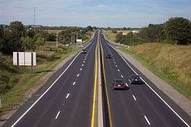
Ontario Highway 115
| |||||||||||||
|---|---|---|---|---|---|---|---|---|---|---|---|---|---|
| Route information | |||||||||||||
| Length: | 56.7 km[1] (35.2 mi) | ||||||||||||
| Existed: | March 22, 1955[2] – present | ||||||||||||
| Major junctions | |||||||||||||
| South end: |
| ||||||||||||
|
Highway 7A | |||||||||||||
| North end: |
| ||||||||||||
| Highway system | |||||||||||||
| |||||||||||||

King's Highway 115, commonly referred to as Highway 115 is a provincially maintained highway in the Canadian province of Ontario that connects Peterborough with Toronto via Highway 401. The highway begins at a junction with Highway 401 southwest of Newcastle and ends at an at-grade intersection with Highway 7 east of Peterborough.
Highway 115 is part of the Algonquin Trail and concurrent with Highway 35 from its southern terminus in Clarington to Enterprise Hill, where it veers towards Peterborough and Highway 35 continues north into the Kawarthas. It is also part of the Trans-Canada Highway from the interchange with Highway 7 south of Springville, Ontario to the northern terminus of the highway. Highway 115 is a freeway northeast of Enterprise Hill and a Right-in/right-out (RIRO) expressway south of it, featuring short ramps with abrupt right turns to and from the highway. By January 2010, exit numbers were added to the freeway section north of the Highway 35 concurrency.
Route description

Highway 115 begins at a trumpet interchange with Highway 401, and is concurrent with Highway 35 for 18.9 km (11.7 mi) to Enterprise Hill.[3][4][5] For the length of this concurrency, it is a divided four lane RIRO expressway. At Enterprise Hill, the expressway curves eastward and Highway 35 exits, continuing north towards Lindsay. Highway 115 continues northeast, and the two carriageways diverge, making it a freeway. A depressed grass median, generally 10 metres (33 ft) wide, separates the opposing directions of travel between this point and Peterborough.
Most of the remainder of the highway is straight and surrounded by agricultural lands and forests, until it meets Highway 7. From this point northeastward, Highway 115 is part of the southern Ontario route of the Trans-Canada Highway and concurrent with Highway 7.[3] The freeway continues along the southern edge of Peterborough and ends at Lansdowne Street to the east of the city. Highway 7 continues east towards Ottawa.
History
Highway 115 was a new highway constructed in the mid-1950s and gradually improved over the following 40 years. Initially, the route was constructed as a two lane connection from Highway 35 near Pontypool to Highway 28 on the outskirts of Peterborough. Because of this, it was known as the Pontypool–Peterborough Road. It was eventually extended to Highway 7 on the east side of Peterborough and later widened to a four-lane expressway in the late 1980s. Since then, improvements have been proposed to extend Highway 115 east to Highway 28, but none have come to fruition.
In 1953, construction began on a two lane road northeastward from Highway 35 south of Pontypool, with the purpose of creating a shorter route between Toronto and Peterborough.[6][7] The Pontypool–Peterborough Road, as it was referred to during construction, was completed and designated as Highway 115 on March 17, 1955,[2][8] ending at an intersection with Highway 28 which became notoriously dangerous.[6]
In 1961, Highway 115 was extended southward to the 401, becoming concurrent with Highway 35. That same year, the new Peterborough By-pass opened, providing a route for Highway 7 around the south side of the city via Monaghan Parkway.[9] Highway 115 was later extended east to connect with the bypass, and the northern terminus became the intersection of Erskine Avenue and Lansdowne Street (the former Highway 7A). The 6.2 kilometres (3.9 mi) extension was opened at a ribbon-cutting ceremony on August 25, 1978.[10]
The entire length of the highway south of Highway 7 was widened to four lanes in the 1980s and early 1990s.[11] Later, Highway 115 was rerouted to join Highway 7 on the newly four-laned Peterborough By-pass route. As Highway 115 currently meets many of the design standards of the 400-series highways northeast of the Highway 35 interchange, this section could potentially be re-designated as Highway 415. Consequently, the codesignation with the Highway 35 RIRO expressway would also be dropped, thus finally eliminating the designation of "Highway 115" entirely.
Exit list
The following table lists the major junctions along Highway 115, as noted by the Ministry of Transportation of Ontario.[1]
| Division | Location | km[1] | mi | Exit | Destinations | Notes |
|---|---|---|---|---|---|---|
| Durham|Regional Municipality of Durham|Durham | Newcastle | 0.0 | 0.0 | Southbound exit and northbound entrance; southern end of Highway 35 concurrency | ||
| Lovekin Road | ||||||
| 1.3 | 0.81 | Formerly | ||||
| 4.2 | 2.6 | Clarke 3rd Concession – Newcastle | ||||
| Clarington | 6.2 | 3.9 | Clarke 4th Concession | |||
| Orono | 8.1 | 5.0 | ||||
| 8.6 | 5.3 | Station Street | No access across Highway 115 | |||
| 10.2 | 6.3 | Mill Street / Tamblyn Road – Orono | Southbound exit and entrance to Mill Street; northbound exit and entrance to Tamblyn Road | |||
| 9.9 | 6.2 | Clarke 6th Concession | ||||
| Clarington | 13.4 | 8.3 | ||||
| Highway 407 | Future interchange[12] | |||||
| Clarke 8th Concession | ||||||
| Clarke 9th Concession | Southbound exit and entrance | |||||
| Wilcox Road | Northbound exit and entrance | |||||
| 18.9 | 11.7 | 19 | Northern end of Highway 35 concurrency; exit numbers begin here | |||
| 21.4 | 13.3 | 21 | ||||
| Kawartha Lakes | ||||||
| 26.4 | 16.4 | 26 | ||||
| Peterborough | Cavan–Monaghan | 33.5 | 20.8 | 33 | Tapley 1/4 Line | |
| 38.0 | 23.6 | 38 | County Road 10 – Millbrook, Cavan | |||
| 40.4 | 25.1 | 40 | Highway 7A west (Cavan 9th Line) – Port Perry | |||
| 45.1 | 28.0 | 45A/B | County Road 28 – Port Hope | The Trans-Canada Highway and Highway 7 are concurrent with Highway 115 northeast of Exit 45A/B | ||
| 49.1 | 30.5 | 49 | County Road 11 (Airport Road) | |||
| City of Peterborough | 51.5 | 32.0 | 51 | The Parkway, Sir Sandford Fleming Drive | ||
| 54.5 | 33.9 | 54 | Bensfort Road | No northeastbound entrance | ||
| 56.3 | 35.0 | 56 | Ashburnham Drive | |||
| 57.6 | 35.8 | At-grade; end of Highway 115 | ||||
1.000 mi = 1.609 km; 1.000 km = 0.621 mi
| ||||||
References
- Sources
- 1 2 3 Ministry of Transportation of Ontario (2007). "Annual Average Daily Traffic (AADT) counts". Retrieved July 25, 2011.
- 1 2 Ontario Department of Highways (March 31, 1955). "Appendix No. 3C - Schedule of Plans Designating the King's Highways". Annual Report for the Fiscal Year (Report). p. 164.
- 1 2 Southcentral Ontario (Map). MapArt. 2010. ISBN 978-1-55368-221-9.
- ↑ Queen's Printer for Ontario (1990). Ontario Official Road Map (Map). Government of Ontario.
- ↑ Perly's (2007). Toronto & area map book (Map). Rand McNally. p. Page 4. ISBN 978-0-88640-928-9.
- 1 2 Miller pp. 97–98
- ↑ Canadian Press (March 1, 1955). ""Dishonest Practices" Hid Real Highway Work—Frost". 112 (213). The Ottawa Citizen. p. 21. Retrieved May 20, 2010.
- ↑ Province of Ontario (Map). Cartography by Ontario Department of Lands and Forests. Department of Highways. 1955. § R–S35.
- ↑ Ontario Department of Highways (March 31, 1964). Annual Report for the Fiscal Year (Report). p. 99.
- ↑ "Official Opening of Highway 115 New (Peterborough Bypass)" (Press release). Ministry of Transportation and Communications. August 25, 1978.
- ↑ Fulton, Ed (August 16, 1987). "Transport minister promises 4-lane Highway 115 by 1992" (213). The Toronto Star. p. C.28. Retrieved May 20, 2010.
|section=ignored (help) - ↑ http://www.407eastea.com/downloads/2009/East_Mainline_Part2.pdf
- Bibliography
- Miller, Ray Y C (2005). "History of Highways in the Area". From Coal Oil Lights to Satellites. Trafford Publishing. ISBN 1-4120-4894-X. Retrieved June 25, 2010.