Page, Nebraska
| Page, Nebraska | |
|---|---|
| Village | |
|
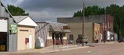
Downtown Page | |
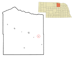 Location of Page, Nebraska | |
| Coordinates: 42°24′1″N 98°25′7″W / 42.40028°N 98.41861°WCoordinates: 42°24′1″N 98°25′7″W / 42.40028°N 98.41861°W | |
| Country | United States |
| State | Nebraska |
| County | Holt |
| Area[1] | |
| • Total | 0.24 sq mi (0.62 km2) |
| • Land | 0.24 sq mi (0.62 km2) |
| • Water | 0 sq mi (0 km2) |
| Elevation | 1,962 ft (598 m) |
| Population (2010)[2] | |
| • Total | 166 |
| • Estimate (2012[3]) | 165 |
| • Density | 691.7/sq mi (267.1/km2) |
| Time zone | Central (CST) (UTC-6) |
| • Summer (DST) | CDT (UTC-5) |
| ZIP code | 68766 |
| Area code(s) | 402 |
| FIPS code | 31-38085[4] |
| GNIS feature ID | 0831951[5] |
Page is a village in Holt County, Nebraska, United States. The population was 166 at the 2010 census.
History
Page had its start in the 1880s by the building of the railroad through that territory.[6] It was named for the Page family of pioneer settlers.[7]
Geography
Page is located at 42°24′1″N 98°25′7″W / 42.40028°N 98.41861°W (42.400412, -98.418682).[8]
According to the United States Census Bureau, the village has a total area of 0.24 square miles (0.62 km2), all of it land.[1]
Demographics
| Historical population | |||
|---|---|---|---|
| Census | Pop. | %± | |
| 1920 | 271 | — | |
| 1930 | 359 | 32.5% | |
| 1940 | 335 | −6.7% | |
| 1950 | 275 | −17.9% | |
| 1960 | 230 | −16.4% | |
| 1970 | 177 | −23.0% | |
| 1980 | 172 | −2.8% | |
| 1990 | 191 | 11.0% | |
| 2000 | 157 | −17.8% | |
| 2010 | 166 | 5.7% | |
| Est. 2015 | 164 | [9] | −1.2% |
2010 census
As of the census[2] of 2010, there were 166 people, 75 households, and 49 families residing in the village. The population density was 691.7 inhabitants per square mile (267.1/km2). There were 92 housing units at an average density of 383.3 per square mile (148.0/km2). The racial makeup of the village was 98.2% White, 1.2% Native American, and 0.6% Asian.
There were 75 households of which 26.7% had children under the age of 18 living with them, 62.7% were married couples living together, 1.3% had a female householder with no husband present, 1.3% had a male householder with no wife present, and 34.7% were non-families. 32.0% of all households were made up of individuals and 18.7% had someone living alone who was 65 years of age or older. The average household size was 2.21 and the average family size was 2.78.
The median age in the village was 43.5 years. 22.3% of residents were under the age of 18; 4.7% were between the ages of 18 and 24; 23.4% were from 25 to 44; 27% were from 45 to 64; and 22.3% were 65 years of age or older. The gender makeup of the village was 50.6% male and 49.4% female.
2000 census
As of the census[4] of 2000, there were 157 people, 79 households, and 42 families residing in the village. The population density was 642.8 people per square mile (252.6/km²). There were 95 housing units at an average density of 389.0 per square mile (152.8/km²). The racial makeup of the village was 100.00% White.
There were 79 households out of which 16.5% had children under the age of 18 living with them, 51.9% were married couples living together, 1.3% had a female householder with no husband present, and 46.8% were non-families. 45.6% of all households were made up of individuals and 27.8% had someone living alone who was 65 years of age or older. The average household size was 1.99 and the average family size was 2.83.
In the village the population was spread out with 15.9% under the age of 18, 7.6% from 18 to 24, 24.8% from 25 to 44, 19.7% from 45 to 64, and 31.8% who were 65 years of age or older. The median age was 46 years. For every 100 females there were 109.3 males. For every 100 females age 18 and over, there were 100.0 males.
As of 2000 the median income for a household in the village was $29,643, and the median income for a family was $48,750. Males had a median income of $38,125 versus $30,313 for females. The per capita income for the village was $18,286. About 13.0% of families and 18.5% of the population were below the poverty line, including 15.6% of those under the age of eighteen and 13.7% of those sixty five or over.
Notable people
- Marian Heiss Price - Former member of the Nebraska Legislature.
References
- 1 2 "US Gazetteer files 2010". United States Census Bureau. Retrieved 2012-06-24.
- 1 2 "American FactFinder". United States Census Bureau. Retrieved 2012-06-24.
- ↑ "Population Estimates". United States Census Bureau. Retrieved 2013-05-29.
- 1 2 "American FactFinder". United States Census Bureau. Retrieved 2008-01-31.
- ↑ "US Board on Geographic Names". United States Geological Survey. 2007-10-25. Retrieved 2008-01-31.
- ↑ "Page, Holt County". Center for Advanced Land Management Information Technologies. University of Nebraska. Retrieved 13 August 2014.
- ↑ Fitzpatrick, Lillian L. (1960). Nebraska Place-Names. University of Nebraska Press. p. 78. ISBN 0-8032-5060-6. A 1925 edition is available for download at University of Nebraska—Lincoln Digital Commons.
- ↑ "US Gazetteer files: 2010, 2000, and 1990". United States Census Bureau. 2011-02-12. Retrieved 2011-04-23.
- ↑ "Annual Estimates of the Resident Population for Incorporated Places: April 1, 2010 to July 1, 2015". Retrieved July 2, 2016.
- ↑ "Census of Population and Housing". Census.gov. Retrieved June 4, 2015.
Municipalities and communities of Holt County, Nebraska, United States | ||
|---|---|---|
| Cities | ||
| Villages | ||
| Townships |
| |
| Unincorporated communities | ||