Painesville, Ohio
| Painesville, Ohio | |
|---|---|
| City | |
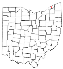
 Location of Painesville, Ohio | |
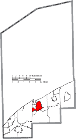
 Location of Painesville in Lake County | |
| Coordinates: 41°43′22″N 81°14′59″W / 41.72278°N 81.24972°WCoordinates: 41°43′22″N 81°14′59″W / 41.72278°N 81.24972°W | |
| Country | United States |
| State | Ohio |
| County | Lake |
| Settled | 1800 |
| Area[1] | |
| • Total | 7.02 sq mi (18.18 km2) |
| • Land | 6.29 sq mi (16.29 km2) |
| • Water | 0.73 sq mi (1.86 km2) |
| Elevation[2] | 676 ft (206 m) |
| Population (2010)[3] | |
| • Total | 19,563 |
| • Estimate (2012[4]) | 19,634 |
| • Density | 3,110.2/sq mi (1,200.9/km2) |
| Time zone | Eastern (EST) (UTC-5) |
| • Summer (DST) | EDT (UTC-4) |
| ZIP code | 44077 |
| Area code(s) | 440 |
| FIPS code | 39-59416[5] |
| GNIS feature ID | 1044274[2] |
| Website |
www |
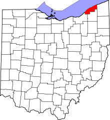
Painesville is a city in and the county seat of Lake County, Ohio, United States,[6] located along the Grand River. Its population was 19,563 at the 2010 census.
Painesville is the home of Lake Erie College, Morley Library, and the 284-acre Historic Downtown Painesville Recreation Area.[7]
History
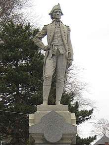
Long occupied by various Indian tribes, this area was not settled by Americans in any number until after the Revolutionary War. It was still considered part of the Connecticut Western Reserve. General Edward Paine (1746–1841), who had served as a captain in the Connecticut militia during the war, and John Walworth arrived in 1800 with a party of sixty-six settlers, among the first in the Western Reserve. General Paine later represented the region in the territorial legislature of the Northwest Territory.
In 1800 the Western Reserve became Trumbull County and at the first Court of Quarter Sessions, the county was divided into eight townships. The smallest of these townships was named Painesville, for General Paine, and encompassed what later became the townships of Perry, Leroy, Hambden, Concord, Chardon, Mentor, and Kirtland. The township government was organized in 1802. The post office in Painesville was opened in 1803 with John Walworth as postmaster.
In what was to become the commercial center of the township was a settlement called Oak Openings, its name being descriptive of the scrub oaks and sandy soil. It was here in 1805 that Gen. Henry Champion laid out a village plat and called it Champion, a name that it carried only until incorporation in 1832, when the name "Painesville" was chosen in honor of General Paine. Two of his descendants, Eleazer A. Paine and Halbert E. Paine, later served as Union Army generals during the American Civil War.

In 1840 Lake County was created from portions of Geauga and Cuyahoga Counties, and Painesville was made the county seat and a courthouse erected. In 1852, the community of Painesville became a village, and in 1902 the village attained city status.
Geography
Painesville is located at 41°43′22″N 81°14′59″W / 41.72278°N 81.24972°W (41.722793, -81.249597).[8]
According to the United States Census Bureau, the city has a total area of 7.02 square miles (18.18 km2), of which 6.29 square miles (16.29 km2) is land and 0.73 square miles (1.89 km2) is water.[1]
Painesville and Concord townships, along with the village of Fairport Harbor and the city of Mentor, are adjacent to Painesville.
Demographics
| Historical population | |||
|---|---|---|---|
| Census | Pop. | %± | |
| 1820 | 257 | — | |
| 1830 | 499 | 94.2% | |
| 1840 | 1,014 | 103.2% | |
| 1860 | 2,649 | — | |
| 1870 | 3,728 | 40.7% | |
| 1880 | 3,841 | 3.0% | |
| 1890 | 4,755 | 23.8% | |
| 1900 | 5,024 | 5.7% | |
| 1910 | 5,501 | 9.5% | |
| 1920 | 7,272 | 32.2% | |
| 1930 | 10,944 | 50.5% | |
| 1940 | 12,235 | 11.8% | |
| 1950 | 14,432 | 18.0% | |
| 1960 | 16,116 | 11.7% | |
| 1970 | 16,536 | 2.6% | |
| 1980 | 16,351 | −1.1% | |
| 1990 | 15,699 | −4.0% | |
| 2000 | 17,503 | 11.5% | |
| 2010 | 19,563 | 11.8% | |
| Est. 2015 | 19,776 | [9] | 1.1% |
| Sources:[10][11][5][12] | |||
Painesville's Hispanic population increased elevenfold between 1990 and 2010. New residents were primarily immigrants from León, Guanajuato, the ninth-largest metropolitan region in Mexico. They had settled in Painesville after finding work in its plant nurseries.[13]
2010 census
As of the census[3] of 2010, there were 19,563 people, 7,095 households, and 4,381 families residing in the city. The population density was 3,110.2 inhabitants per square mile (1,200.9/km2). There were 7,867 housing units at an average density of 1,250.7 per square mile (482.9/km2). The racial makeup of the city was 68.2% White, 13.1% African American, 0.3% Native American, 0.8% Asian, 13.2% from other races, and 4.5% from two or more races. Hispanic or Latino of any race were 22.0% of the population.
There were 7,095 households of which 37.2% had children under the age of 18 living with them, 37.8% were married couples living together, 18.4% had a female householder with no husband present, 5.5% had a male householder with no wife present, and 38.3% were non-families. 29.9% of all households were made up of individuals and 8.2% had someone living alone who was 65 years of age or older. The average household size was 2.64 and the average family size was 3.33.
The median age in the city was 30.2 years. 28.3% of residents were under the age of 18; 12.6% were between the ages of 18 and 24; 29.9% were from 25 to 44; 20.5% were from 45 to 64; and 8.7% were 65 years of age or older. The gender makeup of the city was 50.3% male and 49.7% female.
2000 census
As of the census[5] of 2000, there were 17,503 people, 6,525 households, and 4,032 families residing in the city. The population density was 2,928.6 people per square mile (1,130.1/km²). There were 6,933 housing units at an average density of 1,160.0 per square mile (447.6/km²). The racial makeup of the city was 76.99% White, 12.93% African American, 0.29% Native American, 0.42% Asian, 0.01% Pacific Islander, 6.50% from other races, and 2.86% from two or more races. Hispanic or Latino of any race were 12.89% of the population. 15.2% were of German, 9.7% Irish, 9.4% Italian, 8.3% English and 5.5% American ancestry according to Census 2000. 85.6% spoke English and 13.2% Spanish as their first language.
There were 6,525 households out of which 34.4% had children under the age of 18 living with them, 40.4% were married couples living together, 16.6% had a female householder with no husband present, and 38.2% were non-families. 31.2% of all households were made up of individuals and 9.6% had someone living alone who was 65 years of age or older. The average household size was 2.55 and the average family size was 3.22.
In the city the population was spread out with 27.7% under the age of 18, 12.1% from 18 to 24, 32.5% from 25 to 44, 17.4% from 45 to 64, and 10.2% who were 65 years of age or older. The median age was 30 years. For every 100 females there were 97.0 males. For every 100 females age 18 and over, there were 93.7 males.
The median income for a household in the city was $34,842, and the median income for a family was $41,000. Males had a median income of $31,082 versus $23,346 for females. The per capita income for the city was $15,391. About 13.4% of families and 16.0% of the population were below the poverty line, including 22.6% of those under age 18 and 10.4% of those age 65 or over.
Schools
Public education in the city of Painesville is provided by the Painesville City Schools.
The City of Painesville is also home to Lake Erie College, which is well known around the world for equine studies. The former Andrews Osborne Academy's Painesville campus became part of Lake Erie College in 2008.[14]
Feature film location
The area in and around the City of Painesville was used as the location for the filming of the 1964 feature film One Potato, Two Potato.[15] The film, a 1964 Cannes Film Festival[16] selection, provides a glimpse of that era in the city's downtown, including its central park and surrounding architecture. The Lake County Courthouse and Painesville City Hall remain today. The Parmly Hotel, seen in the opening credits, and occasionally throughout the film is gone, replaced by a shopping mall and office complex.
Notable people
- John S. Casement - Civil War General.
- Joe Dolce - Singer-songwriter.
- Harlan Ellison - Author.
- Shell Kepler - Actor.
- George Trumbull Ladd - Psychologist.
- Eschines P. Matthews - Wisconsin State Assemblyman.
- Tom Orosz - NFL player.
- Byron Paine - Wisconsin Supreme Court Justice.
- Paul Ryczek - NFL player.
- Jason Short - NFL player.
- Don Shula - NFL player, coach.
References
- 1 2 "US Gazetteer files 2010". United States Census Bureau. Retrieved 2013-01-06.
- 1 2 "US Board on Geographic Names". United States Geological Survey. 2007-10-25. Retrieved 2008-01-31.
- 1 2 "American FactFinder". United States Census Bureau. Retrieved 2013-01-06.
- ↑ "Population Estimates". United States Census Bureau. Retrieved 2013-06-17.
- 1 2 3 "American FactFinder". United States Census Bureau. Retrieved 2008-01-31.
- ↑ "Find a County". National Association of Counties. Retrieved 2011-06-07.
- ↑ Lammers, Jacob (2009-12-208). "Recreation area in downtown Painesville proposed to council". The News-Herald. Retrieved 2011-06-17. Check date values in:
|date=(help) - ↑ "US Gazetteer files: 2010, 2000, and 1990". United States Census Bureau. 2011-02-12. Retrieved 2011-04-23.
- ↑ "Annual Estimates of the Resident Population for Incorporated Places: April 1, 2010 to July 1, 2015". Retrieved July 2, 2016.
- ↑ "Number of Inhabitants: Ohio" (PDF). 18th Census of the United States. U.S. Census Bureau. Retrieved 22 November 2013.
- ↑ "Ohio: Population and Housing Unit Counts" (PDF). U.S. Census Bureau. Retrieved 22 November 2013.
- ↑ "Incorporated Places and Minor Civil Divisions Datasets: Subcounty Population Estimates: April 1, 2010 to July 1, 2012". U.S. Census Bureau. Retrieved 25 November 2013.
- ↑ Garcia Cano, Regina (2011-10-24). "Painesville's Hispanic Community Doubles in 10 Years, Multiplies 11 Times since 1990". The Plain Dealer. Retrieved 2011-10-25.
- ↑ Klepach, Sandra M. (2008-08-26). "Andrews Osborne Academy goes coed". The News-Herald. Retrieved 2009-05-27.
- ↑ "Pulled in by Painesville past's 'Potato'".
- ↑ "1964 Cannes Film Festival Selections".
External links
| Wikimedia Commons has media related to Painesville, Ohio. |
