Panalatinga Road, Adelaide
| Panalatinga Road South Australia | |
|---|---|
 | |
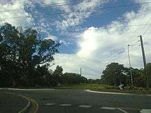
| Panalatinga Road, looking south at the intersection with Pimpala Road | |
| General information | |
| Type | Road |
| Length | 5.6 km (3.5 mi) |
| Major junctions | |
| North end |
|
|
Main South Road & Southern Expressway, Kenihans Road, Reynell Road, Pimpala Road, Bains Road, Wheatsheaf Road | |
| South end | Cox Hill Road, Onkaparinga Hills, South Australia |
| Location(s) | |
| Major suburbs | Reynella East, Old Reynella, Woodcroft, Morphett Vale |
| |
Panalatinga Road is a north-south minor arterial road in the southern suburbs of Adelaide. It runs from the junction of Main South Road and the Southern Expressway in Reynella, and heads south past Wheatsheaf Road where it terminates soon after, continuing as Coxs Hill Road into the Onkaparinga Hills. The road is a four lane dual carriageway for the 4.6 km length north of Wheatsheaf Road, and a two lane single carriageway for the 1 km to the south. The entire road has a speed limit of 80 km/h, and is used as an alternative to South Road and local road States Road. The majority of southbound traffic exits at Wheatsheaf Road, where the road reduces to a single lane, and the right southbound and left northbound lane are made for access to/from Wheatsheaf Road. The Panalatinga Creek runs under the road in the northern section, which gives this road its name. It is derived from the Kaurna name Pandlotinga, with the 'inga' suffix meaning 'path of water'[1] which is often mispronounced as Panatalinga.
History
Panalatinga Road was once a more rural-style road, being entirely like the southern-most extent of the current road, being only a two lane road, with no median strip or kerbs. There were also no traffic lights along the road, with the exception of the junction with South Road at the north, but not at Kenihans Road, and the Southern Expressway did not exist at the time, making these intersections much simpler than in the current day. There was also a roundabout at the intersection with Reynell Road, which has since been upgraded to a signalised intersection. The intersections at Pimpala Road and Bains Road had no traffic management system, as the eastern lengths of these roads were very undeveloped still, and mainly occupied by farming land, these intersections did not have a high level of danger associated with them at the time.[2] In the '70s and '80s, Panalatinga Road did extend further to the south, heading past Cox's Hill Road and to Spriggs Road, then continuing as what's currently known as Kimbley Road, and on to Penney's Hill Road. The road then continued as a dirt trail to Piggott Range Road.[3] The terrain in this now closed southern extent is far from flat, with a large number of crests, making it unsafe to convert into a main thoroughfare when the road was upgraded in the 90's.
Extension
Since the upgrade of Panalatinga Road, and the termination of the road south of Cox's Hill Road, there has been an open area adjacent to Taylors Road which heads towards the roundabout of States and Doctors Road, that the South Australian Government has owned the land with the intention of eventually extending Panalatinga Road down to this point. This proposed road is listed in some road maps, as Margaret Road. Local power lines have been moved underground in preparation of this change, but the project has never been given the 'OK' to go ahead. For years, community members have requested this extension, but the government refuse to take action, claiming the Southern Expressway provides an adequate diversion for traffic off of Panalatinga Road,[4][5] despite being significantly to the west, and not benefiting most drivers with destinations east of South Road. The current alternative to the extension, Wheatsheaf road and States road are often quite congested, particularly before and after school, with a number of schools within the vicinity. With the extension, through traffic could avoid this traffic. The Hackham CFS would also majorly benefit from the extension, as it would reduce travel times to the Onkaparinga Hills, Woodcroft and Reynella, and would save them trying to fight the States Road traffic.
See also
External links
- Extend Panalatinga Road A Facebook group aimed towards making the Panalatinga Road extension a reality
References
- ↑ "Panalatinga Creek". Government of South Australia, Adelaide & Mount Lofty Ranges Natural Resources Management Board. Retrieved 30 April 2012.
- ↑ Adelaide Street Directory, 28th Edition. Adelaide: UBD. 1990. ISBN 0-7319-0115-0.
- ↑ Adelaide Street Directory, 17th Edition. UBD. c. 1979.
- ↑ "Calls to Extend Panalatinga Road". Southern Times Messenger. 21 June 2012. Retrieved 29 April 2012.
- ↑ "Rebuff to Panalatinga Road Plan". Southern Times Messenger. 28 June 2011. Retrieved 29 April 2012.