Glen Osmond Road, Adelaide
| Glen Osmond Road South Australia | |
|---|---|
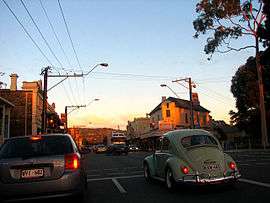 | |
| Peak hour traffic on Glen Osmond Road | |
| Coordinates | 34°56′26″S 138°36′57″E / 34.940594°S 138.615773°E |
| General information | |
| Type | Road |
| Length | 7 km (4.3 mi) |
| Route number(s) |
|
| Former route number |
|
| Major junctions | |
| Northwest end |
|
|
| |
| Southeast end |
|
| Location(s) | |
| Major suburbs | Parkside, Eastwood, Fullarton, Frewville, Myrtle Bank, Glen Osmond |
| |
Glen Osmond Road is a major state Highway 1 road in the city of Adelaide, South Australia.[1] Connecting the Adelaide city centre with the Adelaide Hills via the South Eastern Freeway; Glen Osmond Road carries half of Adelaide's freight traffic and is the major commuter route from the southern Adelaide Hills. It has intersections at Greenhill Road, Fullarton Road, Cross Road and Portrush Road.
Glen Osmond Road houses a strip shopping precinct on the section between Greenhill and Fullarton Roads.[2] The precinct is largely populated by independent boutiques. It is a community main street stationed in the leafy suburbs of Adelaide’s south east. It was earlier known as "The Gateway" because of its connection between the Adelaide CBD and Hills.
Glen Osmond Road Precinct Association
The Glen Osmond Road Precinct Association (GORPA) is an association guiding the growth and development of Glen Osmond Road and marketing the local business community. GORPA is funded by an exclusive rate applied to properties on the City of Unley side of Glen Osmond Road.[3]
Glen Osmond Road forms the boundary of two Council areas — the City of Unley and City of Burnside. The councils work together to promote the local community. Each council has staff dedicated for Business and Economic Development.[4]
Major intersections
| LGA[5] | Location[5] | km[6] | mi | Destinations[6] | Notes |
|---|---|---|---|---|---|
| Adelaide | Adelaide | 0 | 0.0 | South Terrace | |
| 0.65 | 0.40 | Hutt Road | |||
| City of Adelaide, City of Burnside, City of Unley | Adelaide, Parkside, Eastwood | 1.0 | 0.62 | ||
| City of Burnside, City of Unley | Eastwood, Glenside, Frewville, Fullarton, Parkside | 2.0 | 1.2 | Glen Osmond Road carries Route A1 southeast of this intersection; Fullarton Road carries it north. | |
| City of Burnside, City of Unley, City of Mitcham | Glen Osmond, Urrbrae, Myrtle Bank | 4.6 | 2.9 | Continues as | |
| |||||
See also
![]() Australian Roads portal
Australian Roads portal
References
- ↑ 2003 Adelaide Street Directory, 41st Edition. UBD (A Division of Universal Press Pty Ltd). 2003. ISBN 0-7319-1441-4.
- ↑ Not So Naked, Q&A with If You're a Bird boutique's Lanie Evans
- ↑ "The Association". Glen Osmond Road. Glen Osmond Road traders. Retrieved 17 May 2016.
- ↑ "Local Council". Glen Osmand Road. Glen Osmond Road traders. Retrieved 17 May 2016.
- 1 2 "Property Location Browser". Government of South Australia. Retrieved 17 May 2016.
- 1 2 Google (17 May 2016). "Glen Osmond Road" (Map). Google Maps. Google. Retrieved 17 May 2016.