Pant Glas
| Pant Glas | |
 The hamlet from the west |
|
 Pant Glas |
|
| OS grid reference | SH471473 |
|---|---|
| Community | Clynnog |
| Principal area | Gwynedd |
| Country | Wales |
| Sovereign state | United Kingdom |
| Post town | GARNDOLBENMAEN |
| Postcode district | LL51 |
| Dialling code | 01766 |
| Police | North Wales |
| Fire | North Wales |
| Ambulance | Welsh |
| EU Parliament | Wales |
| UK Parliament | Dwyfor Meirionnydd |
| Welsh Assembly | Dwyfor Meirionnydd |
Coordinates: 53°00′04″N 4°16′41″W / 53.001°N 4.278°W
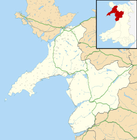
Pant Glas (Welsh for Green Hollow - in Welsh, as in other Celtic languages, "glas" may mean both 'green' and 'blue') is a hamlet on the A487 road in Gwynedd, Wales. Historically in Caernarfonshire, it is located approximately 10 miles (16 km) south of Caernarfon, 9 miles (14 km) miles north-west of Porthmadog, and 10 miles (16 km) north-east of Pwllheli. Nearby is the former Pant Glas railway station on the closed Carnarvonshire Railway. The station closed in January 1957. The railway closed in 1964 and has since been replaced with the Lôn Eifion cycle track. Also nearby is the Arfon transmitting station, the tallest structure in Wales.
Welsh opera singer Bryn Terfel was brought up at Fferm Nant Cyll Ucha, located just outside the hamlet.[1]
In February 2005, the speed limit for the A487 in Pant Glas was reduced from 50 mph (80 km/h) to 40 mph (64 km/h).[2]
References
- ↑ "Bryn Terfel; One of the world's most renowned opera stars.". BBC - North West Wales Arts. BBC. Retrieved 13 August 2009.
- ↑ "The A487 Trunk Road (Pant Glas, Gwynedd) (40 MPH Speed Limit) Order 2005.". Welsh Assembly Government. Retrieved 13 August 2009.
External links
![]() Media related to Pant Glas at Wikimedia Commons
Media related to Pant Glas at Wikimedia Commons
