Patkai
| Patkai Range | |
|---|---|
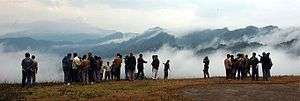 Patkai hill summits seen from the Pangsau Pass | |
| Highest point | |
| Peak | Mount Saramati[1] |
| Elevation | 3,826 m (12,552 ft) |
| Coordinates | 27°0′N 96°0′E / 27.000°N 96.000°ECoordinates: 27°0′N 96°0′E / 27.000°N 96.000°E |
| Geography | |
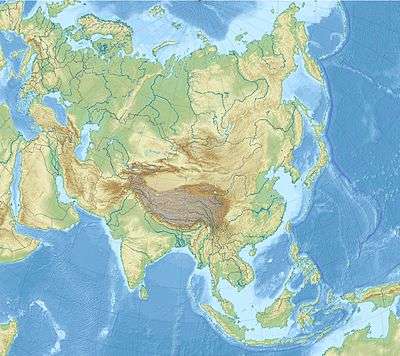 Patkai Range Location in Asia | |
| Location | India, Burma |
The Pat-kai (Pron: ˈpʌtˌkaɪ) or Patkai Bum meaning "to cut (pat) chicken (Kai)" in Tai-Ahom language are the hills on India's north-eastern border with Burma. They were created by the same tectonic processes that resulted in the formation of the Himalayas in the Mesozoic.
Geography
The Patkai hill range are not as rugged as the Himalayas and the peaks are much lower in height. Features of the range include conical peaks, steep slopes and deep valleys.
Three mountain ranges come under the Patkai. The Patkai-Bum (Burmese Kumon Taungdan),[2] the Garo-Khasi-Jaintia, and the Lushai Hills, highest point Phawngpui Tlang, also known as 'Blue Mountain'. The Garo-Khasi range is in the Indian state of Meghalaya. Mawsynram and Cherrapunji, on the windward side of these hills are the world's wettest places, having the highest annual rainfall.
The climate range from temperate to alpine due to differencies in altitude.
The Pangsau Pass offers the most important route through the Patkai. The Ledo Road was built through Pangsau Pass as a strategic supply road built over the range during World War II to link India with the Burma Road into China.
Indian states along the Patkai
See also
Notes
External links
 Media related to Patkai range at Wikimedia Commons
- The Geology of Burma (Myanmar)