Paugussett State Forest
| Paugussett State Forest | |
| Connecticut State Forest | |
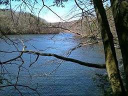 View of Pond Brook inlet from Paugussett State Forest's Upper Block in Newtown, Connecticut | |
| Country | |
|---|---|
| State | |
| County | Fairfield |
| Town | Newtown |
| Elevation | 371 ft (113 m) [1] |
| Coordinates | 41°24′47″N 73°12′24″W / 41.41306°N 73.20667°WCoordinates: 41°24′47″N 73°12′24″W / 41.41306°N 73.20667°W [1] |
| Area | 1,947 acres (788 ha) [2] |
| Established | 1940s [3] |
| Management | Connecticut Department of Energy and Environmental Protection |
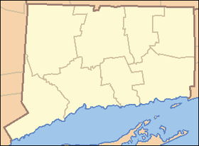 Location in Connecticut | |
| Website: Paugussett State Forest | |
Paugussett State Forest is a Connecticut state forest with two separate sections located on impoundments of the Housatonic River in the town of Newtown.[4] The forest's Upper Block encompasses approximately 800 acres (320 ha)[3] on the western shore of Lake Lillinonah. It offers boating access to the river and hiking on the blue-blazed Lillinonah Trail. The forest's Lower Block encompasses approximately 1,200 acres (490 ha)[3] on the western shore of Lake Zoar and offers hiking on the blue-blazed Zoar Trail.
References
- 1 2 "Paugussett State Forest". Geographic Names Information System. United States Geological Survey.
- ↑ Legislative Program Review and Investigations Committee (January 23, 2014). "State Parks and Forests: Funding" (PDF). Staff Findings and Recommendations. Connecticut General Assembly. p. A-3. Retrieved March 20, 2014.
- 1 2 3 "Connecticut State Forests Seedling Letterbox Series - Clues for Paugussett State Forest". State Parks and Forests. Connecticut Department of Energy and Environmental Protection. Retrieved 2013-09-30.
- ↑ "Paugussett State Forest". State Parks and Forests. Connecticut Department of Energy and Environmental Protection. Retrieved 2013-09-30.
Additional reading
- Lillinonah Trail Connecticut Museum Quest
- Paugussett State Forest Berkshire Hiking
External links
- Paugussett State Forest Connecticut Department of Energy and Environmental Protection
- Paugussett State Forest Upper Block Map Connecticut Department of Energy and Environmental Protection
- Paugussett State Forest Lower Block Map Connecticut Department of Energy and Environmental Protection
This article is issued from Wikipedia - version of the 11/22/2016. The text is available under the Creative Commons Attribution/Share Alike but additional terms may apply for the media files.