Payson, Illinois
| Payson, Illinois | |
| Village | |
| Country | United States |
|---|---|
| State | Illinois |
| County | Adams |
| Township | Payson |
| Coordinates | 39°49′1″N 91°14′33″W / 39.81694°N 91.24250°WCoordinates: 39°49′1″N 91°14′33″W / 39.81694°N 91.24250°W |
| Area | 1.12 sq mi (3 km2) |
| - land | 1.12 sq mi (3 km2) |
| - water | 0.00 sq mi (0 km2) |
| Population | 1,026 (2010) |
| Density | 916.1/sq mi (354/km2) |
| Timezone | CST (UTC-6) |
| - summer (DST) | CDT (UTC-5) |
| Postal code | 62360 |
| Area code | 217 |
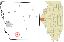 Location in Adams County and the state of Illinois. | |
.svg.png) Location of Illinois in the United States | |
| Wikimedia Commons: Payson, Illinois | |
Payson is a village in Adams County, Illinois, United States. The population was 1,026 at the 2010 census.[1] It is part of the Quincy, IL–MO Micropolitan Statistical Area.
History
During the 1860 presidential campaign, the residents of Payson erected a pole on which they hung banners supporting the Democratic candidate, Stephen Douglas, and an effigy of Abraham Lincoln riding a rail. This resulted in two confrontations with the Quincy Wide Awakes, the Republican para-military organization, on August 25–26, 1860. During the second confrontation, shots were fired at the Wide Awakes, resulting in injuries. This action was related to the "Stone's Prairie Riot" at nearby Plainville.[2]
Geography
According to the 2010 census, Payson has a total area of 1.12 square miles (2.90 km2), all land.[3]
Demographics
| Historical population | |||
|---|---|---|---|
| Census | Pop. | %± | |
| 1900 | 465 | — | |
| 1910 | 467 | 0.4% | |
| 1920 | 453 | −3.0% | |
| 1930 | 414 | −8.6% | |
| 1940 | 456 | 10.1% | |
| 1950 | 490 | 7.5% | |
| 1960 | 502 | 2.4% | |
| 1970 | 589 | 17.3% | |
| 1980 | 1,065 | 80.8% | |
| 1990 | 1,114 | 4.6% | |
| 2000 | 1,066 | −4.3% | |
| 2010 | 1,026 | −3.8% | |
| Est. 2015 | 1,011 | [4] | −1.5% |
As of the census[6] of 2000, there were 1,066 people, 389 households, and 289 families residing in the village. The population density was 929.4 people per square mile (357.9/km2). There were 409 housing units at an average density of 356.6 per square mile (137.3/km2). The racial makeup of the village was 98.78% White, 0.09% African American, 0.09% Pacific Islander, and 1.03% from two or more races. Hispanic or Latino of any race were 0.56% of the population.
There were 389 households out of which 39.8% had children under the age of 18 living with them, 61.2% were married couples living together, 10.8% had a female householder with no husband present, and 25.7% were non-families. 22.6% of all households were made up of individuals and 13.1% had someone living alone who was 65 years of age or older. The average household size was 2.74 and the average family size was 3.24.
In the village the population was spread out with 29.9% under the age of 18, 8.4% from 18 to 24, 31.1% from 25 to 44, 18.9% from 45 to 64, and 11.6% who were 65 years of age or older. The median age was 33 years. For every 100 females there were 96.7 males. For every 100 females age 18 and over, there were 89.1 males.
The median income for a household in the village was $37,321, and the median income for a family was $40,789. Males had a median income of $30,880 versus $20,231 for females. The per capita income for the village was $14,541. About 7.1% of families and 9.3% of the population were below the poverty line, including 11.6% of those under age 18 and 12.2% of those age 65 or over.
Public education is provided at Payson-Seymour Elementary School and Payson-Seymour High School.
Notable person
- Ralph Works, pitcher for the Cincinnati Reds and Detroit Tigers
Registered Historic Places
Footnotes
- ↑ "Geographic Identifiers: 2010 Demographic Profile Data (G001): Payson village, Illinois". U.S. Census Bureau, American Factfinder. Retrieved May 7, 2013.
- ↑ Iris A. Nelson and Walter S. Waggoner, "The Stone's Prairie Riot of 1860", Journal of Illinois History, Vol. 5, p. 19 (Spring 2002)
- ↑ "G001 - Geographic Identifiers - 2010 Census Summary File 1". United States Census Bureau. Retrieved 2015-12-25.
- ↑ "Annual Estimates of the Resident Population for Incorporated Places: April 1, 2010 to July 1, 2015". Retrieved July 2, 2016.
- ↑ "Census of Population and Housing". Census.gov. Archived from the original on May 11, 2015. Retrieved June 4, 2015.
- ↑ "American FactFinder". United States Census Bureau. Retrieved 2008-01-31.
External links
Municipalities and communities of Adams County, Illinois, United States | ||
|---|---|---|
| City | ||
| Town | ||
| Villages | ||
| Townships | ||
| Unincorporated communities | ||