Pennsylvania Route 27
| |||||||
|---|---|---|---|---|---|---|---|
 | |||||||
| Route information | |||||||
| Maintained by PennDOT | |||||||
| Length: | 65.7 mi[1] (105.7 km) | ||||||
| Major junctions | |||||||
| West end: | Park Avenue in Meadville | ||||||
| East end: |
| ||||||
| Location | |||||||
| Counties: | Crawford, Venango, Warren | ||||||
| Highway system | |||||||
| |||||||

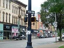
Pennsylvania Route 27 (PA 27) is a 65.7-mile-long (105.7 km) state highway located in northwest Pennsylvania. The western terminus of the route is at Park Avenue near U.S. Route 6 and U.S. Route 19 in Meadville. The eastern terminus is at Pennsylvania Route 69 three miles (5 km) south of Sugar Grove.
History
From 1927 to 1928, PA 27 between U.S. Route 322 in Meadville and US 6 in the Pittsfield Township community of Pittsfield was known as the western segment of Pennsylvania Route 47. In 1928, west PA 47 was decommissioned and replaced with PA 27.
In April 2003, the western terminus of the route was moved from US 6 and US 19 to Park Avenue, which had been the western terminus of PA 27 from 1928 to 1974. However, west of Park Avenue, PA 27 is still signed along North St. Market St., Terrace St and Reynolds Ave. to connect with US 6 and US 19.
Major intersections
| County | Location[2] | mi[3] | km | Destinations | Notes |
|---|---|---|---|---|---|
| Crawford | Meadville | 0.000 | 0.000 | Park Avenue | |
| 0.122 | 0.196 | Southern terminus of PA 86 | |||
| 0.762 | 1.226 | Western terminus of PA 77 | |||
| Randolph Township | 11.395 | 18.338 | Northern terminus of PA 173 | ||
| 12.459 | 20.051 | Eastern terminus of PA 198 | |||
| Troy Township | 16.448 | 26.470 | Northern terminus of PA 427 | ||
| Venango | Plum Township | 20.639 | 33.215 | Western end of concurrency with PA 428 | |
| 20.741 | 33.379 | Eastern end of concurrency with PA 428 | |||
| Crawford | Titusville | 27.152 | 43.697 | Western end of concurrency with PA 8 | |
| 27.362 | 44.035 | Northern terminus of PA 8 Truck | |||
| 27.594 | 44.408 | Eastern end of concurrency with PA 8; southern terminus of PA 89 | |||
| Venango | Oilcreek Township | 32.507 | 52.315 | Western end of concurrency with PA 277 | |
| Pleasantville | 33.205 | 53.438 | Northern terminus of PA 36 | ||
| 33.381 | 53.722 | Eastern end of concurrency with PA 277 | |||
| Warren | Pittsfield Township | 51.937 | 83.584 | Southern terminus of PA 426 | |
| 55.498 | 89.315 | Western end of concurrency with US 6 | |||
| Youngsville | 58.164 | 93.606 | Eastern end of concurrency with US 6 | ||
| Sugar Grove Township | 65.889 | 106.038 | |||
1.000 mi = 1.609 km; 1.000 km = 0.621 mi
| |||||
PA 27 Truck
| |
|---|---|
| Location: | Titusville, Pennsylvania |
| Existed: | 1980–present |
Pennsylvania Route 27 Truck is a 1⁄2-mile-long (0.80 km) truck route in Crawford County, Pennsylvania. In 1980, the designation was established to remove trucks from the complicated intersection with Pennsylvania Route 8 and to provide direct access for local trucks past the Titusville's small industrial area along St. John Street. For its entire length it is cosigned with Truck Route 8.
See also
 U.S. Roads portal
 Pennsylvania portal
References
- ↑ Google (June 20, 2013). "Pennsylvania Route 27" (Map). Google Maps. Google. Retrieved June 20, 2013.
- ↑ "Video Log". Pennsylvania Department of Transportation. Retrieved August 22, 2016.
- ↑ Bureau of Maintenance and Operations (January 2016). Roadway Management System Straight Line Diagrams (Report) (2015 ed.). Pennsylvania Department of Transportation. Retrieved August 22, 2016.
External links
| Wikimedia Commons has media related to Pennsylvania Route 27. |