Peoria, Ohio
| Peoria, Ohio | |
|---|---|
| Unincorporated community | |
 Peoria, Ohio Location of Peoria, Ohio | |
| Coordinates: 40°18′50″N 83°26′45″W / 40.31389°N 83.44583°W | |
| Country | United States |
| State | Ohio |
| Counties | Union |
| Elevation[1] | 1,030 ft (314 m) |
| Time zone | Eastern (EST) (UTC-5) |
| • Summer (DST) | EDT (UTC-4) |
| ZIP codes | 43067, 43040 |
| Area code(s) | 937 |
| GNIS feature ID | 1049075[1] |
Peoria is an unincorporated community in Liberty Township, Union County, Ohio, United States. It is located at 40°18′50″N 83°26′45″W / 40.31389°N 83.44583°WCoordinates: 40°18′50″N 83°26′45″W / 40.31389°N 83.44583°W,[2] along Raymond Road, about 1.75 miles south of Raymond and 6.5 miles northwest of Marysville.[3]
A post office was established in Peoria on September 26, 1872; it was closed on August 11, 1967.[4] The mail service is now sent through the Columbus regional mail sorting facility,[4] and distributed through the Marysville and Raymond local post offices.[5]
Origins
The town was originally platted by Joseph K. Richey in 1870. His plat included 28 "town lots" of roughly 66' by 165' size, about 1/4 acre per lot. The town was established at the junction of what were then the Erie Railroad and the Toledo & Ohio Central (T&OC) Railroad. The Peoria railroad station, situated at the grade crossing of the two lines, was the only depot in Liberty Township that could accommodate both freight and passengers. The station also featured water and a coaling tower. Remnants of the foundations of these structures are still visible today.
Largely because of the railroad station and the post office established there in 1872, Peoria quickly became a commercial center, featuring stores, churches, warehouses, small businesses—including a barber shop and a mill—and a public school. The population of the village was estimated at 150 in 1910.[6]
Peoria today
The commercial enterprises of the past in Peoria no longer exist. The school and the churches are also gone. With the closing of the post office in 1967, the town became primarily residential, with commerce flowing to nearby Raymond and Marysville. Population today is estimated to be roughly the same as in 1910—around 150.
References
- 1 2 "US Board on Geographic Names". United States Geological Survey. 2007-10-25. Retrieved 2008-01-31.
- ↑ U.S. Geological Survey Geographic Names Information System: Peoria, Ohio
- ↑ Rand McNally. The Road Atlas '06. Chicago: Rand McNally, 2006, 78.
- 1 2 U.S. Geological Survey Geographic Names Information System: Peoria Post Office
- ↑ ZipAtlas map of ZIP code 43067
- ↑ History of Union County: Its People, Industries, and Institutions, B.F. Bowen and Co., Inc., 1915
Municipalities and communities of Union County, Ohio, United States | ||
|---|---|---|
| Cities | 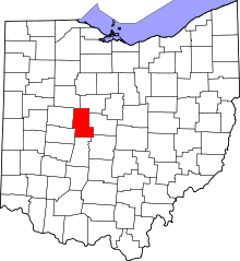 | |
| Villages | ||
| Townships | ||
| CDPs | ||
| Unincorporated communities | ||
| Ghost town | ||
| Footnotes | ‡This populated place also has portions in an adjacent county or counties | |