Perry, Michigan
| Perry, Michigan | |
|---|---|
| City | |
 Location of Perry, Michigan | |
| Coordinates: 42°49′35″N 84°13′14″W / 42.82639°N 84.22056°W | |
| Country | United States |
| State | Michigan |
| County | Shiawassee |
| Area[1] | |
| • Total | 3.18 sq mi (8.24 km2) |
| • Land | 2.92 sq mi (7.56 km2) |
| • Water | 0.26 sq mi (0.67 km2) |
| Elevation | 889 ft (271 m) |
| Population (2010)[2] | |
| • Total | 2,188 |
| • Estimate (2012[3]) | 2,118 |
| • Density | 749.3/sq mi (289.3/km2) |
| Time zone | Eastern (EST) (UTC-5) |
| • Summer (DST) | EDT (UTC-4) |
| ZIP code | 48872 |
| Area code(s) | 517 |
| FIPS code | 26-63700[4] |
| GNIS feature ID | 0634666[5] |
| Website | http://www.perry.mi.us/ |
Perry is a city in Shiawassee County in the U.S. state of Michigan. The population was 2,188 at the 2010 census. The city is located within Perry Township and has Perry High School and Middle School, as well as two elementary schools: Perry East Elementary and Perry West Elementary.
History
A post office has been in operation in Perry since 1850.[6] The city was named for Oliver Hazard Perry, an American naval commander in the War of 1812.[7] Perry was incorporated in 1893.[8]
Geography
According to the United States Census Bureau, the city has a total area of 3.18 square miles (8.24 km2), of which 2.92 square miles (7.56 km2) is land and 0.26 square miles (0.67 km2) is water.[1]
Demographics
| Historical population | |||
|---|---|---|---|
| Census | Pop. | %± | |
| 1880 | 298 | — | |
| 1890 | 440 | 47.7% | |
| 1900 | 641 | 45.7% | |
| 1910 | 720 | 12.3% | |
| 1920 | 734 | 1.9% | |
| 1930 | 835 | 13.8% | |
| 1940 | 879 | 5.3% | |
| 1950 | 1,203 | 36.9% | |
| 1960 | 1,370 | 13.9% | |
| 1970 | 1,531 | 11.8% | |
| 1980 | 2,051 | 34.0% | |
| 1990 | 2,163 | 5.5% | |
| 2000 | 2,065 | −4.5% | |
| 2010 | 2,188 | 6.0% | |
| Est. 2015 | 2,100 | [9] | −4.0% |
Coordinates: 42°49′35″N 84°13′10″W / 42.82639°N 84.21944°W
2010 census
As of the census[2] of 2010, there were 2,188 people, 823 households, and 584 families residing in the city. The population density was 749.3 inhabitants per square mile (289.3/km2). There were 902 housing units at an average density of 308.9 per square mile (119.3/km2). The racial makeup of the city was 96.8% White, 0.3% African American, 0.4% Native American, 0.3% Asian, 0.1% Pacific Islander, 0.5% from other races, and 1.6% from two or more races. Hispanic or Latino of any race were 1.7% of the population.
There were 823 households of which 39.0% had children under the age of 18 living with them, 51.0% were married couples living together, 14.7% had a female householder with no husband present, 5.2% had a male householder with no wife present, and 29.0% were non-families. 23.6% of all households were made up of individuals and 6.5% had someone living alone who was 65 years of age or older. The average household size was 2.66 and the average family size was 3.12.
The median age in the city was 34.1 years. 27.7% of residents were under the age of 18; 8.6% were between the ages of 18 and 24; 29.9% were from 25 to 44; 24.8% were from 45 to 64; and 9% were 65 years of age or older. The gender makeup of the city was 48.3% male and 51.7% female.
2000 census
As of the census[4] of 2000, there were 2,065 people, 748 households, and 563 families residing in the city. The population density was 724.1 per square mile (279.8/km²). There were 784 housing units at an average density of 274.9 per square mile (106.2/km²). The racial makeup of the city was 97.82% White, 0.19% African American, 0.44% Native American, 0.39% Asian, 0.05% from other races, and 1.11% from two or more races. Hispanic or Latino of any race were 0.73% of the population.
There were 748 households out of which 42.1% had children under the age of 18 living with them, 56.3% were married couples living together, 14.2% had a female householder with no husband present, and 24.7% were non-families. 21.7% of all households were made up of individuals and 7.9% had someone living alone who was 65 years of age or older. The average household size was 2.73 and the average family size was 3.16.
In the city the population was spread out with 30.7% under the age of 18, 7.5% from 18 to 24, 32.6% from 25 to 44, 21.0% from 45 to 64, and 8.3% who were 65 years of age or older. The median age was 33 years. For every 100 females there were 88.6 males. For every 100 females age 18 and over, there were 86.9 males.
The median income for a household in the city was $45,179, and the median income for a family was $48,977. Males had a median income of $38,587 versus $26,250 for females. The per capita income for the city was $16,769. About 3.4% of families and 5.7% of the population were below the poverty line, including 4.5% of those under age 18 and 18.5% of those age 65 or over.
References
- 1 2 "US Gazetteer files 2010". United States Census Bureau. Retrieved 2012-11-25.
- 1 2 "American FactFinder". United States Census Bureau. Retrieved 2012-11-25.
- ↑ "Population Estimates". United States Census Bureau. Retrieved 2013-06-03.
- 1 2 "American FactFinder". United States Census Bureau. Retrieved 2008-01-31.
- ↑ "US Board on Geographic Names". United States Geological Survey. 2007-10-25. Retrieved 2008-01-31.
- ↑ "Shiawassee County". Jim Forte Postal History. Retrieved 2 May 2015.
- ↑ "Ghost towns and post offices of Shiawassee County visited". The Argus-Press. October 2, 2000. p. 3. Retrieved 2 May 2015.
- ↑ History of Shiawasse3e County, Michigan
- ↑ "Annual Estimates of the Resident Population for Incorporated Places: April 1, 2010 to July 1, 2015". Retrieved July 2, 2016.
- ↑ "Census of Population and Housing". Census.gov. Retrieved June 4, 2015.
Municipalities and communities of Shiawassee County, Michigan, United States | ||
|---|---|---|
| Cities | 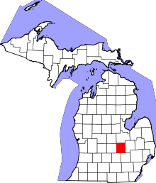 | |
| Villages | ||
| Charter townships | ||
| General law townships | ||
| Unincorporated communities | ||
| Footnotes | ‡This populated place also has portions in an adjacent county | |