Pharsalia, New York
| Pharsalia, New York | |
|---|---|
| Town | |
 Pharsalia Location within the state of New York | |
| Coordinates: 42°36′N 75°45′W / 42.600°N 75.750°W | |
| Country | United States |
| State | New York |
| County | Chenango |
| Government | |
| • Type | Town Council |
| • Town Supervisor | Dennis O. Brown (D, R) |
| • Town Council |
Members' List
|
| Area | |
| • Total | 39.1 sq mi (101.3 km2) |
| • Land | 38.8 sq mi (100.5 km2) |
| • Water | 0.3 sq mi (0.8 km2) |
| Elevation | 1,883 ft (574 m) |
| Population (2010) | |
| • Total | 593 |
| • Density | 15/sq mi (5.9/km2) |
| Time zone | Eastern (EST) (UTC-5) |
| • Summer (DST) | EDT (UTC-4) |
| FIPS code | 36-57507 |
| GNIS feature ID | 0979360 |
Pharsalia is a town in Chenango County, New York, United States. The population was 593 at the 2010 census.[1] Pharsalia is a name related to the location of Julius Caesar's victory over Pompey in 48 BCE.
Pharsalia is an interior town of Chenango County, located in the western half of the county, northwest of the city of Norwich.
History
The town received its first settler in 1797. Pharsalia was founded from part of the town of Norwich in 1806 as "Stonington". In 1808, the town was renamed "Pharsalia".
Geography
According to the United States Census Bureau, the town has a total area of 39.1 square miles (101.3 km2), of which 38.8 square miles (100.5 km2) is land and 0.31 square miles (0.8 km2), or 0.75%, is water.[1]
New York State Route 23 is an east-west highway through the town.
Demographics
| Historical population | |||
|---|---|---|---|
| Census | Pop. | %± | |
| 1820 | 873 | — | |
| 1830 | 987 | 13.1% | |
| 1840 | 1,213 | 22.9% | |
| 1850 | 1,185 | −2.3% | |
| 1860 | 1,261 | 6.4% | |
| 1870 | 1,141 | −9.5% | |
| 1880 | 1,147 | 0.5% | |
| 1890 | 915 | −20.2% | |
| 1900 | 780 | −14.8% | |
| 1910 | 657 | −15.8% | |
| 1920 | 553 | −15.8% | |
| 1930 | 464 | −16.1% | |
| 1940 | 676 | 45.7% | |
| 1950 | 480 | −29.0% | |
| 1960 | 515 | 7.3% | |
| 1970 | 520 | 1.0% | |
| 1980 | 606 | 16.5% | |
| 1990 | 735 | 21.3% | |
| 2000 | 542 | −26.3% | |
| 2010 | 593 | 9.4% | |
| Est. 2014 | 584 | [2] | −1.5% |
As of the census[4] of 2000, there were 542 people, 200 households, and 154 families residing in the town. The population density was 14.0 people per square mile (5.4/km²). There were 333 housing units at an average density of 8.6 per square mile (3.3/km²). The racial makeup of the town was 98.71% White, 0.55% African American, 0.18% Native American, and 0.55% from two or more races. Hispanic or Latino of any race were 0.74% of the population.
There were 200 households out of which 40.0% had children under the age of 18 living with them, 59.5% were married couples living together, 10.0% had a female householder with no husband present, and 23.0% were non-families. 19.5% of all households were made up of individuals and 9.5% had someone living alone who was 65 years of age or older. The average household size was 2.71 and the average family size was 3.05.
In the town the population was spread out with 29.9% under the age of 18, 5.7% from 18 to 24, 29.9% from 25 to 44, 23.4% from 45 to 64, and 11.1% who were 65 years of age or older. The median age was 36 years. For every 100 females there were 109.3 males. For every 100 females age 18 and over, there were 101.1 males.
The median income for a household in the town was $35,417, and the median income for a family was $37,917. Males had a median income of $25,833 versus $18,750 for females. The per capita income for the town was $17,752. About 19.0% of families and 22.1% of the population were below the poverty line, including 30.0% of those under age 18 and 12.9% of those age 65 or over.
Communities and locations in Pharsalia
- East Pharsalia – A hamlet southeast of Pharsalia village near the south town line at the junction of County Roads 8 and 10.
- North Pharsalia – A hamlet northeast of Pharsalia village on NY-23.
- Northwest Corners – A hamlet in the northwest part of the town.
- Pharsalia – The hamlet of Pharsalia is located on NY-23 near the west town line.
- Pharsalia Wildlife Management Area – A conservation area in the north part of the town.
- Waldron Corners – A location by the west town line on County Road 42.
Adjacent towns
- Otselic – north
- Smyrna – northeast
- Plymouth – east
- Preston – southeast
- McDonough – south
- German – southwest
- Pitcher – west
References
- 1 2 "Geographic Identifiers: 2010 Demographic Profile Data (G001): Pharsalia town, Chenango County, New York". U.S. Census Bureau, American Factfinder. Retrieved November 24, 2014.
- ↑ "Annual Estimates of the Resident Population for Incorporated Places: April 1, 2010 to July 1, 2014". Retrieved June 4, 2015.
- ↑ "Census of Population and Housing". Census.gov. Retrieved June 4, 2015.
- ↑ "American FactFinder". United States Census Bureau. Retrieved 2008-01-31.
External links
Coordinates: 42°36′N 75°45′W / 42.600°N 75.750°W
Municipalities and communities of Chenango County, New York, United States | ||
|---|---|---|
| City | 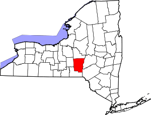 | |
| Towns | ||
| Villages | ||
| CDPs | ||
| Hamlets | ||
| Footnotes | ‡This populated place also has portions in an adjacent county or counties | |