Norwich (town), New York
| Norwich, New York | |
|---|---|
| Town | |
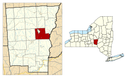 Location in Chenango County and the state of New York. | |
| Coordinates: 42°30′49″N 75°29′35″W / 42.51361°N 75.49306°WCoordinates: 42°30′49″N 75°29′35″W / 42.51361°N 75.49306°W | |
| Country | United States |
| State | New York |
| County | Chenango |
| Government | |
| • Type | Town Council |
| • Town Supervisor | David C. Law (R) |
| • Town Council |
Members' List
|
| Area | |
| • Total | 42.0 sq mi (108.9 km2) |
| • Land | 42.0 sq mi (108.7 km2) |
| • Water | 0.08 sq mi (0.2 km2) |
| Elevation | 1,467 ft (447 m) |
| Population (2010)[1] | |
| • Total | 3,998 |
| • Density | 95/sq mi (36.8/km2) |
| Time zone | Eastern (EST) (UTC-5) |
| • Summer (DST) | EDT (UTC-4) |
| ZIP code | 13815 |
| Area code(s) | 607 |
| FIPS code | 36-53990 |
| GNIS feature ID | 0979297 |
| Website |
townofnorwich |
Norwich is a town in Chenango County, New York, United States. The population was 3,998 at the 2010 census.[1] The town was named after Norwich, Connecticut.
The town of Norwich is located east of the center of the county. The city of Norwich is surrounded on all sides by the northern part of the town.[2]
History
The first settlers arrived around 1788.
The town of Norwich was formed in 1793 from the towns of Union (now in Broome County) and Bainbridge. Afterwards, Norwich, as a "mother town" of the county, lost substantial territory in the formation of new towns. In 1806, Norwich gave up territory to form the towns of Pharsalia, Plymouth and Preston. More of Norwich was lost in 1807 to form part of the towns of New Berlin and Columbus. In 1808 and 1820, Norwich exchanged territory with the town of Preston.
In 1816, the hamlet of Norwich incorporated as a village within the town, later reincorporating as the city of Norwich, now completely separate from the town.
Geography
According to the United States Census Bureau, the town of Norwich has a total area of 42.0 square miles (108.9 km2), of which 42.0 square miles (108.7 km2) is land and 0.08 square miles (0.2 km2), or 0.18%, is water.[1]
The Chenango River, a tributary of the Susquehanna River, flows southward through the town. The Unadilla River, also a south-flowing tributary of the Susquehanna, forms part of the eastern boundary of the town.
New York State Route 12, a north-south highway, intersects New York State Route 23, an east-west highway, in the city of Norwich.
Demographics
| Historical population | |||
|---|---|---|---|
| Census | Pop. | %± | |
| 1820 | 3,257 | — | |
| 1830 | 3,774 | 15.9% | |
| 1840 | 4,145 | 9.8% | |
| 1850 | 3,615 | −12.8% | |
| 1860 | 4,356 | 20.5% | |
| 1870 | 5,601 | 28.6% | |
| 1880 | 5,756 | 2.8% | |
| 1890 | 6,524 | 13.3% | |
| 1900 | 7,004 | 7.4% | |
| 1910 | 1,138 | −83.8% | |
| 1920 | 1,063 | −6.6% | |
| 1930 | 1,131 | 6.4% | |
| 1940 | 1,296 | 14.6% | |
| 1950 | 1,738 | 34.1% | |
| 1960 | 2,587 | 48.8% | |
| 1970 | 3,221 | 24.5% | |
| 1980 | 4,042 | 25.5% | |
| 1990 | 4,084 | 1.0% | |
| 2000 | 3,836 | −6.1% | |
| 2010 | 3,998 | 4.2% | |
| Est. 2014 | 3,906 | [3] | −2.3% |
As of the census of 2000, there were 3,836 people, 1,521 households, and 1,110 families residing in the town. The population density was 91.2 people per square mile (35.2/km²). There were 1,706 housing units at an average density of 40.6 per square mile (15.7/km²). The racial makeup of the town was 97.42% White, 0.50% Black or African American, 0.44% Native American, 0.50% Asian, 0.36% from other races, and 0.78% from two or more races. Hispanic or Latino of any race were 1.41% of the population.[5]
There were 1,521 households out of which 33.0% had children under the age of 18 living with them, 58.5% were married couples living together, 9.7% had a female householder with no husband present, and 27.0% were non-families. 20.6% of all households were made up of individuals and 8.7% had someone living alone who was 65 years of age or older. The average household size was 2.52 and the average family size was 2.88.[5]
In the town the population was spread out with 25.5% under the age of 18, 5.9% from 18 to 24, 27.7% from 25 to 44, 26.7% from 45 to 64, and 14.2% who were 65 years of age or older. The median age was 40 years. For every 100 females there were 93.2 males. For every 100 females age 18 and over, there were 93.4 males.[5]
The median income for a household in the town was $35,357, and the median income for a family was $42,763. Males had a median income of $32,988 versus $22,817 for females. The per capita income for the town was $18,474. About 8.0% of families and 13.1% of the population were below the poverty line, including 18.6% of those under age 18 and 13.4% of those age 65 or over.[5]
Communities and locations
- Hawley Corners – A hamlet east of the city of Norwich on NY-23.
- Haynes – A hamlet in the southwest corner of the town.
- North Guilford Corners – A location at the south town line, south of Webb Corners.
- Polkville – A hamlet southeast of the city of Norwich on County Road 33.
- Springvale – A hamlet east of the city of Norwich, located on County Road 34.
- Webb Corners – A location in the southern part of the town.
- White Store – A location in the southeast corner of the town on Route 8.
- Woods Corners – A hamlet directly north of the city of Norwich on NY-12 and adjacent to the north town line.
References
- 1 2 3 "Geographic Identifiers: 2010 Demographic Profile Data (G001): Norwich town, Chenango County, New York". U.S. Census Bureau, American Factfinder. Retrieved November 21, 2014.
- ↑ (Map). Acme Mapper 2.0 http://mapper.acme.com/?ll=42.53118,-75.52351&z=13&t=T&marker0=42.53118%2C-75.52351%2CNorwich%5C%2C%20NY. Retrieved 2010-02-14. Missing or empty
|title=(help) - ↑ "Annual Estimates of the Resident Population for Incorporated Places: April 1, 2010 to July 1, 2014". Retrieved June 4, 2015.
- ↑ "Census of Population and Housing". Census.gov. Retrieved June 4, 2015.
- 1 2 3 4 "American FactFinder". United States Census Bureau. Retrieved 2008-01-31.
External links
Municipalities and communities of Chenango County, New York, United States | ||
|---|---|---|
| City | 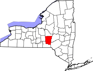 | |
| Towns | ||
| Villages | ||
| CDPs | ||
| Hamlets | ||
| Footnotes | ‡This populated place also has portions in an adjacent county or counties | |