Pilar, Abra
| Pilar | ||
|---|---|---|
| Municipality | ||
| ||
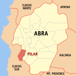 Location within Abra province | ||
.svg.png) Pilar Location within the Philippines | ||
| Coordinates: 17°25′N 120°36′E / 17.42°N 120.6°ECoordinates: 17°25′N 120°36′E / 17.42°N 120.6°E | ||
| Country | Philippines | |
| Region | Cordillera Administrative Region (CAR) | |
| Province | Abra | |
| District | Lone District of Abra | |
| Barangays | 19 (see Barangays) | |
| Government [1] | ||
| • Type | Sangguniang Bayan | |
| • Mayor | Josefin Jaja Somera Disono | |
| Area[2] | ||
| • Total | 66.1 km2 (25.5 sq mi) | |
| Population (2015 census)[3] | ||
| • Total | 10,223 | |
| • Density | 150/km2 (400/sq mi) | |
| • Voter (2016)[4] | 6,843 | |
| Time zone | PST (UTC+8) | |
| ZIP code | 2812 | |
| IDD : area code | +63 (0)74 | |
| Income class | 5th class | |
| PSGC | 140119000 | |

Pilar, officially the Municipality of Pilar (Ilocano: Ili ti Pilar, Filipino: Bayan ng Pilar), is a municipality in the province of Abra in the Cordillera Administrative Region (CAR) of the Philippines. The population was 10,223 at the 2015 census.[3] In the 2016 election, it had 6,843 registered voters.[4]
Geography
Pilar is located at 17°25′N 120°36′E / 17.42°N 120.6°E.
According to the Philippine Statistics Authority, the municipality has a land area of 66.1 square kilometres (25.5 sq mi)[2] constituting 1.59% of the 4,165.25-square-kilometre- (1,608.21 sq mi) total area of Abra.
Barangays
Pilar is politically subdivided into 19 barangays.[5]
| PSGC | Barangay | Population | ±% p.a. | ||
|---|---|---|---|---|---|
| 2015[3] | 2010[6] | ||||
| 140119002 | Bolbolo | 8.2% | 835 | 851 | −0.36% |
| 140119003 | Brookside | 3.6% | 367 | 366 | +0.05% |
| 140119005 | Dalit | 7.8% | 801 | 773 | +0.68% |
| 140119006 | Dintan | 4.1% | 415 | 357 | +2.91% |
| 140119007 | Gapang | 7.4% | 755 | 630 | +3.51% |
| 140119008 | Kinabiti | 8.1% | 831 | 737 | +2.31% |
| 140119009 | Maliplipit | 3.0% | 308 | 301 | +0.44% |
| 140119010 | Nagcanasan | 2.6% | 267 | 259 | +0.58% |
| 140119011 | Nanangduan | 3.1% | 320 | 329 | −0.53% |
| 140119012 | Narnara | 3.1% | 321 | 284 | +2.36% |
| 140119004 | Ocup | 5.0% | 510 | 483 | +1.04% |
| 140119014 | Pang-ot | 5.7% | 581 | 592 | −0.36% |
| 140119015 | Patad | 2.8% | 288 | 306 | −1.15% |
| 140119016 | Poblacion | 17.5% | 1,784 | 1,703 | +0.89% |
| 140119017 | San Juan East | 3.0% | 302 | 338 | −2.12% |
| 140119018 | San Juan West | 5.8% | 591 | 602 | −0.35% |
| 140119019 | South Balioag | 4.2% | 429 | 470 | −1.72% |
| 140119020 | Tikitik | 3.1% | 313 | 272 | +2.71% |
| 140119021 | Villavieja | 2.0% | 205 | 255 | −4.07% |
| Total | 10,223 | 9,908 | +0.60% | ||
Demographics
| Population census of Pilar | |||||||||||||||||||||||||
|---|---|---|---|---|---|---|---|---|---|---|---|---|---|---|---|---|---|---|---|---|---|---|---|---|---|
|
| ||||||||||||||||||||||||
| Source: PSA[3][6][7] | |||||||||||||||||||||||||
In the 2015 census, Pilar had a population of 10,223.[3] The population density was 150 inhabitants per square kilometre (390/sq mi).
In the 2016 election, it had 6,843 registered voters.[4]
References
- ↑ "Municipality". Quezon City, Philippines: Department of the Interior and Local Government. Retrieved 31 May 2013.
- 1 2 "Province: Abra". PSGC Interactive. Makati City, Philippines: Philippine Statistics Authority. Retrieved 28 October 2016.
- 1 2 3 4 5 "CORDILLERA ADMINISTRATIVE REGION (CAR)". Census of Population (2015): Total Population by Province, City, Municipality and Barangay (Report). PSA. Retrieved 20 June 2016.
- 1 2 3 "2016 National and Local Elections Statistics". Commission on Elections. 2016.
- ↑ "Municipal: Pilar, Abra". PSGC Interactive. Quezon City, Philippines: Philippine Statistics Authority. Retrieved 8 January 2016.
- 1 2 "CORDILLERA ADMINISTRATIVE REGION (CAR)". Census of Population and Housing (2010): Total Population by Province, City, Municipality and Barangay (Report). NSO. Retrieved 29 June 2016.
- ↑ "CORDILLERA ADMINISTRATIVE REGION (CAR)". Census of Population (1995, 2000 and 2007): Total Population by Province, City and Municipality (Report). NSO. Archived from the original on 24 June 2011.
External links
| Wikimedia Commons has media related to Pilar, Abra. |
 |
Nagbukel, Ilocos Sur | San Isidro | | |
| Narvacan, Ilocos Sur Santa Maria, Ilocos Sur |
|
Villaviciosa | ||
| ||||
| | ||||
| Burgos, Ilocos Sur | |
San Emilio, Ilocos Sur |
Bangued (capital) | |
| Municipalities | |
| Barangays | |