Plankinton, South Dakota
| Plankinton, South Dakota | |
|---|---|
| City | |
| Motto: "A "Jewel" Of A Location" | |
 Location in Aurora County and the state of South Dakota | |
| Coordinates: 43°42′53″N 98°28′59″W / 43.71472°N 98.48306°WCoordinates: 43°42′53″N 98°28′59″W / 43.71472°N 98.48306°W | |
| Country | United States |
| State | South Dakota |
| County | Aurora |
| Incorporated | 1887[1] |
| Area[2] | |
| • Total | 0.76 sq mi (1.97 km2) |
| • Land | 0.76 sq mi (1.97 km2) |
| • Water | 0 sq mi (0 km2) |
| Elevation | 1,526 ft (465 m) |
| Population (2010)[3] | |
| • Total | 707 |
| • Estimate (2015)[4] | 714 |
| • Density | 930.3/sq mi (359.2/km2) |
| Time zone | Central (CST) (UTC-6) |
| • Summer (DST) | CDT (UTC-5) |
| ZIP code | 57368 |
| Area code(s) | 605 |
| FIPS code | 46-50020[5] |
| GNIS feature ID | 1257087[6] |
Plankinton is a city in Aurora County, South Dakota, United States. The population was 707 at the 2010 census. It is the county seat of Aurora County.[7]
History
Plankinton sprang up with the arrival of the Chicago, Milwaukee, St. Paul and Pacific Railroad to the area in 1880.[8] The town was named for Milwaukee-based meatpacker and railroad official John Plankinton.[9]
The voters approved the incorporation of Plankinton as a village in an election on September 7, 1882. The first officials were elected on September 22, 1882. The first village trustees were C. Thompson, C.C. Irons, T.C. Granger, W.H. Ferguson. [10]
Plankinton was home to an annual wheat palace, which became a successful regional attraction and inspired the Corn Palace in nearby Mitchell, South Dakota. The first Grain Palace in South Dakota opened in Plankinton on September 29, 1891. The last one closed in October 1892.[11]
Geography
Plankinton is located at 43°43′N 98°29′W / 43.717°N 98.483°W (43.7148, -98.4832).[12]
According to the United States Census Bureau, the city has a total area of 0.76 square miles (1.97 km2), all of it land.[2]
Plankinton has been assigned the ZIP code 57368 and the FIPS place code 50020.
Demographics
| Historical population | |||
|---|---|---|---|
| Census | Pop. | %± | |
| 1890 | 654 | — | |
| 1900 | 465 | −28.9% | |
| 1910 | 712 | 53.1% | |
| 1920 | 803 | 12.8% | |
| 1930 | 758 | −5.6% | |
| 1940 | 694 | −8.4% | |
| 1950 | 754 | 8.6% | |
| 1960 | 644 | −14.6% | |
| 1970 | 613 | −4.8% | |
| 1980 | 644 | 5.1% | |
| 1990 | 604 | −6.2% | |
| 2000 | 601 | −0.5% | |
| 2010 | 707 | 17.6% | |
| Est. 2015 | 714 | [13] | 1.0% |
| U.S. Decennial Census[14] 2015 Estimate[4] | |||
2010 census
As of the census[3] of 2010, there were 707 people, 294 households, and 191 families residing in the city. The population density was 930.3 inhabitants per square mile (359.2/km2). There were 341 housing units at an average density of 448.7 per square mile (173.2/km2). The racial makeup of the city was 92.8% White, 0.7% African American, 0.4% Native American, 5.8% from other races, and 0.3% from two or more races. Hispanic or Latino of any race were 10.2% of the population.
There were 294 households of which 30.6% had children under the age of 18 living with them, 50.7% were married couples living together, 10.2% had a female householder with no husband present, 4.1% had a male householder with no wife present, and 35.0% were non-families. 29.9% of all households were made up of individuals and 13.3% had someone living alone who was 65 years of age or older. The average household size was 2.40 and the average family size was 2.99.
The median age in the city was 38.6 years. 26.2% of residents were under the age of 18; 4.7% were between the ages of 18 and 24; 26.3% were from 25 to 44; 25.5% were from 45 to 64; and 17.3% were 65 years of age or older. The gender makeup of the city was 49.6% male and 50.4% female.
2000 census
As of the census[5] of 2000, there were 601 people, 265 households, and 170 families residing in the city. The population density was 920.6 people per square mile (357.0/km²). There were 298 housing units at an average density of 456.5 per square mile (177.0/km²). The racial makeup of the city was 94.51% White, 0.17% Native American, 0.17% Asian, 3.99% from other races, and 1.16% from two or more races. Hispanic or Latino of any race were 5.99% of the population.
There were 265 households out of which 25.3% had children under the age of 18 living with them, 53.2% were married couples living together, 7.5% had a female householder with no husband present, and 35.5% were non-families. 34.3% of all households were made up of individuals and 20.4% had someone living alone who was 65 years of age or older. The average household size was 2.27 and the average family size was 2.89.
In the city the population was spread out with 22.1% under the age of 18, 8.0% from 18 to 24, 23.1% from 25 to 44, 26.0% from 45 to 64, and 20.8% who were 65 years of age or older. The median age was 42 years. For every 100 females there were 95.8 males. For every 100 females age 18 and over, there were 91.0 males.
The median income for a household in the city was $32,019, and the median income for a family was $40,809. Males had a median income of $26,645 versus $19,531 for females. The per capita income for the city was $15,611. About 3.5% of families and 6.2% of the population were below the poverty line, including 5.1% of those under age 18 and 6.8% of those age 65 or over.
References
- ↑ "SD Towns" (PDF). South Dakota State Historical Society. Retrieved 2010-02-15.
- 1 2 "US Gazetteer files 2010". United States Census Bureau. Retrieved 2012-06-21.
- 1 2 "American FactFinder". United States Census Bureau. Retrieved 2012-06-21.
- 1 2 "Population Estimates". United States Census Bureau. Retrieved June 12, 2016.
- 1 2 "American FactFinder". United States Census Bureau. Retrieved 2008-01-31.
- ↑ "US Board on Geographic Names". United States Geological Survey. 2007-10-25. Retrieved 2008-01-31.
- ↑ "Find a County". National Association of Counties. Retrieved 2011-06-07.
- ↑ Federal Writers' Project (1940). South Dakota place-names, v.1-3. University of South Dakota. p. 56.
- ↑ Hellmann, Paul T. (May 13, 2013). "Historical Gazetteer of the United States". Routledge. p. 996. Retrieved 30 November 2013.
- ↑ Andreas, A.T.(1884), Andreas’ Historical Atlas of Dakota Chicago: R.R. Donnelley. p. 183-184.
- ↑ Evans, Rod (2009). Palaces on the Prairie. Canada: North Dakota Institute for Regional Studies.
- ↑ "US Gazetteer files: 2010, 2000, and 1990". United States Census Bureau. 2011-02-12. Retrieved 2011-04-23.
- ↑ "Annual Estimates of the Resident Population for Incorporated Places: April 1, 2010 to July 1, 2015". Retrieved July 2, 2016.
- ↑ United States Census Bureau. "Census of Population and Housing". Retrieved June 12, 2016.
External links
Municipalities and communities of Aurora County, South Dakota, United States | ||
|---|---|---|
| Cities | 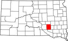 | |
| Town | ||
| Townships |
| |
| CDPs | ||