Polhamus Landing, Arizona
| Polhamus Landing, Arizona | |
|---|---|
| Ghost town | |
 Polhamus Landing, Arizona  Polhamus Landing, Arizona Location in the state of Arizona | |
| Coordinates: 35°11′32″N 114°34′12″W / 35.19222°N 114.57000°WCoordinates: 35°11′32″N 114°34′12″W / 35.19222°N 114.57000°W | |
| Country | United States |
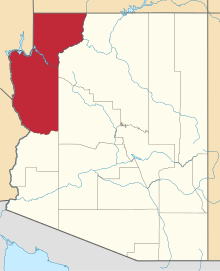
| State | Arizona |
| County | Mohave |
| Founded | 1881 |
| Abandoned | 1882 |
| Elevation | 539 ft (164 m) |
| Population | |
| • Total | 0 |
| Time zone | MST (no DST) |
| Website | [1] |
Polhamus Landing, or Welton & Grounds Landing,[2] was a short-lived steamboat landing in Mohave County, Arizona from 1881 to 1882.
History
By June 1881, Captain Issac Polhamus, superintendent of the Colorado Steam Navigation Company and two partners, Welton & Grounds, merchants from the booming mining camp of Mineral Park, established a new landing five miles up river from Hardyville. It had a large warehouse and other buildings, on land cut from a hill next to the river. They had also constructed a road from their landing that avoided a bad section of the road from Hardyville to Mineral Park and Cerbat and saved 5 miles on the route.[3]
Subsequently freighting to Hardyville dropped drastically, while freight landing at Polhamus Landing rose dramatically. Articles of The Arizona Sentinel, mention freight shipments sent to the two rival locations during the next year:
- 9/09/1881 Hardyville 2,794 lbs; Polhamus Landing, 98,619 lbs [4]
- 6/10/1882 Hardyville, 880 lbs; Polhamus Landing, 22,834 lbs [5]
Mention of Polhamus Landing does not occur in the The Arizona Sentinel after June 1882, indicating that both landings were supplanted by the just constructed Kingman railhead of the advancing Atlantic and Pacific Railroad that would by May 1883 have advanced to bridge the Colorado River at Eastbridge station, and link up with the Southern Pacific Railroad advancing eastward to meet it at Needles.[6]:78, 81, 82[7] The Arizona Sentinel of November 17, 1883 announced the firm of Welton & Grounds had been dissolved, becoming Welton & Beecher.
References
- ↑ Peter Massey, Jeanne Wilson, Backcountry Adventures Arizona, Adler Publishing, Apr 24, 2006, p.48
- ↑ The Arizona Sentinel, 1882-01-14, p.2, col.3
- ↑ The Arizona Sentinel, 1881-06-04, p.3, col.2, River News; "Welton & Grounds, of Mineral Park have established a new landing at a point about 5 miles above Hardyville and have named it Polhamus Landing. They have cut away a large portion of the hill on the bank of the river, have built a commodious warehouse and other buildings and have graded a road from Polhamus to intersect the old road at a point above the sandy streach, avoiding that disagreeable portion of the road, and shortening the distance to Mineral Park by about 5 miles."
- ↑ The Arizona Sentinel, 1881-09-17, p.3, col.1
- ↑ The Arizona Sentinel, 1882-06-10, p.3, col.2
- ↑ Richard E. Lingenfelter, Steamboats on the Colorado River, 1852-1916, University of Arizona Press, Tucson, 1978
- ↑ Map of the 5th Operating Division of the Western Division, Atlantic & Pacific R.R., From Peach Springs to Needles. W.A. Drake, Acting Chief Engineer. Drawing No. J-2-902. from davidrumsey.com accessed July 20, 2015. This map was one of a set of six hand-drawn maps made in 1882 on semi-transparent waxed linen with some color, illustrating the route Lewis Kingman surveyed from Albuquerque to Needles. It was intended to be printed but never was, due possibly to the chronic problems with the bridge at Eastbridge.