Prairie Township, Jewell County, Kansas
| Prairie Township | |
|---|---|
| Township | |
 Location in Jewell County | |
| Coordinates: 39°36′25″N 98°05′26″W / 39.60694°N 98.09056°WCoordinates: 39°36′25″N 98°05′26″W / 39.60694°N 98.09056°W | |
| Country | United States |
| State | Kansas |
| County | Jewell |
| Area | |
| • Total | 37.05 sq mi (95.95 km2) |
| • Land | 37.04 sq mi (95.94 km2) |
| • Water | 0.01 sq mi (0.01 km2) 0.01% |
| Elevation | 1,535 ft (468 m) |
| Population (2000) | |
| • Total | 172 |
| • Density | 4.6/sq mi (1.8/km2) |
| GNIS feature ID | 0472108 |
Prairie Township is a township in Jewell County, Kansas, USA. As of the 2000 census, its population was 172.
Geography
Prairie Township covers an area of 37.05 square miles (95.95 square kilometers); of this, 0.01 square miles (0.01 square kilometers) or 0.01 percent is water. The streams of Dry Creek, Dry Creek, East Buffalo Creek, Spring Creek and West Buffalo Creek run through this township.
Cities and towns
Adjacent townships
- Buffalo Township (north)
- Vicksburg Township (northeast)
- Allen Township (east)
- Plum Creek Township, Mitchell County (south)
- Solomon Rapids Township, Mitchell County (southwest)
- Browns Creek Township (west)
Cemeteries
The township contains two cemeteries: Pleasant Prairie and Star.
Major highways
References
External links
Municipalities and communities of Jewell County, Kansas, United States | ||
|---|---|---|
| Cities | 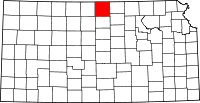 | |
| Unincorporated communities | ||
| Townships | ||
This article is issued from Wikipedia - version of the 11/11/2013. The text is available under the Creative Commons Attribution/Share Alike but additional terms may apply for the media files.