White Mound Township, Jewell County, Kansas
| White Mound Township | |
|---|---|
| Township | |
 Location in Jewell County | |
| Coordinates: 39°53′31″N 98°27′16″W / 39.89194°N 98.45444°WCoordinates: 39°53′31″N 98°27′16″W / 39.89194°N 98.45444°W | |
| Country | United States |
| State | Kansas |
| County | Jewell |
| Area | |
| • Total | 35.78 sq mi (92.66 km2) |
| • Land | 35.73 sq mi (92.55 km2) |
| • Water | 0.04 sq mi (0.11 km2) 0.12% |
| Elevation | 1,781 ft (543 m) |
| Population (2000) | |
| • Total | 49 |
| • Density | 1.4/sq mi (0.5/km2) |
| GNIS feature ID | 0471849 |
White Mound Township is a township in Jewell County, Kansas, USA. As of the 2000 census, its population was 49.
Geography
White Mound Township covers an area of 35.78 square miles (92.66 square kilometers); of this, 0.04 square miles (0.11 square kilometers) or 0.12 percent is water. The streams of Ash Creek, Ayres Creek, North Branch White Rock Creek and Smith Creek run through this township.
Adjacent townships
- Highland Township (north)
- Walnut Township (northeast)
- Burr Oak Township (east)
- Limestone Township (southeast)
- Esbon Township (south)
- Oak Township, Smith County (southwest)
- White Rock Township, Smith County (west)
- Logan Township, Smith County (northwest)
Cemeteries
The township contains three cemeteries: Oak Creek, Providence and Salem.
References
External links
Municipalities and communities of Jewell County, Kansas, United States | ||
|---|---|---|
| Cities | 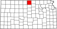 | |
| Unincorporated communities | ||
| Townships | ||
This article is issued from Wikipedia - version of the 11/11/2013. The text is available under the Creative Commons Attribution/Share Alike but additional terms may apply for the media files.