Jewell, Kansas
| Jewell, Kansas | |
|---|---|
| City | |
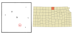 Location within Jewell County and Kansas | |
 KDOT map of Jewell County (legend) | |
| Coordinates: 39°40′15″N 98°9′10″W / 39.67083°N 98.15278°WCoordinates: 39°40′15″N 98°9′10″W / 39.67083°N 98.15278°W | |
| Country | United States |
| State | Kansas |
| County | Jewell |
| Area[1] | |
| • Total | 0.43 sq mi (1.11 km2) |
| • Land | 0.43 sq mi (1.11 km2) |
| • Water | 0 sq mi (0 km2) |
| Elevation | 1,555 ft (474 m) |
| Population (2010)[2] | |
| • Total | 432 |
| • Estimate (2012[3]) | 427 |
| • Density | 1,000/sq mi (390/km2) |
| Time zone | Central (CST) (UTC-6) |
| • Summer (DST) | CDT (UTC-5) |
| ZIP code | 66949 |
| Area code | 785 |
| FIPS code | 20-35475 [4] |
| GNIS feature ID | 0472104 [5] |
Jewell is a city in Jewell County, Kansas, United States. As of the 2010 census, the city population was 432.[6]
History
The City of Jewell began in 1870 as a large sod enclosure called Fort Jewell. Named in honor of Lieutenant-Colonel Lewis R. Jewell, Sixth Kansas Cavalry, who died November 30, 1862, of wounds received in the battle of Cane Hill, Ark. November 28, 1862.[7]
The first post office in Jewell was established in July 1870.[8]
Jewel was incorporated as a city in 1880.[9]
Jewell was located on the Missouri Pacific Railroad.[10]
A new community center was built in 1999 across from the city park, it features a Public library, American Legion offices and a 4-room hotel.
Geography
Jewell is located at 39°40′15″N 98°9′10″W / 39.67083°N 98.15278°W (39.670941, -98.152795).[11] According to the United States Census Bureau, the city has a total area of 0.43 square miles (1.11 km2), all of it land.[1]
Demographics
| Historical population | |||
|---|---|---|---|
| Census | Pop. | %± | |
| 1880 | 372 | — | |
| 1890 | 702 | 88.7% | |
| 1900 | 736 | 4.8% | |
| 1910 | 839 | 14.0% | |
| 1920 | 805 | −4.1% | |
| 1930 | 707 | −12.2% | |
| 1940 | 669 | −5.4% | |
| 1950 | 593 | −11.4% | |
| 1960 | 582 | −1.9% | |
| 1970 | 569 | −2.2% | |
| 1980 | 589 | 3.5% | |
| 1990 | 529 | −10.2% | |
| 2000 | 483 | −8.7% | |
| 2010 | 432 | −10.6% | |
| Est. 2015 | 412 | [12] | −4.6% |
| U.S. Decennial Census | |||
2010 census
As of the census[2] of 2010, there were 432 people, 208 households, and 113 families residing in the city. The population density was 1,004.7 inhabitants per square mile (387.9/km2). There were 251 housing units at an average density of 583.7 per square mile (225.4/km2). The racial makeup of the city was 93.8% White, 1.9% Native American, 0.2% Asian, 0.2% from other races, and 3.9% from two or more races. Hispanic or Latino of any race were 5.6% of the population.
There were 208 households of which 19.7% had children under the age of 18 living with them, 46.6% were married couples living together, 5.3% had a female householder with no husband present, 2.4% had a male householder with no wife present, and 45.7% were non-families. 42.8% of all households were made up of individuals and 24.1% had someone living alone who was 65 years of age or older. The average household size was 2.08 and the average family size was 2.88.
The median age in the city was 49.2 years. 21.5% of residents were under the age of 18; 6% were between the ages of 18 and 24; 17.1% were from 25 to 44; 29.9% were from 45 to 64; and 25.7% were 65 years of age or older. The gender makeup of the city was 50.9% male and 49.1% female.
2000 census
As of the census[4] of 2000, there were 483 people, 224 households, and 133 families residing in the city. The population density was 1,123.5 people per square mile (433.7/km²). There were 267 housing units at an average density of 621.1 per square mile (239.7/km²). The racial makeup of the city was 99.79% White, and 0.21% from two or more races. Hispanic or Latino of any race were 1.24% of the population.
There were 224 households out of which 25.0% had children under the age of 18 living with them, 48.7% were married couples living together, 8.0% had a female householder with no husband present, and 40.6% were non-families. 35.3% of all households were made up of individuals and 21.9% had someone living alone who was 65 years of age or older. The average household size was 2.16 and the average family size was 2.80.
In the city the population was spread out with 24.2% under the age of 18, 5.8% from 18 to 24, 22.6% from 25 to 44, 21.1% from 45 to 64, and 26.3% who were 65 years of age or older. The median age was 43 years. For every 100 females there were 84.4 males. For every 100 females age 18 and over, there were 88.7 males.
The median income for a household in the city was $28,750, and the median income for a family was $34,063. Males had a median income of $28,125 versus $16,528 for females. The per capita income for the city was $15,713. About 13.0% of families and 18.0% of the population were below the poverty line, including 22.5% of those under age 18 and 18.3% of those age 65 or over.
References
- 1 2 "US Gazetteer files 2010". United States Census Bureau. Archived from the original on 2012-07-14. Retrieved 2012-07-06.
- 1 2 "American FactFinder". United States Census Bureau. Retrieved 2012-07-06.
- ↑ "Population Estimates". United States Census Bureau. Archived from the original on 2013-06-17. Retrieved 2013-05-29.
- 1 2 "American FactFinder". United States Census Bureau. Archived from the original on 2013-09-11. Retrieved 2008-01-31.
- ↑ "US Board on Geographic Names". United States Geological Survey. 2007-10-25. Retrieved 2008-01-31.
- ↑ "2010 City Population and Housing Occupancy Status". U.S. Census Bureau. Archived from the original on July 21, 2011. Retrieved May 14, 2011.
- ↑ "Profile for Jewell, Kansas". ePodunk. Retrieved 12 June 2014.
- ↑ "Kansas Post Offices, 1828-1961". Kansas Historical Society. Retrieved 11 June 2014.
- ↑ Blackmar, Frank Wilson (1912). Kansas: A Cyclopedia of State History. Standard Publishing Company. p. 28.
- ↑ Gannett, Henry (1898). A Gazetteer of Kansas. Govt. Print. Off. p. 119.
- ↑ "US Gazetteer files: 2010, 2000, and 1990". United States Census Bureau. 2011-02-12. Retrieved 2011-04-23.
- ↑ "Annual Estimates of the Resident Population for Incorporated Places: April 1, 2010 to July 1, 2015". Retrieved July 2, 2016.
External links
| Wikimedia Commons has media related to Jewell, Kansas. |
- City
- Schools
- USD 107, local school district
- Historical
- Maps
- Jewell City Map, KDOT
Municipalities and communities of Jewell County, Kansas, United States | ||
|---|---|---|
| Cities | 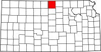 | |
| Unincorporated communities | ||
| Townships | ||