Prosser, Nebraska
| Prosser, Nebraska | |
|---|---|
| Village | |
|
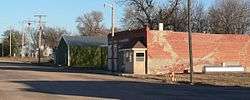
Virginia Avenue in Prosser | |
 Location of Prosser, Nebraska | |
| Coordinates: 40°41′12″N 98°34′39″W / 40.68667°N 98.57750°WCoordinates: 40°41′12″N 98°34′39″W / 40.68667°N 98.57750°W | |
| Country | United States |
| State | Nebraska |
| County | Adams |
| Area[1] | |
| • Total | 0.25 sq mi (0.65 km2) |
| • Land | 0.25 sq mi (0.65 km2) |
| • Water | 0 sq mi (0 km2) |
| Elevation | 2,051 ft (625 m) |
| Population (2010)[2] | |
| • Total | 66 |
| • Estimate (2012[3]) | 68 |
| • Density | 264.0/sq mi (101.9/km2) |
| Time zone | Central (CST) (UTC-6) |
| • Summer (DST) | CDT (UTC-5) |
| Area code(s) | 402 |
| FIPS code | 31-40430[4] |
| GNIS feature ID | 0832406[5] |
Prosser is a village in Adams County, Nebraska, United States. The population was 66 at the 2010 census. It is part of the Hastings, Nebraska Micropolitan Statistical Area.
History
Prosser had its start by the building of the railroad through that territory in the spring of 1888.[6] It was named for T. J. Prosser, a railroad official.[7][8] Prosser was incorporated as a village in 1907.[6]
Geography
Prosser is located at 40°41′12″N 98°34′39″W / 40.68667°N 98.57750°W (40.686649, -98.577585).[9]
According to the United States Census Bureau, the village has a total area of 0.25 square miles (0.65 km2), all of it land.[1]
Demographics
| Historical population | |||
|---|---|---|---|
| Census | Pop. | %± | |
| 1910 | 163 | — | |
| 1920 | 156 | −4.3% | |
| 1930 | 144 | −7.7% | |
| 1940 | 99 | −31.2% | |
| 1950 | 81 | −18.2% | |
| 1960 | 70 | −13.6% | |
| 1970 | 70 | 0.0% | |
| 1980 | 98 | 40.0% | |
| 1990 | 77 | −21.4% | |
| 2000 | 94 | 22.1% | |
| 2010 | 66 | −29.8% | |
| Est. 2015 | 71 | [10] | 7.6% |
2010 census
As of the census[2] of 2010, there were 66 people, 34 households, and 22 families residing in the village. The population density was 264.0 inhabitants per square mile (101.9/km2). There were 40 housing units at an average density of 160.0 per square mile (61.8/km2). The racial makeup of the village was 100.0% White.
There were 34 households of which 11.8% had children under the age of 18 living with them, 61.8% were married couples living together, 2.9% had a female householder with no husband present, and 35.3% were non-families. 32.4% of all households were made up of individuals and 2.9% had someone living alone who was 65 years of age or older. The average household size was 1.94 and the average family size was 2.41.
The median age in the village was 54.4 years. 12.1% of residents were under the age of 18; 2.9% were between the ages of 18 and 24; 13.6% were from 25 to 44; 60.5% were from 45 to 64; and 10.6% were 65 years of age or older. The gender makeup of the village was 43.9% male and 56.1% female.
2000 census
As of the census[4] of 2000, there were 94 people, 37 households, and 26 families residing in the village. The population density was 379.0 people per square mile (145.2/km²). There were 45 housing units at an average density of 181.4 per square mile (69.5/km²). The racial makeup of the village was 98.94% White, 1.06% from other races. Hispanic or Latino of any race were 2.13% of the population.
There were 37 households out of which 27.0% had children under the age of 18 living with them, 59.5% were married couples living together, 8.1% had a female householder with no husband present, and 29.7% were non-families. 24.3% of all households were made up of individuals and 8.1% had someone living alone who was 65 years of age or older. The average household size was 2.54 and the average family size was 3.08.
In the village the population was spread out with 20.2% under the age of 18, 11.7% from 18 to 24, 26.6% from 25 to 44, 31.9% from 45 to 64, and 9.6% who were 65 years of age or older. The median age was 42 years. For every 100 females there were 113.6 males. For every 100 females age 18 and over, there were 114.3 males.
As of 2000 the median income for a household in the village was $29,583, and the median income for a family was $38,750. Males had a median income of $21,875 versus $21,250 for females. The per capita income for the village was $17,011. There were 8.3% of families and 21.4% of the population living below the poverty line, including 38.1% of under eighteens and 50.0% of those over 64.
References
- 1 2 "US Gazetteer files 2010". United States Census Bureau. Retrieved 2012-06-24.
- 1 2 "American FactFinder". United States Census Bureau. Retrieved 2012-06-24.
- ↑ "Population Estimates". United States Census Bureau. Retrieved 2013-05-29.
- 1 2 "American FactFinder". United States Census Bureau. Retrieved 2008-01-31.
- ↑ "US Board on Geographic Names". United States Geological Survey. 2007-10-25. Retrieved 2008-01-31.
- 1 2 Burton, William R. & Lewis, David J. (1916). Past and Present of Adams County, Nebraska, Volume 1. S.J. Clarke Publishing Company. pp. 405–406.
- ↑ Fitzpatrick, Lillian L. (1960). Nebraska Place-Names. University of Nebraska Press. p. 14.
- ↑ "Profile for Prosser, Nebraska". ePodunk. Retrieved 28 July 2014.
- ↑ "US Gazetteer files: 2010, 2000, and 1990". United States Census Bureau. 2011-02-12. Retrieved 2011-04-23.
- ↑ "Annual Estimates of the Resident Population for Incorporated Places: April 1, 2010 to July 1, 2015". Retrieved July 2, 2016.
- ↑ "Census of Population and Housing". Census.gov. Retrieved June 4, 2015.
Municipalities and communities of Adams County, Nebraska, United States | ||
|---|---|---|
| City | ||
| Villages | ||
| Townships | ||
| Unincorporated communities | ||
| Footnotes | ‡This populated place also has portions in an adjacent county or counties | |