Rainsville, Alabama
| Rainsville, Alabama | |
|---|---|
| City | |
|
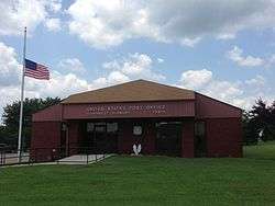
Rainsville post office | |
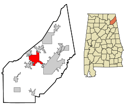 Location in DeKalb County and the state of Alabama | |
| Coordinates: 34°29′32″N 85°50′43″W / 34.49222°N 85.84528°W | |
| Country | United States |
| State | Alabama |
| County | DeKalb |
| Area | |
| • Total | 20.58 sq mi (53.30 km2) |
| • Land | 20.56 sq mi (53.26 km2) |
| • Water | 0.02 sq mi (0.04 km2) |
| Elevation | 1,296 ft (395 m) |
| Population (2010) | |
| • Total | 4,948 |
| • Density | 241/sq mi (92.9/km2) |
| Time zone | Central (CST) (UTC-6) |
| • Summer (DST) | CDT (UTC-5) |
| ZIP code | 35986 |
| Area code(s) | 256 |
| FIPS code | 01-63336 |
| GNIS feature ID | 0150475 |
| Website |
www |
Rainsville is a city in DeKalb County, Alabama, United States. At the 2010 census the population was 4,948,[1] up from 4,499 in 2000. Rainsville is located on top of Sand Mountain, a southern extension of the Cumberland Plateau.
History
Rainsville was incorporated in October 1956.
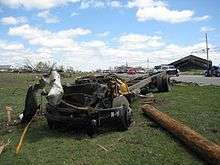
An EF5 tornado struck the city on April 27, 2011, leaving 25 fatalities. It initially touched down 10 miles (16 km) to the southwest in Lakeview, causing structural damage to small buildings and snapping trees. It grew in intensity, and the path width increased from around fifty yards to a half a mile, as the rotation entered the Rainsville and Sylvania communities. Damage included houses that were completely removed from foundations and debris scattered for about one mile, trees debarked, and a few mobile homes were destroyed with debris strewn for about a mile downstream. In Sylvania, some of these houses removed from foundations contained anchor bolts and foundation straps.
Geography
Rainsville is located northwest of the center of DeKalb County at 34°29′32″N 85°50′43″W / 34.49222°N 85.84528°W (34.492258, -85.845316).[2] It is bordered to the northeast by Sylvania, to the northwest by Powell, to the southwest by Shiloh, and to the southeast by Pine Ridge.
Alabama State Routes 35 and 75 intersect in the center of town. AL 35 leads northwest 19 miles (31 km) to Scottsboro and southeast 9 miles (14 km) to Fort Payne, the DeKalb County seat. AL 75 leads northeast 10 miles (16 km) to Henagar and southwest 26 miles (42 km) to Albertville.
According to the U.S. Census Bureau, Rainsville has a total area of 20.6 square miles (53.3 km2), of which 0.02 square miles (0.04 km2), or 0.07%, is water.[1]
Demographics
| Historical population | |||
|---|---|---|---|
| Census | Pop. | %± | |
| 1960 | 398 | — | |
| 1970 | 2,099 | 427.4% | |
| 1980 | 3,907 | 86.1% | |
| 1990 | 3,875 | −0.8% | |
| 2000 | 4,499 | 16.1% | |
| 2010 | 4,948 | 10.0% | |
| Est. 2015 | 5,031 | [3] | 1.7% |
| U.S. Decennial Census[4] 2013 Estimate[5] | |||
As of the 2010 census Rainsville had a population of 4,984. The racial and ethnic composition of the population was 93.5% non-Hispanic white, 0.2% African American, 0.9% Native American, 0.2% Asian, 0.1% Pacific Islander, 2.1% from some other race, 1.3% from two or more races and 3.8% Hispanic or Latino of any race.[6]
As of the census[7] of 2000, there were 4,499 people, 1,880 households, and 1,336 families residing in the city. The population density was 226.5 people per square mile (87.5/km²). There were 2,016 housing units at an average density of 101.5 per square mile (39.2/km²). The racial makeup of the city was 97.11% White, 0.09% Black or African American, 0.44% Native American, 0.09% Asian, 0.09% Pacific Islander, 1.09% from other races, and 1.09% from two or more races. 2.18% of the population were Hispanic or Latino of any race.
There were 1,880 households out of which 31.4% had children under the age of 18 living with them, 58.0% were married couples living together, 10.5% had a female householder with no husband present, and 28.9% were non-families. 26.9% of all households were made up of individuals and 13.6% had someone living alone who was 65 years of age or older. The average household size was 2.39 and the average family size was 2.90.
In the city the population was spread out with 23.6% under the age of 18, 7.8% from 18 to 24, 28.1% from 25 to 44, 25.0% from 45 to 64, and 15.5% who were 65 years of age or older. The median age was 38 years. For every 100 females there were 89.0 males. For every 100 females age 18 and over, there were 83.6 males.
The median income for a household in the city was $29,505, and the median income for a family was $37,426. Males had a median income of $31,776 versus $19,618 for females. The per capita income for the city was $14,806. About 11.9% of families and 14.4% of the population were below the poverty line, including 13.4% of those under age 18 and 18.3% of those age 65 or over.
Education
Plainview High School, home of the Bears, and the DeKalb County School System offices are located in Rainsville.
Cornerstone Christian Academy is located in Rainsville.
Notable people
- Lowell Barron, member of the Alabama Senate from 1982 to 2010
- Jeremy Pruitt, defensive coordinator for the Alabama Crimson Tide football team
- Eric Whitfield, author of Spaghetti Issues a Christian parody of Gospel of the Flying Spaghetti Monster
References
- 1 2 "Geographic Identifiers: 2010 Demographic Profile Data (G001): Rainsville city, Alabama". U.S. Census Bureau, American Factfinder. Retrieved October 6, 2015.
- ↑ "US Gazetteer files: 2010, 2000, and 1990". United States Census Bureau. 2011-02-12. Retrieved 2011-04-23.
- ↑ "Annual Estimates of the Resident Population for Incorporated Places: April 1, 2010 to July 1, 2015". Retrieved July 2, 2016.
- ↑ "U.S. Decennial Census". Census.gov. Retrieved June 6, 2013.
- ↑ "Annual Estimates of the Resident Population: April 1, 2010 to July 1, 2013". Retrieved June 3, 2014.
- ↑ 2010 general profile of population and housing characteristics for Rainsville from the US census
- ↑ "American FactFinder". United States Census Bureau. Retrieved 2008-01-31.
External links
Coordinates: 34°29′32″N 85°50′43″W / 34.492258°N 85.845316°W
Municipalities and communities of DeKalb County, Alabama, United States | ||
|---|---|---|
| Cities | 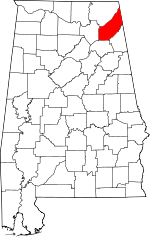 | |
| Towns | ||
| Unincorporated communities | ||
| Ghost towns | ||
| Footnotes | ‡This populated place also has portions in an adjacent county or counties | |