Sylvania, Alabama
| Sylvania, Alabama | |
|---|---|
| Town | |
 Location in DeKalb County and the state of Alabama | |
| Coordinates: 34°33′30″N 85°47′46″W / 34.55833°N 85.79611°W | |
| Country | United States |
| State | Alabama |
| County | DeKalb |
| Area | |
| • Total | 8.6 sq mi (22.2 km2) |
| • Land | 8.5 sq mi (21.9 km2) |
| • Water | 0.1 sq mi (0.3 km2) |
| Elevation | 1,388 ft (423 m) |
| Population (2010) | |
| • Total | 1,837 |
| • Density | 217/sq mi (83.7/km2) |
| Time zone | Central (CST) (UTC-6) |
| • Summer (DST) | CDT (UTC-5) |
| ZIP code | 35988 |
| Area code(s) | 256 |
| FIPS code | 01-74400 |
| GNIS feature ID | 0150546 |
| Website |
www |
Sylvania is a town in DeKalb County, Alabama, United States. It incorporated in October 1967.[1] At the 2010 census the population was 1,837,[2] up from 1,186 in 2000. Sylvania is located atop Sand Mountain.
Geography
Sylvania is located north of the center of DeKalb County at 34°33′30″N 85°47′46″W / 34.55833°N 85.79611°W (34.558304, -85.796154).[3] Alabama State Route 75 passes through the town limits, leading northeast to Henagar and southwest to Rainsville.
According to the U.S. Census Bureau, Sylvania has a total area of 8.6 square miles (22.2 km2), of which 8.5 square miles (21.9 km2) is land and 0.1 square miles (0.3 km2), or 1.16%, is water.[2]
Demographics
| Historical population | |||
|---|---|---|---|
| Census | Pop. | %± | |
| 1970 | 476 | — | |
| 1980 | 1,156 | 142.9% | |
| 1990 | 932 | −19.4% | |
| 2000 | 1,186 | 27.3% | |
| 2010 | 1,837 | 54.9% | |
| Est. 2015 | 1,854 | [4] | 0.9% |
| U.S. Decennial Census[5] 2013 Estimate[6] | |||
As of the census[7] of 2000, there were 1,186 people, 485 households, and 354 families residing in the town. The population density was 161.9 people per square mile (62.5/km²). There were 517 housing units at an average density of 70.6 per square mile (27.2/km²). The racial makeup of the town was 96.37% White, 0.08% Black or African American, 1.18% Native American, 0.08% Asian, 0.51% from other races, and 1.77% from two or more races. 0.67% of the population were Hispanic or Latino of any race.
There were 485 households out of which 34.0% had children under the age of 18 living with them, 59.2% were married couples living together, 10.5% had a female householder with no husband present, and 27.0% were non-families. 25.2% of all households were made up of individuals and 11.8% had someone living alone who was 65 years of age or older. The average household size was 2.45 and the average family size was 2.89.
In the town the population was spread out with 24.3% under the age of 18, 9.8% from 18 to 24, 27.5% from 25 to 44, 25.3% from 45 to 64, and 13.2% who were 65 years of age or older. The median age was 38 years. For every 100 females there were 91.6 males. For every 100 females age 18 and over, there were 88.7 males.
The median income for a household in the town was $28,553, and the median income for a family was $35,000. Males had a median income of $28,681 versus $19,620 for females. The per capita income for the town was $15,561. About 13.6% of families and 16.6% of the population were below the poverty line, including 19.9% of those under age 18 and 30.7% of those age 65 or over.
2010 census
As of the census[8] of 2010, there were 1,837 people, 674 households, and 505 families residing in the town. The population density was 248.2 people per square mile (95.1/km²). There were 750 housing units at an average density of 101.3 per square mile (38.9/km²). The racial makeup of the town was 86.7% White, 0.2% Black or African American, 0.8% Native American, 0.2% Asian, 7.5% from other races, and 4.4% from two or more races. 11.2% of the population were Hispanic or Latino of any race.
There were 674 households out of which 36.2% had children under the age of 18 living with them, 57.9% were married couples living together, 13.6% had a female householder with no husband present, and 25.1% were non-families. 21.2% of all households were made up of individuals and 6.7% had someone living alone who was 65 years of age or older. The average household size was 2.73 and the average family size was 3.18.
In the town the population was spread out with 27.8% under the age of 18, 10.0% from 18 to 24, 26.6% from 25 to 44, 24.7% from 45 to 64, and 10.9% who were 65 years of age or older. The median age was 33.8 years. For every 100 females there were 97.5 males. For every 100 females age 18 and over, there were 92.5 males.
The median income for a household in the town was $34,079, and the median income for a family was $40,648. Males had a median income of $35,417 versus $27,857 for females. The per capita income for the town was $17,793. About 22.3% of families and 24.0% of the population were below the poverty line, including 34.1% of those under age 18 and 18.0% of those age 65 or over.
Education
Sylvania High School, a member of the DeKalb County School System.
References
- ↑ http://www.encyclopediaofalabama.org/article/h-3365
- 1 2 "Geographic Identifiers: 2010 Demographic Profile Data (G001): Sylvania town, Alabama". U.S. Census Bureau, American Factfinder. Retrieved October 7, 2015.
- ↑ "US Gazetteer files: 2010, 2000, and 1990". United States Census Bureau. 2011-02-12. Retrieved 2011-04-23.
- ↑ "Annual Estimates of the Resident Population for Incorporated Places: April 1, 2010 to July 1, 2015". Retrieved July 2, 2016.
- ↑ "U.S. Decennial Census". Census.gov. Retrieved June 6, 2013.
- ↑ "Annual Estimates of the Resident Population: April 1, 2010 to July 1, 2013". Retrieved June 3, 2014.
- ↑ "American FactFinder". United States Census Bureau. Retrieved 2008-01-31.
- ↑ "American FactFinder". United States Census Bureau. Retrieved 2015-07-22.
External links
Coordinates: 34°33′30″N 85°47′46″W / 34.558304°N 85.796154°W
Municipalities and communities of DeKalb County, Alabama, United States | ||
|---|---|---|
| Cities | 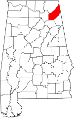 | |
| Towns | ||
| Unincorporated communities | ||
| Ghost towns | ||
| Footnotes | ‡This populated place also has portions in an adjacent county or counties | |